


MapSherpa Catalog
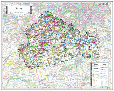
County Map of Surrey
The Map Centre
An Ordnance Survey Map covering the whole of the county showing the county boundary including applicable Unitary Authority boundaries. The mapping outside the county boundary is faded to highlight the county. Part of a series of counties maps that cover England Scotland & Wales all using the same background Ordnance Survey Mapping for continuity across the whole series. This map includes Guildford, Woking
Page Size: 34.75 x 27.75 in (880 x 700 mm)
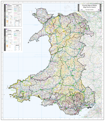
County Map of Wales
The Map Centre
An Ordnance Survey Map covering the whole of the county showing the county boundary including applicable Unitary Authority boundaries. The mapping outside the county boundary is faded to highlight the county. Part of a series of counties maps that cover England Scotland & Wales all using the same background Ordnance Survey Mapping for continuity across the whole series. This map includes Cardiff, Newport, Swansea, Conwy, Wrexham, Llandrindod Wells, Aberystwyth, Pembroke, St Davids
Page Size: 35.5 x 41 in (900 x 1040 mm)
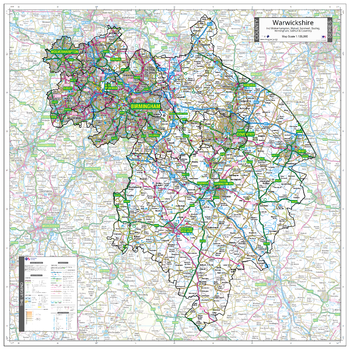
County Map of Warwickshire incl West Midlands
The Map Centre
An Ordnance Survey Map covering the whole of the county showing the county boundary including applicable Unitary Authority boundaries. The mapping outside the county boundary is faded to highlight the county. Part of a series of counties maps that cover England Scotland & Wales all using the same background Ordnance Survey Mapping for continuity across the whole series. This map includes Warwick, Coventry, Birmingham, Wolverhampton, Solihull
Page Size: 35.5 x 35.5 in (900 x 900 mm)
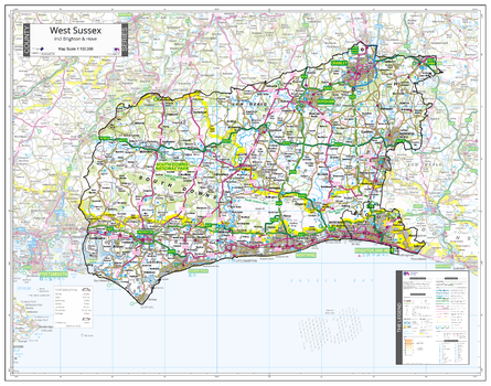
County Map of West Sussex
The Map Centre
An Ordnance Survey Map covering the whole of the county showing the county boundary including applicable Unitary Authority boundaries. The mapping outside the county boundary is faded to highlight the county. Part of a series of counties maps that cover England Scotland & Wales all using the same background Ordnance Survey Mapping for continuity across the whole series. This map includes Brighton, Hove, Chichester, Worthing
Page Size: 37 x 29.25 in (940 x 740 mm)
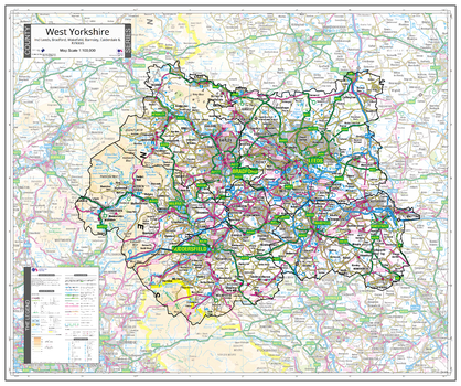
County Map of West Yorkshire
The Map Centre
An Ordnance Survey Map covering the whole of the county showing the county boundary including applicable Unitary Authority boundaries. The mapping outside the county boundary is faded to highlight the county. Part of a series of counties maps that cover England Scotland & Wales all using the same background Ordnance Survey Mapping for continuity across the whole series. This map includes Leeds, Bradford, Halifax
Page Size: 34 x 28.5 in (860 x 720 mm)
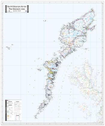
County Map of Western Isles
The Map Centre
An Ordnance Survey Map covering the whole of the county showing the county boundary including applicable Unitary Authority boundaries. The mapping outside the county boundary is faded to highlight the county. Part of a series of counties maps that cover England Scotland & Wales all using the same background Ordnance Survey Mapping for continuity across the whole series. This map includes Stornoway
Page Size: 35.5 x 42.75 in (900 x 1080 mm)
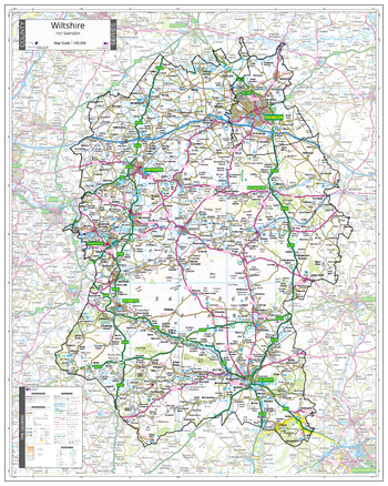
County Map of Wiltshire
The Map Centre
An Ordnance Survey Map covering the whole of the county showing the county boundary including applicable Unitary Authority boundaries. The mapping outside the county boundary is faded to highlight the county. Part of a series of counties maps that cover England Scotland & Wales all using the same background Ordnance Survey Mapping for continuity across the whole series. This map includes Swindon, Chippenham, Salisbury
Page Size: 31.5 x 39.5 in (800 x 1000 mm)
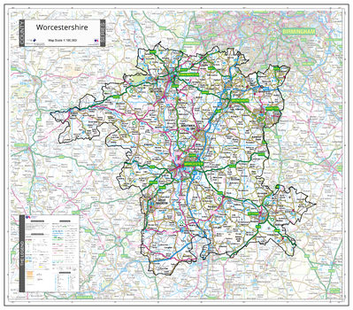
County Map of Worcestershire
The Map Centre
An Ordnance Survey Map covering the whole of the county showing the county boundary including applicable Unitary Authority boundaries. The mapping outside the county boundary is faded to highlight the county. Part of a series of counties maps that cover England Scotland & Wales all using the same background Ordnance Survey Mapping for continuity across the whole series. This map includes Worcester, Malvern, Droitwich
Page Size: 32.5 x 28.5 in (820 x 720 mm)
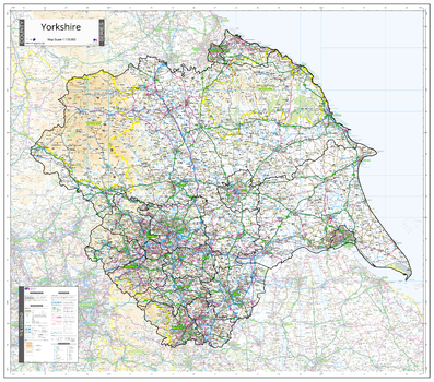
County Map of Yorkshire
The Map Centre
An Ordnance Survey Map covering the whole of the county showing the county boundary including applicable Unitary Authority boundaries. The mapping outside the county boundary is faded to highlight the county. Part of a series of counties maps that cover England Scotland & Wales all using the same background Ordnance Survey Mapping for continuity across the whole series. This map includes North Riding, East Riding, South Riding, West Riding, Leeds, York, Harrogate, Sheffield, Hull, Bradford, Halifax
Page Size: 40.25 x 35.5 in (1020 x 900 mm)
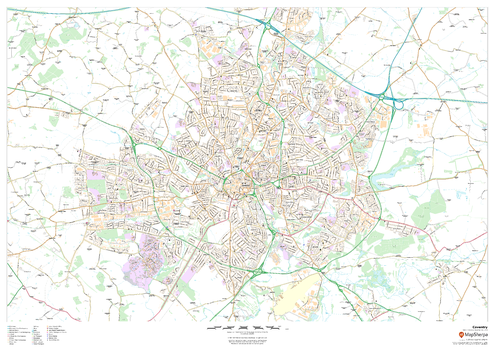
Coventry
MapSherpa
This map of Coventry shows detailed street level information including extensive street labelling. Ideal for planning of deliveries, home services, sales territories, real estate and much more.
Page Size: 47 x 33.25 in (1189 x 841 mm)

Coventry - CV - Postcode Wall Map
XYZ Maps
The Coventry Postcode Sector Wall Map shows detailed postcode sector boundaries (CV1 1, CV1 2) on a comprehensive background and is perfect for determining postcode boundaries for sales areas, planning mailshots and also an excellent reference for logistics. This wall map covers the whole of the CV Postcode Area.
Page Size: 33.25 x 47 in (841 x 1189 mm)
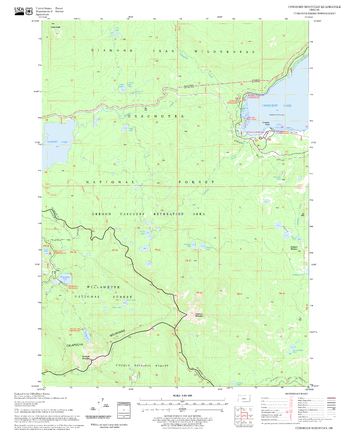
Cowhorn Mountain Quadrangle, Oregon
United States Department of Agriculture Forest Service
United States Department of Agriculture Forestry Service topographical map of Cowhorn Mountain, Deschutes National Forest, Oregon.
Page Size: 21.75 x 27 in (552 x 686 mm)
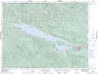
Cowichan Lake - 92 C/16 - British Columbia
Natural Resources Canada
Canadian topographic map of Cowichan Lake, British Columbia. NTS sheet 092C16 Edition 3.
Page Size: 33.75 x 25.25 in (854 x 635 mm)
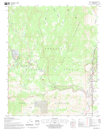
Crag Peak Quadrangle, California
United States Department of Agriculture Forest Service
United States Department of Agriculture Forestry Service topographical map of Crag Peak, Sequoia National Forest, California.
Page Size: 21.75 x 27 in (552 x 686 mm)
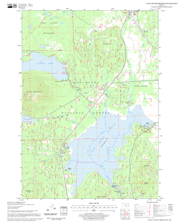
Crane Prairie Reservoir Quadrangle, Oregon
United States Department of Agriculture Forest Service
United States Department of Agriculture Forestry Service topographical map of Crane Prairie Reservoir, Deschutes National Forest, Oregon.
Page Size: 21.75 x 27 in (552 x 686 mm)
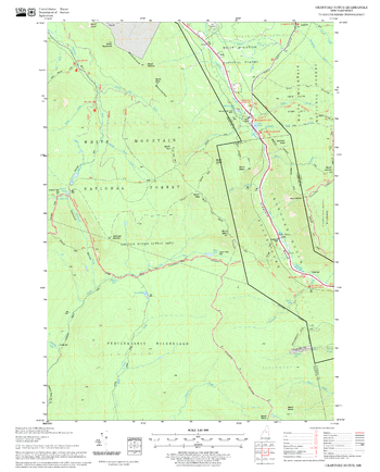
Crawford Notch Quadrangle, New Hampshire-Vermont
United States Department of Agriculture Forest Service
United States Forestry Service topographical map of Crawford Notch, New Hampshire-Vermont
Page Size: 21.75 x 27 in (552 x 686 mm)
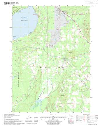
Crescent Lake Quadrangle, Oregon
United States Department of Agriculture Forest Service
United States Department of Agriculture Forestry Service topographical map of Crescent Lake, Deschutes National Forest, Oregon.
Page Size: 21.75 x 27 in (552 x 686 mm)
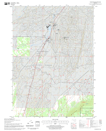
Crescent NE Quadrangle, Oregon
United States Department of Agriculture Forest Service
United States Department of Agriculture Forestry Service topographical map of Crescent NE, Deschutes National Forest, Oregon.
Page Size: 21.75 x 27 in (552 x 686 mm)
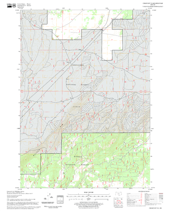
Crescent Quadrangle, Oregon
United States Department of Agriculture Forest Service
United States Department of Agriculture Forestry Service topographical map of Crescent, Deschutes National Forest, Oregon.
Page Size: 21.75 x 27 in (552 x 686 mm)

Crewe - CW - Postcode Wall Map
XYZ Maps
The Crewe Postcode Sector Wall Map shows detailed postcode sector boundaries (CW1 1, CW1 2) on a comprehensive background and is perfect for determining postcode boundaries for sales areas, planning mailshots and also an excellent reference for logistics. This wall map covers the whole of the CW Postcode Area.
Page Size: 47 x 33.25 in (1189 x 841 mm)
No search results