XYZ Maps
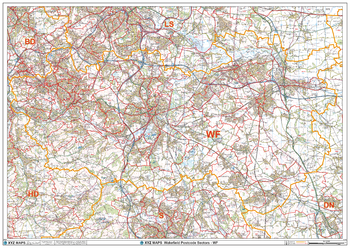
Wakefield - WF - Postcode Wall Map
The Wakefield Postcode Sector Wall Map shows detailed postcode sector boundaries (WF1 1, WF1 2) on a comprehensive background and is perfect for determining postcode boundaries for sales areas, planning mailshots and also an excellent reference for logistics. This wall map covers the whole of the WF Postcode Area.
Page Size: 47 x 33.25 in (1189 x 841 mm)
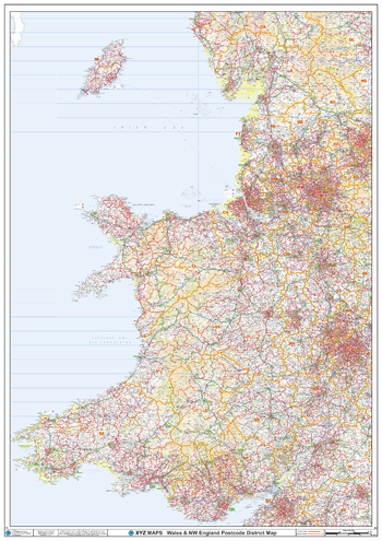
Wales Postcode District Wall Map (D3)
The Wales Postcode District Map clearly shows postcode district boundaries and associated district labels (CF1, CF2) on a comprehensive background and is perfect for determining postcode boundaries for sales territories, logistics, planning mailshots or as a regional reference guide.
Page Size: 33.25 x 47 in (841 x 1189 mm)
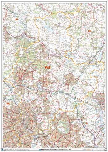
Walsall - WS - Postcode Wall Map
The Walsall Postcode Sector Wall Map shows detailed postcode sector boundaries (WS1 1, WS1 2) on a comprehensive background and is perfect for determining postcode boundaries for sales areas, planning mailshots and also an excellent reference for logistics. This wall map covers the whole of the WS Postcode Area.
Page Size: 33.25 x 47 in (841 x 1189 mm)
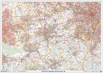
Warrington - WA - Postcode Wall Map
The Warrington Postcode Sector Wall Map shows detailed postcode sector boundaries (WA1 1, WA1 2) on a comprehensive background and is perfect for determining postcode boundaries for sales areas, planning mailshots and also an excellent reference for logistics. This wall map covers the whole of the WA Postcode Area.
Page Size: 47 x 33.25 in (1189 x 841 mm)
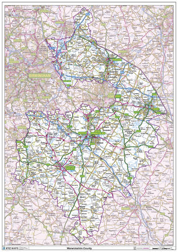
Warwickshire County Map
This is a large ceremonial county map of Warwickshire highlighting the county border, with the surrounding area faded out for excellent contrast. The map covers Nuneaton, Rugby, Royal Leamington Spa, Warwick and Straford-Upon-Avon.The county map shows the latest County and Unitary Authority Boundaries, Overlaid on a Clear and Easy to Read Ordnance Survey map.
Page Size: 33.25 x 47 in (841 x 1189 mm)
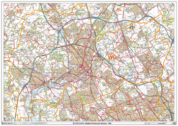
Watford - WD - Postcode Wall Map
The Watford Postcode Sector Wall Map shows detailed postcode sector boundaries (WD1 1, WD1 2) on a comprehensive background and is perfect for determining postcode boundaries for sales areas, planning mailshots and also an excellent reference for logistics. This wall map covers the whole of the WD Postcode Area.
Page Size: 47 x 33.25 in (1189 x 841 mm)
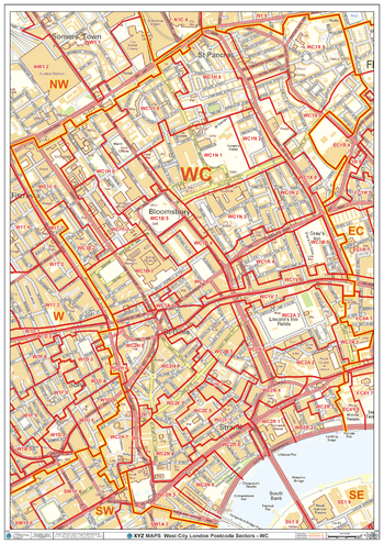
West City London - WC - Postcode Wall Map
The West City London Postcode Sector Wall Map shows detailed postcode sector boundaries (WC1 1, WC1 2) on a comprehensive background and is perfect for determining postcode boundaries for sales areas, planning mailshots and also an excellent reference for logistics. This wall map covers the whole of the WC Postcode Area.
Page Size: 33.25 x 47 in (841 x 1189 mm)
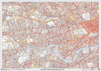
West London - W - Postcode Wall Map
The West London Postcode Sector Wall Map shows detailed postcode sector boundaries (W1 1, W1 2) on a comprehensive background and is perfect for determining postcode boundaries for sales areas, planning mailshots and also an excellent reference for logistics. This wall map covers the whole of the W Postcode Area.
Page Size: 47 x 33.25 in (1189 x 841 mm)
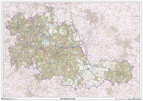
West Midlands County Map
This is a large ceremonial county map of the West Midlands. highlighting the county border, with the surrounding area faded out for excellent contrast. The map covers Wolverhampton, Walsall, West Bromwich, Dudley, Stourbridge, Birmingham, Solihull, Coventry. The county map shows the latest County and Unitary Authority Boundaries, Overlaid on a Clear and Easy to Read Ordnance Survey map.
Page Size: 47 x 33.25 in (1189 x 841 mm)
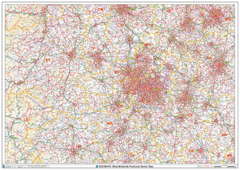
West Midlands Postcode Sector Wall Map (S10)
The West Midlands Postcode Sector Wall Map shows detailed postcode sector boundaries along with its associated label (B1 1, B1 2) on a comprehensive background and is perfect for determining postcode boundaries, for sales, logistics, planning mailshots or as a regional reference guide.
Page Size: 47 x 33.25 in (1189 x 841 mm)
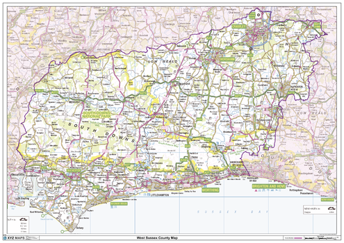
West Sussex County Map
This is a large ceremonial county map of West Sussex highlighting the county border, with the surrounding area faded out for excellent contrast. The map covers East Grinstead, Crawley, Horsham, Midhurst, Chichester, Bognor Regis and Worthing. The county map shows the latest County and Unitary Authority Boundaries, overlaid on a clear and easy to read Ordnance Survey map.
Page Size: 47 x 33.25 in (1189 x 841 mm)
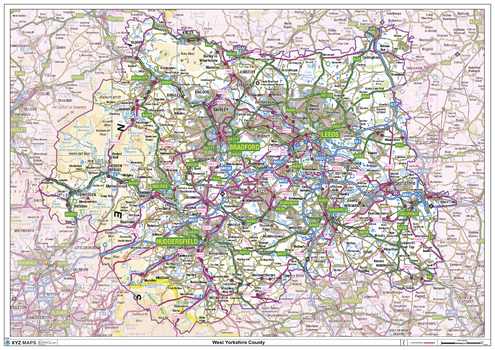
West Yorkshire County Map
This is a large ceremonial county map of West Yorkshire, highlighting the county border, with the surrounding area faded out for excellent contrast. The map covers Bradford, Dewsbury, Halifax, Huddersfield, Leeds, and Wakefield. The county map shows the latest County and Unitary Authority Boundaries, overlaid on a clear and easy to read Ordnance Survey map.
Page Size: 47 x 33.25 in (1189 x 841 mm)
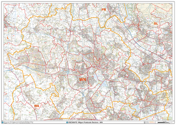
Wigan - WN - Postcode Wall Map
The Wigan Postcode Sector Wall Map shows detailed postcode sector boundaries (WN1 1, WN1 2) on a comprehensive background and is perfect for determining postcode boundaries for sales areas, planning mailshots and also an excellent reference for logistics. This wall map covers the whole of the WN Postcode Area.
Page Size: 47 x 33.25 in (1189 x 841 mm)
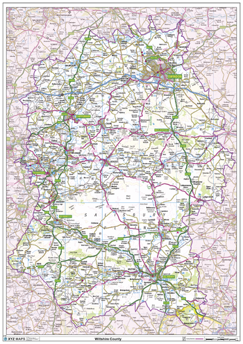
Wiltshire County Map
This is a large ceremonial county map of Wiltshire highlighting the county border, with the surrounding area faded out for excellent contrast. The map covers Bradford on Avon, Chippenham, Devizes, Malmesbury, Marlborough, Melksham, Salisbury, Swindon, Trowbridge and Warminster. The county map shows the latest County and Unitary Authority Boundaries, overlaid on a clear and easy to read Ordnance Survey map.
Page Size: 33.25 x 47 in (841 x 1189 mm)
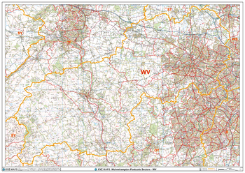
Wolverhampton - WV - Postcode Wall Map
The Wolverhampton Postcode Sector Wall Map shows detailed postcode sector boundaries (WV1 1, WV1 2) on a comprehensive background and is perfect for determining postcode boundaries for sales areas, planning mailshots and also an excellent reference for logistics. This wall map covers the whole of the WV Postcode Area.
Page Size: 47 x 33.25 in (1189 x 841 mm)
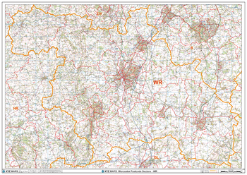
Worcester - WR - Postcode Wall Map
The Worcester Postcode Sector Wall Map shows detailed postcode sector boundaries (WR1 1, WR1 2) on a comprehensive background and is perfect for determining postcode boundaries for sales areas, planning mailshots and also an excellent reference for logistics. This wall map covers the whole of the WR Postcode Area.
Page Size: 47 x 33.25 in (1189 x 841 mm)
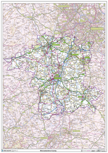
Worcestershire County Map
This is a large ceremonial county map of Worcestershire highlighting the county border, with the surrounding area faded out for excellent contrast. The map covers Worcester, Bromsgrove, Stourport-on-Severn, Droitwich, Evesham, Kidderminster and Malvern. The county map shows the latest County and Unitary Authority Boundaries, Overlaid on a Clear and Easy to Read Ordnance Survey map.
Page Size: 33.25 x 47 in (841 x 1189 mm)
XYZ Basic Map
A plain topographic map of Great Britain at any zoom level from Road Map 1:1 million down to Street Map 1:10 000 with appropriate roads, railways, lakes, rivers, towns, etc. Use this if you need street level delivery maps, walking maps, decorative wall maps, or route planning maps.
XYZ England Clinical Commissioning Groups
The new health structure for England introduced in April 2013.XYZ UK Strategic Health Authorities and Health BoardsStrategic Health Authorities for England, and Health Boards for Wales, Scotland and Northern Ireland.
XYZ Historical Ireland 1940s
Irish Ordnance Survey 1 inch to the mile (1:63 360) mapping from the 1940s. There have been huge changes since that mean these maps give a fascinating record of a by-gone age. Converted to the modern Irish National Grid.