top of page


Worcester - WR - Postcode Wall Map
XYZ Maps
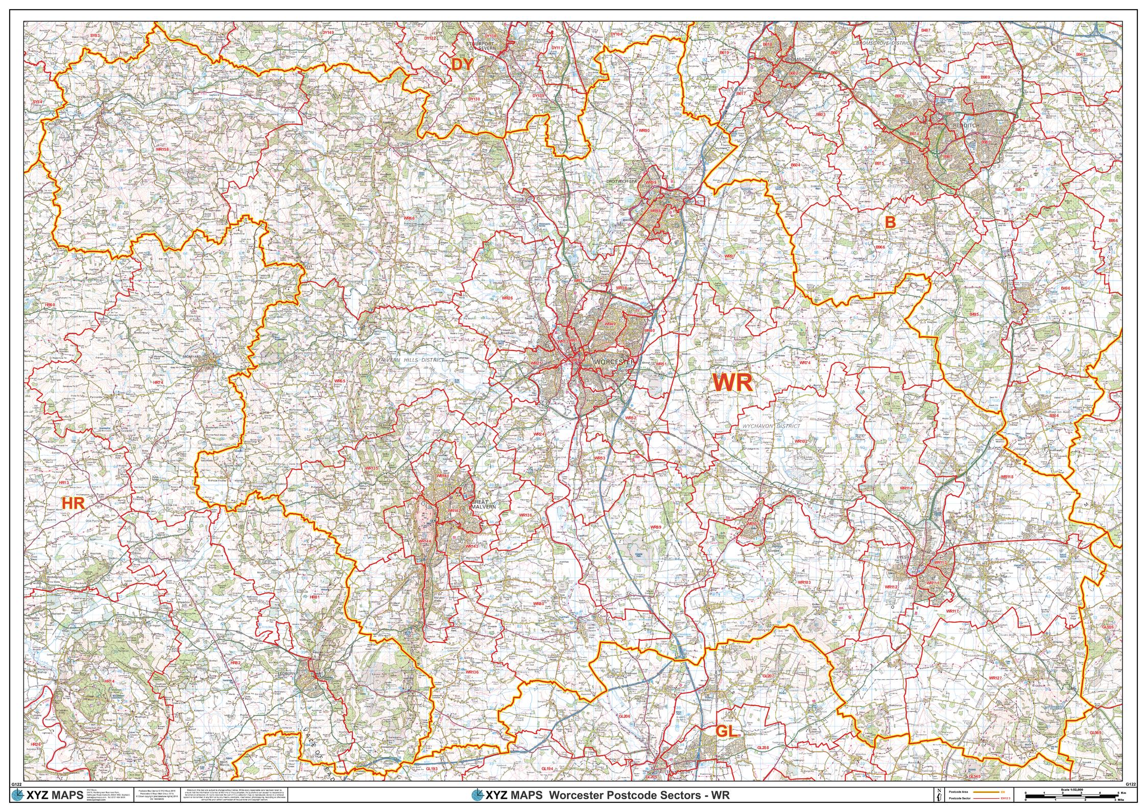
The Worcester Postcode Sector Wall Map shows detailed postcode sector boundaries (WR1 1, WR1 2) on a comprehensive background and is perfect for determining postcode boundaries for sales areas, planning mailshots and also an excellent reference for logistics. This wall map covers the whole of the WR Postcode Area.
Page Size: 47 x 33.25 in (1189 x 841 mm)
Buy this map on MapTrove.ca
bottom of page