top of page
Wales Postcode District Wall Map (D3)
XYZ Maps
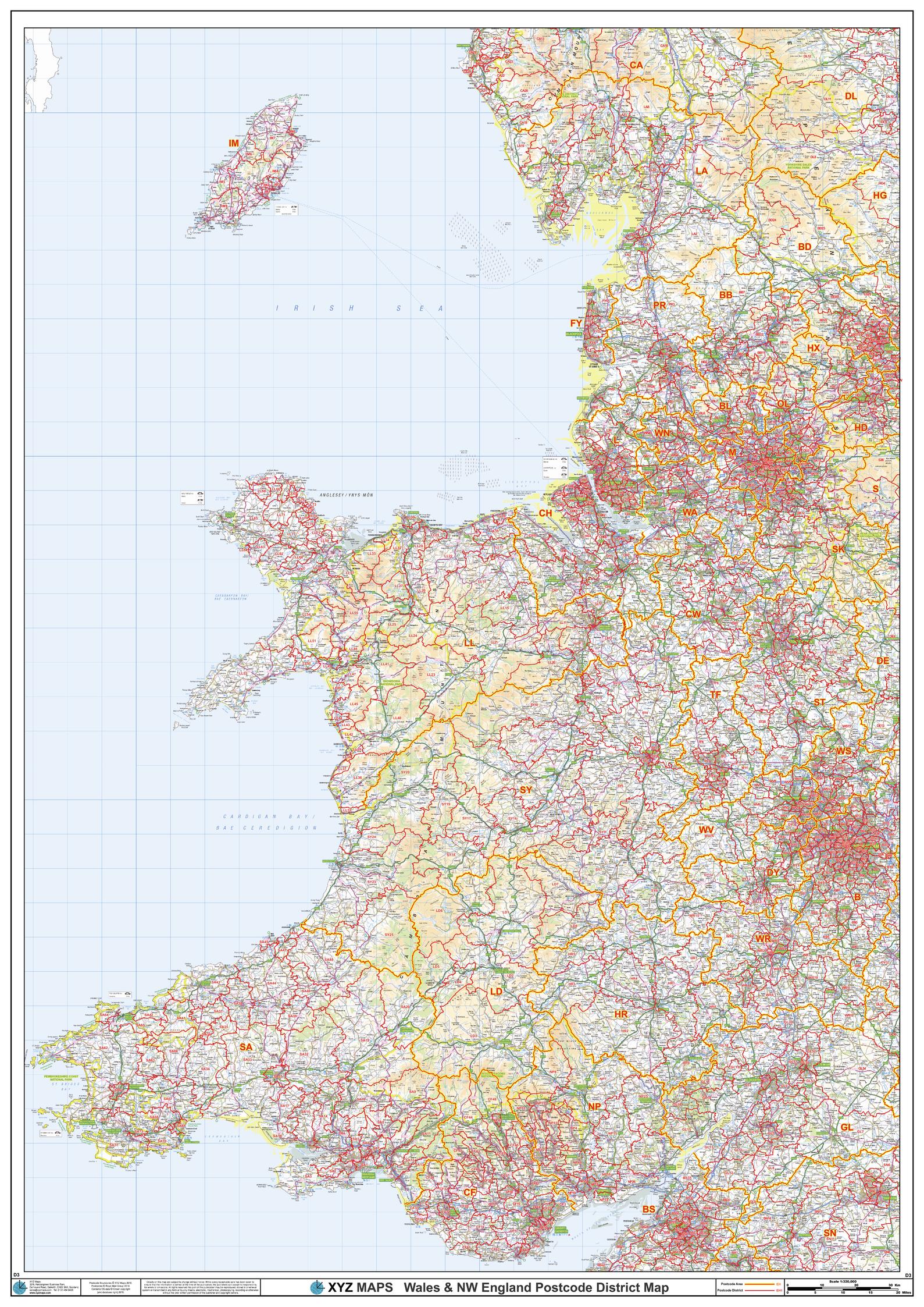
The Wales Postcode District Map clearly shows postcode district boundaries and associated district labels (CF1, CF2) on a comprehensive background and is perfect for determining postcode boundaries for sales territories, logistics, planning mailshots or as a regional reference guide.
Page Size: 33.25 x 47 in (841 x 1189 mm)
Buy this map on MapTrove.ca
bottom of page