top of page
West London - W - Postcode Wall Map
XYZ Maps
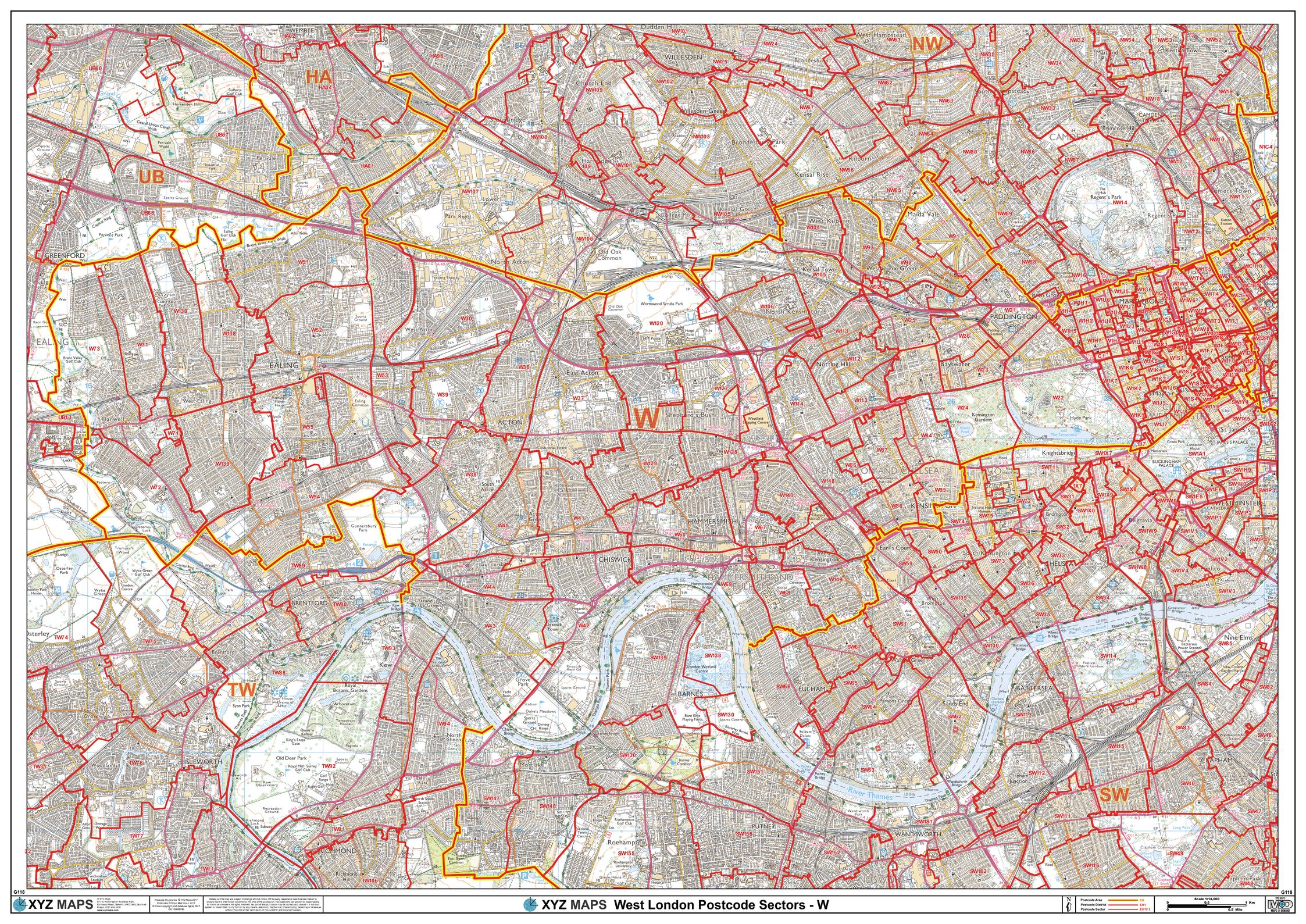
The West London Postcode Sector Wall Map shows detailed postcode sector boundaries (W1 1, W1 2) on a comprehensive background and is perfect for determining postcode boundaries for sales areas, planning mailshots and also an excellent reference for logistics. This wall map covers the whole of the W Postcode Area.
Page Size: 47 x 33.25 in (1189 x 841 mm)
Buy this map on MapTrove.ca
bottom of page