


National Geographic

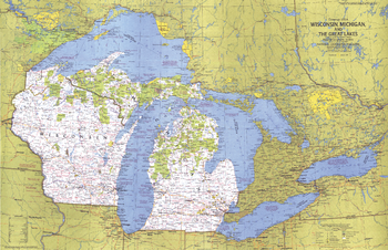
Close-up USA, Wisconsin, Michigan, and the Great Lakes - Published 1973
This map of the United States side of the western Great Lakes highlights the states of Wisconsin and Michigan. It details the vacation areas and sites throughout this beautiful region. Published in August 1973 as part of the "Close-up: U.S.A." series, with the travel poster "Wisconsin, Michigan, and the Great Lakes: Land Between the Waters."
Page Size: 35.25 x 22.75 in (889 x 573 mm)
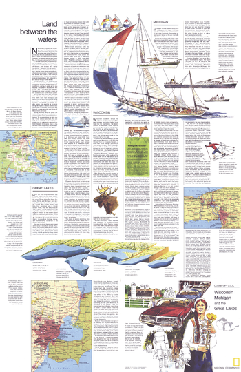
Close-up USA, Wisconsin, Michigan, and the Great Lakes, Land Between the Waters Theme - Published 1973
Part of the "Close-up: U.S.A." series, the "Wisconsin, Michigan, and the Great Lakes: Land Between the Waters" travel map is half of a two-map set, accompanied by the Wisconsin, Michigan, and the Great Lakes map. Published in August 1973, it contains inset maps of the Welland Canal and selected rivers as well as travel information and tips for motorists.
Page Size: 22.75 x 35 in (575 x 887 mm)
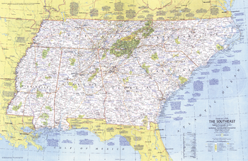
Close-up USA, the Southeast - Published 1975
This map lets you explore the Southeast United States. From the Atlantic seashore to the mighty Mississippi River, this area is rich in history and character. Published in October 1975 as part of the "Close-up: U.S.A." series, with the travel poster "Tennessee, North Carolina, South Carolina, Georgia, Alabama, and Mississippi."
Page Size: 35 x 22.75 in (888 x 577 mm)
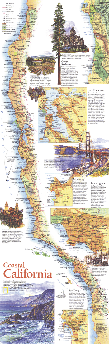
Coastal California - Published 1993
Published in July 1993 as half of a two-map set, this beautifully illustrated map of Coastal California highlights the sites and activities to be found along this extraordinary coastline. From the magnificent redwoods to the sunny beaches of San Diego, this map documents the diverse regions to be experienced along the coastline of the Golden State.
Page Size: 10 x 31.25 in (253 x 792 mm)
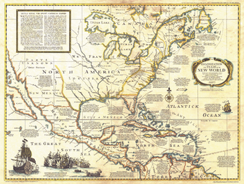
Colonization and Trade in New World - Published 1977
The "Colonization and Trade in the New World" historical map provides information on exploration, trade, and colonization in the New World combined with an antique-style cartography. Printed in December 1977, this map and its companion poster, "History Salvaged from the Sea" make up the two-piece set that accompanied the articles "Reach for the New World" and "Who Discovered America? A New Look at an Old Question."
Page Size: 30 x 22.75 in (761 x 573 mm)
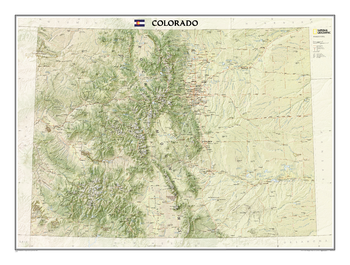
Colorado
The Colorado State Wall Map, part of our growing series of State Wall Maps depicts Colorado's diverse terrain and vegetation. Contains hundreds of place names and precise locations of cities, major roadways and railways, airports, federal and state parks and protected areas, mountain ranges and prominent peaks, military installations, major lakes, rivers and reservoirs, and other geographic features.
Page Size: 40.25 x 30 in (1018 x 758 mm)
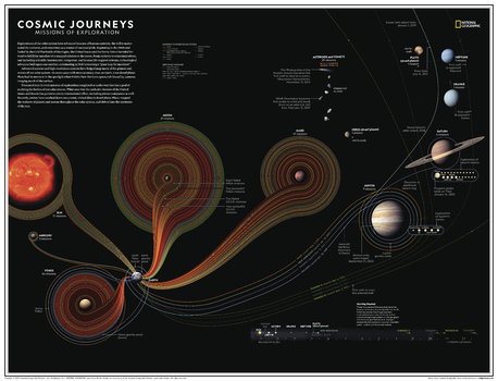
Cosmic Journeys: Missions of Exploration - Atlas of the World, 11th Edition
Explorations of the solar system have advanced because of human curiosity, the will to under-stand the universe, and sometimes as a matter of national pride. Advanced sensors and high-resolution cameras have helped map many of the planets and moons of our solar system—in some cases with more accuracy than on Earth.
Presented here is every mission of exploration completed or under way that has a goal of studying the bodies of our solar system. What once was the exclusive domain of the United States and Russia has grown to a truly international effort, including private companies as well. Recently, probes have touched down on a comet, visited distant dwarf planet Pluto, mapped the surfaces of planets and moons throughout the solar system, and delved into the mysteries of the sun.
This map is found in National Geographic's 11th Edition World Atlas and is now available as a stand alone product.
Page Size: 31.5 x 24 in (798 x 610 mm)
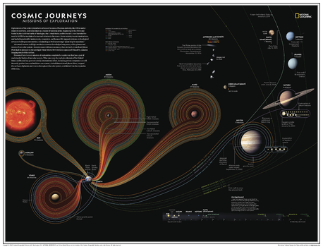
Cosmic Journeys: Missions of Exploration - Atlas of the World, 11th Edition - Compact
Explorations of the solar system have advanced because of human curiosity, the will to under-stand the universe, and sometimes as a matter of national pride. Advanced sensors and high-resolution cameras have helped map many of the planets and moons of our solar system—in some cases with more accuracy than on Earth.
Presented here is every mission of exploration completed or under way that has a goal of studying the bodies of our solar system. What once was the exclusive domain of the United States and Russia has grown to a truly international effort, including private companies as well. Recently, probes have touched down on a comet, visited distant dwarf planet Pluto, mapped the surfaces of planets and moons throughout the solar system, and delved into the mysteries of the sun.
This map is found in National Geographic's 11th Edition World Atlas and is now available as a stand alone product.
Page Size: 21.5 x 16.25 in (540 x 413 mm)
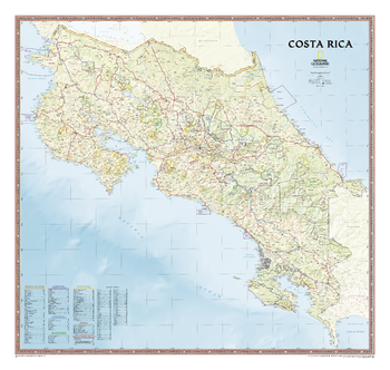
Costa Rica
An intimate introduction to Costa Rica, this full-color map is a richly detailed rendering of one of Central America's greatest treasures. From its northern savannahs and plains to lush forests and pristine jungle-lined beaches, Costa Rica's beauty and diversity beckon the adventure traveler. The map also includes boundaries and information for National Parks, protected areas, marine sancuaries, and more.
Page Size: 38 x 36 in (965 x 914 mm)
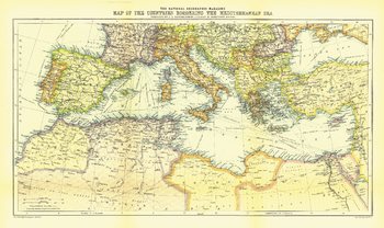
Countries Bordering the Mediterranean Sea - Published 1912
The Map of Countries Bordering the Mediterranean Sea was published in January 1912, prior to the First Balkan War. This colorful map accompanied three articles of the region including "The Sea-Kings of Crete."
Page Size: 19.5 x 11.5 in (490 x 292 mm)
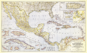
Countries of the Caribbean - Published 1947
Published in October 1947, this map of the Countries of the Caribbean features Mexico, Central America, and the West Indies as well the islands of the Caribbean. Inset maps of ten of the most prominent islands and the Panama Canal zone provide detail of the region. The article "Guatemala Revisited" accompanied the map.
Page Size: 41 x 25 in (1036 x 632 mm)
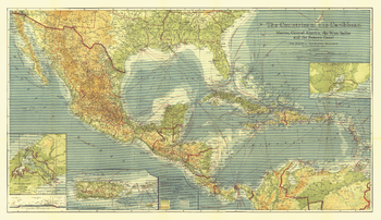
Countries of the Caribbean - Published 1922
This beautiful map of the Caribbean includes Central America, the West Indies, and Mexico. Published in February 1922, this map appeared in an issue entirely devoted to Middle America. Rich color, and details such as inset maps, steamship routes, and wireless stations, make this piece a fine map for collectors.
Page Size: 44 x 25.5 in (1113 x 643 mm)
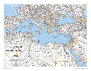
Countries of the Mediterranean Classic
<p>This National Geographic wall map features the countries bordering the "great inland sea"- the Mediterranean. Exquisitely detailed, this reference map contains hundreds of place-names, many shown with their commonly recognized conventional (English) names. Physical geography details include shaded relief and cartographic patterns used to depict sand, lava fields, and areas below sea level. Also included are the elevations of major peaks and ocean soundings, both expressed in meters. This map also features a detailed transportation network including highways, roads, high-speed passenger railroads, and major airports. </p><p>All proceeds from the purchase of a National Geographic map help support the Society's vital exploration, conservation, scientific research, and education programs. </p>
Page Size: 30.25 x 23.5 in (768 x 597 mm)
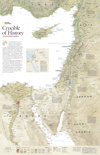
Crucible of History, the Eastern Mediterranean - Published 2008
Few regions on Earth can match the eastern Mediterranean for drama. Its story, written in stone and blood over five millennia, sweeps through history on the wings of empire: Egyptian, Phoenician, Hittite, Assyrian, Canaanite, Israelite, Babylonian, Persian, Greek, Roman, Byzantine Christian, Arab Muslim, and Ottoman -- all ruled in this territory between the Nile and the mountains of Anatolia. Now, the people of the region find themselves in troubled post-colonial societies torn by epic conflicts, ranging from the battles of Israelis and Palestinians over land and resources to the clash of Islam and the West. Explore the eastern Mediterranean region with this attractive and informative map. Published in December 2008, this map was half of a two-map set with "Jerusalem's Holy Ground."
Page Size: 20.25 x 31.25 in (512 x 791 mm)
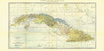
Cuba - Published 1906
This map of Cuba was published in October 1906, the year disputed elections led to an armed revolt on the island. The United States intervened and occupied the country, installing a US governor for three years. This is an attractive historical work and a fine map for collectors.
Page Size: 28 x 13.75 in (710 x 347 mm)
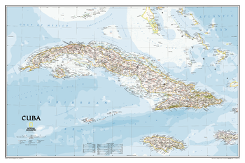
Cuba Classic
The most accurate and detailed reference map available for the iconic Caribbean island nation. <br><br>Cuba's many offshore islands, reefs, and rivers are noted, as are sites of interest including national parks, mountains, swamps, and coastal reefs. Ocean bathymetry, peak elevations, and handcrafted shaded relief provide topographical detail. Jamaica, the Cayman Islands, the Florida Keys, and most of the Bahamas and Haiti are shown, presenting Cuba in the context of its important geographical position in the Caribbean.<br><br>Includes thousands of place names in Spanish and English, accurate political boundaries and major transportation features including highways, roads, canals, ferry routes, and airports.<br><br>Popular places on the map include Havana, Pinar del Rio, Baracoa, Trinidad, Caya Largo, Santa Clara, Varadera, and Isla de la Juventad.
Page Size: 36 x 24 in (914 x 610 mm)

Cuba Index - Published 1906
Index to place names on Cuba Map 1906
Page Size: 28 x 13.75 in (710 x 347 mm)
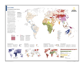
Cultures: A Developing Global Culture - Atlas of the World, 10th Edition
Classifying and Grouping Languages; For More Than Posterity; Mapping Language Diversity; Vanishing Languages; Identifying the World's Religions; Charting Leading Religions
Page Size: 28 x 22 in (711 x 559 mm)
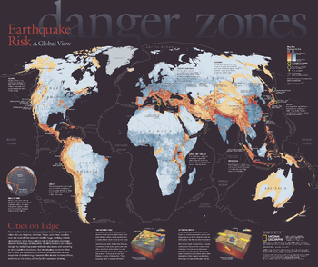
Danger Zones, Earthquake Risk, a Global View - Published 2006
Never before have so many people packed into earthquake-prone cities like Los Angeles, Istanbul, Tokyo, and Lima. Located near the boundaries between Earth's huge, shifting crustal plates, these cities face a rising risk of death and economic disaster from large earthquakes. This eye-catching map reveals the areas most at risk and their populations. Published in April 2006, this map was half of a two-piece set with
Page Size: 24 x 20.25 in (610 x 512 mm)
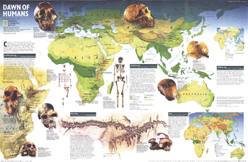
Dawn of Humans - Published 1997
This fascinating map contains a wealth of information on our quest to discover the history of our prehistoric ancestors including fossil sites, information on significant hominid finds, and the challenges researchers face. Published in February 1997 with the "Seeking Our Origins" companion map, this work also includes maps which show the vegetation zones 125,000 years ago, 65,000 years ago, and today.
Page Size: 31.25 x 20.25 in (790 x 513 mm)