


MapSherpa Catalog
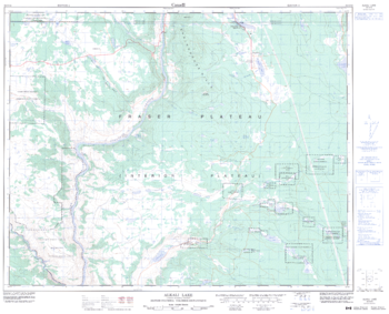
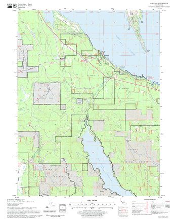
Alkali Lake - 92 O/16 - British Columbia
Natural Resources Canada
Canadian topographic map of Alkali Lake, British Columbia. NTS sheet 092O16 Edition 4.
Page Size: 31.5 x 25.5 in (795 x 643 mm)

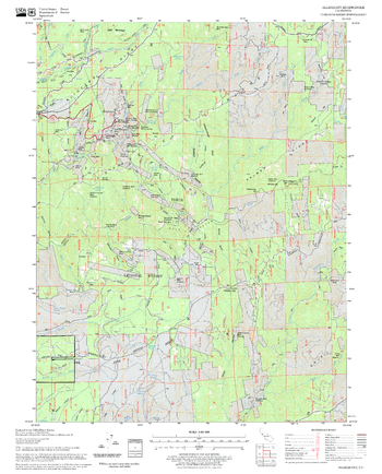
Allan Mountain Quadrangle, Idaho
United States Department of Agriculture Forest Service
United States Department of Agriculture Forestry Service topographical map of Allan Mountain, Salmon-Chalis National Forest, Idaho.
Page Size: 21.75 x 27 in (552 x 686 mm)
Alleghany Quadrangle, California
United States Department of Agriculture Forest Service
United States Department of Agriculture Forestry Service topographical map of Alleghany, Tahoe National Forest, California.
Page Size: 21.75 x 27 in (552 x 686 mm)
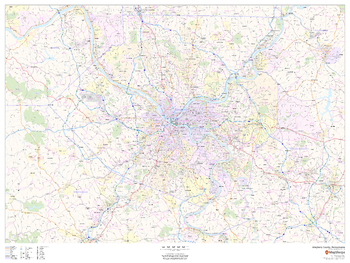
Allegheny County, Pennsylvania
MapSherpa
This map of Allegheny County, Pennsylvania shows regional level information. Base map features include highways and major roads with labelling; neighborhood names; railways; high level land use such as parks and recreation areas, industrial areas and hospital campuses; and a selection of points of interest including transportation hubs like airports and train stations, tourist information, police stations and shopping centres. ZIP code boundaries are shown as a secondary map feature.
Page Size: 48 x 36 in (1219 x 914 mm)
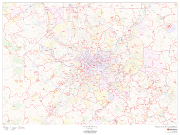
Allegheny County, Pennsylvania ZIP Codes
MapSherpa
This map of Allegheny County, Pennsylvania shows ZIP code areas overlaid on a road map. Ideal for planning of deliveries, home services, sales territories, real estate and much more. Base map features include all roads with major roads and highways labelled; neighborhood names; railways; and high level land use such as parks and recreation areas, industrial areas and hospital campuses.
Page Size: 48 x 36 in (1219 x 914 mm)
Almanor Quadrangle, California
United States Department of Agriculture Forest Service
United States Department of Agriculture Forestry Service topographical map of Almanor, Lassen National Forest, California.
Page Size: 21.75 x 27 in (552 x 686 mm)
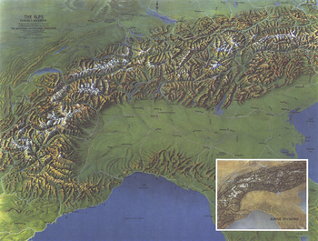
Alps, Europes Backbone - Published 1965
National Geographic
Published in 1965 with the article "The Alps: Man's Own Mountains," this map offers a detailed look at the countries occupying this particularly beautiful mountain region. A wonderful companion map to "The Alps, Europe's Backbone," a relief map printed in the same issue.
Page Size: 25 x 19 in (631 x 478 mm)
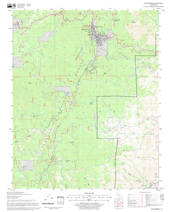
Alta Sierra Quadrangle, California
United States Department of Agriculture Forest Service
United States Department of Agriculture Forestry Service topographical map of Alta Sierra, Sequoia National Forest, California.
Page Size: 21.75 x 27 in (552 x 686 mm)
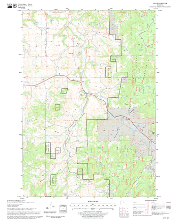
Alva Quadrangle, South Dakota
United States Department of Agriculture Forest Service
United States Department of Agriculture Forestry Service topographical map of Alva, Black Hills National Forest, South Dakota.
Page Size: 21.75 x 27 in (552 x 686 mm)
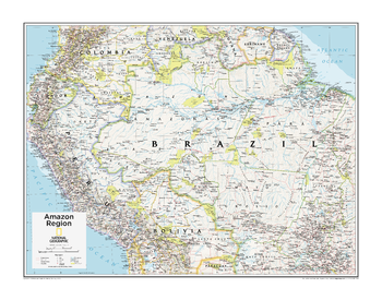
Amazon Region - Atlas of the World, 10th Edition
National Geographic
Brazil, Ecuador, French Guiana (France), Peru, Suriname
Page Size: 28 x 22 in (711 x 559 mm)
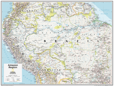
Amazon Region - Atlas of the World, 10th Edition - Compact
National Geographic
Brazil, Ecuador, French Guiana (France), Peru, Suriname
Page Size: 21 x 16 in (532 x 406 mm)
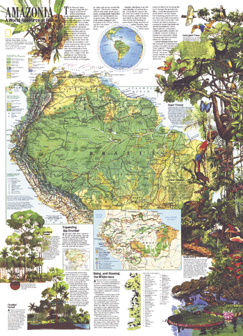
Amazonia, a World Resource At Risk - Published 1992
National Geographic
With a physical map of the Amazon basin as well as an abundance of illustrations and information about this magnificent region, this map is a must-have for those fascinated by the beauty and mystery of the tropical rainforest. Discover how this region's health affects the health of the entire planet and the threats facing it. Published in August 1992, it is a perfect companion for the political map of South America printed in the same issue.
Page Size: 20.25 x 28 in (512 x 707 mm)
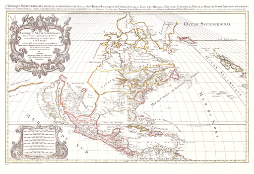
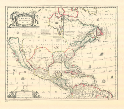
America Septentrionale
Natural Resources Canada
Contained within the Historical Maps, 1639 to 1949, Atlas of Canada map series, is a reproduction of the original Amerique Septentrionale map by Nicolas Sanson and was published in 1695 by Pierre Mortier in Amsterdam.
Page Size: 35.75 x 24.5 in (908 x 620 mm)
America Septentrionalis
Natural Resources Canada
Contained within the Historical Maps, 1639 to 1949, Atlas of Canada map series, is a reproduction of the original 1639 America Septentrionalis map by the Dutch map making family, Hondius.
Page Size: 24 x 21.25 in (604 x 534 mm)
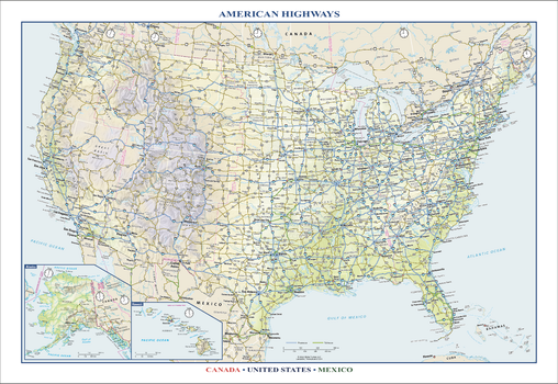
American Highways Wall Map
Globe Turner
Perfect for home, business, or school, this American Highways wall map shows the Interstate Highway System of the United States, along with other important Federal and state highways. Details included on this wall map include: international and state/provincial boundaries; freeways, tollways, and other major roads; cities and towns; time zones; and National Parks in the United States. Insets of Alaska and Hawaii are also included on this map, along with parts of southern Canada and northern Mexico. Special features include colored relief and a white decorative border. City type sizes reflect the 2020 U.S. Census
Page Size: 22.75 x 15.5 in (572 x 394 mm)
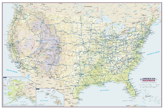
American Highways Wall Map - Poster
Globe Turner
Perfect for home, business, or school, this American Highways wall map shows the Interstate Highway System of the United States, along with other important Federal and state highways. Details on this wall map include international and state/provincial boundaries; freeways, tollways, and other major roads; cities and towns; time zones; and all National Parks in the United States. Insets of Alaska and Hawaii are also included on this map.
Page Size: 36 x 24 in (914 x 610 mm)
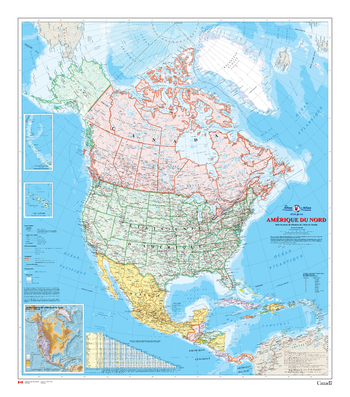
Amérique du Nord - Carte Murale - L'Atlas du Canada
Natural Resources Canada
La série de cartes de référence de 1961 à 2010 de l'Atlas du Canada contient la version la plus récente d'une carte mise à jour régulièrement et qui provient de la série de cartes de base de l'Atlas national du Canada. Chaque version présente l'Amérique du Nord à une échelle de 1/10 000 000. La carte de référence générale couvre en détail les lieux habités, les voies de transport et le réseau hydrographique. Les terres émergées sont colorées afin de représenter chaque pays et ses dépendances, tandis que les zones extracôtières le sont afin de montrer la bathymétrie. La carte possède deux cartons : le premier montre Hawaii, également à l'échelle de 1/10 000 000, et le second est un carton de l'Amérique du Nord à l'échelle de 1/53 000 000 montrant le relief et indiquant l'altitude des montagnes importantes. En outre, la carte comporte un tableau des distances entre les grandes villes.
Page Size: 34 x 39 in (864 x 991 mm)
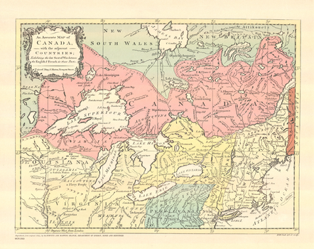
An Accurate Map of Canada with the Adjacent Countries
Natural Resources Canada
Contained within the Historical Maps, 1639 to 1949, Atlas of Canada is a reproduction of the An Accurate Map of Canada with the Adjacent Countries. It was produced by Richard William Seale and published in 1767 in London by J. Hinton.
Page Size: 15.25 x 12 in (383 x 304 mm)
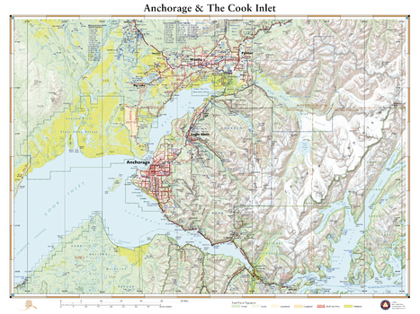
Anchorage and The Cook Inlet
Benchmark Maps
This wall map details the terrain in Alaska’s most populated area. Coverage includes Anchorage, Palmer, Wasilla, the Knik & Turnagain Arms of Cook Inlet, peaks and glaciers of the Chugach Mountains, the fjords of Port Wells and the western reaches of Prince William Sound.
Page Size: 26 x 34.75 in (660 x 881 mm)
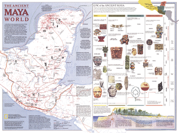
Ancient Maya World - Published 1989
National Geographic
Explore the fascinating world of the Maya with this map published in October 1989. This map accompanied the "Land of the Maya" map in the same issue and three articles on the Maya including "La Ruta Maya." This work features an abundance of information about trade, travel, and the landscape of their civilization, including an explanation of the various eras of Maya history.
Page Size: 27.25 x 20.25 in (687 x 512 mm)
No search results