


MapSherpa Catalog
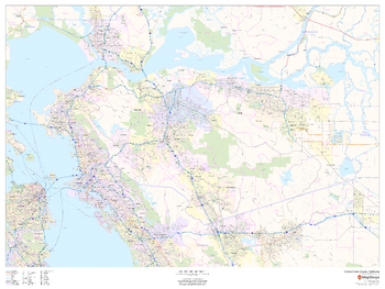
Contra Costa County, California
MapSherpa
This map of Contra Costa County, California shows regional level information. Base map features include highways and major roads with labelling; neighborhood names; railways; high level land use such as parks and recreation areas, industrial areas and hospital campuses; and a selection of points of interest including transportation hubs like airports and train stations, tourist information, police stations and shopping centres. ZIP code boundaries are shown as a secondary map feature.
Page Size: 48 x 36 in (1219 x 914 mm)
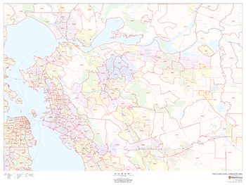
Contra Costa County, California ZIP Codes
MapSherpa
This map of Contra Costa County, California shows ZIP code areas overlaid on a road map. Ideal for planning of deliveries, home services, sales territories, real estate and much more. Base map features include all roads with major roads and highways labelled; neighborhood names; railways; and high level land use such as parks and recreation areas, industrial areas and hospital campuses.
Page Size: 48 x 36 in (1219 x 914 mm)
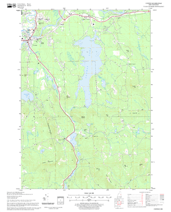
Conway Quadrangle, New Hampshire-Vermont
United States Department of Agriculture Forest Service
United States Forestry Service topographical map of Conway, New Hampshire-Vermont
Page Size: 21.75 x 27 in (552 x 686 mm)
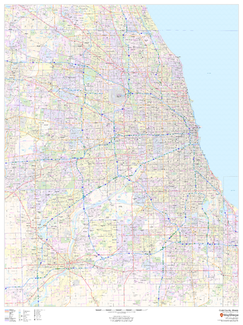
Cook County, Illinois
MapSherpa
This map of Cook County, Illinois shows regional level information. Base map features include highways and major roads with labelling; railways; high level land use such as parks and recreation areas; and a selection of points of interest including transportation hubs like airports and train stations, tourist information and police stations. ZIP code boundaries are shown as a secondary map feature.
Page Size: 36 x 48 in (914 x 1219 mm)
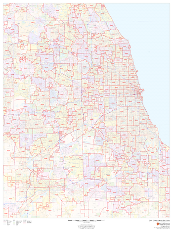
Cook County, Illinois ZIP Codes
MapSherpa
This map of Cook County, Illinois shows ZIP code areas overlaid on a road map. Ideal for planning of deliveries, home services, sales territories, real estate and much more. Base map features include all roads with major roads and highways labelled; neighborhood names; railways; and high level land use such as parks and recreation areas, industrial areas and hospital campuses.
Page Size: 36 x 48 in (914 x 1219 mm)
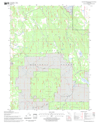
Corders Reservoir Quadrangle, California
United States Department of Agriculture Forest Service
United States Department of Agriculture Forestry Service topographical map of Corders Reservoir, Lassen National Forest, California.
Page Size: 21.75 x 27 in (552 x 686 mm)
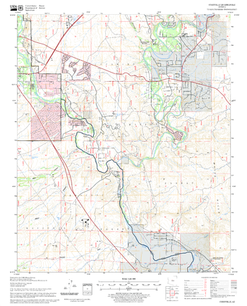
Cornville Quadrangle, Arizona
United States Department of Agriculture Forest Service
United States Department of Agriculture Forestry Service topographical map of Cornville, Coconino National Forest, Arizona.
Page Size: 21.75 x 27 in (552 x 686 mm)

Cornwall County Map
XYZ Maps
This is a large ceremonial county map of Cornwall highlighting the county border, with the surrounding area faded out for excellent contrast. The map covers Bodmin, Bude, Falmouth, Fowey, Launceston, Lostwithiel, Mousehole, Padstow, Penzance, Redruth, St Austell, St Ives, Truro, St Neots, Saltash and Tintagel. The county map shows the latest County and Unitary Authority Boundaries, overlaid on a clear and easy to read Ordnance Survey map.
Page Size: 47 x 33.25 in (1189 x 841 mm)
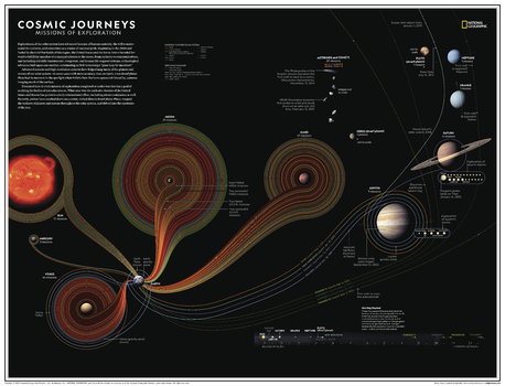
Cosmic Journeys: Missions of Exploration - Atlas of the World, 11th Edition
National Geographic
Explorations of the solar system have advanced because of human curiosity, the will to under-stand the universe, and sometimes as a matter of national pride. Advanced sensors and high-resolution cameras have helped map many of the planets and moons of our solar system—in some cases with more accuracy than on Earth.
Presented here is every mission of exploration completed or under way that has a goal of studying the bodies of our solar system. What once was the exclusive domain of the United States and Russia has grown to a truly international effort, including private companies as well. Recently, probes have touched down on a comet, visited distant dwarf planet Pluto, mapped the surfaces of planets and moons throughout the solar system, and delved into the mysteries of the sun.
This map is found in National Geographic's 11th Edition World Atlas and is now available as a stand alone product.
Page Size: 31.5 x 24 in (798 x 610 mm)

Cosmic Journeys: Missions of Exploration - Atlas of the World, 11th Edition - Compact
National Geographic
Explorations of the solar system have advanced because of human curiosity, the will to under-stand the universe, and sometimes as a matter of national pride. Advanced sensors and high-resolution cameras have helped map many of the planets and moons of our solar system—in some cases with more accuracy than on Earth.
Presented here is every mission of exploration completed or under way that has a goal of studying the bodies of our solar system. What once was the exclusive domain of the United States and Russia has grown to a truly international effort, including private companies as well. Recently, probes have touched down on a comet, visited distant dwarf planet Pluto, mapped the surfaces of planets and moons throughout the solar system, and delved into the mysteries of the sun.
This map is found in National Geographic's 11th Edition World Atlas and is now available as a stand alone product.
Page Size: 21.5 x 16.25 in (540 x 413 mm)
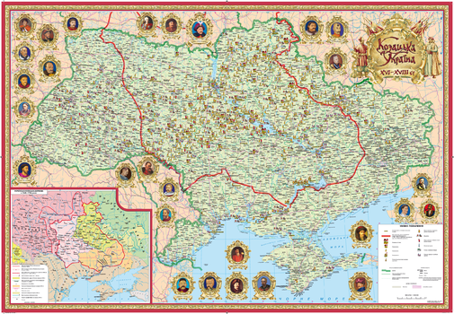
Cossack Ukraine of the 16th - 18th centuries - Ukrainian
Kartographia
This unique Ukranian-language map displays key historical places and events on a modern geographical base. Towns and villages that are associated with the greatest highlights of the Ukrainian Cossackdom - Kozakdom period are marked. These include places of battles, fortresses, ZaporizhianSich places, hetmana's residences, regimental and sotnia towns. The inset map presents a historical map of that period. Map margins contain portraits of prominent Cossack leaders.
Page Size: 38 x 26 in (960 x 660 mm)
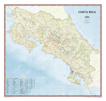
Costa Rica
National Geographic
An intimate introduction to Costa Rica, this full-color map is a richly detailed rendering of one of Central America's greatest treasures. From its northern savannahs and plains to lush forests and pristine jungle-lined beaches, Costa Rica's beauty and diversity beckon the adventure traveler. The map also includes boundaries and information for National Parks, protected areas, marine sancuaries, and more.
Page Size: 38 x 36 in (965 x 914 mm)
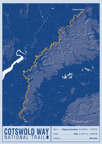
Cotswold Way National Trail Map Print
A-Z Maps
This map print highlights the National Trail route of the Cotswold Way, showing the start and finish points on an attractive relief base and created in the official National Trail colours.
Page Size: 16.75 x 23.5 in (420 x 594 mm)
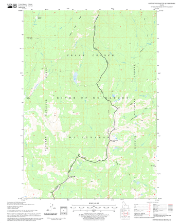
Cottonwood Butte Quadrangle, Idaho
United States Department of Agriculture Forest Service
United States Department of Agriculture Forestry Service topographical map of Cottonwood Butte, Salmon-Chalis National Forest, Idaho.
Page Size: 21.75 x 27 in (552 x 686 mm)
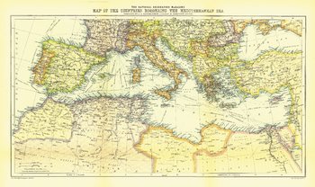
Countries Bordering the Mediterranean Sea - Published 1912
National Geographic
The Map of Countries Bordering the Mediterranean Sea was published in January 1912, prior to the First Balkan War. This colorful map accompanied three articles of the region including "The Sea-Kings of Crete."
Page Size: 19.5 x 11.5 in (490 x 292 mm)
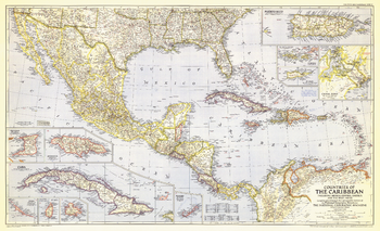
Countries of the Caribbean - Published 1947
National Geographic
Published in October 1947, this map of the Countries of the Caribbean features Mexico, Central America, and the West Indies as well the islands of the Caribbean. Inset maps of ten of the most prominent islands and the Panama Canal zone provide detail of the region. The article "Guatemala Revisited" accompanied the map.
Page Size: 41 x 25 in (1036 x 632 mm)
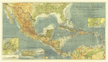
Countries of the Caribbean - Published 1922
National Geographic
This beautiful map of the Caribbean includes Central America, the West Indies, and Mexico. Published in February 1922, this map appeared in an issue entirely devoted to Middle America. Rich color, and details such as inset maps, steamship routes, and wireless stations, make this piece a fine map for collectors.
Page Size: 44 x 25.5 in (1113 x 643 mm)
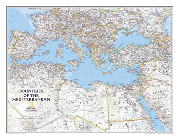
Countries of the Mediterranean Classic
National Geographic
<p>This National Geographic wall map features the countries bordering the "great inland sea"- the Mediterranean. Exquisitely detailed, this reference map contains hundreds of place-names, many shown with their commonly recognized conventional (English) names. Physical geography details include shaded relief and cartographic patterns used to depict sand, lava fields, and areas below sea level. Also included are the elevations of major peaks and ocean soundings, both expressed in meters. This map also features a detailed transportation network including highways, roads, high-speed passenger railroads, and major airports. </p><p>All proceeds from the purchase of a National Geographic map help support the Society's vital exploration, conservation, scientific research, and education programs. </p>
Page Size: 30.25 x 23.5 in (768 x 597 mm)
Countries of the World
MapSherpa
A modern map with a subtle, but colorful palette, noting all the countries of the world, along with their capitals and major cities. Primary water feature names make this World Map and outstanding addition to any home or place of learning.

County Durham County Map
XYZ Maps
This is a large ceremonial county map of County Durham highlighting the county border, with the surrounding area faded out for excellent contrast. The map covers Barnard Castle, Billingham, Blaydon, Darlington, Durham, Gateshead, Hartlepool, Jarrow, South Shields, Stockton-on-Tees, Sunderland and Washington. The county map shows the latest County and Unitary Authority Boundaries, Overlaid on a Clear and Easy to Read Ordnance Survey map.
Page Size: 47 x 33.25 in (1189 x 841 mm)
No search results