


MapSherpa Catalog

Bedfordshire County Map
XYZ Maps
This is a large ceremonial county map of Bedfordshire highlighting the county border, with the surrounding area faded out for excellent contrast. The map covers Ampthill, Luton, Biggleswade, Dunstable, Leighton Buzzard and Sandy. The county map shows the latest County and Unitary Authority Boundaries, overlaid on a clear and easy to read Ordnance Survey map.
Page Size: 33.25 x 47 in (841 x 1189 mm)
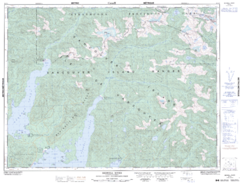
Bedwell River - 92 F/5 - British Columbia
Natural Resources Canada
Canadian topographic map of Bedwell River, British Columbia. NTS sheet 092F05 Edition 5.
Page Size: 33.5 x 25.5 in (846 x 643 mm)
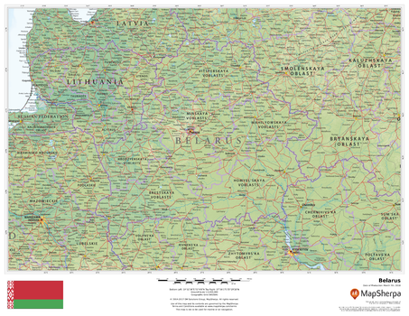
Belarus
MapSherpa
This beautiful map shows physical and political features for Belarus and surrounding areas. Relief shading and the use of different colours by height above sea level are both informative and attractive.
Page Size: 22 x 17 in (559 x 432 mm)
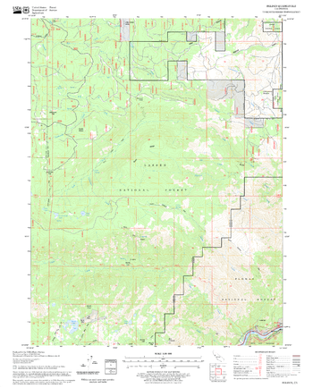
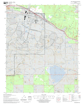
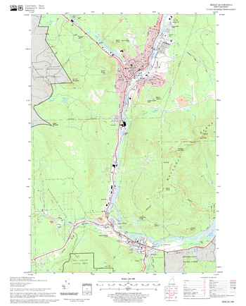
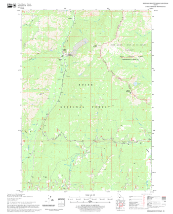
Belden Quadrangle, California
United States Department of Agriculture Forest Service
United States Department of Agriculture Forestry Service topographical map of Belden, Lassen National Forest, California.
Page Size: 21.75 x 27 in (552 x 686 mm)

Belfast - BT - Postcode Wall Map
XYZ Maps
The Belfast Postcode Sector Wall Map shows detailed postcode sector boundaries (BT1 1, BT1 2) on a comprehensive background and is perfect for determining postcode boundaries for sales areas, planning mailshots and also an excellent reference for logistics. This wall map covers the whole of the BT Postcode Area.
Page Size: 47 x 33.25 in (1189 x 841 mm)
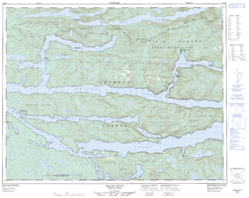
Belize Inlet - 92 M/3 - British Columbia
Natural Resources Canada
Canadian topographic map of Belize Inlet, British Columbia. NTS sheet 092M03 Edition 2.
Page Size: 32 x 25.25 in (807 x 641 mm)
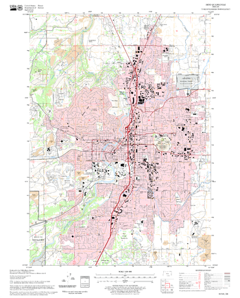
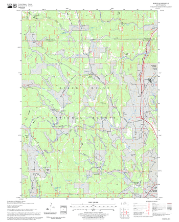
Bellemont Quadrangle, Arizona
United States Department of Agriculture Forest Service
United States Department of Agriculture Forestry Service topographical map of Bellemont, Coconino National Forest, Arizona.
Page Size: 21.75 x 27 in (552 x 686 mm)
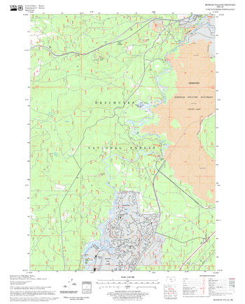
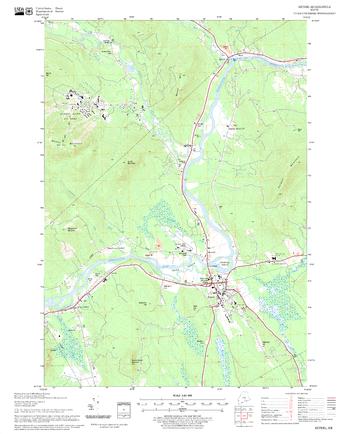
Bend Quadrangle, Oregon
United States Department of Agriculture Forest Service
United States Department of Agriculture Forestry Service topographical map of Bend, Deschutes National Forest, Oregon.
Page Size: 21.75 x 27 in (552 x 686 mm)
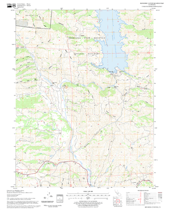
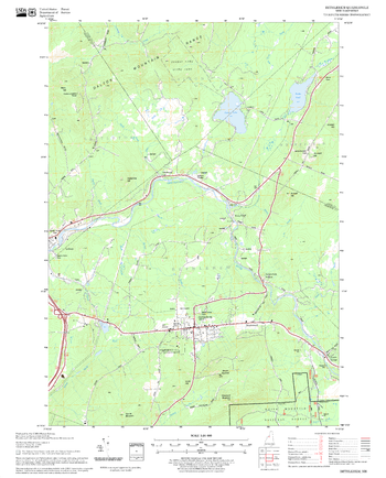
Benham Falls Quadrangle, Oregon
United States Department of Agriculture Forest Service
United States Department of Agriculture Forestry Service topographical map of Benham Falls, Deschutes National Forest, Oregon.
Page Size: 21.75 x 27 in (552 x 686 mm)
Benmore Canyon Quadrangle, California
United States Department of Agriculture Forest Service
United States Department of Agriculture Forestry Service topographical map of Benmore Canyon, Mendocino National Forest, California.
Page Size: 21.75 x 27 in (552 x 686 mm)
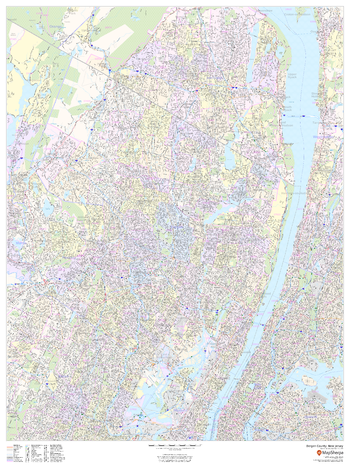
Bergen County, New Jersey
MapSherpa
This map of Bergen County, New Jersey shows street level information including street labeling. Base map features include all roads with major roads and highways labelled; neighborhood names; railways; high level land use such as parks and recreation areas, industrial areas and hospital campuses; and a variety of points of interest including libraries, stadiums, museums, border crossings and more. ZIP code boundaries are shown as a secondary map feature.
Page Size: 36 x 48 in (914 x 1219 mm)
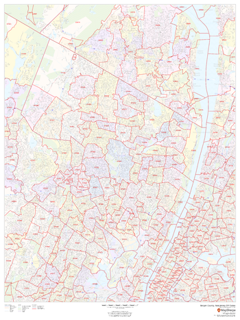
Bergen County, New Jersey ZIP Codes
MapSherpa
This map of Bergen County, New Jersey shows ZIP code areas overlaid on a road map. Ideal for planning of deliveries, home ervices, sales territories, real estate and much more. Base map features include all roads with major roads and highways labelled; neighborhood names; railways; and high level land use such as parks and recreation areas, industrial areas and hospital campuses.
Page Size: 36 x 48 in (914 x 1219 mm)

Berkshire County Map
XYZ Maps
This is a large ceremonial county map of Berkshire highlighting the county border, with the surrounding area faded out for excellent contrast. The map covers Abingdon, Didcot, Harwell, Hungerford, Maidenhead, Newbury, Reading, Wantage and Windsor. The county map shows the latest County and Unitary Authority Boundaries, overlaid on a clear and easy to read Ordnance Survey map.
Page Size: 47 x 33.25 in (1189 x 841 mm)
Berlin Quadrangle, New Hampshire-Vermont
United States Department of Agriculture Forest Service
United States Department of Agriculture Forestry Service topographical map of Berlin, White Mountains National Forest, New Hampshire-Vermont.
Page Size: 21.75 x 27 in (552 x 686 mm)
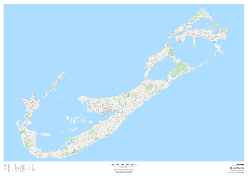
Bermuda
MapSherpa
This map of Bermuda features a full road network for the island including the capital Hamilton, walking paths, land use, points of interest, and many of the buildings. Useful for the traveller, and as a wall map for display in your home.
Page Size: 47 x 33.25 in (1189 x 841 mm)
Bernard Mountain Quadrangle, Idaho
United States Department of Agriculture Forest Service
United States Department of Agriculture Forestry Service topographical map of Bernard Mountain, Salmon-Chalis National Forest, Idaho.
Page Size: 21.75 x 27 in (552 x 686 mm)
Berne Quadrangle, South Dakota
United States Department of Agriculture Forest Service
United States Department of Agriculture Forestry Service topographical map of Berne, Black Hills National Forest, South Dakota.
Page Size: 21.75 x 27 in (552 x 686 mm)
Bethel Quadrangle, New Hampshire-Vermont
United States Department of Agriculture Forest Service
United States Department of Agriculture Forestry Service topographical map of Bethel, White Mountains National Forest, New Hampshire-Vermont.
Page Size: 21.75 x 27 in (552 x 686 mm)
Bethlehem Quadrangle, New Hampshire-Vermont
United States Department of Agriculture Forest Service
United States Forestry Service topographical map of Bethlehem, New Hampshire-Vermont
Page Size: 21.75 x 27 in (552 x 686 mm)
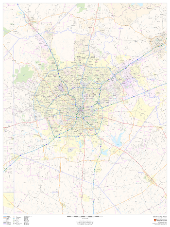
Bexar County, Texas
MapSherpa
This map of Bexar County, Texas shows regional level information. Base map features include highways and major roads with labelling; neighborhood names; railways; high level land use such as parks and recreation areas, industrial areas and hospital campuses; and a selection of points of interest including transportation hubs like airports and train stations, tourist information, police stations and shopping centres. ZIP code boundaries are shown as a secondary map feature.
Page Size: 36 x 48 in (914 x 1219 mm)
No search results