


MapSherpa Catalog
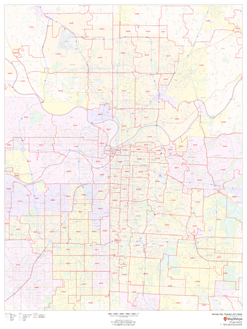
Kansas City, Missouri ZIP Codes
MapSherpa
This map of Kansas City, Missouri shows ZIP code areas overlaid on a road map. Ideal for planning of deliveries, home services, sales territories, real estate and much more. Base map features include all roads with major roads and highways labelled; neighborhood names; railways; and high level land use such as parks and recreation areas, industrial areas and hospital campuses.
Page Size: 36 x 48 in (914 x 1219 mm)

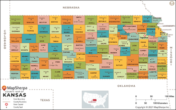
Kansas Counties Map - Extra Large
MapSherpa
This map has been created exclusively for MapSherpa, and designed for reference or business use. Clear and clean colors & fonts matched with cartographic research makes this map of Kansas Counties Map easily readable and useful. The map shows the 105 counties of Kansas and their borders across the Sunflower State.
Page Size: 60 x 37.75 in (1524 x 953 mm)

Kansas Counties Map - Large
MapSherpa
This map has been created exclusively for MapSherpa, and designed for reference or business use. Clear and clean colors & fonts matched with cartographic research makes this map of Kansas Counties Map easily readable and useful. The map shows the 105 counties of Kansas and their borders across the Sunflower State.
Page Size: 48 x 30.25 in (1219 x 763 mm)
Kansas Counties Map - Standard
MapSherpa
This map has been created exclusively for MapSherpa, and designed for reference or business use. Clear and clean colors & fonts matched with cartographic research makes this map of Kansas Counties Map easily readable and useful. The map shows the 105 counties of Kansas and their borders across the Sunflower State.
Page Size: 36 x 22.75 in (914 x 572 mm)
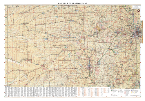
Kansas Recreation Wall Map – 26 inch
Benchmark Maps
Kansas is best known for its rolling agricultural landscapes, which serve as host to a variety of flora and fauna. Fishing and migratory bird hunting are major recreational draws all year. This wall map beautifully illustrates the country roads that crisscross The Sunflower State, and the recreation opportunities that exist throughout.
Page Size: 37.25 x 26 in (943 x 660 mm)
Kansas State Wall Map
Globe Turner
This colorful, easy-to-read state map of Kansas identifies all major thoroughfares, secondary roads, freeway interchanges, rest areas, distance markers, landmarks, recreational areas, and more. Shaded relief on the state map provides a three-dimensional sense of Kansas' topography. Detailed inset maps of Lawrence, Manhattan, Topeka, and Wichita are based on the latest street information from our cartographic experts. County and city indices make it simple to locate even the smallest town.
Page Size: 20.75 x 18.5 in (524 x 467 mm)
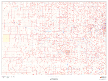
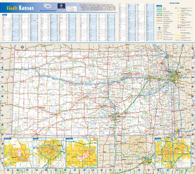
Kansas ZIP Code Map
MapSherpa
This map of Kansas shows ZIP codes overlaid on a road map. Base map features include municipality and county boundaries, major road network features, and state and national parks and conservation areas.
Page Size: 48 x 36 in (1219 x 914 mm)
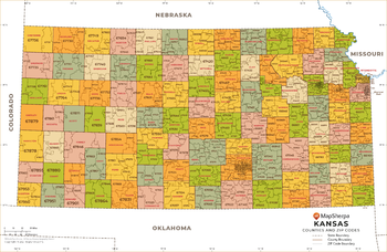
Kansas ZIP Code Map with Counties - Extra Large
MapSherpa
This map has been created exclusively for MapSherpa, and designed for business or reference use. Clear and clean colors & fonts matched with cartographic research makes this Kansas Zip Code Map with Counties easily readable and useful. The map shows the 105 counties of Kansas and the borders of the 697 zip codes across the Sunflower State.
Page Size: 60 x 39.25 in (1524 x 995 mm)

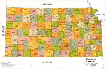
Kansas ZIP Code Map with Counties - Large
MapSherpa
This map has been created exclusively for MapSherpa, and designed for business or reference use. Clear and clean colors & fonts matched with cartographic research makes this Kansas Zip Code Map with Counties easily readable and useful. The map shows the 105 counties of Kansas and the borders of the 697 zip codes across the Sunflower State.
Page Size: 48 x 31.5 in (1219 x 796 mm)
Kansas ZIP Code Map with Counties - Standard
MapSherpa
This map has been created exclusively for MapSherpa, and designed for business or reference use. Clear and clean colors & fonts matched with cartographic research makes this Kansas Zip Code Map with Counties easily readable and useful. The map shows the 105 counties of Kansas and the borders of the 697 zip codes across the Sunflower State.
Page Size: 36 x 23.5 in (914 x 597 mm)
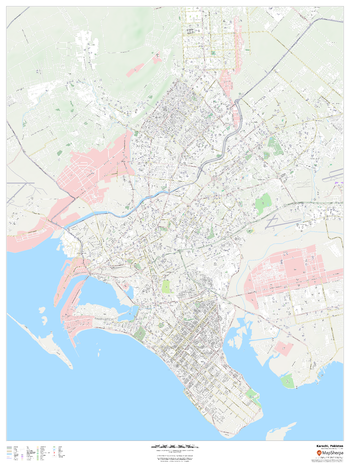
Karachi, Pakistan
MapSherpa
This detailed street map of Karachi, Pakistan shows the full road and rail networks, points of interest, and land use across the city. Useful for businesses operating in the city, or as consumer memorabilia of the city.
Page Size: 36 x 48 in (914 x 1219 mm)
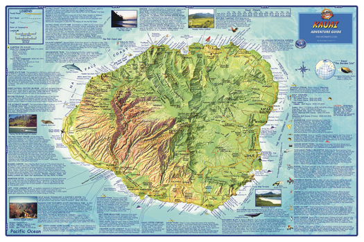
Kauai, Hawaii Wall Map
Franko Maps
The entire island of Kauai depicted on a detailed, dramatic relief map. Hypsometric tinting employs colors to visualize land heights and water depths. Descriptions of outdoor recreation opportunities, golf courses, points of interest and more.
Page Size: 36 x 24 in (914 x 610 mm)
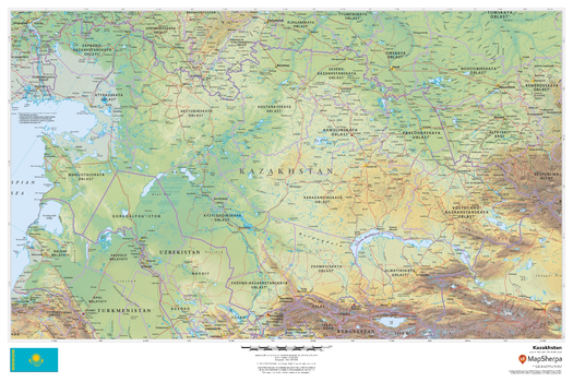
Kazakhstan
MapSherpa
This beautiful map shows physical and political features for Kazakhstan and surrounding areas. Relief shading and the use of different colours by height above sea level are both informative and attractive.
Page Size: 36 x 24 in (914 x 610 mm)
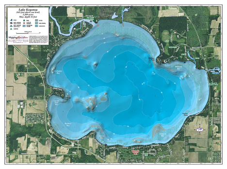
Kegonsa Lake
Mapping Specialists
An Attractive map of the lake showing a visual 3D representation of the lake bottom. Includes boat launches, rock area and vegetation. Land area is high resolution aerial imagery.
Page Size: 37.25 x 27.75 in (943 x 705 mm)
Kehl Ridge Quadrangle, Arizona
United States Department of Agriculture Forest Service
United States Department of Agriculture Forestry Service topographical map of Kehl Ridge, Coconino National Forest, Arizona.
Page Size: 21.75 x 27 in (552 x 686 mm)
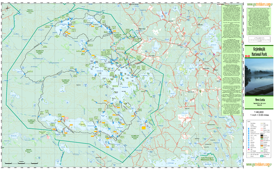
Kejimkujik National Park
GoTrekkers
Kejimkujik National Park
Page Size: 41.5 x 25.5 in (1054 x 648 mm)
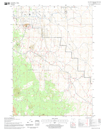
Kelsey Butte Quadrangle, Oregon
United States Department of Agriculture Forest Service
United States Department of Agriculture Forestry Service topographical map of Kelsey Butte, Deschutes National Forest, Oregon.
Page Size: 21.75 x 27 in (552 x 686 mm)
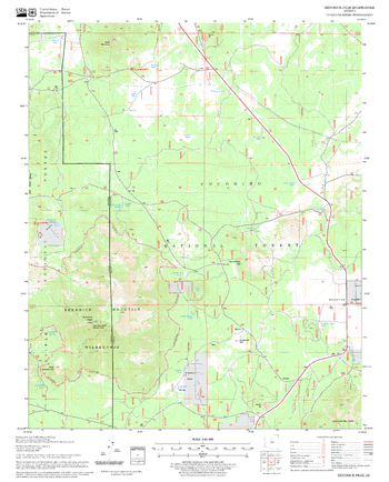
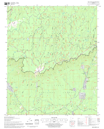
Kendrick Peak Quadrangle, Arizona
United States Department of Agriculture Forest Service
United States Department of Agriculture Forestry Service topographical map of Kendrick Peak, Coconino National Forest, Arizona.
Page Size: 21.75 x 27 in (552 x 686 mm)
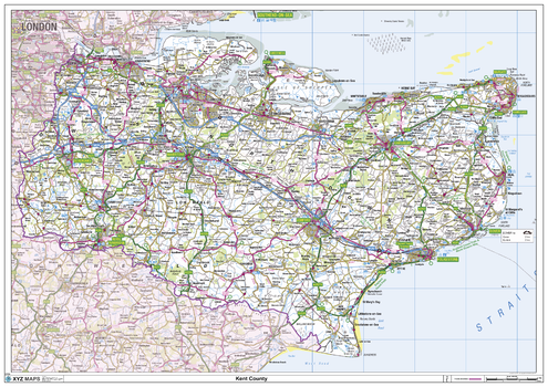
Kent County Map
XYZ Maps
This is a large ceremonial county map of Kent highlighting the county border, with the surrounding area faded out for excellent contrast. The map covers Abbots Bromley, Canterbury, Chatham, Dover, Folkestone, Greenwich, Lewisham, Maidstone, Orpington, Ramsgate, Rochester, Sevenoaks, Tunbridge Wells, Whitstable and Woolwich. The county map shows the latest County and Unitary Authority Boundaries, overlaid on a clear and easy to read Ordnance Survey map.
Page Size: 47 x 33.25 in (1189 x 841 mm)
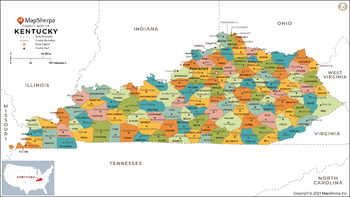
Kentucky Counties Map - Extra Large
MapSherpa
This map has been created exclusively for MapSherpa, and designed for reference or business use. Clear and clean colors & fonts matched with cartographic research makes this map of Kentucky Counties Map easily readable and useful. The map shows the 120 counties of Kentucky and their borders across the Bluegrass State.
Page Size: 60 x 33.75 in (1524 x 857 mm)
No search results