


National Geographic

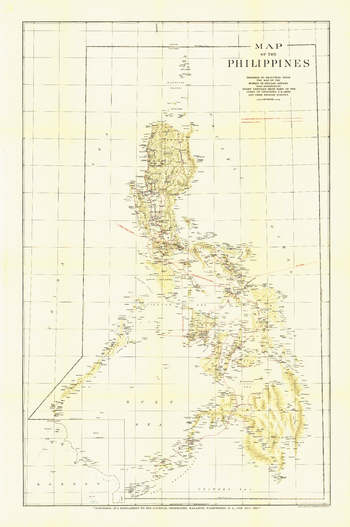
Philippines - Published 1905
Published in August 1905, this map of the Philippines features relief shading and shows the various cable lines of the time. A unique, collectible map for those interested in vintage maps or maps of the Philippines.
Page Size: 24 x 36 in (606 x 913 mm)
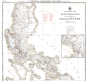
Philippines Military Telegraph Lines North - Published 1902
This map was produced in astonishing detail as a supplement to the January, 1902 National Geographic Magazine, and accompanies the southern Philippines map. Just four years earlier, the United States purchased the rights to the territory from Spain for $20,000,000, and this beautiful map shows the entire group of islands, anlong with a detailed inset of the Manila Bay area. Anyone interested in history or the Far East will find this map to be an excellent addition to your map collection.
Page Size: 36 x 33.75 in (912 x 855 mm)
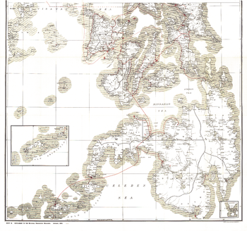
Philippines Military Telegraph Lines South - Published 1902
This map was produced in astonishing detail as a supplement to the January, 1902 National Geographic Magazine, and accompanies the northern Philippine Islands map. Just four years earlier, the United States purchased the rights to the territory from Spain for $20,000,000, and this beautiful map shows the entire group of islands, along with a detailed inset of the Manila Bay area. Anyone interested in history or the Far East will find this map to be an excellent addition to your map collection.
Page Size: 36 x 33.75 in (912 x 855 mm)
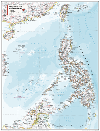
Philippines and South China Sea - Atlas of the World, 11th Edition
This Philippines and South China Sea map of physical and political features can fit in any space. Showcasing the countries in stunning detail with state-of-the-art cartographic techniques delivering accuracy and exceptional quality, the innovative and engaging design makes the content easily accessible and user-friendly.
Ideal for classrooms with an emphasis on teaching geography or environmental themes. The inclusion of physical features gives your students a genuine feel for how our world appears.
This map uses a bright, easy to read color palette featuring blue oceans and stunning shaded relief that has been featured on National Geographic wall maps for over 75 years. It is drawn in Conic projection, in which an area of the earth is projected onto a cone whose vertex is usually above one of the poles, then unrolled onto a flat surface.
Names of geographic features are carefully placed on the map to maintain legibility.
This map is found in National Geographic's 11th Edition World Atlas and is now available as a stand alone product.
Page Size: 24 x 31.5 in (610 x 798 mm)
Philippines and South China Sea - Atlas of the World, 11th Edition - Compact
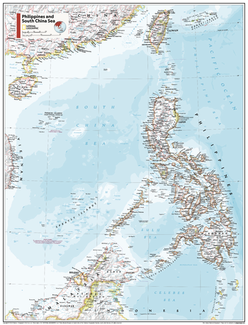
This Philippines and South China Sea map of physical and political features can fit in any space. Showcasing the countries in stunning detail with state-of-the-art cartographic techniques delivering accuracy and exceptional quality, the innovative and engaging design makes the content easily accessible and user-friendly.
Ideal for classrooms with an emphasis on teaching geography or environmental themes. The inclusion of physical features gives your students a genuine feel for how our world appears.
This map uses a bright, easy to read color palette featuring blue oceans and stunning shaded relief that has been featured on National Geographic wall maps for over 75 years. It is drawn in Conic projection, in which an area of the earth is projected onto a cone whose vertex is usually above one of the poles, then unrolled onto a flat surface.
Names of geographic features are carefully placed on the map to maintain legibility.
This map is found in National Geographic's 11th Edition World Atlas and is now available as a stand alone product.
Page Size: 16.25 x 21.5 in (413 x 540 mm)
Physical of South America - Published 1972
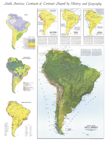
Published in October 1972 with the articles "The Amazon" and "Amazon - The River Sea," this informative physical map also includes six inset maps showing historical, geographic, and economic details of the continent. A perfect companion for the political map of South America published in the same issue.
Page Size: 23 x 30.5 in (580 x 772 mm)
Physical World - Published 1975
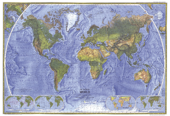
The splendor and beauty of the world's natural features come to life in this physical world map. Mountain ranges, major rivers, vegetation zones, and deserts are depicted, and major physical features are named to provide easy reference. Published in November 1975.
Page Size: 35.25 x 24.25 in (890 x 610 mm)
Physical World Map - Atlas of the World, 10th Edition
null
Page Size: 28 x 22 in (711 x 559 mm)
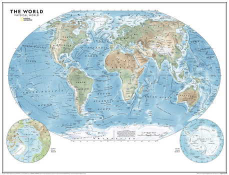
Physical World Map - Atlas of the World, 11th Edition
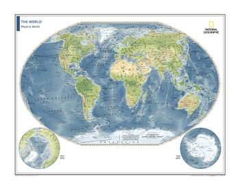
This world map of physical features can fit in any space, and is featured in the National Geographic Atlas of the World, 11th Edition. Showcasing the Earth in stunning detail with state-of-the-art cartographic techniques delivering accuracy and exceptional quality, the innovative and engaging design makes the content easily accessible and user-friendly. Ideal for classrooms with an emphasis on teaching geography or environmental themes. Physical wall maps give your students a genuine feel for how our world appears.
The Physical World Map uses a bright, easy to read color palette featuring blue oceans and stunning shaded relief that has been featured on National Geographic wall maps for over 75 years. Drawn in the Winkel Tripel projection, distortions of land masses around the poles are minimized: unlike many other World maps, Greenland is accurately shown as the same size as Argentina and not the size of all of South America.
Names of geographic features are carefully placed on the map to maintain legibility. Details include clearly defined features such as fracture zones, ocean ridges, mountains, deserts and plateaus. Corner inset maps feature the north and south polar regions.
Page Size: 31.5 x 24 in (798 x 610 mm)
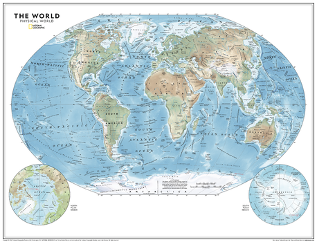
Physical World Map - Atlas of the World, 11th Edition - Compact
This world map of physical features can fit in any space, and is featured in the National Geographic Atlas of the World, 11th Edition. Showcasing the Earth in stunning detail with state-of-the-art cartographic techniques delivering accuracy and exceptional quality, the innovative and engaging design makes the content easily accessible and user-friendly. Ideal for classrooms with an emphasis on teaching geography or environmental themes. Physical wall maps give your students a genuine feel for how our world appears.
The Physical World Map uses a bright, easy to read color palette featuring blue oceans and stunning shaded relief that has been featured on National Geographic wall maps for over 75 years. Drawn in the Winkel Tripel projection, distortions of land masses around the poles are minimized: unlike many other World maps, Greenland is accurately shown as the same size as Argentina and not the size of all of South America.
Names of geographic features are carefully placed on the map to maintain legibility. Details include clearly defined features such as fracture zones, ocean ridges, mountains, deserts and plateaus. Corner inset maps feature the north and south polar regions.
Page Size: 21.5 x 16.25 in (540 x 413 mm)
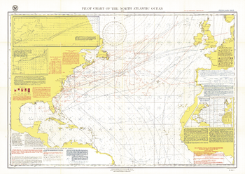
Pilot Chart of the North Atlantic Ocean - Published 1903
The Pilot Chart of the North Atlantic Ocean is a fascinating historical piece which appeared in National Geographic Magazine in February 1903, a time when all travel and trade across the Atlantic was done by boat. It contains recommended routes for steamships, branch hydrographic offices, and a wealth of information about weather patterns over the ocean including storm and gale signals, cyclonic storm tracks, fog reports and more. A truly unique map for collectors.
Page Size: 34 x 24.25 in (861 x 611 mm)
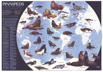
Pinnipeds Around the World - Published 1987
Pinniped means "fin-footed" and refers to seals, sea lions, and walruses. This extraordinary map contains illustrations of the many different species of pinnipeds and interesting facts about where they live, what they eat, and more. Published in April 1987 with the article "Seal and Their Kin," this map also accompanied the map of Antarctica published in the same issue.
Page Size: 69.5 x 48.5 in (1764 x 1227 mm)
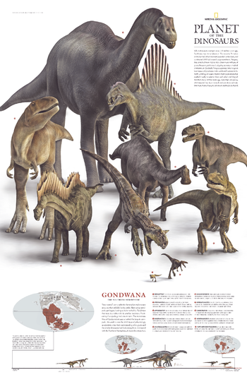
Planet of the Dinosaurs Gondwana - Published 2007
More than 550 species of dinosaurs have been named, and scientists estimate that more than a thousand others are waiting to be found. When the supercontient Pangaea separated into two great landmasses, Gondwana in the south and Laurasia in the north, dinosaur populations were divided into two main populations that evolved mostly in isolation from each other until they met their end 65 million years ago. This remarkable poster was published in December 2007 as half of a two-piece set. It features ten of the dinosaurs that roamed Gondwana in the southern hemisphere.
Page Size: 20.25 x 31.25 in (512 x 791 mm)
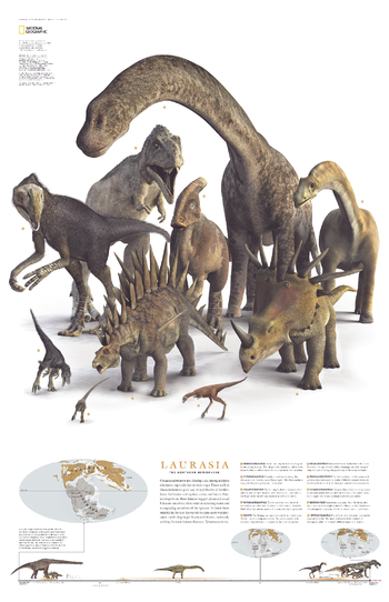
Planet of the Dinosaurs Laurasia - Published 2007
When the supercontient Pangaea separated into two great landmasses, Gondwana in the south and Laurasia in the north, dinosaur populations were divided into two main populations that evolved mostly in isolation from each other until they met their end 65 million years ago. This remarkable poster was published in December 2007 as half of a two-piece set. It features ten of the dinosaurs that roamed Laurasia in the northern hemisphere. More than 550 species of dinosaurs have been named, and scientists estimate that more than a thousand others are waiting to be found.
Page Size: 20.25 x 31.25 in (510 x 790 mm)
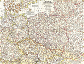
Poland and Czechoslovakia - Published 1958
This detailed map of Poland and Czechoslovakia contains notes about territories and administration during the Cold War era. Several boundaries are shown including those before Germany's invasion of Austria and those between communist and non-communist countries. Published in September 1958.
Page Size: 25 x 19 in (632 x 478 mm)
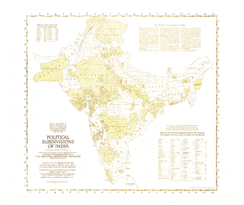
Political Subdivisions of India - Published 1946
Because the hundreds of political subdivisions of India are so complex, this outline map was prepared to amplify the map of India and Burma which appeared in the same issue. Published in April 1946 with three articles on India, these historical maps capture the region known then as India a year before the independent countries of India and Pakistan were formed.
Page Size: 31 x 26.25 in (787 x 661 mm)
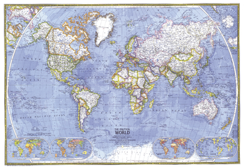
Political World - Published 1975
This beautiful world map emphasizes international political boundaries, and is peppered with thousands of place names across the globe. Published in November of 1975.
Page Size: 35.25 x 24.25 in (890 x 610 mm)
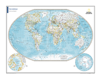
Political World Map - Atlas of the World, 10th Edition
null
Page Size: 28 x 22 in (711 x 559 mm)
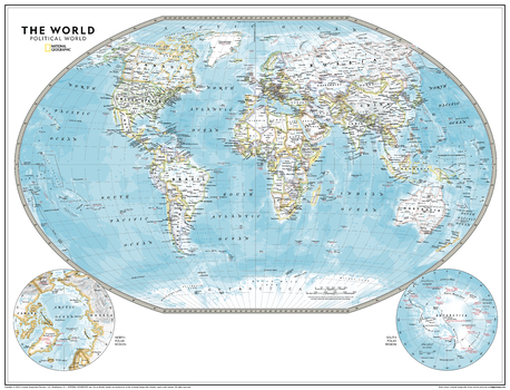
Political World Map - Atlas of the World, 11th Edition
This political world map is featured in the National Geographic Atlas of the World, 11th Edition. Showcasing the Earth in stunning detail with state-of-the-art cartographic techniques delivering accuracy and exceptional quality, the innovative and engaging design makes the content easily accessible and pleasing to the eye.
The Political World Map provides a detailed geographic view of national and regional boundaries, depicting current political realities across all continents. It uses a bright, easy to read color palette featuring blue oceans and stunning shaded relief that has been featured on National Geographic wall maps for over 75 years. Drawn in the Winkel Tripel projection, distortions of land masses around the poles are minimized: unlike many other World maps, Greenland is accurately shown as the same size as Argentina and not the size of all of South America.
Thousands of place names are carefully placed on the map to maintain legibility even in the heavily populated areas of Europe, Asia and the Middle East. Details include clearly defined international boundaries, cities, physical features, rivers, and ocean floor features. Corner inset maps feature the north and south polar regions.
Page Size: 31.5 x 24 in (798 x 610 mm)
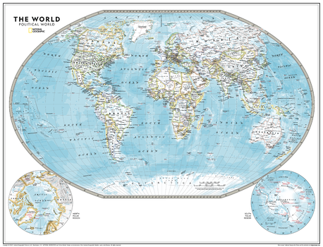
Political World Map - Atlas of the World, 11th Edition - Compact
This political world map is featured in the National Geographic Atlas of the World, 11th Edition. Showcasing the Earth in stunning detail with state-of-the-art cartographic techniques delivering accuracy and exceptional quality, the innovative and engaging design makes the content easily accessible and pleasing to the eye.
The Political World Map provides a detailed geographic view of national and regional boundaries, depicting current political realities across all continents. It uses a bright, easy to read color palette featuring blue oceans and stunning shaded relief that has been featured on National Geographic wall maps for over 75 years. Drawn in the Winkel Tripel projection, distortions of land masses around the poles are minimized: unlike many other World maps, Greenland is accurately shown as the same size as Argentina and not the size of all of South America.
Thousands of place names are carefully placed on the map to maintain legibility even in the heavily populated areas of Europe, Asia and the Middle East. Details include clearly defined international boundaries, cities, physical features, rivers, and ocean floor features. Corner inset maps feature the north and south polar regions.
Page Size: 21.5 x 16.25 in (540 x 413 mm)