top of page


Poland and Czechoslovakia - Published 1958
National Geographic
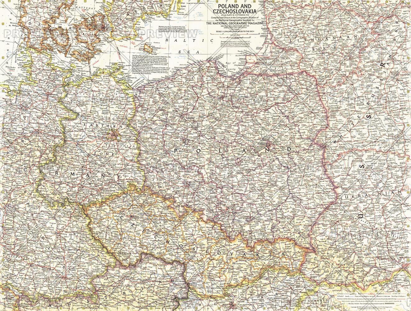
This detailed map of Poland and Czechoslovakia contains notes about territories and administration during the Cold War era. Several boundaries are shown including those before Germany's invasion of Austria and those between communist and non-communist countries. Published in September 1958.
Page Size: 25 x 19 in (632 x 478 mm)
Buy this map on MapTrove.ca or MapTrove.com
bottom of page