top of page
Philippines Military Telegraph Lines North - Published 1902
National Geographic
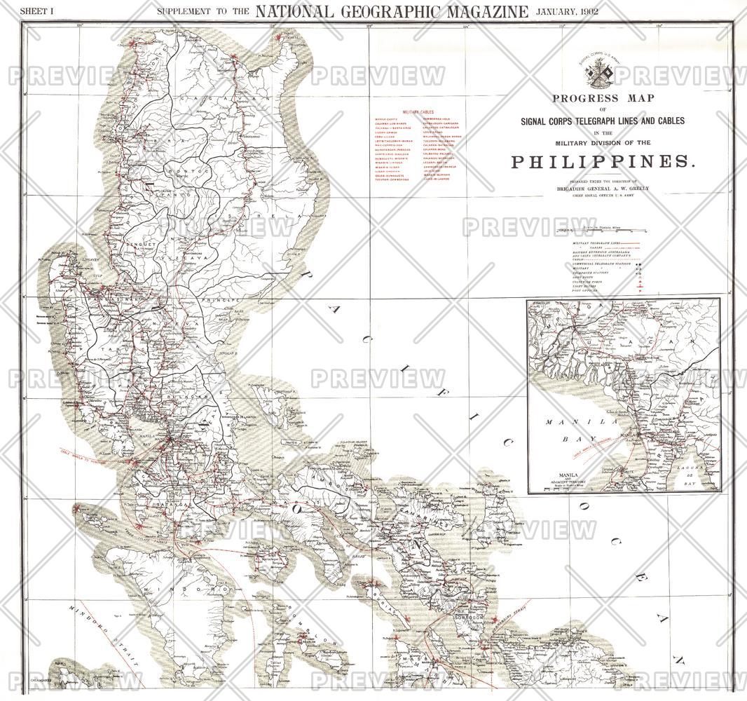
This map was produced in astonishing detail as a supplement to the January, 1902 National Geographic Magazine, and accompanies the southern Philippines map. Just four years earlier, the United States purchased the rights to the territory from Spain for $20,000,000, and this beautiful map shows the entire group of islands, anlong with a detailed inset of the Manila Bay area. Anyone interested in history or the Far East will find this map to be an excellent addition to your map collection.
Page Size: 36 x 33.75 in (912 x 855 mm)
Buy this map on MapTrove.ca or MapTrove.com
bottom of page