


National Geographic

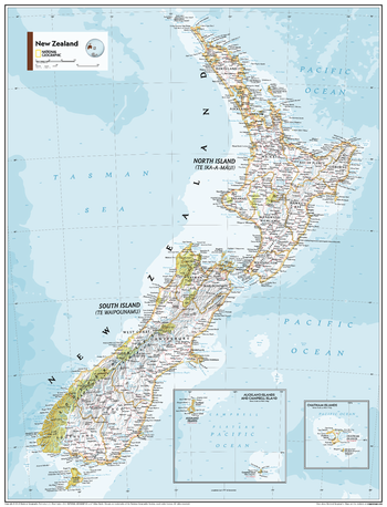
New Zealand - Atlas of the World, 11th Edition
This New Zealand map of political and physical can fit in any space. Showcasing the country in stunning detail with state-of-the-art cartographic techniques delivering accuracy and exceptional quality, the innovative and engaging design makes the content easily accessible and user-friendly.
Ideal for classrooms with an emphasis on teaching geography or environmental themes. The inclusion of physical features gives your students a genuine feel for how our world appears.
This map uses a bright, easy to read color palette featuring blue oceans and stunning shaded relief that has been featured on National Geographic wall maps for over 75 years. It is drawn in the Oblique Mercator projection, which is a cylindrical map projection for nautical navigation because it represents lines of constant course.
This map is found in National Geographic's 11th Edition World Atlas and is now available as a stand alone product.
Page Size: 24 x 31.5 in (610 x 798 mm)
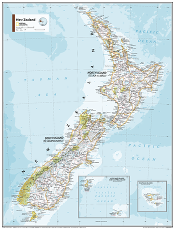
New Zealand - Atlas of the World, 11th Edition - Compact
This New Zealand map of political and physical can fit in any space. Showcasing the country in stunning detail with state-of-the-art cartographic techniques delivering accuracy and exceptional quality, the innovative and engaging design makes the content easily accessible and user-friendly.
Ideal for classrooms with an emphasis on teaching geography or environmental themes. The inclusion of physical features gives your students a genuine feel for how our world appears.
This map uses a bright, easy to read color palette featuring blue oceans and stunning shaded relief that has been featured on National Geographic wall maps for over 75 years. It is drawn in the Oblique Mercator projection, which is a cylindrical map projection for nautical navigation because it represents lines of constant course.
This map is found in National Geographic's 11th Edition World Atlas and is now available as a stand alone product.
Page Size: 16.25 x 21.5 in (413 x 540 mm)
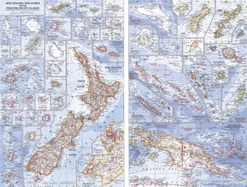
New Zealand, New Guinea and the Principal Pacific Islands - Published 1962
This map of the Pacific Ocean includes Australia, the Pacific Islands, and the continental coastlines that border the ocean. Inset maps provide detail of some of the larger islands groups. Published in April 1962, this map accompanied an article on New Zealand and the map of New Zealand, New Guinea and the Principal Pacific Islands.
Page Size: 25 x 19 in (633 x 480 mm)
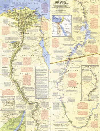
Nile Valley, Land of the Pharaohs - Published 1965
Herodotus wrote of Egypt, "nowhere are there so many marvelous things, nor in the whole world beside are there to be seen so many works of unspeakable greatness." Explore the beauty, mystery, and wonder of the fertile Nile Valley and the great civilizations it supported in this compelling map, which is loaded with an abundance of interesting historic and geographic facts. Published in May 1965 with the article "Yankee Cruises the Storied Nile." Originally half of a two–map set with "Your Introduction to Ancient Egypt", which contained an index to this map and an introduction to the history of this ancient land.
Page Size: 19 x 25 in (481 x 630 mm)
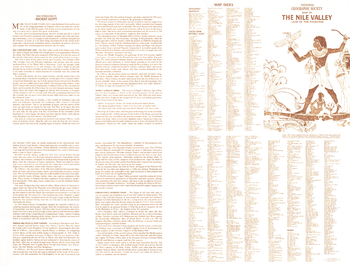
Nile Valley, Land of the Pharaohs Index - Published 1965
Your Introduction to Ancient Egypt was published in National Geographic in May 1965 to accompany the "Nile Valley, Land of the Pharaohs" map and the article "Yankee Cruises the Storied Nile." The four-panel text introduces you to Egypt and its history, with information about how the Nile's annual flooding nurtures the land, the first Pharaoh, the Egyptian dynasties, and the fall of this great civilization. It also includes a map index for the "Nile Valley, Land of the Pharaohs" map.
Page Size: 25 x 19 in (631 x 480 mm)
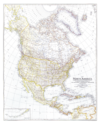
North America - Published 1942
The North America map of May 1942 shows the continent just months after Japan attacked Pearl Harbor, bringing the United States into World War II. U.S. Naval bases are noted and an inset map of the Aleutian Islands is included.
Page Size: 27.25 x 33.75 in (690 x 853 mm)
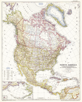
North America - Published 1952
The North America map of March 1952 includes Central America and the West Indies as well as inset maps of both the Aleutian and Diomede Islands. Of particular note is the absence of the Interstate Highway System in the United States which was yet to be built.
Page Size: 28 x 35 in (709 x 883 mm)
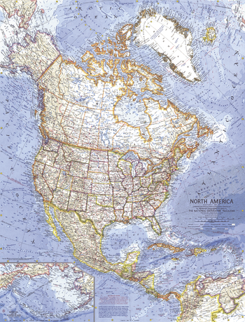
North America - Published 1964
At the time of this map's creation, the United States had imposed a diplomatic and commercial embargo on communist Cuba as Cold War tension between the United States and the USSR grew. The signs of this tension are evident in the distant early warning lines, missile tracking stations, and missile ranges shown on this detailed map of the North American continent. Published in April 1964.
Page Size: 19 x 25 in (480 x 631 mm)
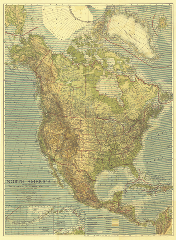
North America - Published 1924
Published in May 1924, this beautiful map of North America is colored to indicate elevation and ocean depth, and features boldly drawn state, provincial, and international boundaries. Inset maps of the Aleutian Islands and the eastern part of the West Indies complete this attractive presentation of the region.
Page Size: 28 x 38 in (707 x 963 mm)
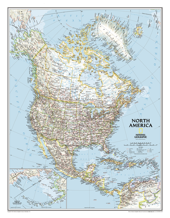
North America Classic
The political map of North America features trademark National Geographic detail and accuracy. The map shows country boundaries, place names, major highways and roads, bodies of water, and more. An inset map shows the Aleutian Islands off the coast of Alaska.
Page Size: 23.75 x 30.5 in (600 x 770 mm)
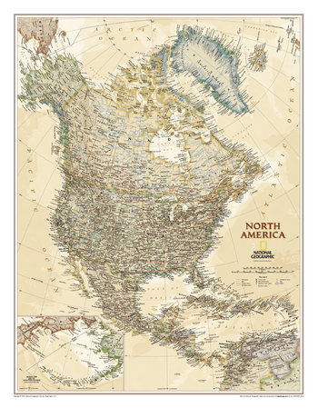
North America Executive
Our executive style political map of North America features country boundaries, place names, bodies of water, airports, major highways and roads, and much more.
Page Size: 23.75 x 30.5 in (600 x 770 mm)
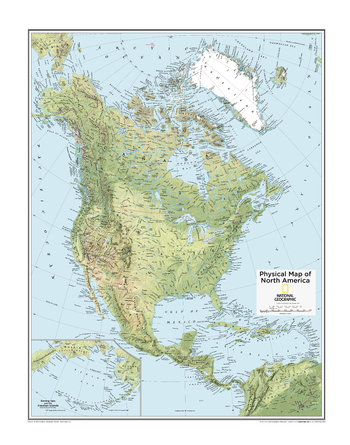
North America Physical - Atlas of the World, 10th Edition
null
Page Size: 22 x 28 in (559 x 711 mm)
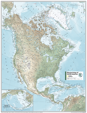
North America Physical - Atlas of the World, 11th Edition
This North American map of physical features can fit in any space. Showcasing the continent in stunning detail with state-of-the-art cartographic techniques delivering accuracy and exceptional quality, the innovative and engaging design makes the content easily accessible.
Ideal for classrooms with an emphasis on teaching geography or environmental themes. Physical wall maps give your students a genuine feel for how the continent appears.
This map uses a bright, easy to read color palette featuring blue oceans and stunning shaded relief that has been featured on National Geographic wall maps for over 75 years. Drawn in the Azimuthal Equidistant projection, this map ensures that all points on the map are at proportionally correct distances from the center point. Names of geographic features are carefully placed on the map to maintain legibility. Inset map features enlarged Bering Sea and Aleutian Islands regions.
This map is found in National Geographic's 11th Edition World Atlas and is now available as a stand alone product.
Page Size: 24 x 31.5 in (610 x 798 mm)
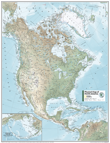
North America Physical - Atlas of the World, 11th Edition - Compact
This North American map of physical features can fit in any space. Showcasing the continent in stunning detail with state-of-the-art cartographic techniques delivering accuracy and exceptional quality, the innovative and engaging design makes the content easily accessible.
Ideal for classrooms with an emphasis on teaching geography or environmental themes. Physical wall maps give your students a genuine feel for how the continent appears.
This map uses a bright, easy to read color palette featuring blue oceans and stunning shaded relief that has been featured on National Geographic wall maps for over 75 years. Drawn in the Azimuthal Equidistant projection, this map ensures that all points on the map are at proportionally correct distances from the center point. Names of geographic features are carefully placed on the map to maintain legibility. Inset map features enlarged Bering Sea and Aleutian Islands regions.
This map is found in National Geographic's 11th Edition World Atlas and is now available as a stand alone product.
Page Size: 16.25 x 21.5 in (413 x 540 mm)
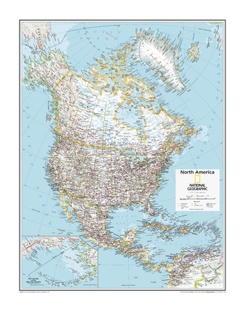
North America Political - Atlas of the World, 10th Edition
null
Page Size: 22 x 28 in (559 x 711 mm)
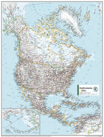
North America Political - Atlas of the World, 11th Edition
This North American map of political features can fit in any space. Showcasing the continent in stunning detail with state-of-the-art cartographic techniques delivering accuracy and exceptional quality, the innovative and engaging design makes the content easily accessible.
Ideal for classrooms with an emphasis on teaching geography or environmental theme, this map is perfect to help students develop navigation skills using latitude and longitude.
This map uses a bright, easy to read color palette featuring blue oceans and stunning shaded relief that has been featured on National Geographic wall maps for over 75 years. Drawn in the Azimuthal Equidistant projection, this map ensures that all points on the map are at proportionally correct distances from the center point.
Names of political and geographic features are carefully placed on the map to maintain legibility. Inset map features a scaled-up representation of the Bering Sea and Aleutian Islands region.
This map is found in National Geographic's 11th Edition World Atlas and is now available as a stand alone product.
Page Size: 24 x 31.5 in (610 x 798 mm)
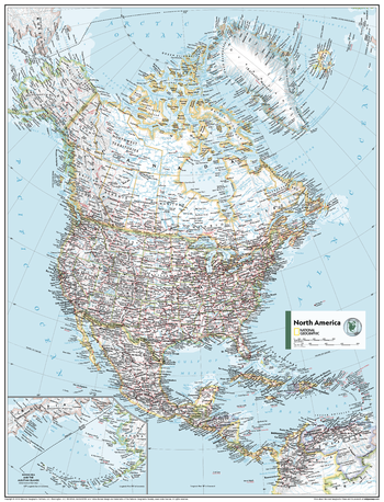
North America Political - Atlas of the World, 11th Edition - Compact
This North American map of political features can fit in any space. Showcasing the continent in stunning detail with state-of-the-art cartographic techniques delivering accuracy and exceptional quality, the innovative and engaging design makes the content easily accessible.
Ideal for classrooms with an emphasis on teaching geography or environmental theme, this map is perfect to help students develop navigation skills using latitude and longitude.
This map uses a bright, easy to read color palette featuring blue oceans and stunning shaded relief that has been featured on National Geographic wall maps for over 75 years. Drawn in the Azimuthal Equidistant projection, this map ensures that all points on the map are at proportionally correct distances from the center point.
Names of political and geographic features are carefully placed on the map to maintain legibility. Inset map features a scaled-up representation of the Bering Sea and Aleutian Islands region.
This map is found in National Geographic's 11th Edition World Atlas and is now available as a stand alone product.
Page Size: 16.25 x 21.5 in (413 x 540 mm)
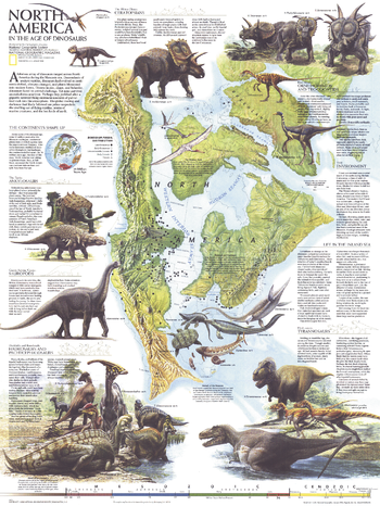
North America in the Age of the Dinosaurs - Published 1993
Explore North America in the Age of the Dinosaurs with this educational map. Published in January 1993, this striking work shows North America as it was 74 million years ago when Tyrannosaurs, Ceratopsians, and Sauropods roamed the region. Containing a wealth of information on the various dinosaur species, fossil distribution, and illustrations, this map accompanied the poster, "Dawn on the Delta: 74 Million Years Ago."
Page Size: 20.25 x 27 in (513 x 683 mm)
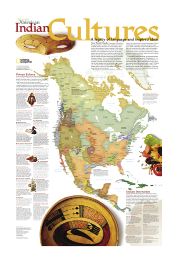
North American Indian Cultures
A legacy of language and inspired ideas is explored in this compelling North American Indian Cultures map. The map shows a broad sampling of linguistic families throughout the continent along with descriptions of each language group. A special inset highlights Native Americans innovations from parkas and snow goggles to new medicines and agricultural techniques. A perfect complement to our Indian Country map..
Page Size: 20 x 31 in (508 x 787 mm)
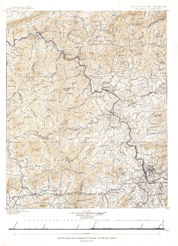
North Carolina Tennessee Cumerberland Blue Ridge - Published 1889
Published in October 1889, the "North Carolina-Tennessee: Asheville Sheet" map shows the area from the Cumberland Plateau to the Blue Ridge Mountains. This intricately drawn map shows the city of Asheville and other towns throughout the region. A unique historical map for collectors.
Page Size: 16 x 22 in (403 x 554 mm)