top of page
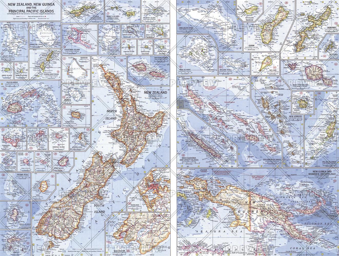
New Zealand, New Guinea and the Principal Pacific Islands - Published 1962
National Geographic
This map of the Pacific Ocean includes Australia, the Pacific Islands, and the continental coastlines that border the ocean. Inset maps provide detail of some of the larger islands groups. Published in April 1962, this map accompanied an article on New Zealand and the map of New Zealand, New Guinea and the Principal Pacific Islands.
Page Size: 25 x 19 in (633 x 480 mm)
Buy this map on MapTrove.ca or MapTrove.com
bottom of page