


MapSherpa Catalog
Great Lakes
MapSherpa
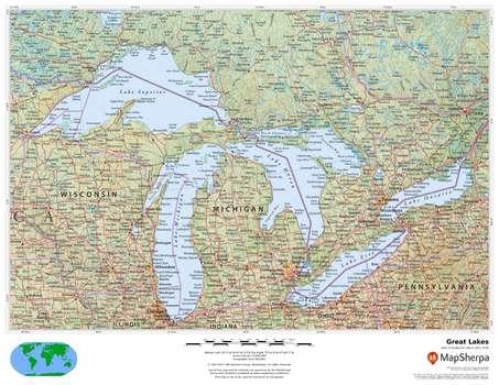
This beautiful map shows physical and political features for the Great Lakes and surrounding areas. Relief shading and the use of different colours by height above sea level are both informative and attractive.
Page Size: 22 x 17 in (559 x 432 mm)
Great Lakes Map Side 1 - Published 1987
National Geographic
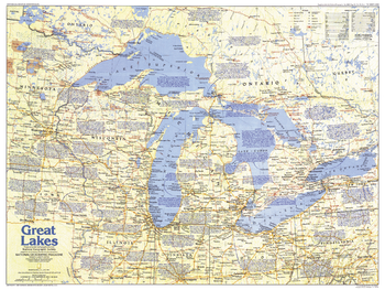
Comprised of Lake Superior, Lake Michigan, Lake Huron, Lake Erie, and Lake Ontario, the Great Lakes are the largest group of freshwater lakes on earth. This map of the Great Lakes region, which abuts both Canada and the United States, contains a vast amount of historical information, as well as tourist attractions. Published in July 1987 as part of the "Making of America" series.
Page Size: 27.25 x 20.5 in (687 x 516 mm)
Great Lakes Map Side 2 - Published 1987
National Geographic
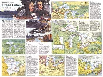
A maritime world in the heart of a continent, the Great Lakes have a long history of trade, immigration, agriculture, and industry. Published in July 1987, this map of the Great Lakes is half of a two-map set in the "Making of America" series. From the early days of the fur trade to Detroit's auto industry, this educational map provides a wealth of information on this fascinating region.
Page Size: 27.25 x 20.5 in (687 x 516 mm)
Great Lakes U.S. - Atlas of the World, 10th Edition
National Geographic
Illinois, Indiana, Kentucky, Michigan, Ohio, Wisconsin
Page Size: 22 x 28 in (559 x 711 mm)
Great Lakes U.S. - Atlas of the World, 11th Edition
National Geographic
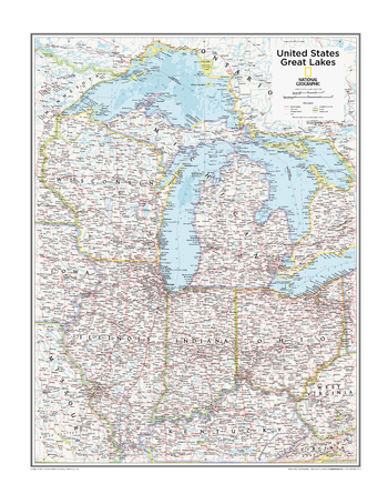
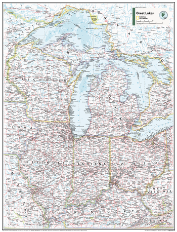
This Great Lakes regional map of physical and political features can fit in any space. Showcasing the region in stunning detail with state-of-the-art cartographic techniques delivering accuracy and exceptional quality, the innovative and engaging design makes the content easily accessible and user-friendly.
Ideal for classrooms with an emphasis on teaching geography or environmental themes. The inclusion of physial features gives your students a genuine feel for how our world appears.
This map uses a bright, easy to read color palette featuring blue oceans and stunning shaded relief that has been featured on National Geographic wall maps for over 75 years. It is drawn in the Albers Conic Equal-Area projection, which uses two standard parallels between which distortion is minimized, however scale and shape are not preserved.
This map is found in National Geographic's 11th Edition World Atlas and is now available as a stand alone product.
Page Size: 24 x 31.5 in (610 x 798 mm)
Great Lakes U.S. - Atlas of the World, 11th Edition - Compact
National Geographic
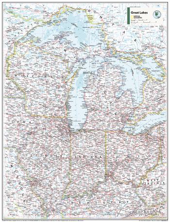
This Great Lakes regional map of physical and political features can fit in any space. Showcasing the region in stunning detail with state-of-the-art cartographic techniques delivering accuracy and exceptional quality, the innovative and engaging design makes the content easily accessible and user-friendly.
Ideal for classrooms with an emphasis on teaching geography or environmental themes. The inclusion of physical features gives your students a genuine feel for how our world appears.
This map uses a bright, easy to read color palette featuring blue oceans and stunning shaded relief that has been featured on National Geographic wall maps for over 75 years. It is drawn in the Albers Conic Equal-Area projection, which uses two standard parallels between which distortion is minimized, however scale and shape are not preserved.
This map is found in National Geographic's 11th Edition World Atlas and is now available as a stand alone product.
Page Size: 16.25 x 21.5 in (413 x 540 mm)
Great Smoky Mountain National Park
Benchmark Maps
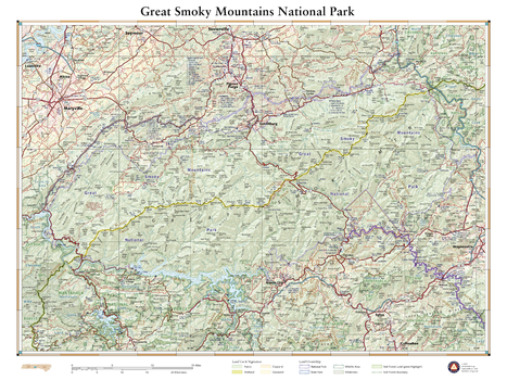
The rugged mountains that straddle the Tennessee – North Carolina border are home to a staggering array of biodiversity and a wealth of historic structures. The Smokies include some of the loftiest peaks in the eastern US and comprise the highest elevations found along the Appalachian Trail. More than 800 miles of trail wind through the Smokies’ forests, ridges, and coves, offering mountain solitude in the country’s most-visited national park. This wall map details the terrain and recreation features inside Great Smoky Mountains National Park and highlights its surrounding communities.
Page Size: 26 x 34.75 in (660 x 881 mm)
Great Whales, Migration and Range - Published 1976
National Geographic
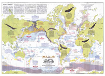
This map illustrates the migration and range of the six species of great whales, including the Fin, Humpback, Sperm, Gray, Bowhead, and Right. Provides information about how commercial whaling has decimated the populations of these magnificent mammals, and the actions being taken to protect them. Published in December 1976 with two articles on whales and the "Whales of the World" poster.
Page Size: 30 x 21.75 in (760 x 552 mm)
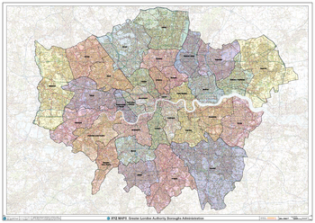
Greater London Authority Boroughs Wall Map
XYZ Maps
The Greater London Authority Boroughs Wall Map shows the London boroughs within the Greater London Authority, on a comprehensive background. This is perfect for determining the boundaries within the Greater London Authority. Ideal for sales, logistics or a regional reference guide.
Page Size: 47 x 33.25 in (1189 x 841 mm)
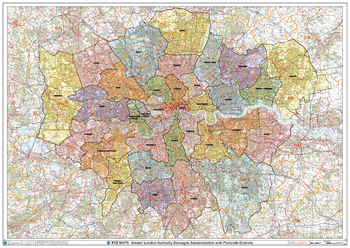
Greater London Authority Boroughs with Postcode Districts Wall Map
XYZ Maps
This Greater London Authority Boroughs Wall Map shows the London boroughs within the Greater London Authority including detailed postcode district boundaries and labels (UB1) on a comprehensive background. This is perfect for determining the postcode boundaries within the Greater London Authority or vice versa. Ideal for sales, logistics, planning mailshots or a regional reference guide.
Page Size: 47 x 33.25 in (1189 x 841 mm)
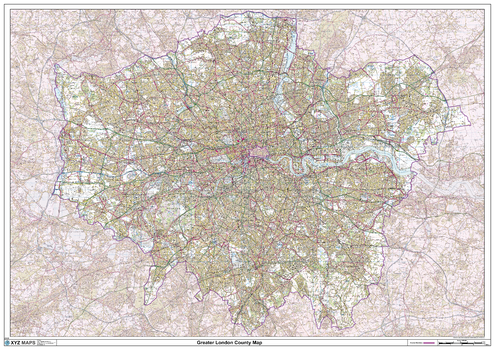
Greater London County Map
XYZ Maps
This is a large ceremonial county map of Greater London. highlighting the county border, with the surrounding area faded out for excellent contrast. The map covers Enfield, Walthamstow, Harrow, Uxbridge, Kingston Upon Thames, Sutton, Croydon, City of London, Bexley, Dagenham and Romford. The county map shows the latest County and Unitary Authority Boundaries, overlaid on a clear and easy to read Ordnance Survey map.
Page Size: 47 x 33.25 in (1189 x 841 mm)
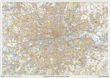
Greater London Postcode Area Wall Map
XYZ Maps
This Greater London Postcode Areas Map shows Postcode Area Boundaries (NW) on a clear comprhensive colour background and is perfect for sales/franchise planning or as a regional reference guide. This map covers the area within the M25.
Page Size: 47 x 33.25 in (1189 x 841 mm)
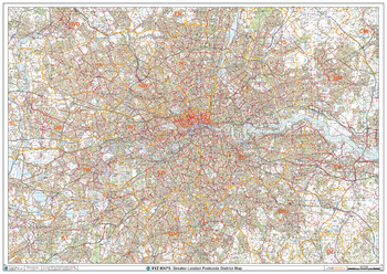
Greater London Postcode District Wall Map (D7)
XYZ Maps
This Greater London Postcode District Map clearly shows postcode district boundaries and associated district labels (E1, E2) on a comprehensive background and is perfect for determining postcode boundaries for sales territories, logistics, planning mailshots or as a regional reference guide.
Page Size: 47 x 33.25 in (1189 x 841 mm)
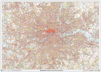
Greater London Postcode Postcode Sector Wall Map (C7)
XYZ Maps
The Greater London Postcode Postcode Sector Wall Map shows detailed postcode sector boundaries along with its associated label (UB1 1, UB1 2) on a comprehensive background and is perfect for determining postcode boundaries, for sales, logistics, planning mailshots or as a regional reference guide.
Page Size: 47 x 33.25 in (1189 x 841 mm)
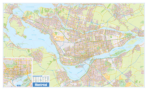
Greater Montreal Wall Map - Street Detail - Extra Large
Lucidmap
This wall map of the Greater Montreal Area shows highly detailed local information for the city of Montreal and the surrounding area. Full street labeling along with transit information, parks, schools, churches and landmarks throughout the city are displayed.
The map has been designed in a very clear and legible manner with a traditional Canadian street map style embraced by map buyers over many years.
Page Size: 79 x 48 in (2007 x 1219 mm)
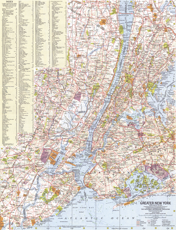
Greater New York - Published 1964
National Geographic
This map of Greater New York provides a detailed look at this extraordinary city. A complete index is included, making it easy to find the hundreds of points of interest the city has to offer. Published in July 1964 as part of a two–map set with "Tourist Manhattan."
Page Size: 15.25 x 20 in (385 x 504 mm)
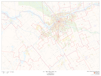
Greater Ottawa - Gatineau Postal Code Forward Sortation Areas
MapSherpa
This map of Ottawa-Gatineau shows postal code forward sortation areas overlaid on a road map. Ideal for planning of deliveries, home services, sales territories, real estate and much more. Base map features include all roads with major roads and highways labelled; neighbourhood names; railways; and high level land use such as parks and recreation areas, industrial areas and hospital campuses.
Page Size: 48 x 36 in (1219 x 914 mm)
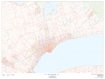
Greater Toronto Postal Code Forward Sortation Areas
MapSherpa
This map of Greater Toronto shows postal code forward sortation areas overlaid on a road map. Ideal for planning of deliveries, home services, sales territories, real estate and much more. Base map features include all roads with major roads and highways labelled; neighbourhood names; railways; and high level land use such as parks and recreation areas and industrial areas.
Page Size: 48 x 36 in (1219 x 914 mm)
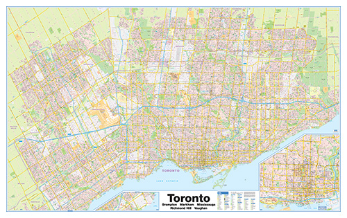
Greater Toronto Wall Map - Street Detail - Extra Large
Lucidmap
This wall map of the Greater Toronto Area shows highly detailed local information for the city of Toronto and the surrounding area. Full street labeling along with transit information, parks, schools, churches and landmarks throughout the city are displayed.
The map has been designed in a very clear and legible manner with a traditional Canadian street map style embraced by map buyers over many years.
Page Size: 80 x 50 in (2032 x 1270 mm)
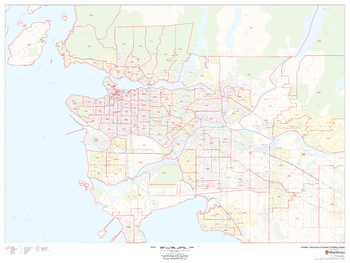
Greater Vancouver Postal Code Forward Sortation Areas
MapSherpa
This map of Greater Vancouver shows postal code forward sortation areas overlaid on a road map. Ideal for planning of deliveries, home services, sales territories, real estate and much more. Base map features include all roads with major roads and highways labelled; neighbourhood names; railways; and high level land use such as parks and recreation areas, industrial areas and hospital campuses.
Page Size: 48 x 36 in (1219 x 914 mm)
No search results