


MapSherpa Catalog
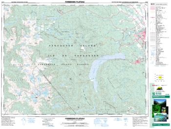
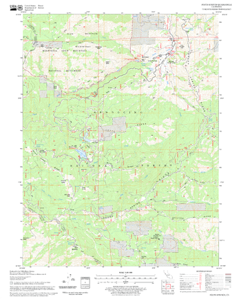
Forbidden Plateau - 92 F/11 - British Columbia
Natural Resources Canada
Canadian topographic map of Forbidden Plateau, British Columbia. NTS sheet 092F11 Edition 6.
Page Size: 34.5 x 26 in (872 x 659 mm)
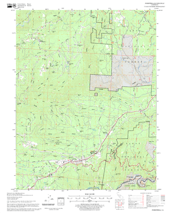
Foresthill Quadrangle, California
United States Department of Agriculture Forest Service
United States Department of Agriculture Forestry Service topographical map of Foresthill, Tahoe National Forest, California.
Page Size: 21.75 x 27 in (552 x 686 mm)
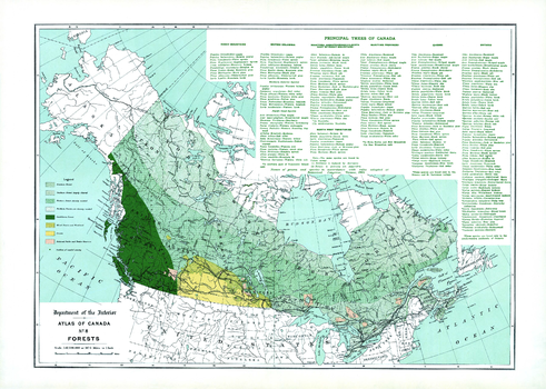
Forests (1906)
Natural Resources Canada
Contained within the 1st Edition (1906) of the Atlas of Canada is a map that shows the extent of forested regions, using tints of green, in Canada circa 1906. These regions include the Southern forest, Northern forest, and the Cordilleran forest. The map presents general portions of forested areas across the country which has been generally cleared of timber. Displayed is the section of Northern Forest that are less densely wooded; mixed prairie and woodland; Prairie; National Parks and Forest Reserves of the Dominion. There are also lists, by province, of the principal trees of Canada, in addition to notes of when distribution is confined to a comparatively small portion of the area of the province. The map also includes major cities, rivers, major bodies of water, and some railway systems.
Page Size: 24 x 17.25 in (609 x 434 mm)
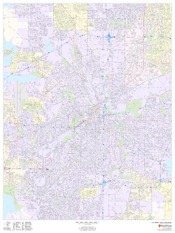
Fort Worth, Texas Inner Metro - Landscape
MapSherpa
This landscape-oriented map of central Fort Worth, Texas shows detailed street level information including extensive street labeling. Ideal for planning of deliveries, home services, sales territories, real estate and much more. Base map features include all roads with major roads and highways labelled; neighborhood names; railways; high level land use such as parks and recreation areas, industrial areas and hospital campuses; and a variety of points of interest including schools, libraries, stadiums, museums, border crossings and more.
Page Size: 48 x 36 in (1219 x 914 mm)
Fort Worth, Texas Inner Metro - Portrait
MapSherpa
This portrait-oriented map of central Fort Worth, Texas shows detailed street level information including extensive street labeling. Ideal for planning of deliveries, home services, sales territories, real estate and much more. Base map features include all roads with major roads and highways labelled; neighborhood names; railways; high level land use such as parks and recreation areas, industrial areas and hospital campuses; and a variety of points of interest including schools, libraries, stadiums, museums, border crossings and more.
Page Size: 36 x 48 in (914 x 1219 mm)
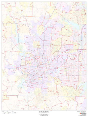
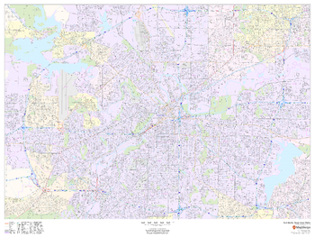
Fort Worth, Texas ZIP Codes
MapSherpa
This map of Fort Worth shows ZIP code areas overlaid on a road map. Ideal for planning of deliveries, home services, sales territories, real estate and much more. Base map features include all roads with major roads and highways labelled; neighborhood names; railways; and high level land use such as parks and recreation areas, industrial areas and hospital campuses.
Page Size: 36 x 48 in (914 x 1219 mm)
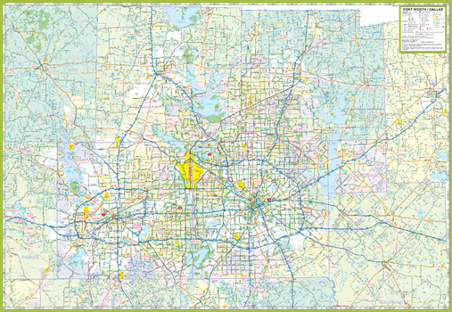
Forth Worth and Vicinity Map
GM Johnson
Dallas - Fort Worth & Vicinity, Texas Regional Map. Map Coverage Area: Arlington, Cleburne, Corsicana, Decatur, Denton, Garland, Greenville, Iriving, McKinney, Plano, Waxahachie, & Adjoining Communities.
Page Size: 39.5 x 27.25 in (1003 x 692 mm)
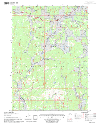
Foster Mountain Quadrangle, California
United States Department of Agriculture Forest Service
United States Department of Agriculture Forestry Service topographical map of Foster Mountain, Mendocino National Forest, California.
Page Size: 21.75 x 27 in (552 x 686 mm)
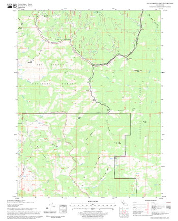
Four Corners Rock Quadrangle, California
United States Department of Agriculture Forest Service
United States Department of Agriculture Forestry Service topographical map of Four Corners Rock, Mendocino National Forest, California.
Page Size: 21.75 x 27 in (552 x 686 mm)
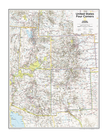
Four Corners U.S. - Atlas of the World, 10th Edition
National Geographic
Arizona, Colorado, New Mexico, Utah
Page Size: 22 x 28 in (559 x 711 mm)
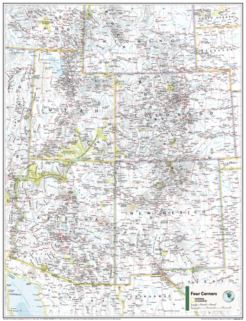
Four Corners U.S. - Atlas of the World, 11th Edition
National Geographic
This Four Corners USA map of physical and political features can fit in any space. Showcasing the region in stunning detail with state-of-the-art cartographic techniques delivering accuracy and exceptional quality, the innovative and engaging design makes the content easily accessible and user-friendly.
Ideal for classrooms with an emphasis on teaching geography or environmental themes. The inclusion of physical features gives your students a genuine feel for how our world appears.
This map uses a bright, easy to read color palette featuring blue oceans and stunning shaded relief that has been featured on National Geographic wall maps for over 75 years. It is drawn in the Albers Conic Equal-Area projection, which uses two standard parallels between which distortion is minimized, however scale and shape are not preserved.
This map is found in National Geographic's 11th Edition World Atlas and is now available as a stand alone product.
Page Size: 24 x 31.5 in (610 x 798 mm)

Four Corners U.S. - Atlas of the World, 11th Edition - Compact
National Geographic
This Four Corners USA map of physical and political features can fit in any space. Showcasing the region in stunning detail with state-of-the-art cartographic techniques delivering accuracy and exceptional quality, the innovative and engaging design makes the content easily accessible and user-friendly.
Ideal for classrooms with an emphasis on teaching geography or environmental themes. The inclusion of physical features gives your students a genuine feel for how our world appears.
This map uses a bright, easy to read color palette featuring blue oceans and stunning shaded relief that has been featured on National Geographic wall maps for over 75 years. It is drawn in the Albers Conic Equal-Area projection, which uses two standard parallels between which distortion is minimized, however scale and shape are not preserved.
This map is found in National Geographic's 11th Edition World Atlas and is now available as a stand alone product.
Page Size: 16.25 x 21.5 in (413 x 540 mm)
Fourmile Quadrangle, South Dakota
United States Department of Agriculture Forest Service
United States Department of Agriculture Forestry Service topographical map of Fourmile, Black Hills National Forest, South Dakota.
Page Size: 21.75 x 27 in (552 x 686 mm)
Fouts Springs Quadrangle, California
United States Department of Agriculture Forest Service
United States Department of Agriculture Forestry Service topographical map of Fouts Springs, Mendocino National Forest, California.
Page Size: 21.75 x 27 in (552 x 686 mm)
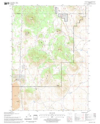
Fox Butte Quadrangle, Oregon
United States Department of Agriculture Forest Service
United States Department of Agriculture Forestry Service topographical map of Fox Butte, Deschutes National Forest, Oregon.
Page Size: 21.75 x 27 in (552 x 686 mm)
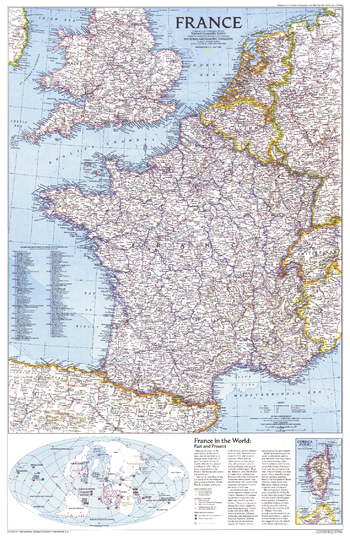
France - Published 1989
National Geographic
National Geographic celebrated the bicentennial of the French Revolution in July 1989 by devoting the entire issue to France. This detailed map political map of the country appeared as a companion to the "Historical France" map.
Page Size: 20.5 x 31.5 in (517 x 797 mm)
France Explorer
MapSherpa
This versatile product allows you to get a topographic map of anywhere in France. It has been designed so you can create a map for your next excursion.This product has been designed to make custom topographic maps suitable for short walks to week long treks and anything in between. Walking and bike paths are featured prominently on this map along with key points of interest such as campsites, trailheads, and landmarks. Also included are traditional topographic features such as elevation contours, landforms, lakes, and rivers along with roads, rails, trails, and park boundaries.The details of this map make it ideal to plan your next trek and take it with you. Invaluable for outdoor recreation activities such as walking, biking, and exploration.
France Roads and Recreation
MapSherpa
This versatile product allows you to get a road map of anywhere in France. It has been designed so you can create a map for your next trip.This product has been designed to make custom road and street maps suitable for road trips and sightseeing. This map features comprehensive points of interest including attractions, landmarks, amenities, scenic views and local foot and bike paths. Also included is a complete network of highways, streets and roads you can count on.The details of this map make it ideal to plan a trip and take it with you. Travel with confidence using a map created specifically for the area you will be discovering.
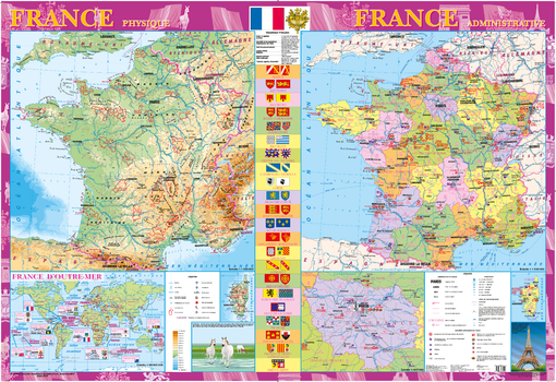
France Wall Map - Physical and Political - French - Extra Large
Kartographia
This decorative wall map of France (in French) includes both a physical map “FRANCE physique”, political map “FRANCE administrative”, and an inset map “ILE-DE-FRANCE” (scale of 1:450,000). The French Republic consists of a number of administrative units located outside of the mother country. The overseas possessions of France are shown on the inset map “FRANCE D’OTRE-MER” (scale of 1:90,000,000).
The map contains statistical information about the country, flags and coats of arms of regions. Points of interest identified include architectural and historical monuments, middle age abbeys, palaces and castles, Olympic games sites, installations and competitions devoted to the national horse racing and equestrian sport, festivals, fairs, holidays, places of birth of prominent people, centers of national art of cooking etc. Special attention is given to UNESCO world heritage monuments. The map is supplemented by illustrations; pictures are supplied with short comments.
In 2011, this map won an award in Paris at the 25th International Cartographic Conference.
Page Size: 62.25 x 42.75 in (1580 x 1080 mm)

France, Belgium and the Netherlands - Published 1960
National Geographic
This detailed map of France, Belgium and the Netherlands is unique in its focus on these three particular countries. Features a list of the "départements", or administrative divisions, for each country and their capitals. Includes inset maps of Paris, Amsterdam, and Brussels. Published in June 1960.
Page Size: 19 x 25 in (480 x 631 mm)
No search results