France Wall Map - Physical and Political - French - Extra Large
Kartographia
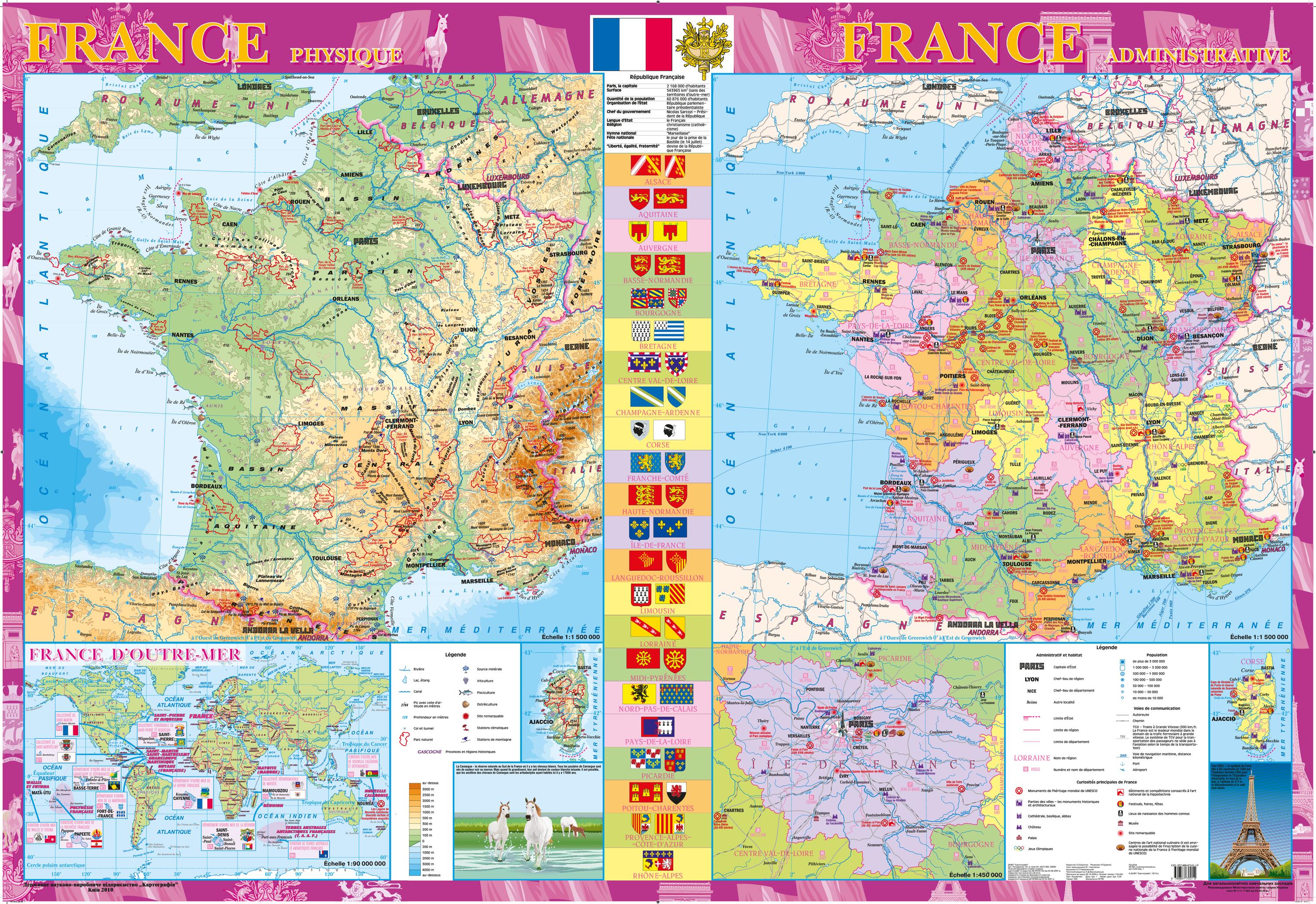
This decorative wall map of France (in French) includes both a physical map “FRANCE physique”, political map “FRANCE administrative”, and an inset map “ILE-DE-FRANCE” (scale of 1:450,000). The French Republic consists of a number of administrative units located outside of the mother country. The overseas possessions of France are shown on the inset map “FRANCE D’OTRE-MER” (scale of 1:90,000,000).
The map contains statistical information about the country, flags and coats of arms of regions. Points of interest identified include architectural and historical monuments, middle age abbeys, palaces and castles, Olympic games sites, installations and competitions devoted to the national horse racing and equestrian sport, festivals, fairs, holidays, places of birth of prominent people, centers of national art of cooking etc. Special attention is given to UNESCO world heritage monuments. The map is supplemented by illustrations; pictures are supplied with short comments.
In 2011, this map won an award in Paris at the 25th International Cartographic Conference.
Page Size: 62.25 x 42.75 in (1580 x 1080 mm)
Buy this map on MapTrove.ca