


MapSherpa Catalog
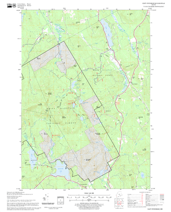
East Middlebury Quadrangle, New Hampshire-Vermont
United States Department of Agriculture Forest Service
United States Forestry Service topographical map of East Middlebury, New Hampshire-Vermont
Page Size: 21.75 x 27 in (552 x 686 mm)

East Midlands Postcode Sector Wall Map (S7)
XYZ Maps
The East Midlands Postcode Sector Wall Map shows detailed postcode sector boundaries along with its associated label (NN1 1, NN1 2) on a comprehensive background and is perfect for determining postcode boundaries, for sales, logistics, planning mailshots or as a regional reference guide.
Page Size: 47 x 33.25 in (1189 x 841 mm)

East Riding of Yorkshire County Map
XYZ Maps
This is a large ceremonial county map of East Riding of Yorkshire, highlighting the ceremonial county border, with the surrounding area faded out for excellent contrast. The county map shows the latest ceremonial boundaries overlaid on a clear, easy to read and up to date Ordnance Survey map.
Page Size: 47 x 33.25 in (1189 x 841 mm)
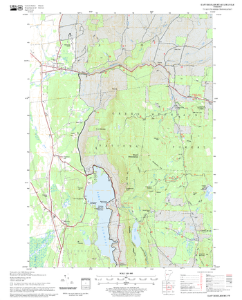
East Stoneham Quadrangle, New Hampshire-Vermont
United States Department of Agriculture Forest Service
United States Forestry Service topographical map of East Stoneham, New Hampshire-Vermont
Page Size: 21.75 x 27 in (552 x 686 mm)

East Sussex County Map
XYZ Maps
This is a large ceremonial county map of East Sussex highlighting the county border, with the surrounding area faded out for excellent contrast. The map covers Crowborough, Uckfield, Heathfield, Hailsham, Lewes, Eastbourne, Hastings, Battle and Rye. The county map shows the latest County and Unitary Authority Boundaries, overlaid on a clear and easy to read Ordnance Survey map.
Page Size: 47 x 33.25 in (1189 x 841 mm)
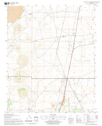
East of S P Mountain Quadrangle, Arizona
United States Department of Agriculture Forest Service
United States Department of Agriculture Forestry Service topographical map of East of S P Mountain, Coconino National Forest, Arizona.
Page Size: 21.75 x 27 in (552 x 686 mm)
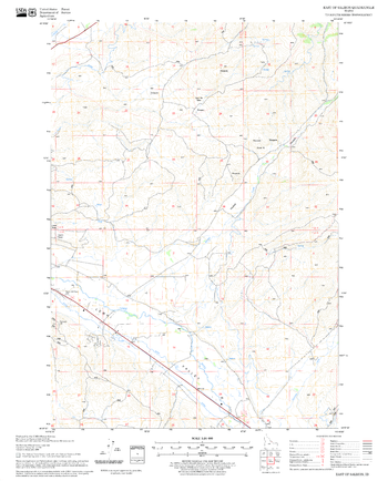
East of Salmon Quadrangle, Idaho
United States Department of Agriculture Forest Service
United States Department of Agriculture Forestry Service topographical map of East of Salmon, Salmon-Chalis National Forest, Idaho.
Page Size: 21.75 x 27 in (552 x 686 mm)
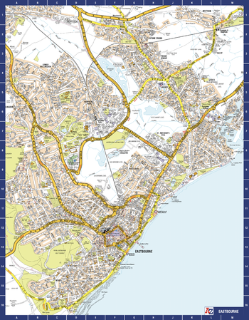
Eastbourne A-Z Street Map
A-Z Maps
The perfect reference map for finding your way around Eastbourne. This up-to-date detailed A-Z town plan includes 1,500 streets in and around Eastbourne. As well as the Eastbourne Pier the other areas covered are Birling Gap, Beachy Head, Hailsham, Polegate, Pevensey Bay, Willingdon, Langney, East Dean and Friston. The highly detailed 1 mile to 5.5 inch street map includes places of interest, among other features.
Page Size: 22.25 x 28.5 in (560 x 718 mm)
Eastern Atlantic Provinces
Lucidmap
Create custom regional maps in Canada from this series of attractive detailed road maps covering most of the populated areas across Canada. Maps are developed from Lucidmap’s iconic Canadian cartography. Coverage of the eastern Atlantic provinces includes Nova Scotia, Prince Edward Island and eastern New Brunswick. Eastern-most communities in New Brunswick include Jacquet River, Blackville, Kingston and Rocky Corner. Native scale is 1:250,000.
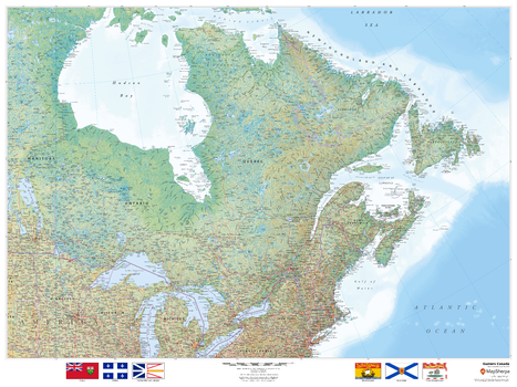
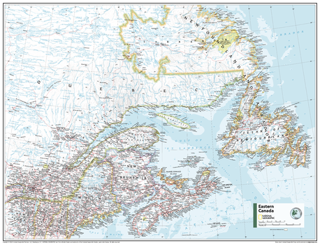
Eastern Canada
MapSherpa
This beautiful map shows physical and political features for Eastern Canada. Relief shading and the use of different colours by height above sea level are both informative and attractive.
Page Size: 48 x 36 in (1219 x 914 mm)
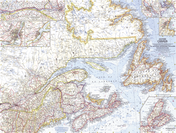
Eastern Canada - Published 1967
National Geographic
Explore the multitude of harbors, bays, inlets, and rivers to be found in Newfoundland, Labrador, Quebec, and the Maritime provinces with this compelling map of Eastern Canada. Includes wonderful detail of the region with inset maps of the provincial capitals, as well as maps of Cape Breton Island and the St. Lawrence Seaway. Published in May 1967, makes a fine companion to the maps of Central Canada (1963) and Western Canada (1966).
Page Size: 25 x 19 in (632 x 478 mm)
Eastern Canada - Atlas of the World, 10th Edition
National Geographic
null
Page Size: 28 x 22 in (711 x 559 mm)
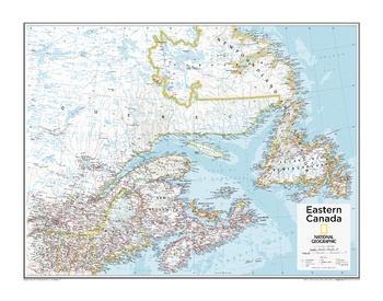
Eastern Canada - Atlas of the World, 11th Edition
National Geographic
This Eastern Canada map of physical and political features can fit in any space. Showcasing the region in stunning detail with state-of-the-art cartographic techniques delivering accuracy and exceptional quality, the innovative and engaging design makes the content easily accessible and user-friendly.
Ideal for classrooms with an emphasis on teaching geography or environmental themes. The inclusion of physical features to this map gives your students a genuine feel for how our world appears.
This map uses a bright, easy to read color palette featuring blue oceans and stunning shaded relief that has been featured on National Geographic wall maps for over 75 years. It is drawn in the Albers Conic Equal-Area projection, which uses two standard parallels between which distortion is minimized, however scale and shape are not preserved.
Names of geographic features are carefully placed on the map to maintain legibility, and the contrasts between Canada's populated and unpopulated areas are on brilliant display.
This map is found in National Geographic's 11th Edition World Atlas and is now available as a stand alone product.
Page Size: 31.5 x 24 in (798 x 610 mm)

Eastern Canada - Atlas of the World, 11th Edition - Compact
National Geographic
This Eastern Canada map of physical and political features can fit in any space. Showcasing the region in stunning detail with state-of-the-art cartographic techniques delivering accuracy and exceptional quality, the innovative and engaging design makes the content easily accessible and user-friendly.
Ideal for classrooms with an emphasis on teaching geography or environmental themes. The inclusion of physical features to this map gives your students a genuine feel for how our world appears.
This map uses a bright, easy to read color palette featuring blue oceans and stunning shaded relief that has been featured on National Geographic wall maps for over 75 years. It is drawn in the Albers Conic Equal-Area projection, which uses two standard parallels between which distortion is minimized, however scale and shape are not preserved.
Names of geographic features are carefully placed on the map to maintain legibility, and the contrasts between Canada's populated and unpopulated areas are on brilliant display.
This map is found in National Geographic's 11th Edition World Atlas and is now available as a stand alone product.
Page Size: 21.5 x 16.25 in (540 x 413 mm)

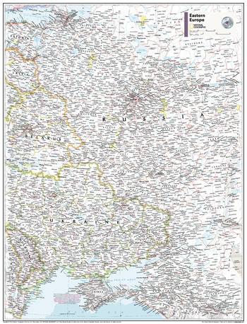
Eastern Europe - Atlas of the World, 11th Edition
National Geographic
This Eastern Europe map of physical and political features can fit in any space. Showcasing the countries in stunning detail with state-of-the-art cartographic techniques delivering accuracy and exceptional quality, the innovative and engaging design makes the content easily accessible and user-friendly.
Ideal for classrooms with an emphasis on teaching geography or environmental themes. The inclusion of physical features gives your students a genuine feel for how our world appears.
This map uses a bright, easy to read color palette featuring blue oceans and stunning shaded relief that has been featured on National Geographic wall maps for over 75 years. It is drawn in Conic projection, in which an area of the earth is projected onto a cone whose vertex is usually above one of the poles, then unrolled onto a flat surface.
Names of geographic features are carefully placed on the map to maintain legibility.
This map is found in National Geographic's 11th Edition World Atlas and is now available as a stand alone product.
Page Size: 24 x 31.5 in (610 x 798 mm)
Eastern Europe - Atlas of the World, 11th Edition - Compact
National Geographic
This Eastern Europe map of physical and political features can fit in any space. Showcasing the countries in stunning detail with state-of-the-art cartographic techniques delivering accuracy and exceptional quality, the innovative and engaging design makes the content easily accessible and user-friendly.
Ideal for classrooms with an emphasis on teaching geography or environmental themes. The inclusion of physical features gives your students a genuine feel for how our world appears.
This map uses a bright, easy to read color palette featuring blue oceans and stunning shaded relief that has been featured on National Geographic wall maps for over 75 years. It is drawn in Conic projection, in which an area of the earth is projected onto a cone whose vertex is usually above one of the poles, then unrolled onto a flat surface.
Names of geographic features are carefully placed on the map to maintain legibility.
This map is found in National Geographic's 11th Edition World Atlas and is now available as a stand alone product.
Page Size: 16.25 x 21.5 in (413 x 540 mm)
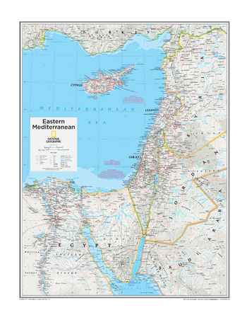
Eastern Mediterranean - Atlas of the World, 10th Edition
National Geographic
Cyprus, Gaza Strip, Israel, Jordan, Lebanon, West Bank
Page Size: 22 x 28 in (559 x 711 mm)
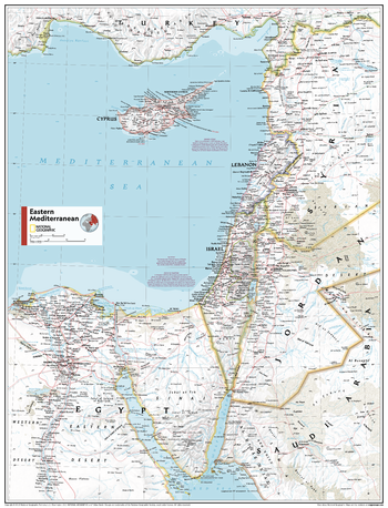
Eastern Mediterranean - Atlas of the World, 11th Edition
National Geographic
This Eastern Mediterranean area map of physical and political features can fit in any space. Showcasing the region in stunning detail with state-of-the-art cartographic techniques delivering accuracy and exceptional quality, the innovative and engaging design makes the content easily accessible and user-friendly.
Ideal for classrooms with an emphasis on teaching geography or environmental themes. The inclusion of physical features gives your students a genuine feel for how our world appears.
This map uses a bright, easy to read color palette featuring blue oceans and stunning shaded relief that has been featured on National Geographic wall maps for over 75 years.
Names of geographic features are carefully placed on the map to maintain legibility.
This map is found in National Geographic's 11th Edition World Atlas and is now available as a stand alone product.
Page Size: 24 x 31.5 in (610 x 798 mm)

Eastern Mediterranean - Atlas of the World, 11th Edition - Compact
National Geographic
This Eastern Mediterranean area map of physical and political features can fit in any space. Showcasing the region in stunning detail with state-of-the-art cartographic techniques delivering accuracy and exceptional quality, the innovative and engaging design makes the content easily accessible and user-friendly.
Ideal for classrooms with an emphasis on teaching geography or environmental themes. The inclusion of physical features gives your students a genuine feel for how our world appears.
This map uses a bright, easy to read color palette featuring blue oceans and stunning shaded relief that has been featured on National Geographic wall maps for over 75 years.
Names of geographic features are carefully placed on the map to maintain legibility.
This map is found in National Geographic's 11th Edition World Atlas and is now available as a stand alone product.
Page Size: 16.25 x 21.5 in (413 x 540 mm)
Eastern Ontario Western Québec
Lucidmap
Create custom regional maps in Canada from this series of attractive detailed road maps covering most of the populated areas across Canada. Maps are developed from Lucidmap’s iconic Canadian cartography. Coverage of eastern Ontario and western Québec ranges along the Saint Lawrence River from Saint-Marc-des-Carrières, QC to Lake Ontario, and west to Colborne; and along the Ottawa River from Stonecliffe, ON to Montréal, QC. Communities in Québec north of this area include Mont-Laurier, Saint-Michel-des-Saints, La Tuque and Rivière-à-Pierre. The southern limit of the coverage is the Canada-USA border. Native scale is 1:250,000.
No search results