


MapSherpa Catalog
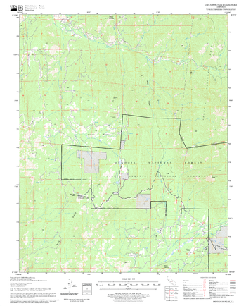
Dennison Peak Quadrangle, California
United States Department of Agriculture Forest Service
United States Department of Agriculture Forestry Service topographical map of Dennison Peak, Sequoia National Forest, California.
Page Size: 21.75 x 27 in (552 x 686 mm)
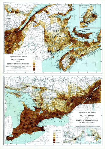
Density of Population Maritime Provinces, Quebec, Ontario (1906)
Natural Resources Canada
Contained within the 1st Edition (1906) of the Atlas of Canada is a plate that shows two maps. The maps show the density of population per square mile for every township the Maritime Provinces, Quebec and Ontario, circa 1901. Cities and towns of 5000 inhabitants or more are shown as black dots. The size of the circle is proportionate to the population. The map uses eight classes, seven of which are shades of brown, more densely populated portions are shown in the darker tints. Numbers make it clear which class is being shown in any one township.
Page Size: 17.25 x 24.25 in (433 x 612 mm)
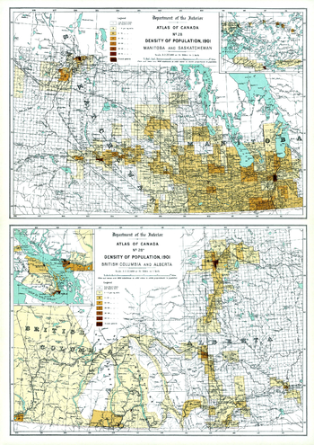
Density of Population, Western Canada (1906)
Natural Resources Canada
Contained within the 1st Edition (1906) of the Atlas of Canada is a plate that shows two maps. The maps show the density of population per square mile for every township in Manitoba, Saskatchewan, British Columbia, Alberta, circa 1901. The statistics from the 1901 census are used, yet the population of Saskatchewan and Alberta is shown as confined within the vicinity of the railways, this is because the railways have been brought up to date of publication, 1906. Cities and towns of 5000 inhabitants or more are shown as black dots. The size of the circle is proportionate to the population. The map uses eight classes, seven of which are shades of brown, more densely populated portions are shown in the darker tints. Numbers make it clear which class is being shown in any one township. Major railway systems are shown. The map also displays the rectangular survey system which records the land that is available to the public.
Page Size: 17.25 x 24.25 in (433 x 612 mm)
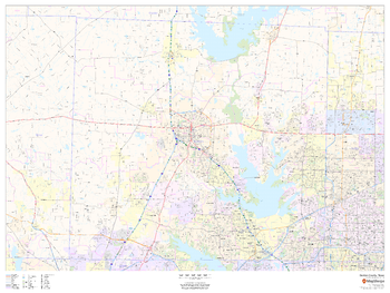
Denton County, Texas
MapSherpa
This map of Denton County, Texas shows regional level information. Base map features include highways and major roads with labelling; neighborhood names; railways; high level land use such as parks and recreation areas, industrial areas and hospital campuses; and a selection of points of interest including transportation hubs like airports and train stations, tourist information, police stations and shopping centres. ZIP code boundaries are shown as a secondary map feature.
Page Size: 48 x 36 in (1219 x 914 mm)
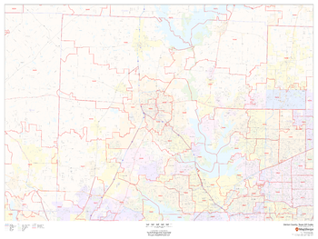
Denton County, Texas ZIP Codes
MapSherpa
This map of Denton County, Texas shows ZIP code areas overlaid on a road map. Ideal for planning of deliveries, home ervices, sales territories, real estate and much more. Base map features include all roads with major roads and highways labelled; neighborhood names; railways; and high level land use such as parks and recreation areas, industrial areas and hospital campuses.
Page Size: 48 x 36 in (1219 x 914 mm)
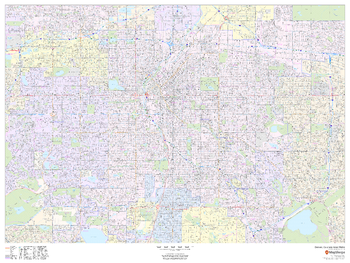
Denver, Colorado Inner Metro - Landscape
MapSherpa
This landscape-oriented map of central Denver, Colorado shows detailed street level information including extensive street labeling. Ideal for planning of deliveries, home services, sales territories, real estate and much more. Base map features include all roads with major roads and highways labelled; neighborhood names; railways; high level land use such as parks and recreation areas, industrial areas and hospital campuses; and a variety of points of interest including schools, libraries, stadiums, museums, border crossings and more.
Page Size: 48 x 36 in (1219 x 914 mm)
Denver, Colorado Inner Metro - Portrait
MapSherpa
This portrait-oriented map of central Denver, Colorado shows detailed street level information including extensive street labeling. Ideal for planning of deliveries, home services, sales territories, real estate and much more. Base map features include all roads with major roads and highways labelled; neighborhood names; railways; high level land use such as parks and recreation areas, industrial areas and hospital campuses; and a variety of points of interest including schools, libraries, stadiums, museums, border crossings and more.
Page Size: 36 x 48 in (914 x 1219 mm)
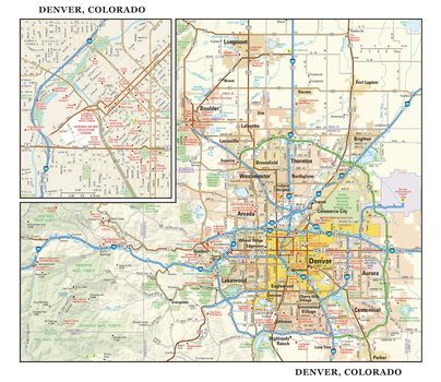
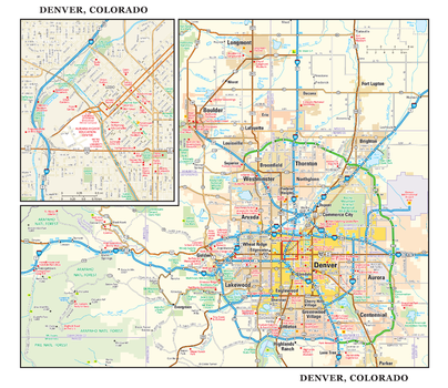
Denver, Colorado Wall Map, large
Globe Turner
This detailed reference map combines two maps in one - a regional map of metropolitan Denver plus a street-level map of downtown Denver. The area’s cities and towns, highways and roads, and a variety of points of interest are depicted on the regional map. Boulder, Aurora, and Golden are among the cities surrounding Denver that are shown. The map is beautifully rendered with terrain relief. The highly detailed inset of Denver’s business district shows highways, streets, parks, landmarks, and other points of interest. The state capitol, Coors Field, and the U.S. Mint are among the many points of interest shown on this map. Also available in a small size of 22.50" wide X 19.50" high.
Page Size: 22.75 x 19.5 in (572 x 495 mm)
Denver, Colorado Wall Map, small
Globe Turner
This detailed reference map combines two maps in one - a regional map of metropolitan Denver plus a street-level map of downtown Denver. The area’s cities and towns, highways and roads, and a variety of points of interest are depicted on the regional map. Boulder, Aurora, and Golden are among the cities surrounding Denver that are shown. The map is beautifully rendered with terrain relief. The highly detailed inset of Denver’s business district shows highways, streets, parks, landmarks, and other points of interest. The state capitol, Coors Field, and the U.S. Mint are among the many points of interest shown on this map. Also available in a large size of 22.50" wide X 19.50" high.
Page Size: 11.25 x 9.75 in (286 x 248 mm)
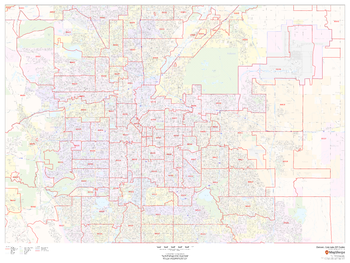
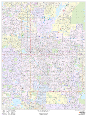
Denver, Colorado ZIP Codes
MapSherpa
This map of Denver shows ZIP code areas overlaid on a road map. Ideal for planning of deliveries, home services, sales territories, real estate and much more. Base map features include all roads with major roads and highways labelled; neighborhood names; railways; and high level land use such as parks and recreation areas, industrial areas and hospital campuses.
Page Size: 48 x 36 in (1219 x 914 mm)
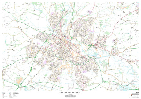
Derby
MapSherpa
This map of Derby shows detailed street level information including extensive street labelling. Ideal for planning of deliveries, home services, sales territories, real estate and much more.
Page Size: 47 x 33.25 in (1189 x 841 mm)

Derby - DE - Postcode Wall Map
XYZ Maps
The Derby Postcode Sector Wall Map shows detailed postcode sector boundaries (DE1 1, DE1 2) on a comprehensive background and is perfect for determining postcode boundaries for sales areas, planning mailshots and also an excellent reference for logistics. This wall map covers the whole of the DE Postcode Area.
Page Size: 33.25 x 47 in (841 x 1189 mm)

Derbyshire County Map
XYZ Maps
This is a large ceremonial county map of Derbyshire highlighting the county border, with the surrounding area faded out for excellent contrast. The map covers Ashbourne, Bakewell, Buxton, Chesterfield, Derby, Glossop, Matlock, Ilkeston, Long Eaton and Swadlincote.The county map shows the latest County and Unitary Authority Boundaries, Overlaid on a Clear and Easy to Read Ordnance Survey map.
Page Size: 33.25 x 47 in (841 x 1189 mm)
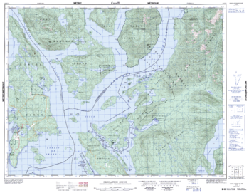
Desolation Sound - 92 K/2 - British Columbia
Natural Resources Canada
Canadian topographic map of Desolation Sound, British Columbia. NTS sheet 092K02 Edition 2.
Page Size: 32.75 x 25.5 in (831 x 644 mm)
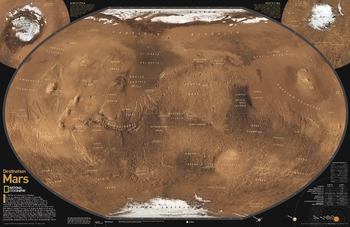
Destination Mars
National Geographic
See Mars as it really looks, from the heights of Olympus Mons (nearly 70,000 feet above the surface), to ancient canyons, to Hellas Planitia, the lowest point on Mars, where a meteorite punched a hole in the surface 1,300 miles wide and five miles deep. Destination Mars was created for National Geographic with over 1,000 images taken by the Mars Orbiter Camera, and merged with 330 million elevation points to create the sharpest view yet of Mars and its spectacular terrain.
Page Size: 31.25 x 20.25 in (794 x 514 mm)
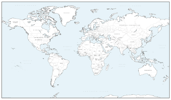
Detailed World Colouring Map - Big
Cosmographics
Make learning fun and be creative. A simple World map with country borders and names. The American states and other country state and province borders are also shown. Buy this World map as a gift, or for you and your family to colour in and help learn the countries at the same time.
Page Size: 27.75 x 16.25 in (700 x 410 mm)
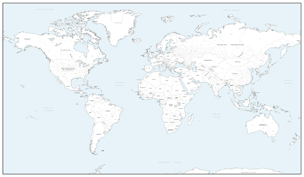
Detailed World Colouring Map - Giant
Cosmographics
Make learning fun and be creative. A simple World map with country borders and names. The American states and other country state and province borders are also shown and named. Buy this World map as a gift, or for you and your family to colour in and help learn the countries at the same time.
Page Size: 53.5 x 31.25 in (1355 x 790 mm)
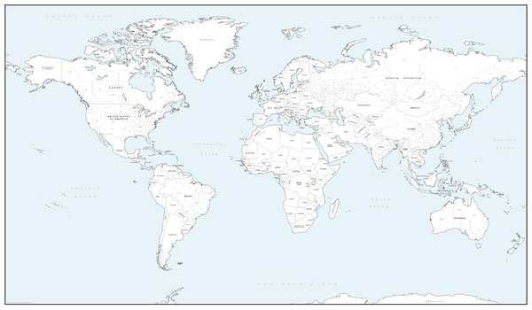
Detailed World Colouring Map - Large
Cosmographics
Make learning fun and be creative. A simple World map with country borders and names. The American states and other country state and province borders are also shown and named. Buy this World map as a gift, or for you and your family to colour in and help learn the countries at the same time.
Page Size: 40.25 x 23.5 in (1020 x 595 mm)
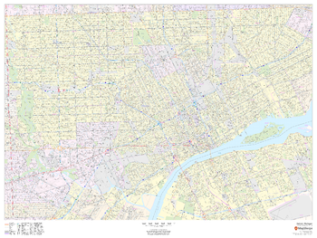
Detroit, Michigan - Landscape
MapSherpa
This landscape-oriented map of Detroit, Michigan shows detailed street level information including extensive street labeling. Ideal for planning of deliveries, home services, sales territories, real estate and much more. Base map features include all roads with major roads and highways labelled; neighborhood names; railways; high level land use such as parks and recreation areas, industrial areas and hospital campuses; and a variety of points of interest including schools, libraries, stadiums, museums, border crossings and more.
Page Size: 48 x 36 in (1219 x 914 mm)
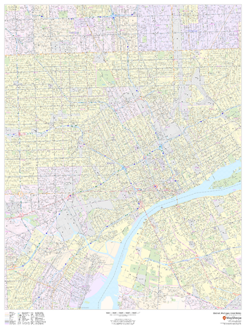
Detroit, Michigan Inner Metro - Portrait
MapSherpa
This portrait-oriented map of central Detroit, Michigan shows detailed street level information including extensive street labeling. Ideal for planning of deliveries, home services, sales territories, real estate and much more. Base map features include all roads with major roads and highways labelled; neighborhood names; railways; high level land use such as parks and recreation areas, industrial areas and hospital campuses; and a variety of points of interest including schools, libraries, stadiums, museums, border crossings and more.
Page Size: 36 x 48 in (914 x 1219 mm)
No search results