top of page
Density of Population Maritime Provinces, Quebec, Ontario (1906)
Natural Resources Canada
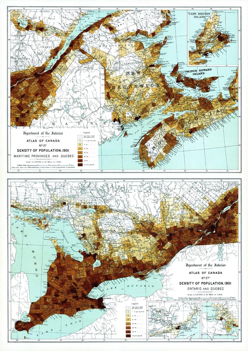
Contained within the 1st Edition (1906) of the Atlas of Canada is a plate that shows two maps. The maps show the density of population per square mile for every township the Maritime Provinces, Quebec and Ontario, circa 1901. Cities and towns of 5000 inhabitants or more are shown as black dots. The size of the circle is proportionate to the population. The map uses eight classes, seven of which are shades of brown, more densely populated portions are shown in the darker tints. Numbers make it clear which class is being shown in any one township.
Page Size: 17.25 x 24.25 in (433 x 612 mm)
Buy this map on MapTrove.ca or MapTrove.com
bottom of page