


MapSherpa Catalog
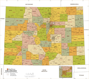
Colorado ZIP Code Map with Counties - Large
MapSherpa
This map has been created exclusively for MapSherpa, and designed for business or reference use. Clear and clean colors & fonts matched with cartographic research makes this Colorado Zip Code Map with Counties easily readable and useful. The map shows the 64 counties of Colorado and the borders of the over 500 zip codes across the Centennial State.
Page Size: 48 x 42.5 in (1219 x 1078 mm)

Colorado ZIP Code Map with Counties - Standard
MapSherpa
This map has been created exclusively for MapSherpa, and designed for business or reference use. Clear and clean colors & fonts matched with cartographic research makes this Colorado Zip Code Map with Counties easily readable and useful. The map shows the 64 counties of Colorado and the borders of the over 500 zip codes across the Centennial State.
Page Size: 36 x 32 in (914 x 808 mm)
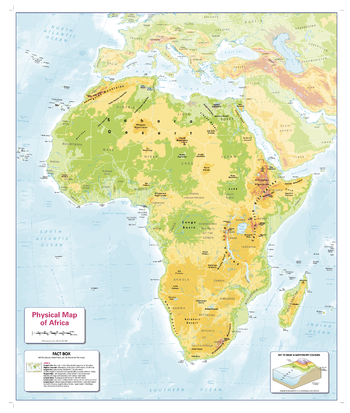
Colour Blind Friendly Children's Physical Map of Africa
Cosmographics
There is likely to be at least one child in every classroom that is colour blind. Designed especially to work with any form of colour blindness, this colourful, easy to read children's map of Africa showing the main physical features on land and the seabed and a useful facts box is ideal for the classroom.
Page Size: 26.5 x 31.75 in (668 x 805 mm)
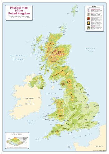
Colour Blind Friendly Children's Physical Map of the UK
Cosmographics
There is likely to be at least one child in every classroom that is colour blind. Designed especially to work with any form of colour blindness, this colourful, easy to read children's map of the United Kingdom showing the main physical features on land and the seabed and a useful facts box is ideal for the classroom.
Page Size: 25.25 x 36 in (640 x 910 mm)
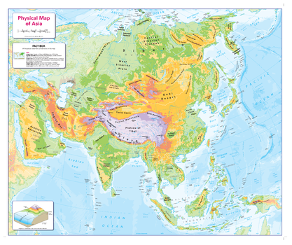
Colour Blind Friendly Children's Physical Map of Asia
Cosmographics
There is likely to be at least one child in every classroom that is colour blind. Designed especially to work with any form of colour blindness, this colourful, easy to read children's map of Asiashowing the main physical features on land and the seabed and a useful facts box is ideal for the classroom.
Page Size: 31.75 x 26.5 in (804 x 668 mm)
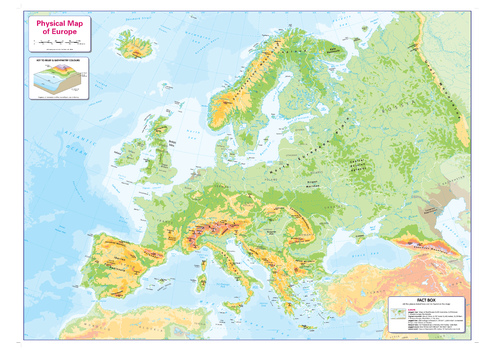
Colour Blind Friendly Children's Physical Map of Europe
Cosmographics
There is likely to be at least one child in every classroom that is colour blind. Designed especially to work with any form of colour blindness, this colourful, easy to read children's map of Europe showing the main physical features on land and the seabed and a useful facts box is ideal for the classroom.
Page Size: 35.75 x 26.5 in (905 x 669 mm)
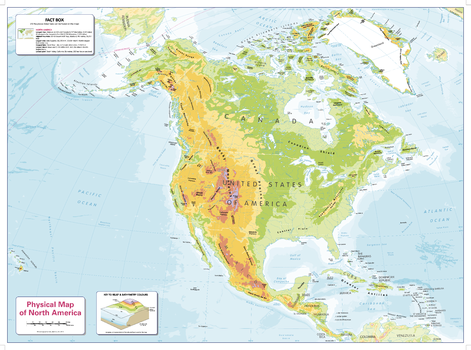
Colour Blind Friendly Children's Physical Map of North America
Cosmographics
There is likely to be at least one child in every classroom that is colour blind. Designed especially to work with any form of colour blindness, this colourful, easy to read children's map of North America showing the main physical features on land and the seabed and a useful facts box is ideal for the classroom.
Page Size: 35.75 x 26.5 in (905 x 668 mm)
Colour Blind Friendly Children's Physical Map of Oceania
Cosmographics
There is likely to be at least one child in every classroom that is colour blind. Designed especially to work with any form of colour blindness, this colourful, easy to read children's map of Oceania showing the main physical features on land and the seabed and a useful facts box is ideal for the classroom.
Page Size: 31.75 x 26.5 in (805 x 668 mm)
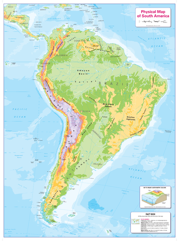
Colour Blind Friendly Children's Physical Map of South America
Cosmographics
There is likely to be at least one child in every classroom that is colour blind. Designed especially to work with any form of colour blindness, this colourful, easy to read children's map of South America showing the main physical features on land and the seabed and a useful facts box is ideal for the classroom.
Page Size: 26.5 x 35.75 in (668 x 905 mm)
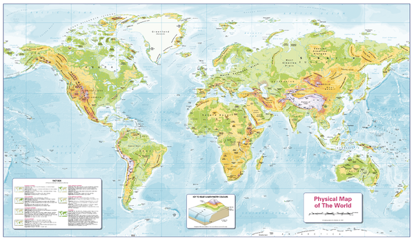
Colour Blind Friendly Children's Physical Map of the World
Cosmographics
There is likely to be at least one child in every classroom that is colour blind. Designed especially to work with any form of colour blindness, this colourful, easy to read children's map of the World showing the main physical features on land and the seabed and a useful facts box is ideal for the classroom.
Page Size: 40.25 x 23.5 in (1022 x 595 mm)
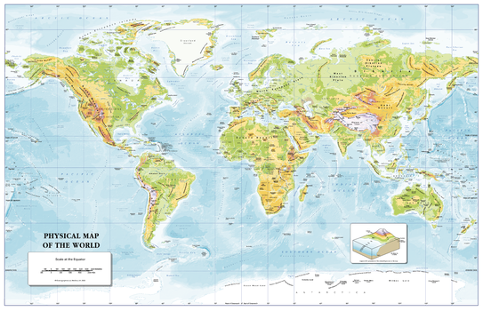
Colour Blind Friendly Children's Physical Map of the World – Small
Cosmographics
A great reference to the world's physical features. A colourful, informative map of the world showing and naming the main physical features both land and ocean. Designed especially to work with any form of colour blindness this map is ideal for the classroom or office, as well as for the home. There is likely to be at least one child in every classroom that is colour blind.
Page Size: 24.5 x 15.75 in (620 x 400 mm)
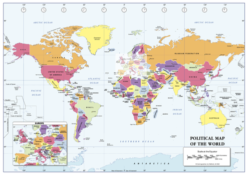
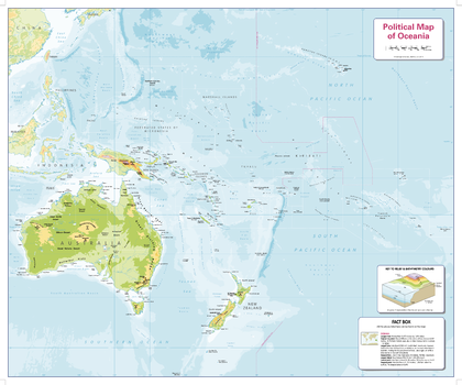
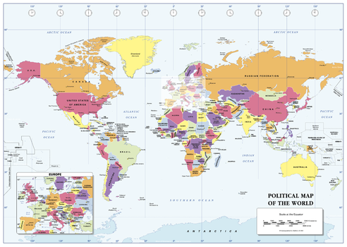
Colour Blind Friendly Political Wall Map of the World - A3
Cosmographics
A colourful, simplified, easy to read Politically coloured world map. Clearly shows and names countries and a selection of cities around the world. Designed especially to work with any form of colour blindness this map is ideal for the classroom or office, as well as for the home. There is likely to be at least one child in every classroom that is colour blind.
Page Size: 16.75 x 11.75 in (420 x 297 mm)
Colour Blind Friendly Political Wall Map of the World - A4
Cosmographics
A colourful, simplified, easy to read Politically coloured world map. Clearly shows countries and names most of them.Designed especially to work with any form of colour blindness this map is ideal for the classroom or office, as well as for the home. There is likely to be at least one child in every classroom that is colour blind.
Page Size: 11.75 x 8.5 in (297 x 210 mm)
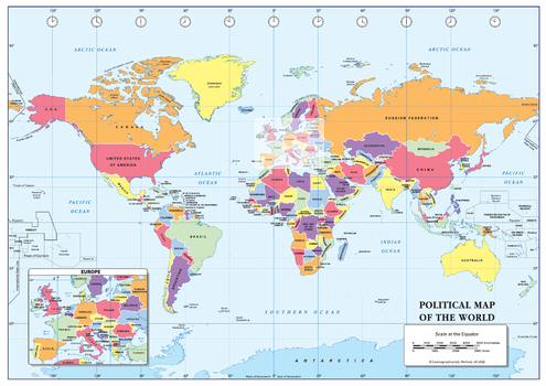
Colour Blind Friendly Political Wall Map of the World - Small
Cosmographics
A colourful, simplified, easy to read Politically coloured world map. Clearly shows and names countries and a selection of cities around the world.Designed especially to work with any form of colour blindness this map is ideal for the classroom or office, as well as for the home. There is likely to be at least one child in every classroom that is colour blind.
Page Size: 22.25 x 15.75 in (562 x 400 mm)
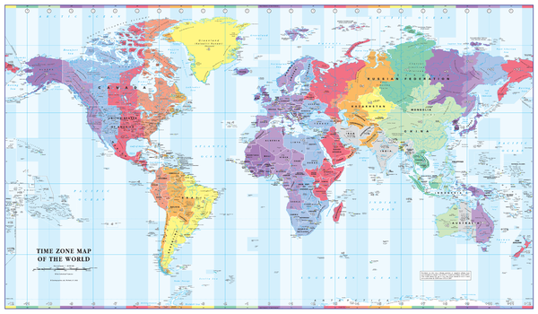
Colour Blind Friendly Time Zone Wall Map of the World
Cosmographics
Designed especially to work with any form of colour blindness this informative map is ideal for the office. Combined with a detailed political map of the world, contrasting colours are used to accurately depict the different time zones, both on land and in the oceans.
Page Size: 40.25 x 23.5 in (1022 x 595 mm)
Colour Blind Friendly Time Zone Wall Map of the World - A3
Cosmographics
A great reference to the world's time zones. A colourful, easy to read map showing the the time zones and country borders, naming most countries and a selection of cities around the world. Designed especially to work with any form of colour blindness this map is ideal for the classroom or office, as well as for the home. There is likely to be at least one child in every classroom that is colour blind.
Page Size: 16.75 x 11.75 in (420 x 297 mm)
Colour Blind Friendly Time Zone Wall Map of the World - A4
Cosmographics
A great reference to the world's time zones. A colourful, easy to read map showing the the time zones and country borders, naming most countries and a selection of cities around the world. Designed especially to work with any form of colour blindness this map is ideal for the classroom or office, as well as for the home. There is likely to be at least one child in every classroom that is colour blind.
Page Size: 11.75 x 8.5 in (297 x 210 mm)
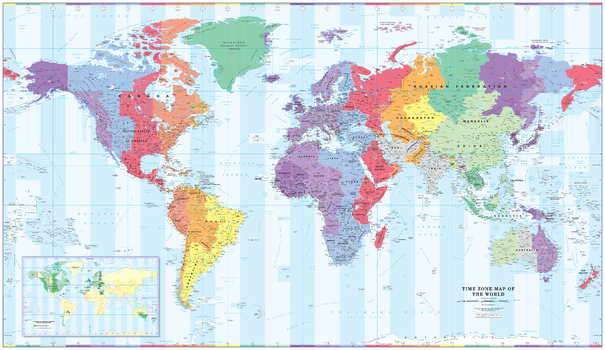
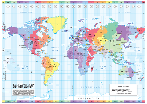
Colour Blind Friendly Time Zone Wall Map of the World - Extra Large
Cosmographics
Designed to be fully inclusive and work for everyone including those with colour vision deficiency, this informative map is ideal for the office. Combined with a detailed political map of the world, contrasting colours are used to accurately depict the different time zones, both on land and in the oceans. Includes an additional map showing countries/states that adopt daylight saving hours. This giant map will make a stunning addition to any office or boardroom or maybe consider as wall art for the home.
Page Size: 79.75 x 46.25 in (2023 x 1171 mm)
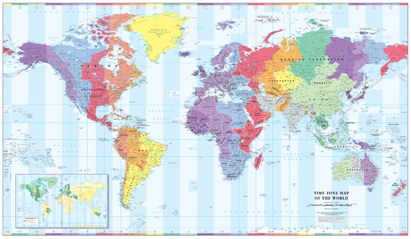
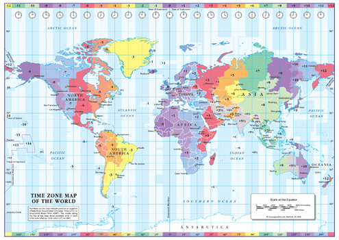
Colour Blind Friendly Time Zone Wall Map of the World - Large
Cosmographics
Designed especially to work with any form of colour blindness this informative map is ideal for the office. Combined with a detailed political map of the world, contrasting colours are used to accurately depict the different time zones, both on land and in the oceans. Includes an additional map showing countries/states that adopt daylight saving hours.
Page Size: 53.75 x 31.5 in (1365 x 797 mm)
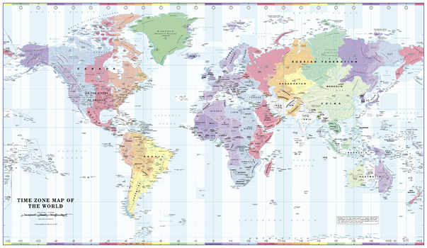
Colour Blind Friendly Time Zone Wall Map of the World - Poster
Cosmographics
Designed to be fully inclusive and work for everyone including those with colour vision deficiency, this informative map is ideal for the office. Combined with a detailed political map of the world, contrasting colours are used to accurately depict the different time zones, both on land and in the oceans.
Page Size: 39 x 22.75 in (991 x 575 mm)
No search results