top of page
Colorado ZIP Code Map with Counties - Large
MapSherpa
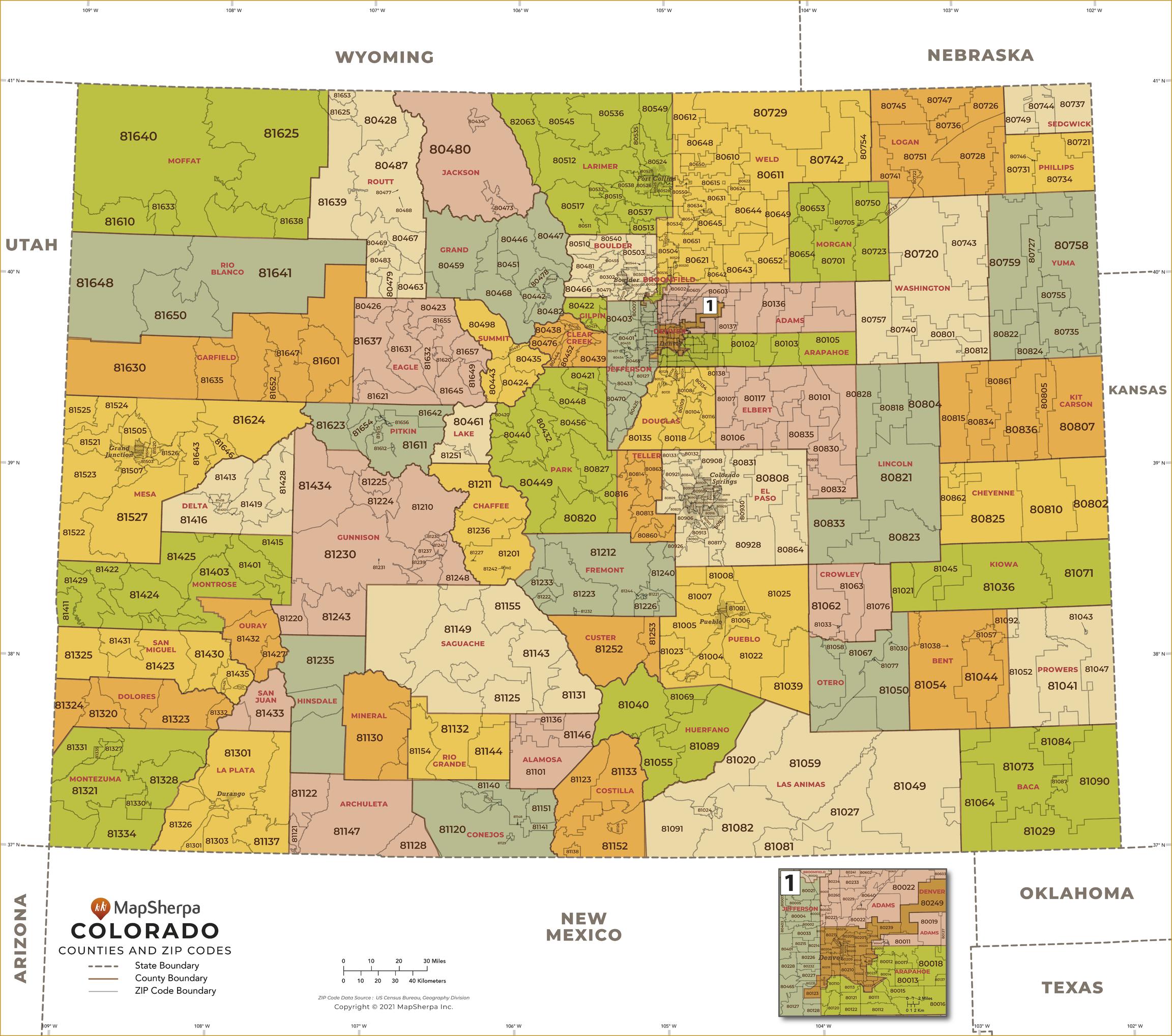
This map has been created exclusively for MapSherpa, and designed for business or reference use. Clear and clean colors & fonts matched with cartographic research makes this Colorado Zip Code Map with Counties easily readable and useful. The map shows the 64 counties of Colorado and the borders of the over 500 zip codes across the Centennial State.
Page Size: 48 x 42.5 in (1219 x 1078 mm)
Buy this map on MapTrove.ca
bottom of page