


MapSherpa Catalog
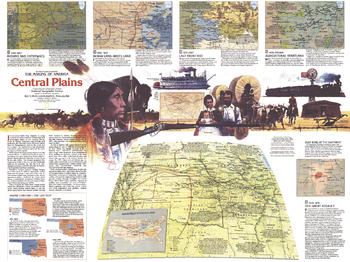
Central Plains Map Side 2 - Published 1985
National Geographic
In four-hundred years the Great Plains of America shifted from a wild landscape of Bison and the Native American tribes who hunted them to the nation's breadbasket and agricultural heartland. Explore the region's colorful and often tragic history with the Central Plains map. Published in September 1985, this map represents Side Two of a two-map set in the "Making of America" series.
Page Size: 27.25 x 20.5 in (687 x 515 mm)
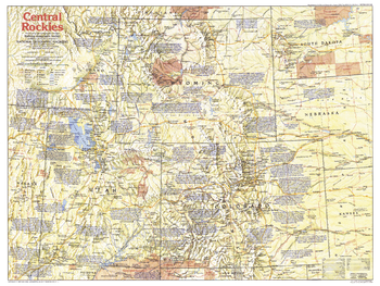
Central Rockies Side 1 - Published 1984
National Geographic
The Central Rockies region of the United States has a colorful history and is world-renowned for the beauty of its national parks. This map shows the states of Colorado, Utah, Wyoming, and their immediate neighbors, and includes a wealth of historical notes and points of interest. Published in August 1984 as part of the "Making of America" series.
Page Size: 27.25 x 20.5 in (688 x 516 mm)
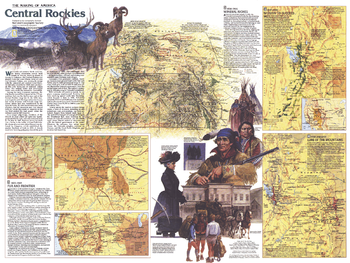
Central Rockies Side 2 - Published 1984
National Geographic
This map of the Central Rockies represents Side Two in a two-piece set of maps focused on this extraordinary region of awesome natural beauty, colorful history, and abundant resources. Published in August 1984 as part of the "Making of America" series, this map provides a detailed look at the history of Colorado, Utah, and Wyoming as the region changed from tribal lands, fur trading posts, and mining towns to a region known for its national parks, wildlife, ski resorts, and energy resources.
Page Size: 27.25 x 20.5 in (688 x 516 mm)

Central Southern England Postcode Sector Wall Map (S3)
XYZ Maps
The Central Southern England Postcode Sector Wall Map shows detailed postcode sector boundaries along with its associated label (RG1 1, RG1 2) on a comprehensive background and is perfect for determining postcode boundaries, for sales, logistics, planning mailshots or as a regional reference guide.
Page Size: 33.25 x 47 in (841 x 1189 mm)
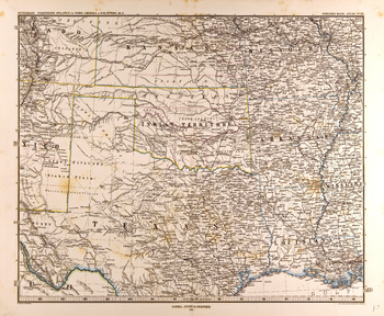
Central United States Map in German (1872)
Artokoloro
Map of the central United States in German from the Gotha Justus Perthes 1872 Atlas. Full title: Petermann: Vereinigte Staaten von Nord-Amerika in 6 Blättern, Bl. 5.
Page Size: 25.25 x 20.75 in (639 x 526 mm)
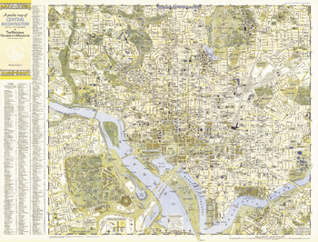
Central Washington, District of Columbia - Published 1948
National Geographic
A Pocket Map of Central Washington, District of Columbia is half of a two-map set published in September 1948 with the article "American Masters in the National Gallery." Detailed and indexed, this map features all the sites of note, from the White House, the U.S. Capital building, and the Lincoln Memorial, to the Smithsonian, the National Gallery of Art, and the National Zoo. Its companion map, "A Pocket Map of Suburban Washington, D.C., Maryland and Virginia" appeared in the same issue.
Page Size: 31.75 x 24.25 in (804 x 611 mm)
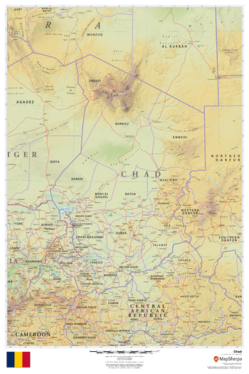
Chad
MapSherpa
This beautiful map shows physical and political features for Chad and surrounding areas. Relief shading and the use of different colours by height above sea level are both informative and attractive.
Page Size: 24 x 36 in (610 x 914 mm)
Challenge Quadrangle, California
United States Department of Agriculture Forest Service
United States Department of Agriculture Forestry Service topographical map of Challenge, Tahoe National Forest, California.
Page Size: 21.75 x 27 in (552 x 686 mm)
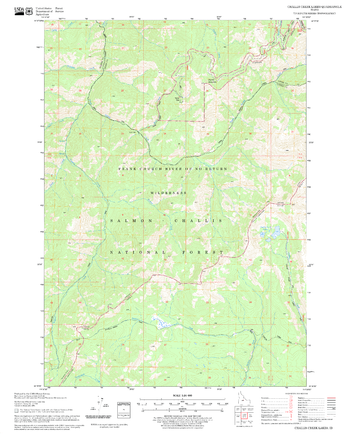
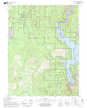
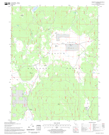
Challis Creek Lakes Quadrangle, Idaho
United States Department of Agriculture Forest Service
United States Department of Agriculture Forestry Service topographical map of Challis Creek Lakes, Salmon-Chalis National Forest, Idaho.
Page Size: 21.75 x 27 in (552 x 686 mm)
Champs Flat Quadrangle, California
United States Department of Agriculture Forest Service
United States Department of Agriculture Forestry Service topographical map of Champs Flat, Lassen National Forest, California.
Page Size: 21.75 x 27 in (552 x 686 mm)
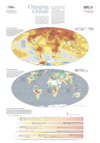
Changing Climate - Published 2007
National Geographic
The scientific evidence is clear: Surface temperatures on Earth are warming at a pace that signals a decisive shift in the global climate, one expected to last for centuries. Climate is changing more rapidly than ever before and human activity is the main cause. Burning of fossil fuels has flooded the atmosphere with heat-trapping carbon dioxide, triggering a 1 degree (F) spike in average global temperature in the past century, largely in the past 30 years. This informative map, published in October 2007 as half of a two-map set with "Greenhouse Earth," reveals evidence which suggests that unless CO2 emissions are slashed, the planet will likely heat up even faster, fundamentally changing the world we live in.
Page Size: 22 x 31.5 in (559 x 800 mm)
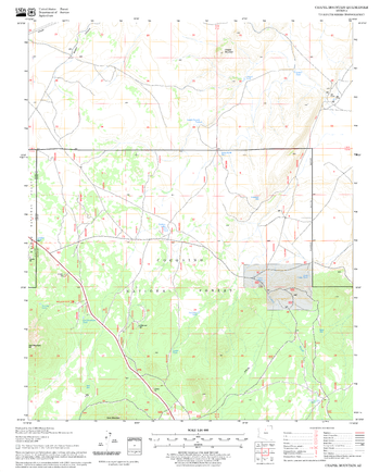
Chapel Mountain Quadrangle, Arizona
United States Department of Agriculture Forest Service
United States Department of Agriculture Forestry Service topographical map of Chapel Mountain, Coconino National Forest, Arizona.
Page Size: 21.75 x 27 in (552 x 686 mm)
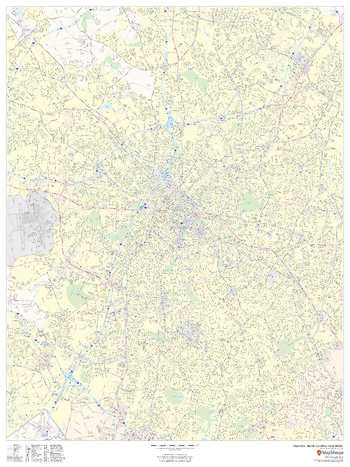
Charlotte, North Carolina Inner Metro - Landscape
MapSherpa
This landscape-oriented map of central Charlotte, North Carolina shows detailed street level information including extensive street labeling. Ideal for planning of deliveries, home services, sales territories, real estate and much more. Base map features include all roads with major roads and highways labelled; neighborhood names; railways; high level land use such as parks and recreation areas, industrial areas and hospital campuses; and a variety of points of interest including schools, libraries, stadiums, museums, border crossings and more.
Page Size: 48 x 36 in (1219 x 914 mm)
Charlotte, North Carolina Inner Metro - Portrait
MapSherpa
This portrait-oriented map of central Charlotte, North Carolina shows detailed street level information including extensive street labeling. Ideal for planning of deliveries, home services, sales territories, real estate and much more. Base map features include all roads with major roads and highways labelled; neighborhood names; railways; high level land use such as parks and recreation areas, industrial areas and hospital campuses; and a variety of points of interest including schools, libraries, stadiums, museums, border crossings and more.
Page Size: 36 x 48 in (914 x 1219 mm)
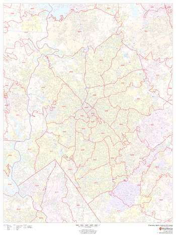
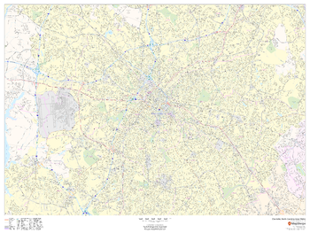
Charlotte, North Carolina ZIP Codes
MapSherpa
This map of Charlotte shows ZIP code areas overlaid on a road map. Ideal for planning of deliveries, home services, sales territories, real estate and much more. Base map features include all roads with major roads and highways labelled; neighborhood names; railways; and high level land use such as parks and recreation areas, industrial areas and hospital campuses.
Page Size: 36 x 48 in (914 x 1219 mm)
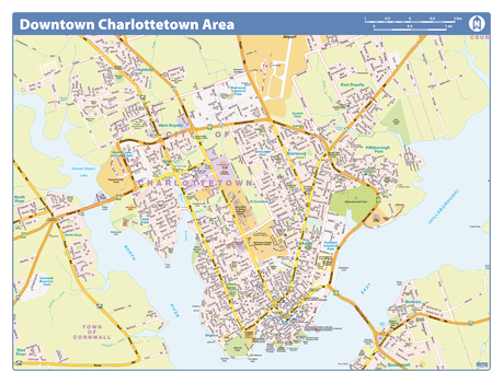
Charlottetown Downtown - Compact
Lucidmap
Map of downtown Charlottetown showing all roads, road names, political boundaries, transit, points of interest, parks, schools, churches, public buildings and landmarks.
Page Size: 21.5 x 16.25 in (546 x 413 mm)
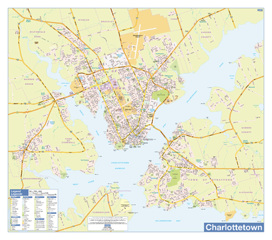
Charlottetown Wall Map - Street Detail
Lucidmap
This wall map shows highly detailed local information for the city of Charlottetown. Full street labeling along with transit information, parks, schools, churches and landmarks throughout the city are displayed.
The map has been designed in a very clear and legible manner with a traditional Canadian street map style embraced by map buyers over many years.
Page Size: 33 x 29 in (838 x 737 mm)
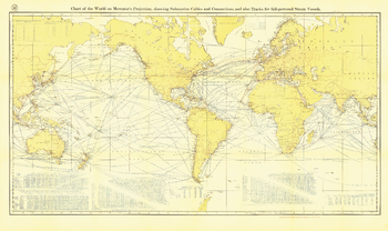
Chart of the World on Mercator's Projection - Published 1905
National Geographic
Submarine cables have played an important part in the development of world-wide communications since the 1850's. National Geographic first charted these cables in 1896. In comparison to that earlier map, this map, published in February 1905 reveals the explosion of communications infrastructure worldwide at the beginning of the last century.
Page Size: 46.75 x 28 in (1187 x 707 mm)
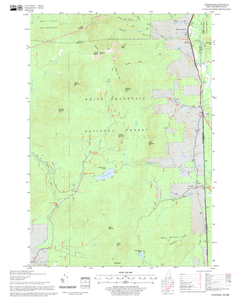
Chatham Quadrangle, New Hampshire-Vermont
United States Department of Agriculture Forest Service
United States Forestry Service topographical map of Chatham, New Hampshire-Vermont
Page Size: 21.75 x 27 in (552 x 686 mm)
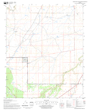
Chavez Mountain East Quadrangle, Arizona
United States Department of Agriculture Forest Service
United States Department of Agriculture Forestry Service topographical map of Chavez Mountain East, Coconino National Forest, Arizona.
Page Size: 21.75 x 27 in (552 x 686 mm)
No search results