


MapSherpa Catalog
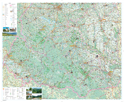
Carpatians Tourist Map - Latynka
Kartographia
The Carpathian region, a popular holiday destination, is one of the most attractive regions to travel in Ukraine. This map provides information useful to tourists: the most famous historical and cultural, architectural and archaeological monuments, features of nature preservation, museums and spas. Tourist infrastructure and tourist service facilities are listed.
Place names on the map are written in the Ukrainian Latin alphabet (Latynka), and the legend is in English.
Page Size: 42.75 x 34.75 in (1080 x 880 mm)
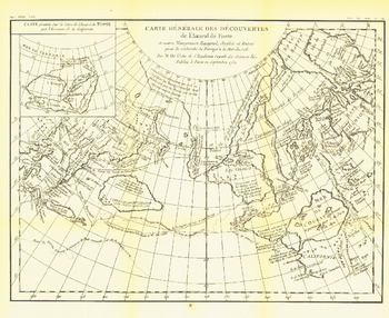
Carte Generale Des Decouvertes De Lamiral De Fonte 1752 - Published 1892
National Geographic
The "Carte Generale des Decouvertes de l'Amiral de Fonte" map is a black and white antique map created by Joseph-Nicolas De l'Isle in 1752 showing the supposed discoveries of Spanish explorer Admiral de la Fuente and the tracks of Spanish, English, and Russian navigators. These mythical "discoveries" included a Northwest Passage. Published in February 1892, it accompanied the article "The Cartography and Observations of Bering's First Voyage."
Page Size: 16 x 13 in (403 x 329 mm)
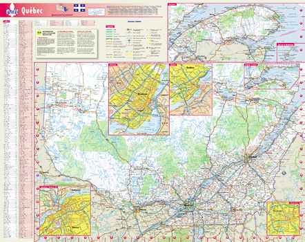
Carte du Québec, en français
Globe Turner
Cette carte de province colorée et facile à lire du Québec identifie toutes les artères principales, les routes secondaires, les échangeurs d'autoroutes, les aires de repos, les repères de distance, les repères, les aires récréatives, et plus encore. Un relief ombré sur la carte de la province donne un aperçu tridimensionnel de la topographie du Québec. Les cartes détaillées de Montréal, Québec, Gatineau / Ottawa, ON et Sherbrooke sont basées sur les dernières informations de nos experts en cartographie. La carte comprend également des encarts mis à jour de l'est du Québec, de la Gaspésie et des Îles-de-la-Madeleine, ainsi que les dernières informations sur les passages frontaliers. Un index de ville le rend simple pour localiser même la plus petite ville.
Page Size: 19 x 24 in (483 x 610 mm)
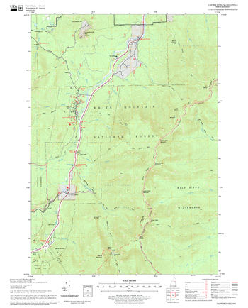
Carter Dome Quadrangle, New Hampshire-Vermont
United States Department of Agriculture Forest Service
United States Forestry Service topographical map of Carter Dome, New Hampshire-Vermont
Page Size: 21.75 x 27 in (552 x 686 mm)
Casa Vieja Meadows Quadrangle, California
United States Department of Agriculture Forest Service
United States Department of Agriculture Forestry Service topographical map of Casa Vieja Meadows, Sequoia National Forest, California.
Page Size: 21.75 x 27 in (552 x 686 mm)
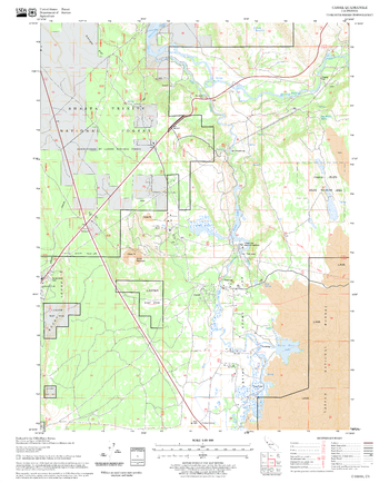
Cascade Springs Quadrangle, South Dakota
United States Department of Agriculture Forest Service
United States Department of Agriculture Forestry Service topographical map of Cascade Springs, Black Hills National Forest, South Dakota.
Page Size: 21.75 x 27 in (552 x 686 mm)
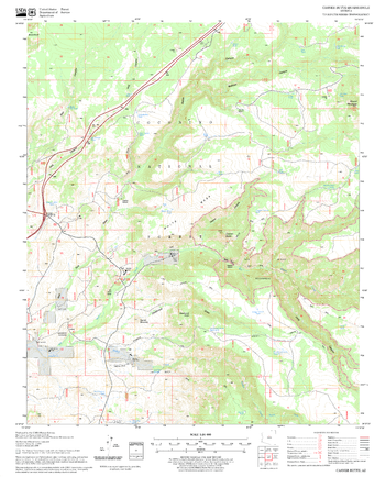
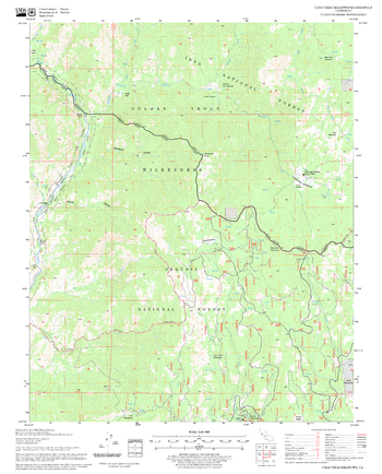
Casner Butte Quadrangle, Arizona
United States Department of Agriculture Forest Service
United States Department of Agriculture Forestry Service topographical map of Casner Butte, Coconino National Forest, Arizona.
Page Size: 21.75 x 27 in (552 x 686 mm)
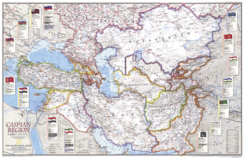
Caspian Region, Promise and Peril - Published 1999
National Geographic
The countries surrounding the Caspian Sea include many former Soviet republics working to build viable economies and stable governments. Meanwhile, national cohesion has been challenged by wide ethnic diversity. Explore the countries throughout this region with this attractive and informative map. Published in May 1999 as half of a two–map set with "Caspian Sea."
Page Size: 31 x 20.25 in (785 x 509 mm)
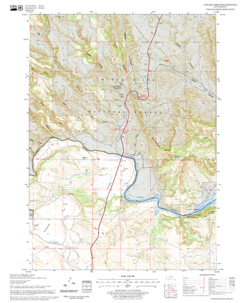
Cassel Quadrangle, California
United States Department of Agriculture Forest Service
United States Department of Agriculture Forestry Service topographical map of Cassel, Lassen National Forest, California.
Page Size: 21.75 x 27 in (552 x 686 mm)

Castle Rock Lake
Mapping Specialists
An Attractive map of the lake showing a visual 3D representation of the lake bottom. Includes boat launches, rock area and vegetation. Land area is high resolution aerial imagery.
Page Size: 27.75 x 37.25 in (705 x 943 mm)
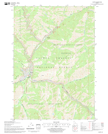
Casto Quadrangle, Idaho
United States Department of Agriculture Forest Service
United States Department of Agriculture Forestry Service topographical map of Casto, Salmon-Chalis National Forest, Idaho.
Page Size: 21.75 x 27 in (552 x 686 mm)

Catto Creek - 92 M/8 - British Columbia
Natural Resources Canada
Canadian topographic map of Catto Creek, British Columbia. NTS sheet 092M08 Edition 2.
Page Size: 31.5 x 25 in (798 x 633 mm)
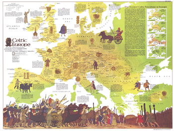
Celtic Europe - Published 1977
National Geographic
Learn all about the ancient Celts, founders of Europe, with this educational map filled with details about Celtic civilization, its range through the ages, and locations of historical sites. Published in May 1977 to accompany the article "The Celts" and the map of modern Europe.
Page Size: 30 x 22.5 in (760 x 571 mm)
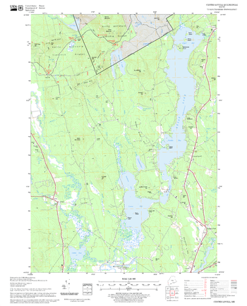
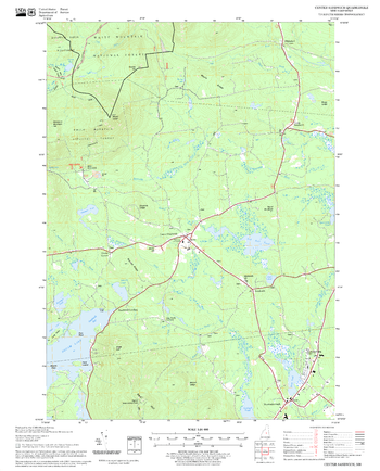
Center Lovell Quadrangle, New Hampshire-Vermont
United States Department of Agriculture Forest Service
United States Forestry Service topographical map of Center Lovell, New Hampshire-Vermont
Page Size: 21.75 x 27 in (552 x 686 mm)
Center Sandwich Quadrangle, New Hampshire-Vermont
United States Department of Agriculture Forest Service
United States Forestry Service topographical map of Center Sandwich, New Hampshire-Vermont
Page Size: 21.75 x 27 in (552 x 686 mm)
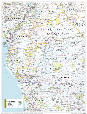
Central Africa - Atlas of the World, 11th Edition
National Geographic
This Central Africa map of physical and political features can fit in any space. Showcasing the region in stunning detail with state-of-the-art cartographic techniques delivering accuracy and exceptional quality, the innovative and engaging design makes the content easily accessible and user-friendly.
Ideal for classrooms with an emphasis on teaching geography or environmental themes. The inclusion of physical features gives your students a genuine feel for how our world appears.
This map uses a bright, easy to read color palette featuring blue oceans and stunning shaded relief that has been featured on National Geographic wall maps for over 75 years. It is drawn in the Transverse Mercator projection, which is a cylindrical map projection for nautical navigation because it represents lines of constant course.
This map is found in National Geographic's 11th Edition World Atlas and is now available as a stand alone product.
Page Size: 24 x 31.5 in (610 x 798 mm)

Central Africa - Atlas of the World, 11th Edition - Compact
National Geographic
This Central Africa map of physical and political features can fit in any space. Showcasing the region in stunning detail with state-of-the-art cartographic techniques delivering accuracy and exceptional quality, the innovative and engaging design makes the content easily accessible and user-friendly.
Ideal for classrooms with an emphasis on teaching geography or environmental themes. The inclusion of physical features gives your students a genuine feel for how our world appears.
This map uses a bright, easy to read color palette featuring blue oceans and stunning shaded relief that has been featured on National Geographic wall maps for over 75 years. It is drawn in the Transverse Mercator projection, which is a cylindrical map projection for nautical navigation because it represents lines of constant course.
This map is found in National Geographic's 11th Edition World Atlas and is now available as a stand alone product.
Page Size: 16.25 x 21.5 in (413 x 540 mm)
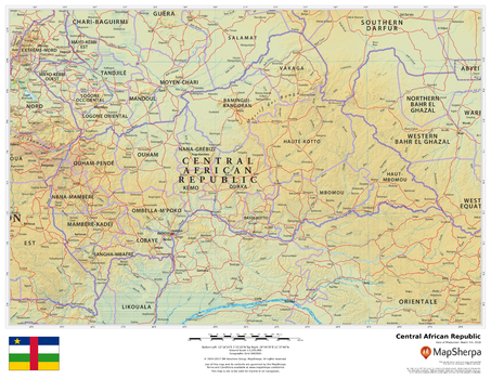
Central African Republic
MapSherpa
This beautiful map shows physical and political features for the Central African Republic and surrounding areas. Relief shading and the use of different colours by height above sea level are both informative and attractive.
Page Size: 22 x 17 in (559 x 432 mm)
Central America - Published 1973
National Geographic
A perfect companion for the Mexico map published in the same issue, this May 1973 map of Central America demonstrates the fine cartography National Geographic is known for. Of particular note is the ocean bathymetry in the Caribbean. Both maps accompanied the article "Mexico, the City That Founded a Nation."
Page Size: 34.25 x 23 in (867 x 581 mm)
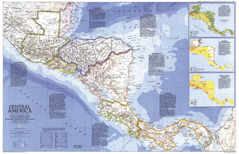
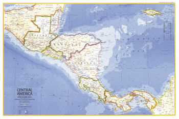
Central America - Published 1986
National Geographic
This colorful map of Central America features a unique overview of each country in the region, and includes details such as size, population, religion, language, and more. Published in April 1986, it is half of a two–map set with "Central America Past and Present".
Page Size: 31.75 x 20.5 in (801 x 517 mm)
No search results