


MapSherpa Catalog
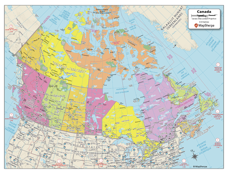
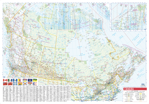
Canada Political Map - Compact
MapSherpa
Explore the vastness of Canada with this map created specifically for MapSherpa. From sea to sea, this Canadian Political Map displays the ten provinces and three territories that make up the country. Stretching from the Arctic in the north to both the Atlantic and Pacific Oceans, this map prominently shows; Province capitals, primary cities & towns, major national parks, primary water features, mountain ranges and all time zones. With multiple sizes available, this is the perfect reference map for home, office, or school use.
Page Size: 21 x 16 in (533 x 406 mm)
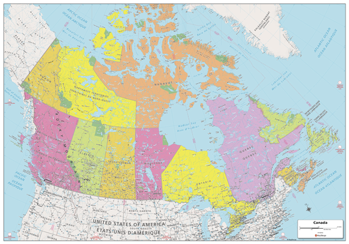
Canada Political Map - Extra Large
MapSherpa
Explore the vastness of Canada with this map created specifically for MapSherpa. From sea to sea, this Canadian Political Map displays the ten provinces and three territories that make up the country. Stretching from the Arctic in the north to both the Atlantic and Pacific Oceans, this map prominently shows; Province capitals, primary cities & towns, major national parks, primary water features, mountain ranges and all time zones. With multiple sizes available, this is the perfect reference map for home, office, or school use.
Page Size: 60 x 42 in (1524 x 1067 mm)
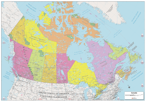
Canada Political Map - Large
MapSherpa
Explore the vastness of Canada with this map created specifically for MapSherpa. From sea to sea, this Canadian Political Map displays the ten provinces and three territories that make up the country. Stretching from the Arctic in the north to both the Atlantic and Pacific Oceans, this map prominently shows; Province capitals, primary cities & towns, major national parks, primary water features, mountain ranges and all time zones. With multiple sizes available, this is the perfect reference map for home, office, or school use.
Page Size: 48 x 33.5 in (1219 x 851 mm)
Canada Political Wall Map
Maps International
This Canada wall map clearly depicts all the cities, major roads and also shows all the Provinces and Territory boundaries. All major cities and areas are displayed bi-lingually.
Page Size: 47.25 x 39.5 in (1200 x 1000 mm)
Canada Political Wallpaper
Maps International
This political map of Canada clearly depicts all the cities, major roads and also shows all the Provinces and Territory boundaries. All major cities and areas are displayed bi-lingually.
Canada Postal Codes - Forward Sortation Areas
MapSherpa
Custom postal code maps, grouped by forward sortation area (FSA), can be made for anywhere in Canada. FSAs are the first three characters of a postal code that represent roughly the same area as 5-digit Zip Codes in the United States. These attractive and informative maps include extensive geographic detail including: provincial highways; streets and street names at detailed scales; cities and towns; and, counties and province names and boundaries.Ideal for service delivery, retail siting, sales region planning and many other business and organizational functions.
Canada Roads and Recreation
MapSherpa
This versatile product allows you to get a road map of anywhere in Canada. It has been designed so you can create a map for your next trip.This product has been designed to make custom road and street maps suitable for road trips and sightseeing. This map features comprehensive points of interest including attractions, landmarks, amenities, scenic views and local foot and bike paths. Also included is a complete network of highways, streets and roads you can count on.The details of this map make it ideal to plan a trip and take it with you. Travel with confidence using a map created specifically for the area you will be discovering.
Canada Streets
MapSherpa
The MapSherpa Street product is ideal for the Business owner who needs local or regional road network information within a service delivery, catchment area or a sales territory. Information on the map highlights Municipal, Town and Zip Code boundaries. This multi-scale product for Canada uses the most current TomTom map data; you can count on this map showing the latest changes in your area. This product has been designed to make custom maps suitable from city to county scales, and anywhere in between. Rich regional maps include display highway infrastructure including, interchanges, weigh stations and tolls. Full street labelling, block numbers and street direction afford detailed city level maps. Infrastructure such as airports, hospitals, shopping malls, exhibition centers, industrial complexes and other business centric features are easily identifiable on the map.
Canada Streets Index
MapSherpa
The MapSherpa Street product is ideal for the Business owner who needs local or regional road network information within a service delivery, catchment area or a sales territory. Information on the map highlights Municipal, Town and Zip Code boundaries. This multi-scale product for Canada uses the most current TomTom map data; you can count on this map showing the latest changes in your area. This product has been designed to make custom maps suitable from city to county scales, and anywhere in between. Rich regional maps include display highway infrastructure including, interchanges, weigh stations and tolls. Full street labelling, block numbers and street direction afford detailed city level maps. Infrastructure such as airports, hospitals, shopping malls, exhibition centers, industrial complexes and other business centric features are easily identifiable on the map.The map has an index grid (columns are labelled A, B, C, D… and rows are labelled 1, 2, 3, 4 …). The street index is provided as a separate Index file and lists the street name, address and grid coordinates. This multi-scale product for Canada is based on TomTom data and updated twice a year.
Canada Terrain
MapSherpa
This versatile product allows you to get a wall map of anywhere in Canada. It has been designed to create beautiful maps that emphasize the natural landscape around places important to you.This product has been designed to make custom wall maps suitable from your local area to the whole country, and anywhere in between. 3D terrain shading provides a sense of relief of the surrounding topography enhanced by traditional topographic features such as elevation contours, landforms, lakes, and rivers. Also included are roads, rails, trails, buildings, and park boundaries.The cartography beautifully captures your connection to the landscape making this map ideal for showing off cottages, resorts, lakes and other favourite places. Makes a perfect personalized gift or memento of your latest adventure.
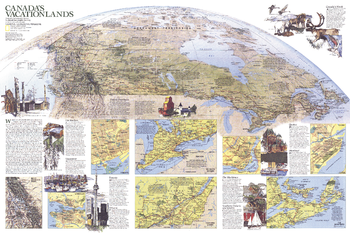
Canada Vacationlands - Published 1985
National Geographic
Explore Canada's diverse vacationlands with this educational map printed in November 1985 to supplement the political and physical map of the country and the article "Kluane: Canada's Icy Wilderness Park." From world-class wilderness to spirited cities, Canada has something for every vacationer.
Page Size: 34 x 22.75 in (861 x 574 mm)
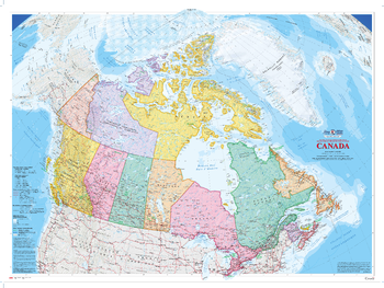
Canada Wall Map (2009) - Bilingual - Atlas of Canada
Natural Resources Canada
This bilingual colourful edition of the Canada map published in 2009 is the largest of the Atlas of Canada wall maps. Relief shading highlights the physiography of the country and the map's projection provides a three-dimensional view of Canada.
Page Size: 64.25 x 48.25 in (1626 x 1220 mm)
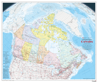
Canada Wall Map - Bilingual - Atlas of Canada
Natural Resources Canada
This bilingual map is the latest publication in the Atlas of Canada Reference Map Series. It is an update to the 1:6 000 000 paper map of Canada published in 2006. The map uses a vertical near-side perspective projection, which provides a unique three-dimensional view of Canada. Most data are current to the period 2010 to 2013.
Page Size: 42.5 x 35.75 in (1078 x 906 mm)
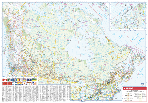
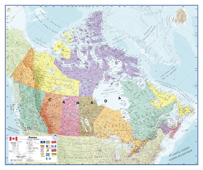
Canada Wall Map with Flags - English and French
Lucidmap
This wall map of Canada is a bilingual French-English product, making this an ideal product in Canada for schools, businesses and public areas.
Time zones, provincial flags, and an easy reference place name index make this a highly informative and attractive product.
Page Size: 39.5 x 27.25 in (1003 x 692 mm)
Canada Wall Map with Flags - English and French - Large
Lucidmap
This large wall map of Canada is a bilingual French-English product, making this an ideal product in Canada for schools, businesses and public areas.
Time zones, provincial flags, and an easy reference place name index make this a highly informative and attractive product.
Page Size: 54 x 37.5 in (1372 x 953 mm)
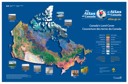
Canada's Land Cover / Couverture des terres du Canada
Natural Resources Canada
Contained within the Atlas of Canada Poster Map Series, is a poster showing the different types of land cover across the Country. The map is primarily based on AVHRR (Advanced Very High Resolution Radiometer) data, offering very precise detail. The land cover image contains 31 land cover classes. These have been grouped into 9 large land cover classes from coniferous forest to snow and ice. There are photos showing visually what each of these 9 land cover areas look like.
Page Size: 35.5 x 23.5 in (902 x 597 mm)
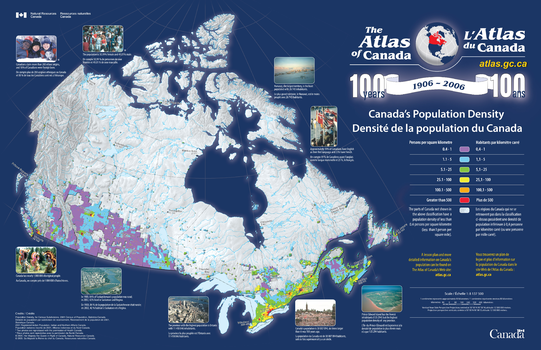
Canada's Population Density / Densité de la population du Canada
Natural Resources Canada
Contained within the Atlas of Canada Poster Map Series, is a poster showing population density across Canada. There is a relief base to the map on top of which is shown all populated areas of Canada where the population density is great than 0.4 persons per square kilometer. This area is then divided into five colour classes of population density based on Statistics Canada's census divisions.
Page Size: 34 x 22 in (864 x 559 mm)
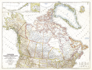
Canada, Alaska and Greenland - Published 1947
National Geographic
This unique map of Canada, Alaska and Greenland shows North America's northernmost reaches. Published in June 1947, this map provides a snapshot of Canada two years before the Dominion of Newfoundland became its tenth province.
Page Size: 34.5 x 26.5 in (875 x 670 mm)
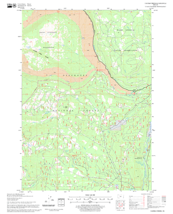
Candle Creek Quadrangle, Oregon
United States Department of Agriculture Forest Service
United States Department of Agriculture Forestry Service topographical map of Candle Creek, Deschutes National Forest, Oregon.
Page Size: 21.75 x 27 in (552 x 686 mm)
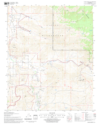
Cane Canyon Quadrangle, California
United States Department of Agriculture Forest Service
United States Department of Agriculture Forestry Service topographical map of Cane Canyon, Sequoia National Forest, California.
Page Size: 21.75 x 27 in (552 x 686 mm)
No search results