XYZ Maps

Devon County Map
This is a large ceremonial county map of Devon highlighting the county border, with the surrounding area faded out for excellent contrast. The map covers Axminster, Barnstaple, Bideford, Dartmouth, Exeter, Exmouth, Ilfracombe, Newton Abbot, Plymouth, Sidmouth, Torquay, Paignton, Tiverton, Newton Abbot and Tavistock. The county map shows the latest County and Unitary Authority Boundaries, overlaid on a clear and easy to read Ordnance Survey map.
Page Size: 33.25 x 47 in (841 x 1189 mm)

Devon, Dorset & Somerset Postcode Sector Wall Map (S2)
The Devon, Dorset & Somerset Postcode Sector Wall Map shows detailed postcode sector boundaries along with its associated label (TA1 1, TA1 2) on a comprehensive background and is perfect for determining postcode boundaries, for sales, logistics, planning mailshots or as a regional reference guide.
Page Size: 47 x 33.25 in (1189 x 841 mm)

Doncaster - DN - Postcode Wall Map
The Doncaster Postcode Sector Wall Map shows detailed postcode sector boundaries (DN1 1, DN1 2) on a comprehensive background and is perfect for determining postcode boundaries for sales areas, planning mailshots and also an excellent reference for logistics. This wall map covers the whole of the DN Postcode Area.
Page Size: 47 x 33.25 in (1189 x 841 mm)

Dorchester - DT - Postcode Wall Map
The Dorchester Postcode Sector Wall Map shows detailed postcode sector boundaries (DT1 1, DT1 2) on a comprehensive background and is perfect for determining postcode boundaries for sales areas, planning mailshots and also an excellent reference for logistics. This wall map covers the whole of the DT Postcode Area.
Page Size: 47 x 33.25 in (1189 x 841 mm)

Dorset County Map
This is a large ceremonial county map of Dorset highlighting the county border, with the surrounding area faded out for excellent contrast. The map covers Abbotsbury, Bridport, Dorchester, Gillingham, Lyme Regis, Poole, Portland, Shaftesbury, Sherborne, Herbourne, Swanage, Weymouth and Wimborne Minster. The county map shows the latest County and Unitary Authority Boundaries, Overlaid on a Clear and Easy to Read Ordnance Survey map.
Page Size: 47 x 33.25 in (1189 x 841 mm)

Dudley - DY - Postcode Wall Map
The Dudley Postcode Sector Wall Map shows detailed postcode sector boundaries (DY1 1, DY1 2) on a comprehensive background and is perfect for determining postcode boundaries for sales areas, planning mailshots and also an excellent reference for logistics. This wall map covers the whole of the DY Postcode Area.
Page Size: 47 x 33.25 in (1189 x 841 mm)

Dumfries & Galloway - DG - Postcode Wall Map
The Dumfries & Galloway Postcode Sector Wall Map shows detailed postcode sector boundaries (DG1 1, DG1 2) on a comprehensive background and is perfect for determining postcode boundaries for sales areas, planning mailshots and also an excellent reference for logistics. This wall map covers the whole of the DG Postcode Area.
Page Size: 47 x 33.25 in (1189 x 841 mm)

Dundee - DD - Postcode Wall Map
The Dundee Postcode Sector Wall Map shows detailed postcode sector boundaries (DD1 1, DD1 2) on a comprehensive background and is perfect for determining postcode boundaries for sales areas, planning mailshots and also an excellent reference for logistics. This wall map covers the whole of the DD Postcode Area.
Page Size: 47 x 33.25 in (1189 x 841 mm)

Durham - DH - Postcode Wall Map
The Durham Postcode Sector Wall Map shows detailed postcode sector boundaries (DH1 1, DH1 2) on a comprehensive background and is perfect for determining postcode boundaries for sales areas, planning mailshots and also an excellent reference for logistics. This wall map covers the whole of the DH Postcode Area.
Page Size: 47 x 33.25 in (1189 x 841 mm)

East City London - EC - Postcode Wall Map
The East City London Postcode Sector Wall Map shows detailed postcode sector boundaries (EC1 1, EC1 2) on a comprehensive background and is perfect for determining postcode boundaries for sales areas, planning mailshots and also an excellent reference for logistics. This wall map covers the whole of the EC Postcode Area.
Page Size: 47 x 33.25 in (1189 x 841 mm)

East London - E - Postcode Wall Map
The East London Postcode Sector Wall Map shows detailed postcode sector boundaries (E1 1, E1 2) on a comprehensive background and is perfect for determining postcode boundaries for sales areas, planning mailshots and also an excellent reference for logistics. This wall map covers the whole of the E Postcode Area.
Page Size: 33.25 x 47 in (841 x 1189 mm)

East Midlands Postcode Sector Wall Map (S7)
The East Midlands Postcode Sector Wall Map shows detailed postcode sector boundaries along with its associated label (NN1 1, NN1 2) on a comprehensive background and is perfect for determining postcode boundaries, for sales, logistics, planning mailshots or as a regional reference guide.
Page Size: 47 x 33.25 in (1189 x 841 mm)

East Riding of Yorkshire County Map
This is a large ceremonial county map of East Riding of Yorkshire, highlighting the ceremonial county border, with the surrounding area faded out for excellent contrast. The county map shows the latest ceremonial boundaries overlaid on a clear, easy to read and up to date Ordnance Survey map.
Page Size: 47 x 33.25 in (1189 x 841 mm)

East Sussex County Map
This is a large ceremonial county map of East Sussex highlighting the county border, with the surrounding area faded out for excellent contrast. The map covers Crowborough, Uckfield, Heathfield, Hailsham, Lewes, Eastbourne, Hastings, Battle and Rye. The county map shows the latest County and Unitary Authority Boundaries, overlaid on a clear and easy to read Ordnance Survey map.
Page Size: 47 x 33.25 in (1189 x 841 mm)

Edinburgh - EH - Postcode Wall Map
The Edinburgh Postcode Sector Wall Map shows detailed postcode sector boundaries (EH1 1, EH1 2) on a comprehensive background and is perfect for determining postcode boundaries for sales areas, planning mailshots and also an excellent reference for logistics. This wall map covers the whole of the EH Postcode Area.
Page Size: 47 x 33.25 in (1189 x 841 mm)

Edinburgh City Centre Postcode Sectors Wall Map (C6)
The Edinburgh City Centre Postcode Sector Wall Map shows detailed postcode sector boundaries along with its associated label(EH1 1, EH1 2) on a comprehensive background and is perfect for determining postcode boundaries, for sales, logistics, planning mailshots or as a regional reference guide.
Page Size: 47 x 33.25 in (1189 x 841 mm)

Enfield - EN - Postcode Wall Map
The Enfield Postcode Sector Wall Map shows detailed postcode sector boundaries (EN1 1, EN1 2) on a comprehensive background and is perfect for determining postcode boundaries for sales areas, planning mailshots and also an excellent reference for logistics. This wall map covers the whole of the EN Postcode Area.
Page Size: 47 x 33.25 in (1189 x 841 mm)

England & Wales Postcode District Wall Map (D9)
The England & Wales Postcode District Map clearly shows postcode district boundaries and associated district labels (SL1, SL2) on a comprehensive background and is perfect for determining postcode boundaries for sales territories, logistics, planning mailshots or as a regional reference guide.
Page Size: 47 x 33.25 in (1189 x 841 mm)

Essex County Map
This is a large ceremonial county map of Essex highlighting the county border, with the surrounding area faded out for excellent contrast. The map covers Barking, Basildon, Colchester, Dagenham, Chelmsford, Harwich, Illford, Maldon, Romford, Saffron Waldon, Southend-on-Sea, Stansted Mountfitchet, Tilbury, Tiptree, West Ham and Woodford. The county map shows the latest County and Unitary Authority Boundaries, Overlaid on a Clear and Easy to Read Ordnance Survey1:250,000 map.
Page Size: 47 x 33.25 in (1189 x 841 mm)
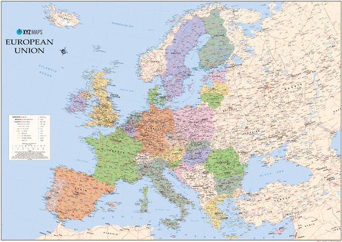
European Union 2017 Wall Map
The European Union 2017 Political wall map is ideal for the office or educational environment. This EU map features political colouring showing Europe and the member countries of the European Union. All major Towns, Roads, Rivers and Lakes are shown on this map. This map shows the 2017 membership of the EU.
Page Size: 47 x 33.25 in (1189 x 841 mm)