XYZ Maps
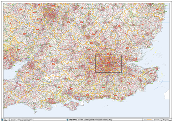
South East England Postcode District Wall Map (D2)
This South East England Postcode District Map clearly shows postcode district boundaries and associated district labels (SL1, SL2) on a comprehensive background and is perfect for determining postcode boundaries for sales territories, logistics, planning mailshots or as a regional reference guide.
Page Size: 47 x 33.25 in (1189 x 841 mm)
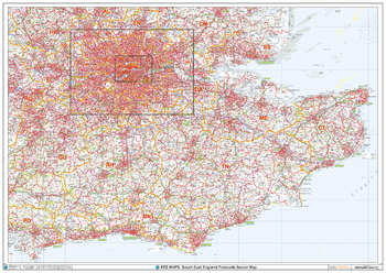
South East England Postcode Sector Wall Map (S4)
The South East England Postcode Sector Wall Map shows detailed postcode sector boundaries along with its associated label (BN1 1, BN1 2) on a comprehensive background and is perfect for determining postcode boundaries, for sales, logistics, planning mailshots or as a regional reference guide.
Page Size: 47 x 33.25 in (1189 x 841 mm)

South East London - SE - Postcode Wall Map
The South East London Postcode Sector Wall Map shows detailed postcode sector boundaries (SE1 1, SE1 2) on a comprehensive background and is perfect for determining postcode boundaries for sales areas, planning mailshots and also an excellent reference for logistics. This wall map covers the whole of the SE Postcode Area.
Page Size: 47 x 33.25 in (1189 x 841 mm)
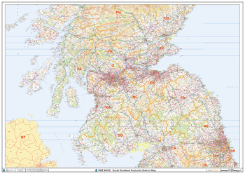
South Scotland Postcode District Wall Map (D5)
The South Scotland Postcode District Map clearly shows postcode district boundaries and associated district labels (EH1, EH2) on a comprehensive background and is perfect for determining postcode boundaries for sales territories, logistics, planning mailshots or as a regional reference guide.
Page Size: 47 x 33.25 in (1189 x 841 mm)
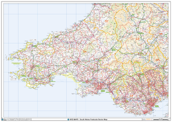
South Wales Postcode Sector Wall Map (S5)
The South Wales Postcode Sector Wall Map shows detailed postcode sector boundaries along with its associated label (CF1 1, CF1 2) on a comprehensive background and is perfect for determining postcode boundaries, for sales, logistics, planning mailshots or as a regional reference guide.
Page Size: 47 x 33.25 in (1189 x 841 mm)
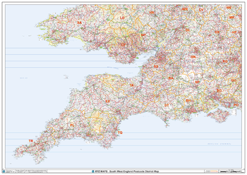
South West England Postcode District Wall Map (D1)
This South West England Postcode District Map clearly shows postcode district boundaries and associated district labels (LS1, LS2) on a comprehensive background and is perfect for determining postcode boundaries for sales territories, logistics, planning mailshots or as a regional reference guide.
Page Size: 47 x 33.25 in (1189 x 841 mm)
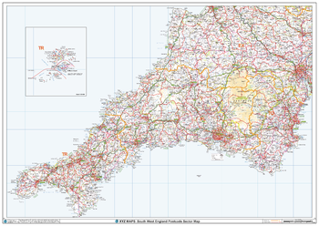
South West England Postcode Sector Wall Map (S1)
The South West England Postcode Sector Wall Map shows detailed postcode sector boundaries along with its associated label (TR1 1, TR1 2) on a comprehensive background and is perfect for determining postcode boundaries, for sales, logistics, planning mailshots or as a regional reference guide.
Page Size: 47 x 33.25 in (1189 x 841 mm)
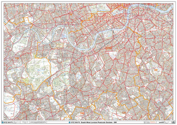
South West London - SW - Postcode Wall Map
The South West London Postcode Sector Wall Map shows detailed postcode sector boundaries (SW1 1, SW1 2) on a comprehensive background and is perfect for determining postcode boundaries for sales areas, planning mailshots and also an excellent reference for logistics. This wall map covers the whole of the SW Postcode Area.
Page Size: 47 x 33.25 in (1189 x 841 mm)
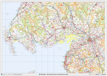
South West Scottish Borders Postcode Sector Wall Map (S15)
The South West Scottish Borders Postcode Sector Wall Map shows detailed postcode sector boundaries along with its associated label (DG1 1, DG1 2) on a comprehensive background and is perfect for determining postcode boundaries, for sales, logistics, planning mailshots or as a regional reference guide.
Page Size: 47 x 33.25 in (1189 x 841 mm)
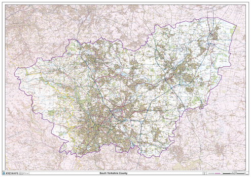
South Yorkshire County Map
This is a large ceremonial county map of South Yorkshire highlighting the county border, with the surrounding area faded out for excellent contrast. The map covers Barnsley, Doncaster, Rotherham and Sheffield. The county map shows the latest County and Unitary Authority Boundaries, Overlaid on a Clear and Easy to Read Ordnance Survey map.
Page Size: 47 x 33.25 in (1189 x 841 mm)
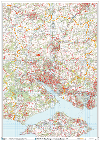
Southampton - SO - Postcode Wall Map
The Southampton Postcode Sector Wall Map shows detailed postcode sector boundaries (SO1 1, SO1 2) on a comprehensive background and is perfect for determining postcode boundaries for sales areas, planning mailshots and also an excellent reference for logistics. This wall map covers the whole of the SO Postcode Area.
Page Size: 33.25 x 47 in (841 x 1189 mm)
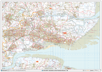
Southend on Sea - SS - Postcode Wall Map
The Southend on Sea Postcode Sector Wall Map shows detailed postcode sector boundaries (SS1 1, SS1 2) on a comprehensive background and is perfect for determining postcode boundaries for sales areas, planning mailshots and also an excellent reference for logistics. This wall map covers the whole of the SS Postcode Area.
Page Size: 47 x 33.25 in (1189 x 841 mm)
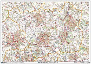
St Albans - AL - Postcode Wall Map
The St Albans Postcode Sector Wall Map shows detailed postcode sector boundaries (AL1 1, AL1 2) on a comprehensive background and is perfect for determining postcode boundaries for sales areas, planning mailshots and also an excellent reference for logistics. This wall map covers the whole of the AL Postcode Area.
Page Size: 47 x 33.25 in (1189 x 841 mm)
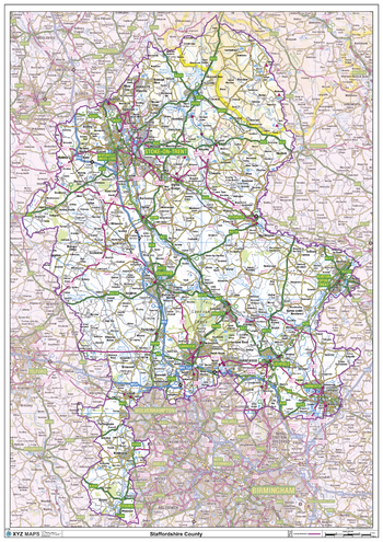
Staffordshire County Map
This is a large ceremonial county map of Staffordshire highlighting the county border, with the surrounding area faded out for excellent contrast. The map covers Burslem, Burton upon Trent, Hanley, Leek, Lichfield, Stoke-on-Trent, Stafford, Uttoxeter, Walsall, West Bromwich and Wolverhampton. The county map shows the latest County and Unitary Authority Boundaries, Overlaid on a Clear and Easy to Read Ordnance Survey map.
Page Size: 33.25 x 47 in (841 x 1189 mm)
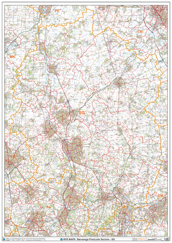
Stevenage - SG - Postcode Wall Map
The Stevenage Postcode Sector Wall Map shows detailed postcode sector boundaries (SG1 1, SG1 2) on a comprehensive background and is perfect for determining postcode boundaries for sales areas, planning mailshots and also an excellent reference for logistics. This wall map covers the whole of the SG Postcode Area.
Page Size: 33.25 x 47 in (841 x 1189 mm)
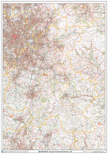
Stockport - SK - Postcode Wall Map
The Stockport Postcode Sector Wall Map shows detailed postcode sector boundaries (SK1 1, SK1 2) on a comprehensive background and is perfect for determining postcode boundaries for sales areas, planning mailshots and also an excellent reference for logistics. This wall map covers the whole of the SK Postcode Area.
Page Size: 33.25 x 47 in (841 x 1189 mm)
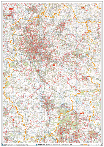
Stoke-on-Trent - ST - Postcode Wall Map
The Stoke-on-Trent Postcode Sector Wall Map shows detailed postcode sector boundaries (ST1 1, ST1 2) on a comprehensive background and is perfect for determining postcode boundaries for sales areas, planning mailshots and also an excellent reference for logistics. This wall map covers the whole of the ST Postcode Area.
Page Size: 33.25 x 47 in (841 x 1189 mm)
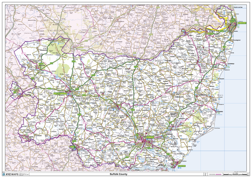
Suffolk County Map
This is a large ceremonial county map of Suffolk highlighting the county border, with the surrounding area faded out for excellent contrast. The map covers Aldeburgh, Bury St Edmunds, Felixstowe, Framlington, Gorleston, Haverhill, Long Melford, Lowestoft, Newmarket and Woodbridge. The county map shows the latest County and Unitary Authority Boundaries, Overlaid on a Clear and Easy to Read Ordnance Survey map.
Page Size: 47 x 33.25 in (1189 x 841 mm)
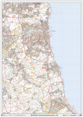
Sunderland - SR - Postcode Wall Map
The Sunderland Postcode Sector Wall Map shows detailed postcode sector boundaries (SR1 1, SR1 2) on a comprehensive background and is perfect for determining postcode boundaries for sales areas, planning mailshots and also an excellent reference for logistics. This wall map covers the whole of the SR Postcode Area.
Page Size: 33.25 x 47 in (841 x 1189 mm)
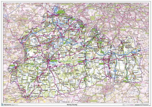
Surrey County Map
This is a large ceremonial county map of Surrey highlighting the county border, with the surrounding area faded out for excellent contrast. The map covers Battersea, Brixton, Clapham, Croydon, Epsom, Farnham, Gatwick, Guildford, Haselmere, Kington-upon-Thames, Leatherhead, Richmond, Southwark, Wandsworth, Wimbledon and Woking. The county map shows the latest County and Unitary Authority Boundaries, Overlaid on a Clear and Easy to Read Ordnance Survey1:250,000 map.
Page Size: 47 x 33.25 in (1189 x 841 mm)