United States Department of Agriculture Forest Service
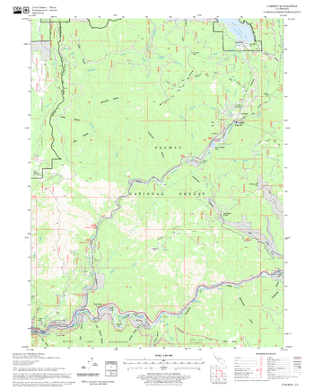
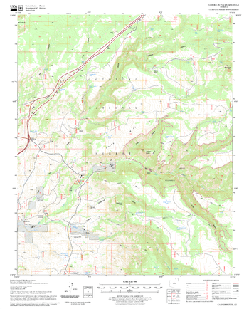
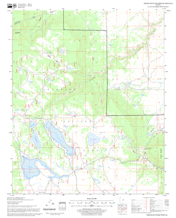
Caribou Quadrangle, California
United States Department of Agriculture Forestry Service topographical map of Caribou, Lassen National Forest, California.
Page Size: 21.75 x 27 in (552 x 686 mm)
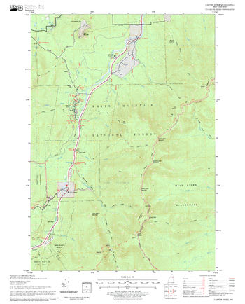
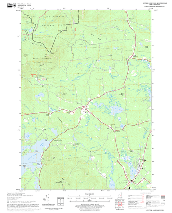
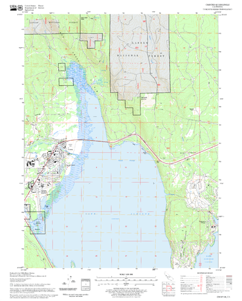
Carter Dome Quadrangle, New Hampshire-Vermont
United States Forestry Service topographical map of Carter Dome, New Hampshire-Vermont
Page Size: 21.75 x 27 in (552 x 686 mm)
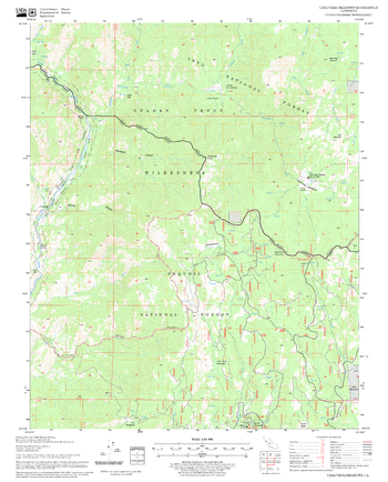
Casa Vieja Meadows Quadrangle, California
United States Department of Agriculture Forestry Service topographical map of Casa Vieja Meadows, Sequoia National Forest, California.
Page Size: 21.75 x 27 in (552 x 686 mm)
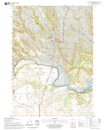
Cascade Springs Quadrangle, South Dakota
United States Department of Agriculture Forestry Service topographical map of Cascade Springs, Black Hills National Forest, South Dakota.
Page Size: 21.75 x 27 in (552 x 686 mm)
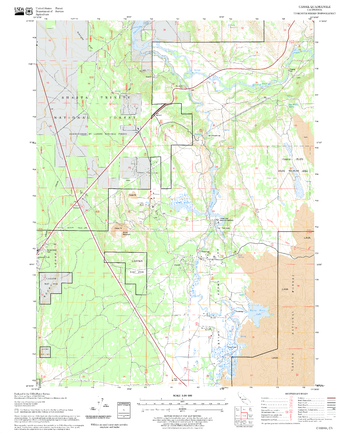
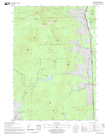
Casner Butte Quadrangle, Arizona
United States Department of Agriculture Forestry Service topographical map of Casner Butte, Coconino National Forest, Arizona.
Page Size: 21.75 x 27 in (552 x 686 mm)
Cassel Quadrangle, California
United States Department of Agriculture Forestry Service topographical map of Cassel, Lassen National Forest, California.
Page Size: 21.75 x 27 in (552 x 686 mm)
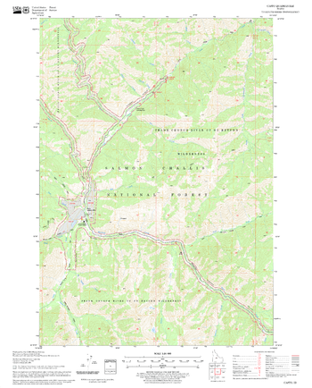
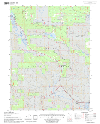
Casto Quadrangle, Idaho
United States Department of Agriculture Forestry Service topographical map of Casto, Salmon-Chalis National Forest, Idaho.
Page Size: 21.75 x 27 in (552 x 686 mm)
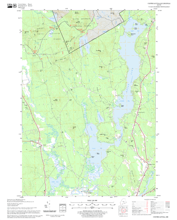
Center Lovell Quadrangle, New Hampshire-Vermont
United States Forestry Service topographical map of Center Lovell, New Hampshire-Vermont
Page Size: 21.75 x 27 in (552 x 686 mm)
Center Sandwich Quadrangle, New Hampshire-Vermont
United States Forestry Service topographical map of Center Sandwich, New Hampshire-Vermont
Page Size: 21.75 x 27 in (552 x 686 mm)
Challenge Quadrangle, California
United States Department of Agriculture Forestry Service topographical map of Challenge, Tahoe National Forest, California.
Page Size: 21.75 x 27 in (552 x 686 mm)
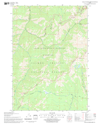
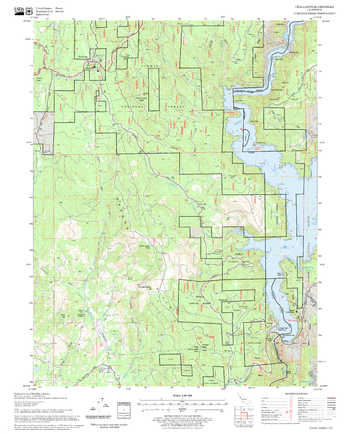
Challis Creek Lakes Quadrangle, Idaho
United States Department of Agriculture Forestry Service topographical map of Challis Creek Lakes, Salmon-Chalis National Forest, Idaho.
Page Size: 21.75 x 27 in (552 x 686 mm)
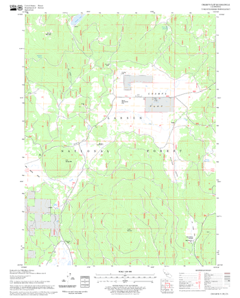
Champs Flat Quadrangle, California
United States Department of Agriculture Forestry Service topographical map of Champs Flat, Lassen National Forest, California.
Page Size: 21.75 x 27 in (552 x 686 mm)
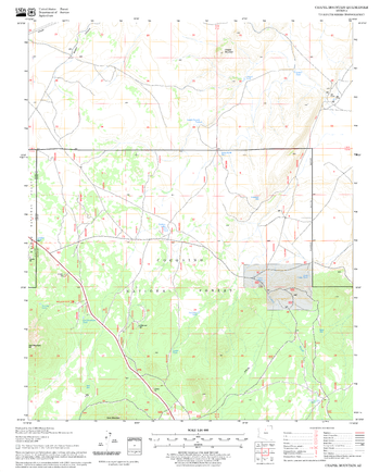
Chapel Mountain Quadrangle, Arizona
United States Department of Agriculture Forestry Service topographical map of Chapel Mountain, Coconino National Forest, Arizona.
Page Size: 21.75 x 27 in (552 x 686 mm)
Chatham Quadrangle, New Hampshire-Vermont
United States Forestry Service topographical map of Chatham, New Hampshire-Vermont
Page Size: 21.75 x 27 in (552 x 686 mm)
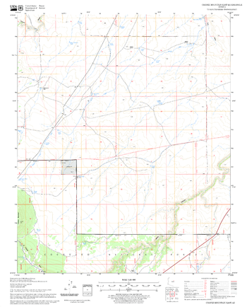
Chavez Mountain East Quadrangle, Arizona
United States Department of Agriculture Forestry Service topographical map of Chavez Mountain East, Coconino National Forest, Arizona.
Page Size: 21.75 x 27 in (552 x 686 mm)
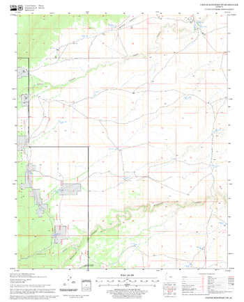
Chavez Mountain NW Quadrangle, Arizona
United States Department of Agriculture Forestry Service topographical map of Chavez Mountain NW, Coconino National Forest, Arizona.
Page Size: 21.75 x 27 in (552 x 686 mm)
Chavez Mountain West Quadrangle, Arizona
United States Department of Agriculture Forestry Service topographical map of Chavez Mountain West, Coconino National Forest, Arizona.
Page Size: 21.75 x 27 in (552 x 686 mm)
Chester Quadrangle, California
United States Department of Agriculture Forestry Service topographical map of Chester, Lassen National Forest, California.
Page Size: 21.75 x 27 in (552 x 686 mm)

Chicago Park Quadrangle, California
United States Department of Agriculture Forestry Service topographical map of Chicago Park, Tahoe National Forest, California.
Page Size: 21.75 x 27 in (552 x 686 mm)
Childs Meadows Quadrangle, California
United States Department of Agriculture Forestry Service topographical map of Childs Meadows, Lassen National Forest, California.
Page Size: 21.75 x 27 in (552 x 686 mm)