


The Map Centre
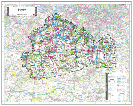
County Map of Surrey
An Ordnance Survey Map covering the whole of the county showing the county boundary including applicable Unitary Authority boundaries. The mapping outside the county boundary is faded to highlight the county. Part of a series of counties maps that cover England Scotland & Wales all using the same background Ordnance Survey Mapping for continuity across the whole series. This map includes Guildford, Woking
Page Size: 34.75 x 27.75 in (880 x 700 mm)
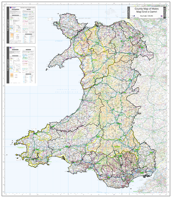
County Map of Wales
An Ordnance Survey Map covering the whole of the county showing the county boundary including applicable Unitary Authority boundaries. The mapping outside the county boundary is faded to highlight the county. Part of a series of counties maps that cover England Scotland & Wales all using the same background Ordnance Survey Mapping for continuity across the whole series. This map includes Cardiff, Newport, Swansea, Conwy, Wrexham, Llandrindod Wells, Aberystwyth, Pembroke, St Davids
Page Size: 35.5 x 41 in (900 x 1040 mm)
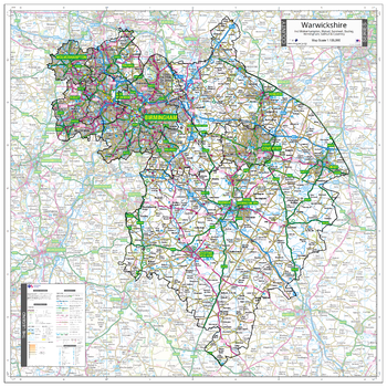
County Map of Warwickshire incl West Midlands
An Ordnance Survey Map covering the whole of the county showing the county boundary including applicable Unitary Authority boundaries. The mapping outside the county boundary is faded to highlight the county. Part of a series of counties maps that cover England Scotland & Wales all using the same background Ordnance Survey Mapping for continuity across the whole series. This map includes Warwick, Coventry, Birmingham, Wolverhampton, Solihull
Page Size: 35.5 x 35.5 in (900 x 900 mm)
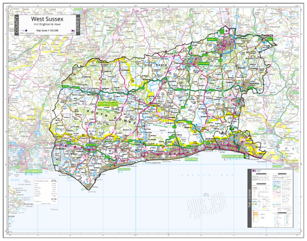
County Map of West Sussex
An Ordnance Survey Map covering the whole of the county showing the county boundary including applicable Unitary Authority boundaries. The mapping outside the county boundary is faded to highlight the county. Part of a series of counties maps that cover England Scotland & Wales all using the same background Ordnance Survey Mapping for continuity across the whole series. This map includes Brighton, Hove, Chichester, Worthing
Page Size: 37 x 29.25 in (940 x 740 mm)
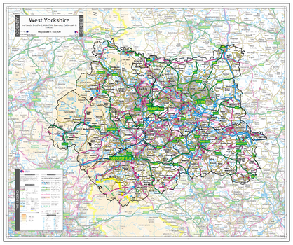
County Map of West Yorkshire
An Ordnance Survey Map covering the whole of the county showing the county boundary including applicable Unitary Authority boundaries. The mapping outside the county boundary is faded to highlight the county. Part of a series of counties maps that cover England Scotland & Wales all using the same background Ordnance Survey Mapping for continuity across the whole series. This map includes Leeds, Bradford, Halifax
Page Size: 34 x 28.5 in (860 x 720 mm)
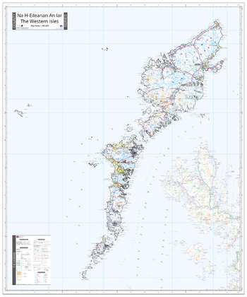
County Map of Western Isles
An Ordnance Survey Map covering the whole of the county showing the county boundary including applicable Unitary Authority boundaries. The mapping outside the county boundary is faded to highlight the county. Part of a series of counties maps that cover England Scotland & Wales all using the same background Ordnance Survey Mapping for continuity across the whole series. This map includes Stornoway
Page Size: 35.5 x 42.75 in (900 x 1080 mm)
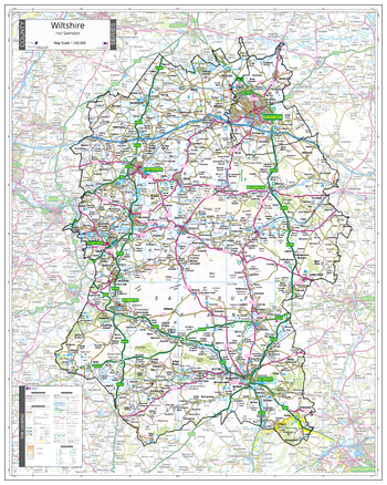
County Map of Wiltshire
An Ordnance Survey Map covering the whole of the county showing the county boundary including applicable Unitary Authority boundaries. The mapping outside the county boundary is faded to highlight the county. Part of a series of counties maps that cover England Scotland & Wales all using the same background Ordnance Survey Mapping for continuity across the whole series. This map includes Swindon, Chippenham, Salisbury
Page Size: 31.5 x 39.5 in (800 x 1000 mm)
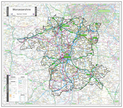
County Map of Worcestershire
An Ordnance Survey Map covering the whole of the county showing the county boundary including applicable Unitary Authority boundaries. The mapping outside the county boundary is faded to highlight the county. Part of a series of counties maps that cover England Scotland & Wales all using the same background Ordnance Survey Mapping for continuity across the whole series. This map includes Worcester, Malvern, Droitwich
Page Size: 32.5 x 28.5 in (820 x 720 mm)
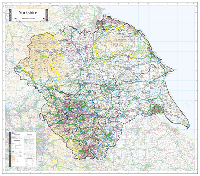
County Map of Yorkshire
An Ordnance Survey Map covering the whole of the county showing the county boundary including applicable Unitary Authority boundaries. The mapping outside the county boundary is faded to highlight the county. Part of a series of counties maps that cover England Scotland & Wales all using the same background Ordnance Survey Mapping for continuity across the whole series. This map includes North Riding, East Riding, South Riding, West Riding, Leeds, York, Harrogate, Sheffield, Hull, Bradford, Halifax
Page Size: 40.25 x 35.5 in (1020 x 900 mm)