


National Geographic

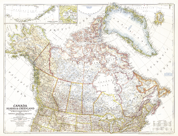
Canada, Alaska and Greenland - Published 1947
This unique map of Canada, Alaska and Greenland shows North America's northernmost reaches. Published in June 1947, this map provides a snapshot of Canada two years before the Dominion of Newfoundland became its tenth province.
Page Size: 34.5 x 26.5 in (875 x 670 mm)
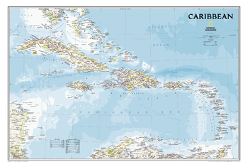
Caribbean Classic
One of the most authoritative maps for the islands of the Caribbean Sea.<br><br>It shows the entire region in great detail, with coverage extending from the tip of Florida to the northern extents of Colombia and Venezuela, east to Barbados, and west to the eastern edge of Honduras, Costa Rica, and Nicaragua. Updated bathymetry reveals the remarkable seafloor variation of the Caribbean including the Puerto Rico Trench, the deepest point in the Atlantic Ocean at 8,605 meters (28,232 feet).<br><br>Includes over 1,000 named places including country capitals, primary and secondary towns; political boundaries, important infrastructure, and all key landforms. Useful and informative notes about the region's history and unique geography are spread throughout the map, providing the reader further understanding of the Caribbean's unique attributes.
Page Size: 36 x 24 in (914 x 609 mm)
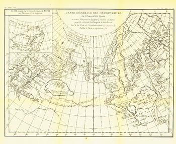
Carte Generale Des Decouvertes De Lamiral De Fonte 1752 - Published 1892
The "Carte Generale des Decouvertes de l'Amiral de Fonte" map is a black and white antique map created by Joseph-Nicolas De l'Isle in 1752 showing the supposed discoveries of Spanish explorer Admiral de la Fuente and the tracks of Spanish, English, and Russian navigators. These mythical "discoveries" included a Northwest Passage. Published in February 1892, it accompanied the article "The Cartography and Observations of Bering's First Voyage."
Page Size: 16 x 13 in (403 x 329 mm)
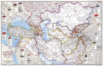
Caspian Region, Promise and Peril - Published 1999
The countries surrounding the Caspian Sea include many former Soviet republics working to build viable economies and stable governments. Meanwhile, national cohesion has been challenged by wide ethnic diversity. Explore the countries throughout this region with this attractive and informative map. Published in May 1999 as half of a two–map set with "Caspian Sea."
Page Size: 31 x 20.25 in (785 x 509 mm)
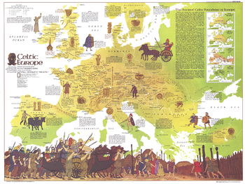
Celtic Europe - Published 1977
Learn all about the ancient Celts, founders of Europe, with this educational map filled with details about Celtic civilization, its range through the ages, and locations of historical sites. Published in May 1977 to accompany the article "The Celts" and the map of modern Europe.
Page Size: 30 x 22.5 in (760 x 571 mm)
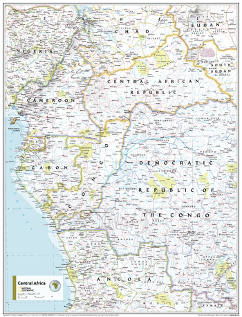
Central Africa - Atlas of the World, 11th Edition
This Central Africa map of physical and political features can fit in any space. Showcasing the region in stunning detail with state-of-the-art cartographic techniques delivering accuracy and exceptional quality, the innovative and engaging design makes the content easily accessible and user-friendly.
Ideal for classrooms with an emphasis on teaching geography or environmental themes. The inclusion of physical features gives your students a genuine feel for how our world appears.
This map uses a bright, easy to read color palette featuring blue oceans and stunning shaded relief that has been featured on National Geographic wall maps for over 75 years. It is drawn in the Transverse Mercator projection, which is a cylindrical map projection for nautical navigation because it represents lines of constant course.
This map is found in National Geographic's 11th Edition World Atlas and is now available as a stand alone product.
Page Size: 24 x 31.5 in (610 x 798 mm)
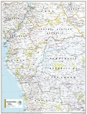
Central Africa - Atlas of the World, 11th Edition - Compact
This Central Africa map of physical and political features can fit in any space. Showcasing the region in stunning detail with state-of-the-art cartographic techniques delivering accuracy and exceptional quality, the innovative and engaging design makes the content easily accessible and user-friendly.
Ideal for classrooms with an emphasis on teaching geography or environmental themes. The inclusion of physical features gives your students a genuine feel for how our world appears.
This map uses a bright, easy to read color palette featuring blue oceans and stunning shaded relief that has been featured on National Geographic wall maps for over 75 years. It is drawn in the Transverse Mercator projection, which is a cylindrical map projection for nautical navigation because it represents lines of constant course.
This map is found in National Geographic's 11th Edition World Atlas and is now available as a stand alone product.
Page Size: 16.25 x 21.5 in (413 x 540 mm)
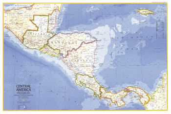
Central America - Published 1973
A perfect companion for the Mexico map published in the same issue, this May 1973 map of Central America demonstrates the fine cartography National Geographic is known for. Of particular note is the ocean bathymetry in the Caribbean. Both maps accompanied the article "Mexico, the City That Founded a Nation."
Page Size: 34.25 x 23 in (867 x 581 mm)
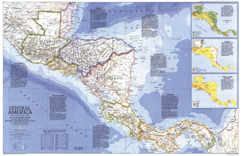
Central America - Published 1986
This colorful map of Central America features a unique overview of each country in the region, and includes details such as size, population, religion, language, and more. Published in April 1986, it is half of a two–map set with "Central America Past and Present".
Page Size: 31.75 x 20.5 in (801 x 517 mm)
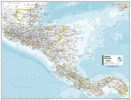
Central America - Atlas of the World, 11th Edition
This Central America map of physical and political features can fit in any space. Showcasing the region in stunning detail with state-of-the-art cartographic techniques delivering accuracy and exceptional quality, the innovative and engaging design makes the content easily accessible and user-friendly.
Ideal for classrooms with an emphasis on teaching geography or environmental themes. The inclusion of physical features gives your students a genuine feel for how our world appears.
This map uses a bright, easy to read color palette featuring blue oceans and stunning shaded relief that has been featured on National Geographic wall maps for over 75 years. It is drawn in the Albers Conic Equal-Area projection, which uses two standard parallels between which distortion is minimized, however scale and shape is not preserved.
Names of geographic features are carefully placed on the map to maintain legibility.
This map is found in National Geographic's 11th Edition World Atlas and is now available as a stand alone product.
Page Size: 31.5 x 24 in (798 x 610 mm)
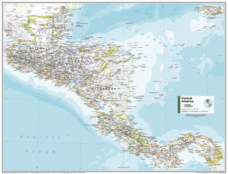
Central America - Atlas of the World, 11th Edition - Compact
This Central America map of physical and political features can fit in any space. Showcasing the region in stunning detail with state-of-the-art cartographic techniques delivering accuracy and exceptional quality, the innovative and engaging design makes the content easily accessible and user-friendly.
Ideal for classrooms with an emphasis on teaching geography or environmental themes. The inclusion of physical features gives your students a genuine feel for how our world appears.
This map uses a bright, easy to read color palette featuring blue oceans and stunning shaded relief that has been featured on National Geographic wall maps for over 75 years. It is drawn in the Albers Conic Equal-Area projection, which uses two standard parallels between which distortion is minimized, however scale and shape is not preserved.
Names of geographic features are carefully placed on the map to maintain legibility.
This map is found in National Geographic's 11th Edition World Atlas and is now available as a stand alone product.
Page Size: 21.5 x 16.25 in (540 x 413 mm)
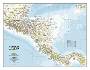
Central America Classic
Our most detailed wall map of Central America. Map coverage includes the countries of: Guatemala, Belize, El Salvador, Honduras, Nicaragua, Costa Rica, and Panama. Features thousands of place names, accurate boundaries, national parks, archeological sites, and major infrastructure networks such as roads, canals, ferry routes, airports, and railroads. The region's diverse terrain is detailed through accurate shaded relief, coastal bathymetry, and symbolism for water features and other land forms. Elevations, depth curves, and soundings are expressed in meters.
Page Size: 29 x 22.5 in (731 x 567 mm)
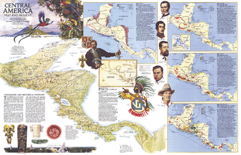
Central America Past and Present - Published 1986
Half of a two-map set, this map of "Central America Past and Present" accompanied the political map of Central America that appeared in the same issue. Published in April 1986, this educational map features six individual maps highlighting the history of the region and colorful illustrations of historical figures, artifacts, and wildlife.
Page Size: 31.75 x 20.5 in (801 x 517 mm)
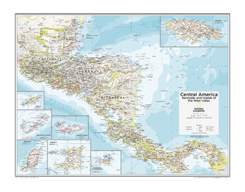
Central America, Bermuda, and Islands of the West Indies - Atlas of the World, 10th Edition
Belize, Bermuda Is. (U.K.), Costa Rica, El Salvador, Grand Cayman (U.K.), Grenada, Guatemala, Honduras, Jamaica, Nicaragua, Panama, St.-Martin (Fr.), St. Maarten (Neth.),Trinidad and Tobago; Note: Bermuda Islands, a mid-Atlantic island group, is included as an inset map on this plate.
Page Size: 28 x 22 in (711 x 559 mm)
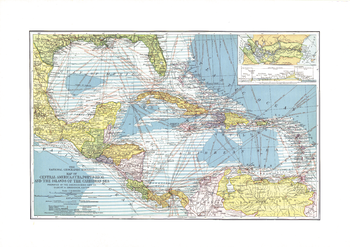
Central America, Cuba, Porto Rico, and the Islands of the Caribbean Sea - Published 1913
This beautiful map of Central America and the Caribbean features ocean bathymetry and colorful county borders, including overlapping colors demonstrating boundaries in dispute. Published in February 1913 one year before the completion of the Panama Canal, this work contains an abundance of unique details including principal lighthouses, U.S. Consular representatives, steamship routes, and coaling stations.
Page Size: 23.25 x 16.5 in (588 x 415 mm)
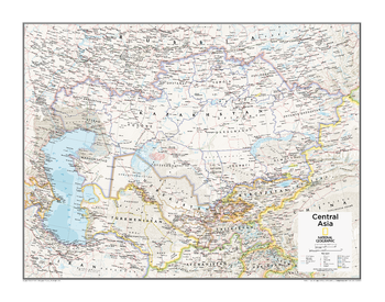
Central Asia - Atlas of the World, 10th Edition
Kazakhstan, Kyrgyzstan, Tajikistan, Turkmenistan, Uzbekistan
Page Size: 28 x 22 in (711 x 559 mm)
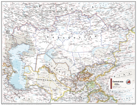
Central Asia - Atlas of the World, 11th Edition
This Central Asia map of physical and political features can fit in any space. Showcasing the region in stunning detail with state-of-the-art cartographic techniques delivering accuracy and exceptional quality, the innovative and engaging design makes the content easily accessible and user-friendly.
Ideal for classrooms with an emphasis on teaching geography or environmental themes. The inclusion of physical features gives your students a genuine feel for how our world appears.
This map uses a bright, easy to read color palette featuring blue oceans and stunning shaded relief that has been featured on National Geographic wall maps for over 75 years. It is drawn in the Lambert Conformal Conic projection, which seats a cone over the sphere of the Earth and projects the surface conformally onto the cone.
This map is found in National Geographic's 11th Edition World Atlas and is now available as a stand alone product.
Page Size: 31.5 x 24 in (798 x 610 mm)
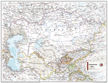
Central Asia - Atlas of the World, 11th Edition - Compact
This Central Asia map of physical and political features can fit in any space. Showcasing the region in stunning detail with state-of-the-art cartographic techniques delivering accuracy and exceptional quality, the innovative and engaging design makes the content easily accessible and user-friendly.
Ideal for classrooms with an emphasis on teaching geography or environmental themes. The inclusion of physical features gives your students a genuine feel for how our world appears.
This map uses a bright, easy to read color palette featuring blue oceans and stunning shaded relief that has been featured on National Geographic wall maps for over 75 years. It is drawn in the Lambert Conformal Conic projection, which seats a cone over the sphere of the Earth and projects the surface conformally onto the cone.
This map is found in National Geographic's 11th Edition World Atlas and is now available as a stand alone product.
Page Size: 21.5 x 16.25 in (540 x 413 mm)
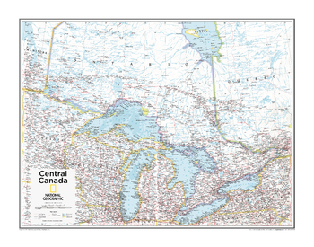
Central Canada - Atlas of the World, 10th Edition
null
Page Size: 28 x 22 in (711 x 559 mm)
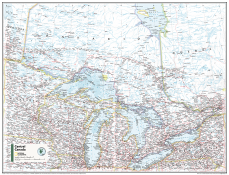
Central Canada - Atlas of the World, 11th Edition
This Central Canada map of physical and political features can fit in any space. Showcasing the Great Lakes region in stunning detail with state-of-the-art cartographic techniques delivering accuracy and exceptional quality, the innovative and engaging design makes the content easily accessible and user-friendly.
Ideal for classrooms with an emphasis on teaching geography or environmental themes. The inclusion of physical features gives your students a genuine feel for how our world appears.
This map uses a bright, easy to read color palette featuring blue oceans and stunning shaded relief that has been featured on National Geographic wall maps for over 75 years. It is drawn in the Albers Conic Equal-Area projection, which uses two standard parallels between which distortion is minimized.
Names of geographic features are carefully placed on the map to maintain legibility.
This map is found in National Geographic's 11th Edition World Atlas and is now available as a stand alone product.
Page Size: 31.5 x 24 in (798 x 610 mm)