


National Geographic

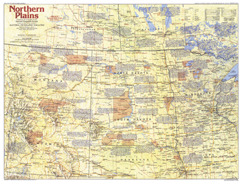
Northern Plains Map Side 1 - Published 1986
This map of the Northern Plains region of the United States contains a wealth of historical notes and a variety of points of interest, including the Battle of Little Bighorn site, the Oregon-Mormon Trail, and Mount Rushmore. Published in December 1986 as part of the "Making of America" series, and as a companion to the article "Ghosts on the Little Bighorn."
Page Size: 27 x 20.5 in (686 x 518 mm)
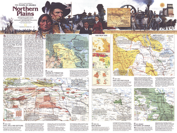
Northern Plains Map Side 2 - Published 1986
Published in December 1986, this map of the Northern Plains represents Side Two in a two-map set in the "Making of America" series. Multiple maps illustrate the region's change from the buffalo ranges and hunting grounds of the Plains Indian tribes to the agriculture, petroleum, mining, and manufacturing industries today.
Page Size: 27 x 20.5 in (686 x 518 mm)
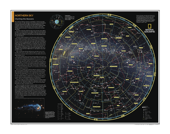
Northern Sky: Charting the Heavens - Atlas of the World, 10th Edition
null
Page Size: 28 x 22 in (711 x 559 mm)
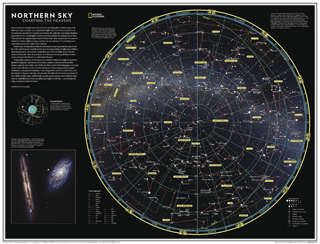
Northern Sky: Charting the Heavens - Atlas of the World, 11th Edition
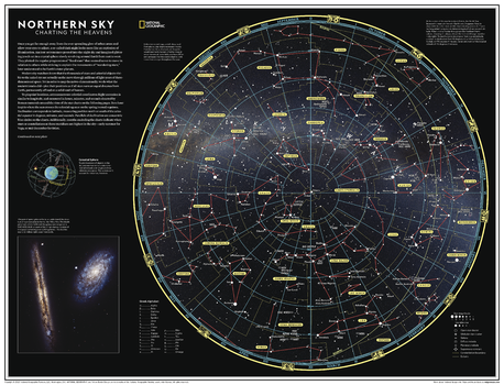
Once you get far enough away from the ever spreading glow of urban areas and allow your eyes to adjust, a so-called "dark night" looks more like an explosion of illumination. Ancient astronomers peered into the night sky and imagined glittering jewels set in a crystal sphere slowly revolving around Earth from east to west.
Every culture has drawn pictures in the stars, creating constellations that represent animals or mythical figures. This map of the sky as seen from the northern hemisphere features the 88 constellations today recognized by the International Astronomical Union (IAU). These constellations are not just pictures but basic units that partition the sky. As seen on this map, main stars in a constellation have Greek letter designations - alpha for the brightest, beta for the second brightest, and onward. Galaxies, star clusters and nebulae are designated by the letter M, for Messier Catalogue objects, or NGC for New General Catalogue, followed by their number designation.
This map is an attractive product for the stargazer and budding astronomer. It makes an essential companion to Southern Sky: Charting the Heavens, and its size makes it perfect for a gallery wall.
This map is found in National Geographic's 11th Edition World Atlas and is now available as a stand alone product.
Page Size: 31.5 x 24 in (798 x 610 mm)
Northern Sky: Charting the Heavens - Atlas of the World, 11th Edition - Compact
Once you get far enough away from the ever spreading glow of urban areas and allow your eyes to adjust, a so-called "dark night" looks more like an explosion of illumination. Ancient astronomers peered into the night sky and imagined glittering jewels set in a crystal sphere slowly revolving around Earth from east to west.
Every culture has drawn pictures in the stars, creating constellations that represent animals or mythical figures. This map of the sky as seen from the northern hemisphere features the 88 constellations today recognized by the International Astronomical Union (IAU). These constellations are not just pictures but basic units that partition the sky. As seen on this map, main stars in a constellation have Greek letter designations - alpha for the brightest, beta for the second brightest, and onward. Galaxies, star clusters and nebulae are designated by the letter M, for Messier Catalogue objects, or NGC for New General Catalogue, followed by their number designation.
This map is an attractive product for the stargazer and budding astronomer. It makes an essential companion to Southern Sky: Charting the Heavens, and its size makes it perfect for a gallery wall.
This map is found in National Geographic's 11th Edition World Atlas and is now available as a stand alone product.
Page Size: 21.5 x 16.25 in (540 x 413 mm)
Northern and Southern Hemispheres - Published 1943
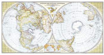
A true classic, this world map first published in April of 1943, shows the northern and southern hemisphers side by side, to give the viewer a perspective that centers each hemisphere on its pole. New to this map were special insets showing airline distances in the Eastern, Western, Northern, and Southern Hemispheres. Stunning cartography and special details make this a marvelous collector's item.
Page Size: 41 x 21.75 in (1041 x 552 mm)
Northwestern Africa - Published 1966
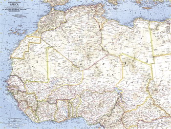
This detailed map of northwestern Africa was published in August 1966 with the article "Freedom Speaks French in Ouagadougou." Ouagadougou is the capital of the Republic of Upper Volta (later renamed Burkina Faso) which gained its independence from France in 1960.
Page Size: 25 x 19 in (633 x 478 mm)
Northwestern Africa - Atlas of the World, 10th Edition
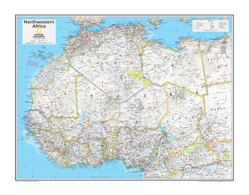
Algeria, Benin, Burkina Faso, Cameroon, Central African Republic, Chad, Côte d'Ivoire (Ivory Coast), Gambia, Ghana, Guinea, Guinea-Bissau, Liberia, Libya, Mali, Mauritania, Morocco, Niger, Nigeria, Senegal, Sierra Leone, Togo, Tunisia, Western Sahara (Morocco)
Page Size: 28 x 22 in (711 x 559 mm)
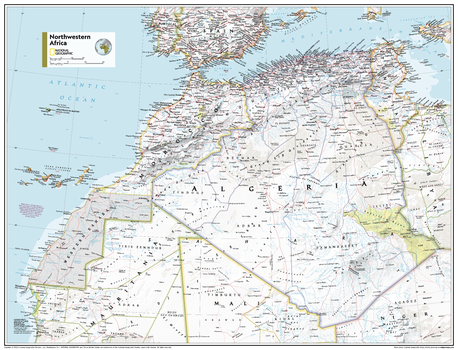
Northwestern Africa - Atlas of the World, 11th Edition
This Northwestern Africa map of physical and political features can fit in any space. Showcasing the region in stunning detail with state-of-the-art cartographic techniques delivering accuracy and exceptional quality, the innovative and engaging design makes the content easily accessible and user-friendly.
Ideal for classrooms with an emphasis on teaching geography or environmental themes. The inclusion of physical features gives your students a genuine feel for how our world appears.
This map uses a bright, easy to read color palette featuring blue oceans and stunning shaded relief that has been featured on National Geographic wall maps for over 75 years. It is drawn in the Transverse Mercator projection, which is a cylindrical map projection for nautical navigation because it represents lines of constant course.
This map is found in National Geographic's 11th Edition World Atlas and is now available as a stand alone product.
Page Size: 31.5 x 24 in (798 x 610 mm)
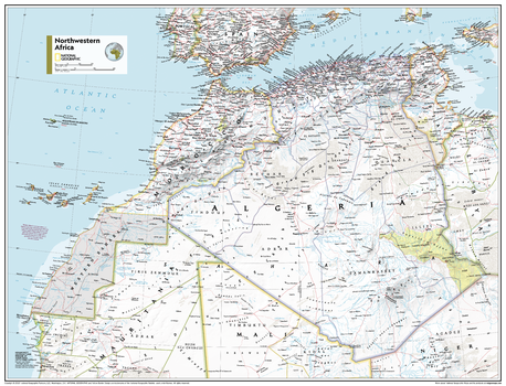
Northwestern Africa - Atlas of the World, 11th Edition - Compact
This Northwestern Africa map of physical and political features can fit in any space. Showcasing the region in stunning detail with state-of-the-art cartographic techniques delivering accuracy and exceptional quality, the innovative and engaging design makes the content easily accessible and user-friendly.
Ideal for classrooms with an emphasis on teaching geography or environmental themes. The inclusion of physical features gives your students a genuine feel for how our world appears.
This map uses a bright, easy to read color palette featuring blue oceans and stunning shaded relief that has been featured on National Geographic wall maps for over 75 years. It is drawn in the Transverse Mercator projection, which is a cylindrical map projection for nautical navigation because it represents lines of constant course.
This map is found in National Geographic's 11th Edition World Atlas and is now available as a stand alone product.
Page Size: 21.5 x 16.25 in (540 x 413 mm)
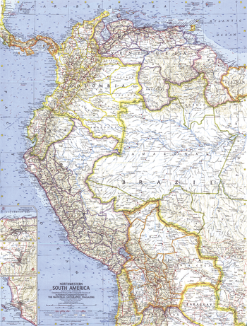
Northwestern South America - Published 1964
This map of the Northwestern part of South America features inset maps of the cities of Bogota, Caracas, and Lima. Published in February 1964 with the article "The Five Worlds of Peru." A fine companion to the 1962 map of Eastern South America.
Page Size: 19 x 25 in (480 x 632 mm)
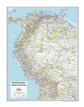
Northwestern South America - Atlas of the World, 10th Edition
Bolivia, Colombia, Ecuador, Guyana, Peru, Venezuela
Page Size: 22 x 28 in (559 x 711 mm)
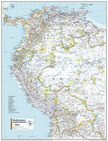
Northwestern South America - Atlas of the World, 11th Edition
This Northwestern South America map of physical and political features can fit in any space. Showcasing the region in stunning detail with state-of-the-art cartographic techniques delivering accuracy and exceptional quality, the innovative and engaging design makes the content easily accessible and user-friendly.
Ideal for classrooms with an emphasis on teaching geography or environmental themes. The inclusion of physical features gives your students a genuine feel for how our world appears.
This map uses a bright, easy to read color palette featuring blue oceans and stunning shaded relief that has been featured on National Geographic wall maps for over 75 years. Drawn in the Azimuthal Equidistant projection, this map ensures that all points on the map are at proportionally correct distances from the center point.
Names of geographic features are carefully placed on the map to maintain legibility. National parks pop off the page in vivid yellow.
This map is found in National Geographic's 11th Edition World Atlas and is now available as a stand alone product.
Page Size: 24 x 31.5 in (610 x 798 mm)
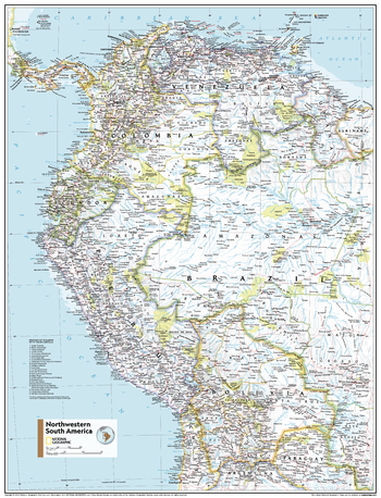
Northwestern South America - Atlas of the World, 11th Edition - Compact
This Northwestern South America map of physical and political features can fit in any space. Showcasing the region in stunning detail with state-of-the-art cartographic techniques delivering accuracy and exceptional quality, the innovative and engaging design makes the content easily accessible and user-friendly.
Ideal for classrooms with an emphasis on teaching geography or environmental themes. The inclusion of physical features gives your students a genuine feel for how our world appears.
This map uses a bright, easy to read color palette featuring blue oceans and stunning shaded relief that has been featured on National Geographic wall maps for over 75 years. Drawn in the Azimuthal Equidistant projection, this map ensures that all points on the map are at proportionally correct distances from the center point.
Names of geographic features are carefully placed on the map to maintain legibility. National parks pop off the page in vivid yellow.
This map is found in National Geographic's 11th Edition World Atlas and is now available as a stand alone product.
Page Size: 16.25 x 21.5 in (413 x 540 mm)
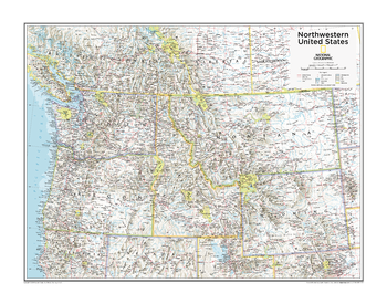
Northwestern U.S. - Atlas of the World, 10th Edition
Idaho, Montana, Oregon, Washington, Wyoming
Page Size: 28 x 22 in (711 x 559 mm)
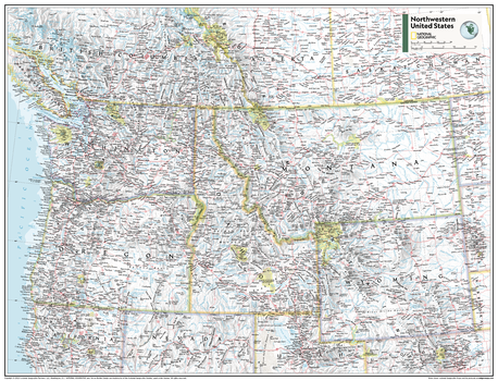
Northwestern U.S. - Atlas of the World, 11th Edition
This Northwestern USA map of physical and political features can fit in any space. Showcasing the region in stunning detail with state-of-the-art cartographic techniques delivering accuracy and exceptional quality, the innovative and engaging design makes the content easily accessible and user-friendly.
Ideal for classrooms with an emphasis on teaching geography or environmental themes. The inclusion of physical features give your students a genuine feel for how our world appears.
This map uses a bright, easy to read color palette featuring blue oceans and stunning shaded relief that has been featured on National Geographic wall maps for over 75 years. It is drawn in the Albers Conic Equal-Area projection, which uses two standard parallels between which distortion is minimized, however scale and shape are not preserved.
This map is found in National Geographic's 11th Edition World Atlas and is now available as a stand alone product.
Page Size: 31.5 x 24 in (798 x 610 mm)
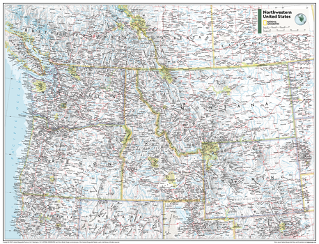
Northwestern U.S. - Atlas of the World, 11th Edition - Compact
This Northwestern USA map of physical and political features can fit in any space. Showcasing the region in stunning detail with state-of-the-art cartographic techniques delivering accuracy and exceptional quality, the innovative and engaging design makes the content easily accessible and user-friendly.
Ideal for classrooms with an emphasis on teaching geography or environmental themes. The inclusion of physical features give your students a genuine feel for how our world appears.
This map uses a bright, easy to read color palette featuring blue oceans and stunning shaded relief that has been featured on National Geographic wall maps for over 75 years. It is drawn in the Albers Conic Equal-Area projection, which uses two standard parallels between which distortion is minimized, however scale and shape are not preserved.
This map is found in National Geographic's 11th Edition World Atlas and is now available as a stand alone product.
Page Size: 21.5 x 16.25 in (540 x 413 mm)
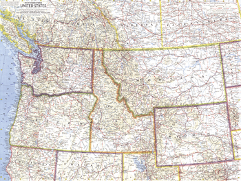
Northwestern United States - Published 1960
This map of the Northwestern United States features Washington, Oregon, Idaho, Montana, and Wyoming. Intercontinental ballistic missile bases make it evident that this map was printed during a particularly strained period of the Cold War. Published in April 1960, it is part of a series of six sectional maps of the United States published between 1958 and 1961.
Page Size: 25 x 19 in (634 x 478 mm)
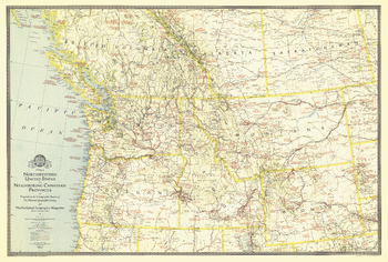
Northwestern United States and Canadian Provinces - Published 1941
The map of Northwestern United States and Neighboring Canadian Provinces appeared in National Geographic Magazine in June of 1941 and focused on the states of Washington, Oregon, Idaho, Montana, and Wyoming, and the southern portion of the provinces of British Columbia, Alberta, and Saskatchewan. It contains an abundance of notes on historical sites and places of interest as well as the routes of explorers.
Page Size: 36 x 24.25 in (912 x 616 mm)
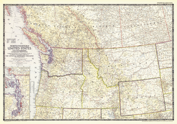
Northwestern United States and Canadian Provinces - Published 1950
The Northwestern United States and Neighboring Canadian Provinces map is the sixth in a series of sectional maps of the United States dated from 1945 to 1950. Published in June 1950, it provides a thorough look at the states of Washington, Oregon, Idaho, Montana, and Wyoming, as well as the southern portions of British Columbia, Alberta, and Saskatchewan.
Page Size: 36.25 x 25.5 in (918 x 646 mm)