


National Geographic

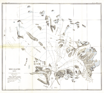
Muir Glacier, Alaska - Published 1892
Named after the naturalist, John Muir, Muir Glacier is a tidewater glacier located in Glacier Bay National Park and Preserve in southeastern Alaska. This antique map of Muir Glacier was surveyed with Plane Table in 1890 by Harry Fielding Reid. Published in March 1892, this unique work makes a fine companion to the Alaska map of 1891.
Page Size: 19 x 17 in (482 x 429 mm)
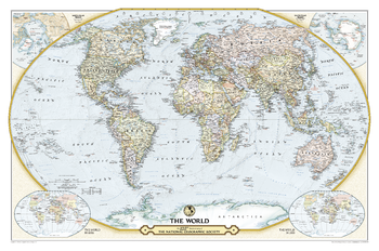
NGS 125th Anniversary World Map
This world map commemorates the National Geographic Society's 125th Anniversary with a modern spin on a classic map design.A contemporary political world map design accompanied by two insets, showing the world as it appeared in 1888 and 1988—the Society's founding and centennial years.
Page Size: 46 x 30.5 in (1166 x 773 mm)
National Geographic TOPO!
National Geographic's TOPO! equips backcountry explorers with the maps they need to reach mountain peaks, secluded lakes, and every road in between. The Series uses the most detailed USGS topographic maps available, showing essential landmarks and navigational aids, so you'll know where to go on your backpacking, mountain biking, kayaking, and fishing adventures.
National Geographic World Atlas
National Geographic World Atlas
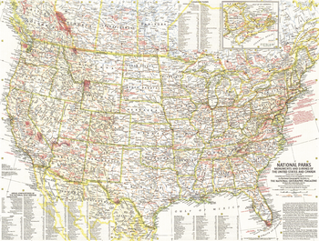
National Parks - Published 1958
This map lets you discover the abundance and diversity of the lands, forests, memorials, and battle sites administered by the National Park Service. Includes Canadian parks with an inset map of New Brunswick, Nova Scotia, and Prince Edward Island. Published in May 1958 as half of a two–map presentation on national parks.
Page Size: 25 x 19 in (632 x 480 mm)
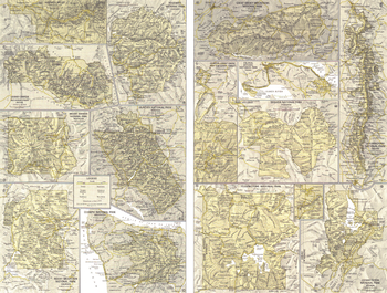
National Parks Inset Maps - Published 1958
This detailed map of the twelve move visited sites in the nation's park system appeared in the May 1958 issue as half of a two-map presentation on national parks. One of the parks featured on this map, Sequoia National Park, boasts California's finest stands of sequoias. The National Geographic Society and individual members contributed $9.990,000 to help preserve these ancient trees for the American people.
Page Size: 25 x 19 in (633 x 479 mm)
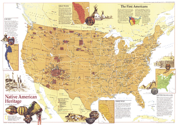
Native American Heritage - Published 1991
This educational map reveals tribal and archaeological sites across the United States, including federal reservations and museums. Published in October 1991 as a companion to the "Indian America - What You Can Visit Today" map (which includes the index to this map) and seven articles on pre-Columbus America.
Page Size: 29 x 20.5 in (735 x 517 mm)
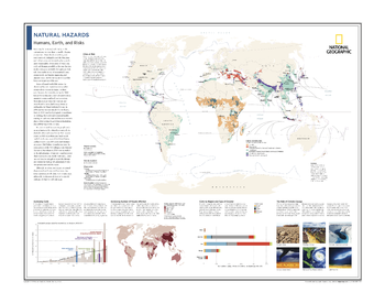
Natural Hazards: Humans, Earth, and Risks - Atlas of the World, 10th Edition
Cities at Risk; Increasing Costs; Increasing Number of People Affected; Costs by Region and Type of Disaster; The Role of Climate Change
Page Size: 28 x 22 in (711 x 559 mm)
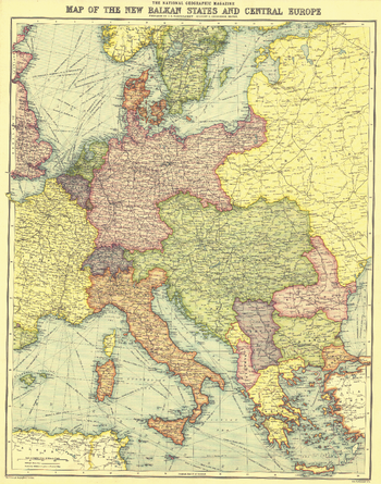
New Balkan States and Central Europe - Published 1914
This historic map of the Balkan States and Central Europe features vibrant color and steamship routes. Published in August 1914, it captured Central Europe as it stood at the start of the First World War.
Page Size: 18 x 23 in (455 x 578 mm)
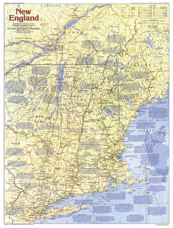
New England Map Side 1 - Published 1987
This map of New England provides a wealth of information about this historically rich region of the United States. Early Puritan settlements, battlefields of the American Revolution, and the Appalachian Trail are just some of the sites to be found here. Published in February 1987 as part of the "Making of America" series, and as a companion to the article "A Tunnel Through Time: The Appalachian Trail."
Page Size: 20.5 x 27 in (521 x 686 mm)
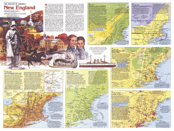
New England Map Side 2 - Published 1987
From the early days of the fur trade and Puritan settlements to the hub of technology and education that it is today, New England has a rich past and a exciting future. Explore the history of settlement, revolution, immigration, and industry in New England with this educational map. Published in February 1987, this work is half of a two-map set in the "Making of America" series.
Page Size: 27.25 x 20.5 in (687 x 519 mm)
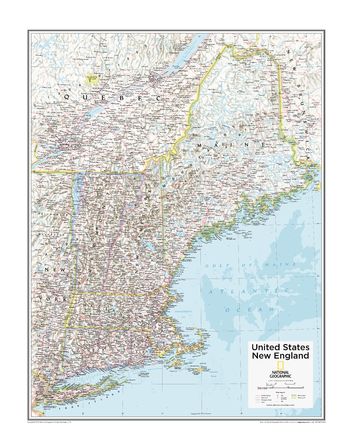
New England U.S. - Atlas of the World, 10th Edition
Connecticut, Long Island (N.Y.), Maine, Massachusetts, New Hampshire, Rhode Island, Vermont
Page Size: 22 x 28 in (559 x 711 mm)
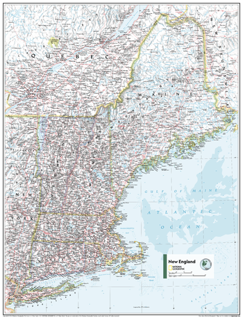
New England U.S. - Atlas of the World, 11th Edition
This New England regional map of physical and political features can fit in any space. Showcasing the region in stunning detail with state-of-the-art cartographic techniques delivering accuracy and exceptional quality, the innovative and engaging design makes the content easily accessible and user-friendly.
Ideal for classrooms with an emphasis on teaching geography or environmental themes. The inclusion of physical features gives your students a genuine feel for how our world appears.
This map uses a bright, easy to read color palette featuring blue oceans and stunning shaded relief that has been featured on National Geographic wall maps for over 75 years. It is drawn in the Albers Conic Equal-Area projection, which uses two standard parallels between which distortion is minimized, however scale and shape are not preserved.
This map is found in National Geographic's 11th Edition World Atlas and is now available as a stand alone product.
Page Size: 24 x 31.5 in (610 x 798 mm)
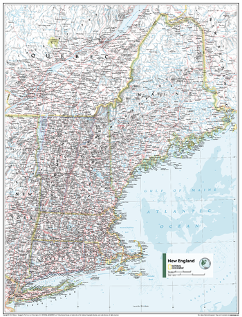
New England U.S. - Atlas of the World, 11th Edition - Compact
This New England regional map of physical and political features can fit in any space. Showcasing the region in stunning detail with state-of-the-art cartographic techniques delivering accuracy and exceptional quality, the innovative and engaging design makes the content easily accessible and user-friendly.
Ideal for classrooms with an emphasis on teaching geography or environmental themes. The inclusion of physical features gives your students a genuine feel for how our world appears.
This map uses a bright, easy to read color palette featuring blue oceans and stunning shaded relief that has been featured on National Geographic wall maps for over 75 years. It is drawn in the Albers Conic Equal-Area projection, which uses two standard parallels between which distortion is minimized, however scale and shape are not preserved.
This map is found in National Geographic's 11th Edition World Atlas and is now available as a stand alone product.
Page Size: 16.25 x 21.5 in (413 x 540 mm)
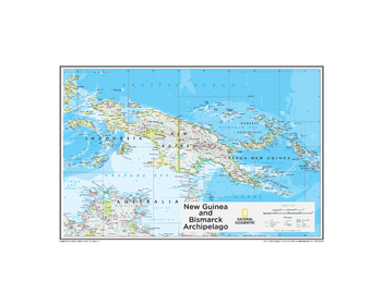
New Guinea and Bismarck Archipelago - Atlas of the World, 10th Edition
Papua New Guinea
Page Size: 26 x 20 in (660 x 508 mm)
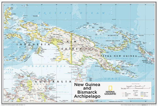
New Guinea and Bismarck Archipelago - Atlas of the World, 10th Edition - Compact
Papua New Guinea
Page Size: 24 x 16 in (605 x 406 mm)

New Views of Our Sun, Cool to Hot - Published 2004
Recent technology has enabled us to view our sun in new and spectacular ways. This beautiful poster reveals five remarkable images of the sun captured by the Swedish 1-meter Solar Telescope in the Canary Islands, the Solar and Heliospheric Observatory's Extreme-Ultraviolet Imaging Telescope, the Transition Region and Coronal Explorer satellite, and Japanese satellite Yohkoh. Published in July 2004, this stunning poster was printed as half of a two-piece set with "Exploring Space Weather."
Page Size: 31.25 x 20.25 in (790 x 511 mm)
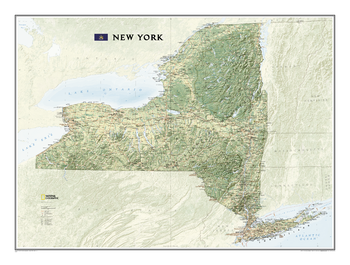
New York
This map offers a dramatic visualization of New York's physical geography. Land cover colorization distinguishes forests and deserts. Stunning shaded relief depicts mountains and ocean depths. The map locates and names cities, towns, islands airports, national and state parks, military bases, mountains (with peak elevations), lakes, rivers, and other natural features.
Page Size: 40.25 x 30 in (1018 x 758 mm)
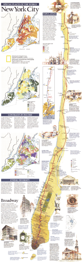
New York City - Published 1990
Published in September 1990, the New York City map is part of the "Special Places of the World" series. An abundance of text, notes, and several individual maps highlight such elements as population density, ethnic diversity, and income of the residents of New York City. Half of a two-map set, this map accompanied a map of Manhattan and three articles on the city.
Page Size: 10 x 31.25 in (253 x 791 mm)
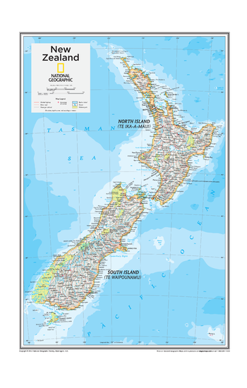
New Zealand - Atlas of the World, 10th Edition
New Zealand
Page Size: 14 x 22 in (356 x 559 mm)