


National Geographic

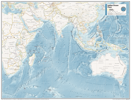
Indian Ocean Floor - Atlas of the World, 11th Edition
This map of physical ocean seafloor can fit in any space. Showcasing the Indian Ocean floor in stunning detail with state-of-the-art cartographic techniques delivering accuracy and exceptional quality, the innovative and engaging design makes the content easily accessible and user-friendly.
Ideal for classrooms with an emphasis on teaching geography or environmental themes. The mapping of the ocean terrain gives your students a unique glimpse into how our world appears under the sea.
This physical map of the Indian Ocean floor uses stunning contrasts to highlight the ocean floor and its physical features. This map is drawn in the Miller Cylindrical projection, an adapted version of the Mercator projection for nautical navigation because it represents lines of constant course, known as rhumb lines or loxodromes, as straight segments that conserve the angles with the meridians.
This map is found in National Geographic's 11th Edition World Atlas and is now available as a stand alone product.
Page Size: 31.5 x 24 in (798 x 610 mm)
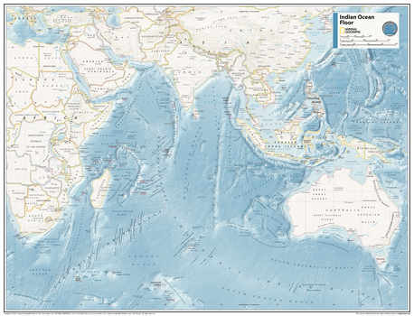
Indian Ocean Floor - Atlas of the World, 11th Edition - Compact
This map of physical ocean seafloor can fit in any space. Showcasing the Indian Ocean floor in stunning detail with state-of-the-art cartographic techniques delivering accuracy and exceptional quality, the innovative and engaging design makes the content easily accessible and user-friendly.
Ideal for classrooms with an emphasis on teaching geography or environmental themes. The mapping of the ocean terrain gives your students a unique glimpse into how our world appears under the sea.
This physical map of the Indian Ocean floor uses stunning contrasts to highlight the ocean floor and its physical features. This map is drawn in the Miller Cylindrical projection, an adapted version of the Mercator projection for nautical navigation because it represents lines of constant course, known as rhumb lines or loxodromes, as straight segments that conserve the angles with the meridians.
This map is found in National Geographic's 11th Edition World Atlas and is now available as a stand alone product.
Page Size: 21.5 x 16.25 in (540 x 413 mm)
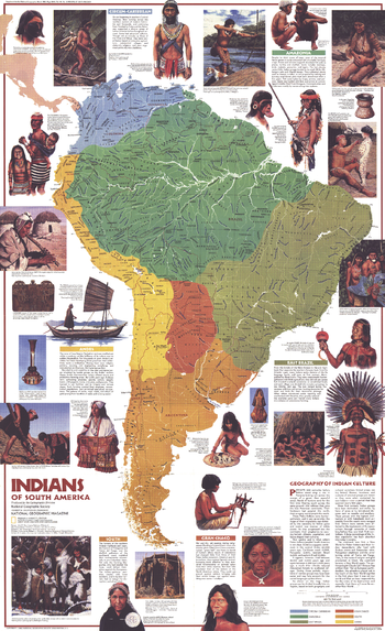
Indians of South America - Published 1982
Discover the fascinating pre-Columbian cultures of the Amazon, the Andes, and beyond. This map captures the essence of the diverse tribes of the continent with informative profiles and colorful illustrations. Published in March 1982 as a companion to the "Archaeology of South America" map.
Page Size: 22.75 x 37 in (573 x 938 mm)
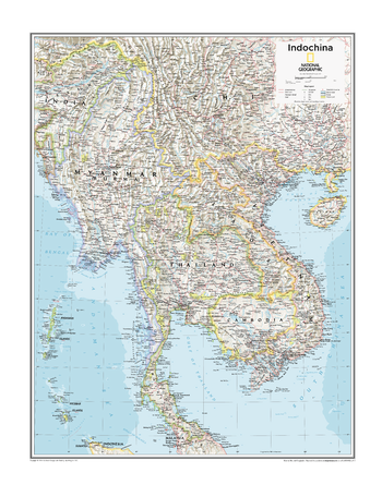
Indochina - Atlas of the World, 10th Edition
Cambodia, Laos, Myanmar (Burma), Thailand, Vietnam
Page Size: 22 x 28 in (559 x 711 mm)
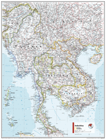
Indochina - Atlas of the World, 11th Edition
This Indochina regional map of physical and political features can fit in any space. Showcasing the region in stunning detail with state-of-the-art cartographic techniques delivering accuracy and exceptional quality, the innovative and engaging design makes the content easily accessible and user-friendly.
Ideal for classrooms with an emphasis on teaching geography or environmental themes. The inclusion of physical features gives your students a genuine feel for how our world appears.
This map uses a bright, easy to read color palette featuring blue oceans and stunning shaded relief that has been featured on National Geographic wall maps for over 75 years. It is drawn in the Oblique Mercator projection, which is a cylindrical map projection for nautical navigation because it represents lines of constant course.
This map is found in National Geographic's 11th Edition World Atlas and is now available as a stand alone product.
Page Size: 24 x 31.5 in (610 x 798 mm)
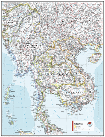
Indochina - Atlas of the World, 11th Edition - Compact
This Indochina regional map of physical and political features can fit in any space. Showcasing the region in stunning detail with state-of-the-art cartographic techniques delivering accuracy and exceptional quality, the innovative and engaging design makes the content easily accessible and user-friendly.
Ideal for classrooms with an emphasis on teaching geography or environmental themes. The inclusion of physical features gives your students a genuine feel for how our world appears.
This map uses a bright, easy to read color palette featuring blue oceans and stunning shaded relief that has been featured on National Geographic wall maps for over 75 years. It is drawn in the Oblique Mercator projection, which is a cylindrical map projection for nautical navigation because it represents lines of constant course.
This map is found in National Geographic's 11th Edition World Atlas and is now available as a stand alone product.
Page Size: 16.25 x 21.5 in (413 x 540 mm)
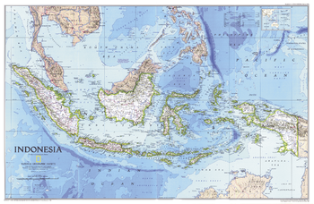
Indonesia - Published 1996
This vibrant map of Indonesia features subtle relief shading of mountainous regions and ocean bathymetry. Published in February 1996 as half of a two–map set with "Indonesia Theme", and accompanied by the article "Irian Jaya: Indonesia's Wild Side."
Page Size: 31.25 x 20.25 in (789 x 513 mm)
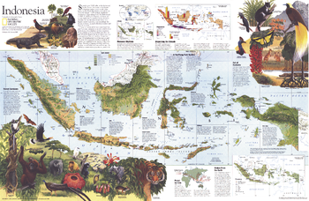
Indonesia Theme - Published 1996
Explore a fascinating land of unique animal species, the world's largest flower, and butterflies with foot-wide wingspans, with this beautiful and educational map of Indonesia. Published in February 1996 as half of a two–map set with "Indonesia", and accompanied by the article "Irian Jaya: Indonesia's Wild Side."
Page Size: 31.25 x 20.25 in (789 x 513 mm)
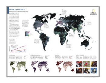
Interconnectivity: An Expanding Information Society - Atlas of the World, 10th Edition
Connecting to the Internet; Global Growth; ICT Development Index; Booming Mobile-Cellular Subscriptions; Internet Access; Evolving Use of Technologies
Page Size: 28 x 22 in (711 x 559 mm)
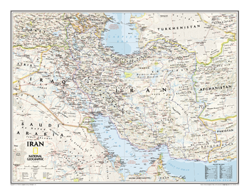
Iran Classic
Wallmap of Iran, features the classic National Geographic reference styling. Includes hundreds of place names, accurate political boundaries, national parks, archeological sites, and major infrastructure networks such as roads, canals, ferry routes, and railroads. Iran's diverse terrain is detailed through accurate shaded relief, coastal bathymetry, and symbolism for water features and other landforms. Includes table of geographic equivalents translated into English. Elevations of major peaks and depth soundings are expressed in meters. In addition, the bordering countries of Iraq, Turkey, Armenia, Azerbaijan, Turkmenistan, Afghanistan, and Pakistan are shown as well as outlying countries including Syria, Uzbekistan, United Arab Emirates, Oman, Kuwait, and Saudi Arabia.
Page Size: 30.25 x 23.5 in (768 x 596 mm)
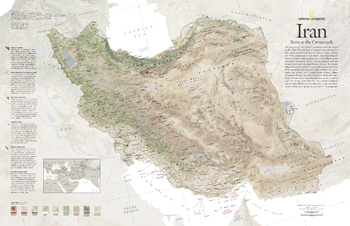
Iran, Born at the Crossroads - Published 2008
Iran's diverse geography is revealed in this unique map. Information about the formation of the terrain combined with earth-tone colors and shaded relief present this compelling country in a way that demonstrates how its landscape has been so integral in the shaping of its history and culture. Published in August 2008, this map was half of a two-map set with "The Empire of Persia."
Page Size: 31.25 x 20.25 in (791 x 511 mm)
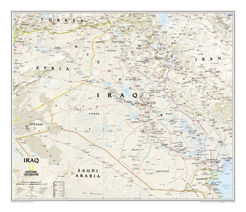
Iraq Classic
Wallmap of Iraq, features the classic National Geographic reference styling. Includes hundreds of place names, accurate political boundaries, and major infrastructure networks such as roads, oil fields and pipelines, aqueducts, and railroads. Iraq's terrain is detailed through accurate shaded relief and symbolism for water features and other landforms. This map also includes table of geographic equivalents translated into English. Elevations of major peaks and depth soundings are expressed in meters. The bordering countries of Iran, Syria, Saudi Arabia, Kuwait, Jordan and Turkey are also shown.
Page Size: 28.75 x 24.75 in (727 x 625 mm)
Iraq and Iran - Atlas of the World, 10th Edition
null
Page Size: 28 x 22 in (711 x 559 mm)
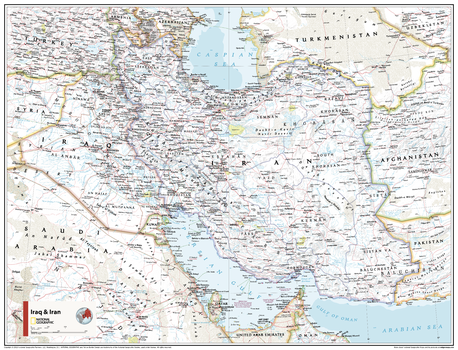
Iraq and Iran - Atlas of the World, 11th Edition
This Iraq and Iran map of physical and political features can fit in any space. Showcasing the region in stunning detail with state-of-the-art cartographic techniques delivering accuracy and exceptional quality, the innovative and engaging design makes the content easily accessible and user-friendly.
Ideal for classrooms with an emphasis on teaching geography or environmental themes. The inclusion of physical features gives your students a genuine feel for how our world appears.
This map uses a bright, easy to read color palette featuring blue oceans and stunning shaded relief that has been featured on National Geographic wall maps for over 75 years. It is drawn in the Polyconic projection, where the parallels are all non-concentric circular arcs except for the equator, which is straight.
This map is found in National Geographic's 11th Edition World Atlas and is now available as a stand alone product.
Page Size: 31.5 x 24 in (798 x 610 mm)
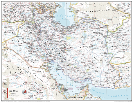
Iraq and Iran - Atlas of the World, 11th Edition - Compact
This Iraq and Iran map of physical and political features can fit in any space. Showcasing the region in stunning detail with state-of-the-art cartographic techniques delivering accuracy and exceptional quality, the innovative and engaging design makes the content easily accessible and user-friendly.
Ideal for classrooms with an emphasis on teaching geography or environmental themes. The inclusion of physical features gives your students a genuine feel for how our world appears.
This map uses a bright, easy to read color palette featuring blue oceans and stunning shaded relief that has been featured on National Geographic wall maps for over 75 years. It is drawn in the Polyconic projection, where the parallels are all non-concentric circular arcs except for the equator, which is straight.
This map is found in National Geographic's 11th Edition World Atlas and is now available as a stand alone product.
Page Size: 21.5 x 16.25 in (540 x 413 mm)
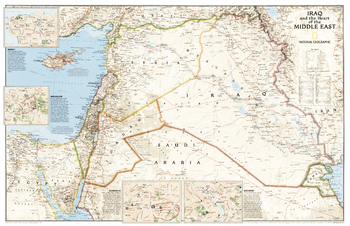
Iraq and the Heart of the Middle East - Published 2003
This timely map of Iraq and the Middle East features a wealth of geographic, political, natural resource, and cultural information. The front of the map features an incredibly accurate, detailed map of political boundaries, cities and towns, major roadways, bodies of water, oil fields and pipelines, and other geographic features. It also includes city insets that show street plans and describe the history and cultures of Baghdad, Beirut, Damascus, and Jerusalem.
Page Size: 36.25 x 23.5 in (917 x 592 mm)
Ireland (Éire) and Scotland - Atlas of the World, 10th Edition
null
Page Size: 28 x 22 in (711 x 559 mm)
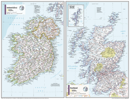
Ireland (Éire) and Scotland - Atlas of the World, 11th Edition
This Ireland (Éire) and Scotland map of physical and political features can fit in any space. Showcasing the countries in stunning detail with state-of-the-art cartographic techniques delivering accuracy and exceptional quality, the innovative and engaging design makes the content easily accessible and user-friendly.
Ideal for classrooms with an emphasis on teaching geography or environmental themes. Physical maps give your students a genuine feel for how our world appears.
This map uses a bright, easy to read color palette featuring blue oceans and stunning shaded relief that has been featured on National Geographic wall maps for over 75 years. It is drawn in a Polyconic projection, where the parallels are all non-concentric circular arcs.
Names of geographic features are carefully placed on the map to maintain legibility. This side-by-side map includes an inset of the Shetland Islands.
This map is found in National Geographic's 11th Edition World Atlas and is now available as a stand alone product
Page Size: 31.5 x 24 in (798 x 610 mm)
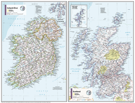
Ireland (Éire) and Scotland - Atlas of the World, 11th Edition - Compact
This Ireland (Éire) and Scotland map of physical and political features can fit in any space. Showcasing the countries in stunning detail with state-of-the-art cartographic techniques delivering accuracy and exceptional quality, the innovative and engaging design makes the content easily accessible and user-friendly.
Ideal for classrooms with an emphasis on teaching geography or environmental themes. Physical maps give your students a genuine feel for how our world appears.
This map uses a bright, easy to read color palette featuring blue oceans and stunning shaded relief that has been featured on National Geographic wall maps for over 75 years. It is drawn in a Polyconic projection, where the parallels are all non-concentric circular arcs.
Names of geographic features are carefully placed on the map to maintain legibility. This side-by-side map includes an inset of the Shetland Islands.
This map is found in National Geographic's 11th Edition World Atlas and is now available as a stand alone product
Page Size: 21.5 x 16.25 in (540 x 413 mm)
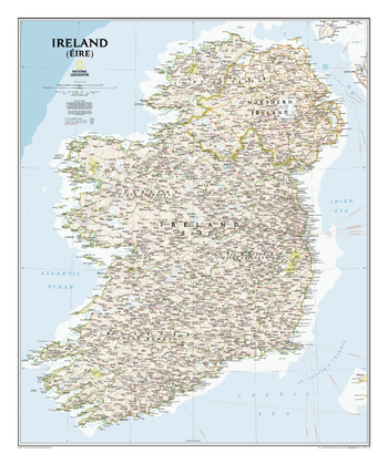
Ireland Classic
This classic-style Ireland wall map is one of the most authoritative maps yet published of the Emerald Isle. Of the nearly 1,000 place-names shown on this map, all within the Republic of Ireland adhere to that nation's constitution—that the Irish and English language share official status. Thus, Gaelic (Irish) place-names, along with their English variants in parentheses, are shown within Irish-speaking regions while English place-names, along with their Gaelic variants, are shown outside these areas.<br><br>Ireland Executive is ideal for those researching their Irish ancestry, a perfect tool for business reference, and a beautiful addition to any décor. It's one of the largest and most detailed wall maps specifically for Ireland available today. Includes over 1,000 named places including primary and secondary towns, counties, political boundaries, infrastructure, and selected historical sites for both Ireland and Northern Ireland. Per the Republic of Ireland's constitution, the Irish and English languages share official status. In the GaeltachtI, or predominantly Irish-speaking regions, only Irish place-names have official status and are used on signposts. These districts are found within the counties of Cork, Donegal, Galway, Kerry, Mayo, Meath, and Waterford.
Page Size: 30 x 36 in (762 x 914 mm)