Indian Ocean Floor - Atlas of the World, 11th Edition
National Geographic
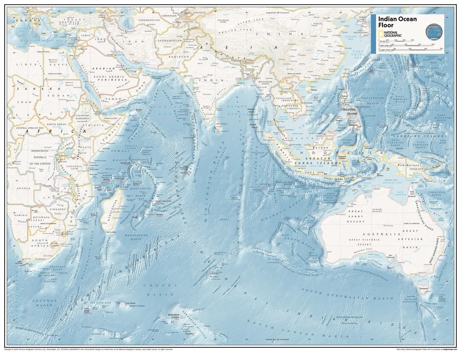
This map of physical ocean seafloor can fit in any space. Showcasing the Indian Ocean floor in stunning detail with state-of-the-art cartographic techniques delivering accuracy and exceptional quality, the innovative and engaging design makes the content easily accessible and user-friendly.
Ideal for classrooms with an emphasis on teaching geography or environmental themes. The mapping of the ocean terrain gives your students a unique glimpse into how our world appears under the sea.
This physical map of the Indian Ocean floor uses stunning contrasts to highlight the ocean floor and its physical features. This map is drawn in the Miller Cylindrical projection, an adapted version of the Mercator projection for nautical navigation because it represents lines of constant course, known as rhumb lines or loxodromes, as straight segments that conserve the angles with the meridians.
This map is found in National Geographic's 11th Edition World Atlas and is now available as a stand alone product.
Page Size: 31.5 x 24 in (798 x 610 mm)
Buy this map on MapTrove.ca