


National Geographic

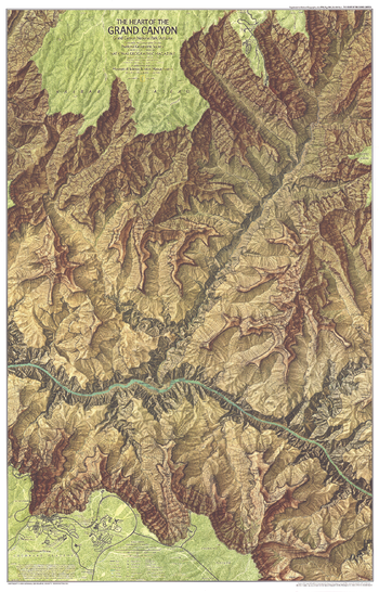
Heart of the Grand Canyon - Published 1978
Compiled from aerial photographs taken in 1972 and field surveying, this map provides striking topography of the canyon and detail of its park facilities, trails, campgrounds, and more. Published in July 1978 as half of a two–map set with "The Grand Canyon of the Colorado", and a companion to two articles on the park.
Page Size: 22.5 x 35 in (568 x 886 mm)
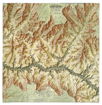
Heart of the Grand Canyon - Published 1999
This map displays the striking topography of the Grand Canyon, while providing details of its park facilities, trails, campgrounds.
Page Size: 35 x 36 in (888 x 913 mm)
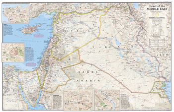
Heart of the Middle East - Published 2002
This attractive political map showing the countries at the heart of the Middle East region also contains inset maps of the cities of Beirut, Jerusalem, Damascus, and Baghdad. Published in October 2002 as half of a two–map set with "Middle East: Crossroads of Faith and Conflict."
Page Size: 31.25 x 20.25 in (791 x 511 mm)
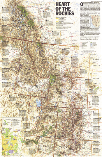
Heart of the Rockies - Published 1995
Stretching more than 3,000 miles from British Columbia in Canada to New Mexico in the United States, the Rocky Mountains attract millions of tourists each year who come for the spectacular scenery and abundant recreational activities. This map of the region features information on dozens of popular sites. Published in July 1995, this map accompanied the "Above the Rockies" physical map which was created using satellite imaging.
Page Size: 20.25 x 31.25 in (513 x 792 mm)
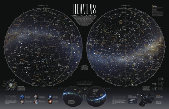
Heavens - Majesty of the Night Sky - Published 2023
Earth's position in a spur of one of the Milky Way's spiraling arms gives us a clear view of the wonders - and enduring mysteries - of deep space. Humans have long marveled at the beauty of the billions of stars above, observing their regular traverse across the sky and seeking to understand their origins and order. Here, a mosaic of thousands of images reveals our celestial sphere in its entirety, and with it, a diversity of multicultural names and imagined patterns amassed over centuries of scholarship and awe.
Page Size: 31.25 x 20.25 in (791 x 511 mm)
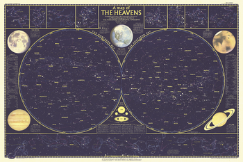
Heavens - Published 1957
Published in December 1957, this map is half of a two-part map of the heavens that appeared with the article "How Man-made Satellites Can Affect Our Lives." It shows the constellations and brightest stars as seen from both the northern and southern hemispheres and also includes information on the planets including their relative size.
Page Size: 42.25 x 28 in (1068 x 711 mm)
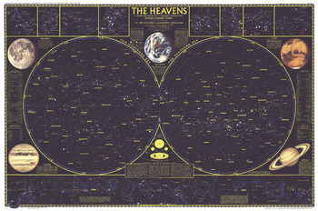
Heavens - Published 1970
Published in August 1970, this map of the heavens shows the constellations and brightest stars as seen from both the northern and southern hemispheres. It also includes information on the planets including their relative size. This map is a wonderful companion to the "Map of the Heavens with Monthly Star Charts for Both Hemispheres" which appeared in the same issue.
Page Size: 34.5 x 22.75 in (871 x 577 mm)
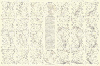
Heavens Star Chart - Published 1957
Explore the heavens from both the northern and southern hemispheres with this detailed star chart. Printed in December 1957 as half of the two-part map of the heavens and with the article "How Man-made Satellites Can Affect Our Lives," this work is a wonderful primer for the amateur astronomer.
Page Size: 42.25 x 28 in (1068 x 711 mm)
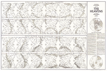
Heavens Star Chart - Published 1970
Explore the heavens from both the northern and southern hemispheres with this detailed star chart. Printed in August 1970 as a companion to "The Heavens" map in the same issue, this work is a wonderful primer for the amateur astronomer.
Page Size: 34.5 x 22.75 in (871 x 577 mm)
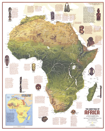
Heritage of Africa - Published 1971
This Africa map features a physical map of the continent and an abundance of historical notes. Published in December 1971 as half of a two–map set with the "Ethnolinguistic Map of the Peoples of Africa" map, and as a companion to the article "The Zulus: Black Nation in a Land of Aparteid."
Page Size: 22.75 x 28.25 in (575 x 716 mm)
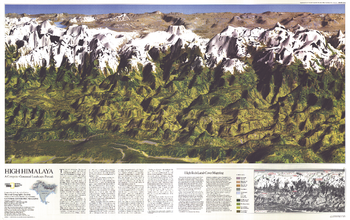
High Himalaya - Published 1988
This computer-generated panorama of the Himalayas from Kathmandu to just east of Mount Everest is neither photograph nor painting, though it resembles both with its dimension and color. Published in November 1988 with a companion map of and three articles about Mount Everest, this stunning map brings these majestic mountains to life in striking relief.
Page Size: 36 x 22.75 in (911 x 573 mm)
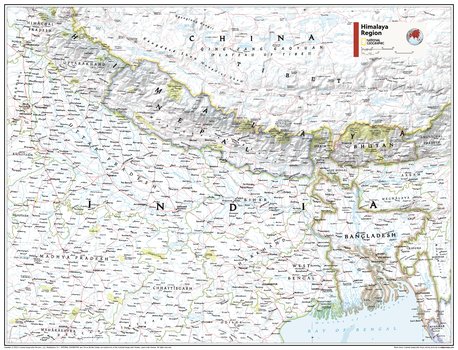
Himalaya Region - Atlas of the World, 11th Edition
This Himalaya Region map of physical and political features can fit in any space. Showcasing the countries in stunning detail with state-of-the-art cartographic techniques delivering accuracy and exceptional quality, the innovative and engaging design makes the content easily accessible and user-friendly.
Ideal for classrooms with an emphasis on teaching geography or environmental themes. The inclusion of physical features gives your students a genuine feel for how our world appears.
This map uses a bright, easy to read color palette featuring blue oceans and stunning shaded relief that has been featured on National Geographic wall maps for over 75 years. It is drawn in Conic projection, in which an area of the earth is projected onto a cone whose vertex is usually above one of the poles, then unrolled onto a flat surface.
Names of geographic features are carefully placed on the map to maintain legibility.
This map is found in National Geographic's 11th Edition World Atlas and is now available as a stand alone product.
Page Size: 31.5 x 24 in (798 x 610 mm)
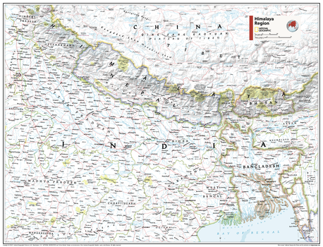
Himalaya Region - Atlas of the World, 11th Edition - Compact
This Himalaya Region map of physical and political features can fit in any space. Showcasing the countries in stunning detail with state-of-the-art cartographic techniques delivering accuracy and exceptional quality, the innovative and engaging design makes the content easily accessible and user-friendly.
Ideal for classrooms with an emphasis on teaching geography or environmental themes. The inclusion of physical features gives your students a genuine feel for how our world appears.
This map uses a bright, easy to read color palette featuring blue oceans and stunning shaded relief that has been featured on National Geographic wall maps for over 75 years. It is drawn in Conic projection, in which an area of the earth is projected onto a cone whose vertex is usually above one of the poles, then unrolled onto a flat surface.
Names of geographic features are carefully placed on the map to maintain legibility.
This map is found in National Geographic's 11th Edition World Atlas and is now available as a stand alone product.
Page Size: 21.5 x 16.25 in (540 x 413 mm)

Historic Ireland Theme - Published 1981
This educational map of Historic Ireland was published in April 1981 with three articles on Ireland and an additional map entitled "Ireland and Northern Ireland: A Visitor's Guide." These maps provide a wonderful overview of the island's tumultuous and colorful history.
Page Size: 14 x 20.5 in (353 x 520 mm)
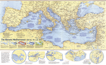
Historic Mediterranean, 800 BC to AD 1500 - Published 1982
The Mediterranean region was home to many of the greatest civilizations in human history, including the ancient Greeks and Romans. This map contains a wealth of information about the history of the civilizations who inhabited the region from 800 BC to AD 1500, and the archeaological sites they left behind. Published in December 1982 as a companion to the outstanding "Mediterranean Seafloor" map and three articles on the Mediterranean Sea.
Page Size: 37 x 22.75 in (934 x 573 mm)
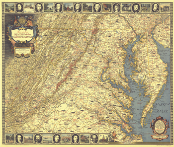
Historic and Scenic Reaches of the Nations Capital - Published 1938
With its border of notable figures and places, this map of the Historic and Scenic Reaches of the Nation's Capital is as much a work of art as a map. Published in July 1938 with the article "Roads from Washington," it contains a variety of interesting historical sites and notes. A unique cartographic work and perfect for framing.
Page Size: 30.75 x 26.25 in (781 x 661 mm)
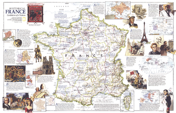
Historical France - Published 1989
National Geographic celebrated the bicentennial of the French Revolution in July 1989 by devoting the entire issue to France. This wonderful map contains a wealth of information about the history of France, historical sites, and popular resorts and tourist activities. It appeared as a companion to the "France" political map of the country.
Page Size: 31.5 x 20.5 in (799 x 515 mm)
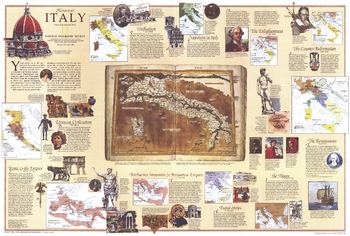
Historical Italy Theme - Published 1995
Half of a two-map set, this historical map of Italy appeared in the February 1995 issue of National Geographic with a stunning physical and political map of the country and an article on Venice. Filled with historical information and illustrations, this map boasts eleven inset maps detailing key periods.
Page Size: 33 x 22.25 in (834 x 563 mm)

Historical Japan - Published 1984
The companion to the Japan map of 1984 and the article "Hagi: Where Japan's Revolution Began," this stunning work contains six maps detailing periods of history from the Stone Age through modern Japan. The elegant illustrations, abundant text and historical timeline make this a must-have for anyone interested in Japanese history.
Page Size: 11.25 x 37.25 in (283 x 941 mm)
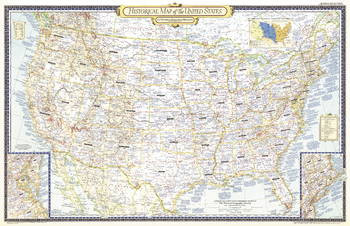
Historical Map of the United States - Published 1953
The Historical Map of the United States published in June 1953 accompanied six articles on the United States including "Founders of New England." A unique collectible, this map of the continental United States features a wealth of historical information, subtle relief shading, and details such as explorers' routes and immigrant trails.
Page Size: 41 x 26.5 in (1038 x 671 mm)