top of page
High Himalaya - Published 1988
National Geographic
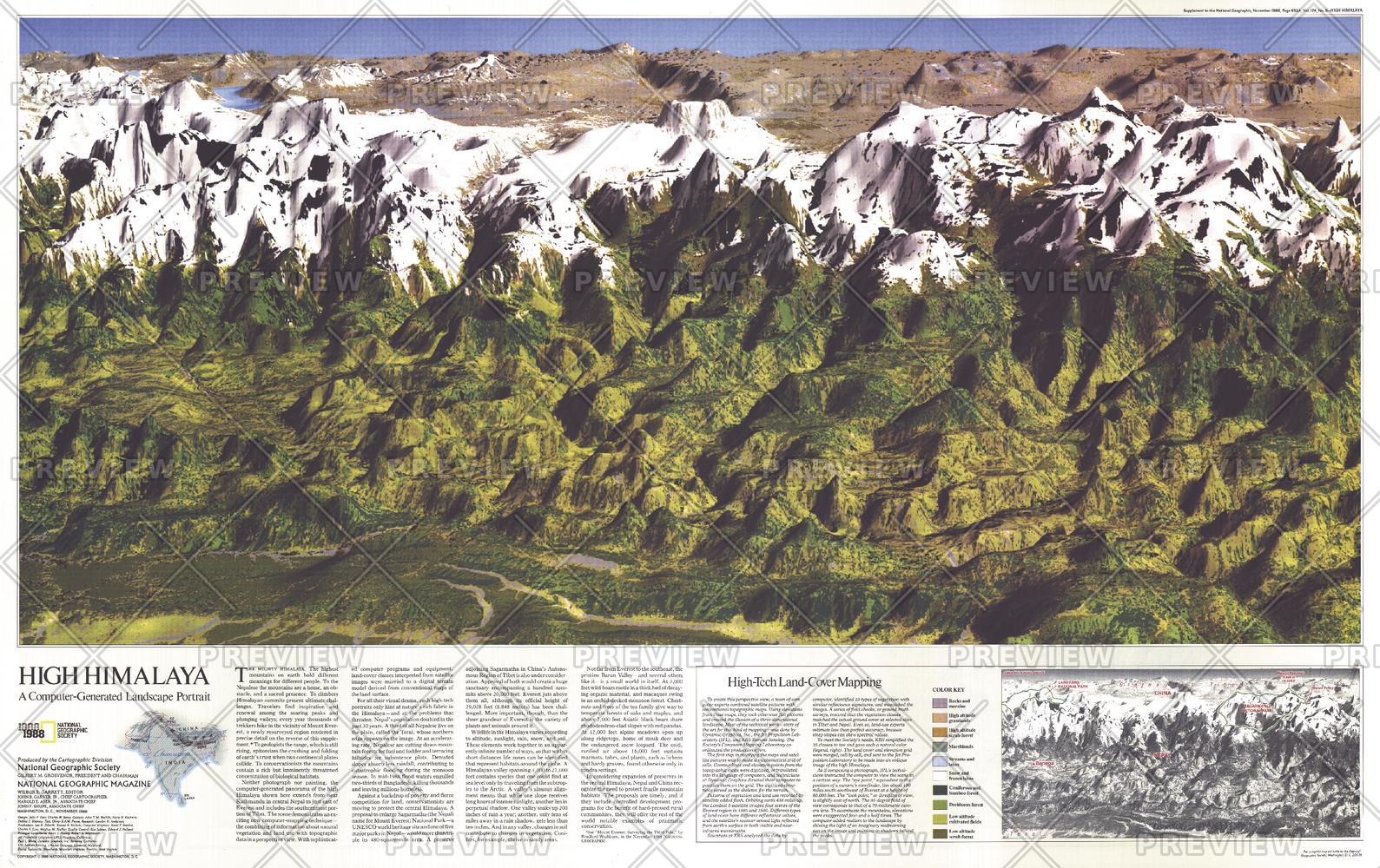
This computer-generated panorama of the Himalayas from Kathmandu to just east of Mount Everest is neither photograph nor painting, though it resembles both with its dimension and color. Published in November 1988 with a companion map of and three articles about Mount Everest, this stunning map brings these majestic mountains to life in striking relief.
Page Size: 36 x 22.75 in (911 x 573 mm)
Buy this map on MapTrove.ca or MapTrove.com
bottom of page