


MapSherpa
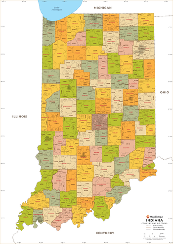
Indiana ZIP Code Map with Counties - Large
This map has been created exclusively for MapSherpa, and designed for business or reference use. Clear and clean colors & fonts matched with cartographic research makes this Indiana Zip Code Map with Counties easily readable and useful. The map shows the 92 counties of Indiana and the borders of the 773 zip codes across the Hoosier State.
Page Size: 48 x 67.5 in (1219 x 1713 mm)
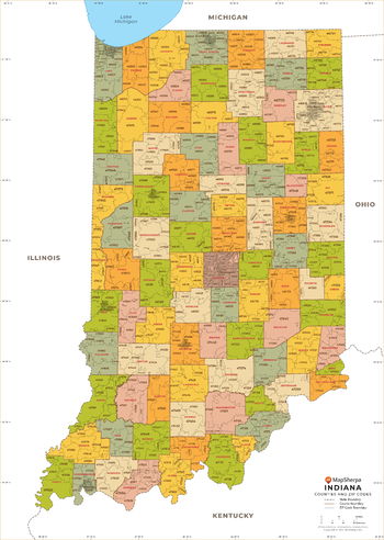
Indiana ZIP Code Map with Counties - Standard
This map has been created exclusively for MapSherpa, and designed for business or reference use. Clear and clean colors & fonts matched with cartographic research makes this Indiana Zip Code Map with Counties easily readable and useful. The map shows the 92 counties of Indiana and the borders of the 773 zip codes across the Hoosier State.
Page Size: 36 x 50.75 in (914 x 1285 mm)
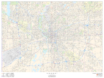
Indianapolis, Indiana Inner Metro - Landscape
This landscape-oriented map of central Indianapolis, Indiana shows detailed street level information including extensive street labeling. Ideal for planning of deliveries, home services, sales territories, real estate and much more. Base map features include all roads with major roads and highways labelled; neighborhood names; railways; high level land use such as parks and recreation areas, industrial areas and hospital campuses; and a variety of points of interest including schools, libraries, stadiums, museums, border crossings and more.
Page Size: 48 x 36 in (1219 x 914 mm)
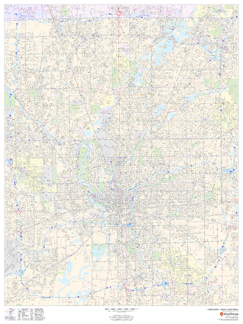
Indianapolis, Indiana Inner Metro - Portrait
This portrait-oriented map of central Indianapolis, Indiana shows detailed street level information including extensive street labeling. Ideal for planning of deliveries, home services, sales territories, real estate and much more. Base map features include all roads with major roads and highways labelled; neighborhood names; railways; high level land use such as parks and recreation areas, industrial areas and hospital campuses; and a variety of points of interest including schools, libraries, stadiums, museums, border crossings and more.
Page Size: 36 x 48 in (914 x 1219 mm)
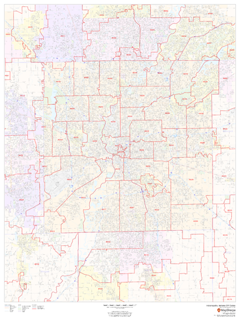
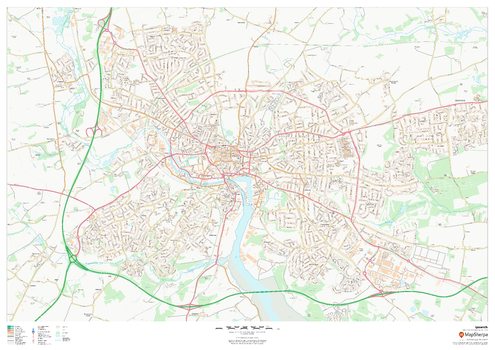
Indianapolis, Indiana ZIP Codes
This map of Indianapolis shows ZIP code areas overlaid on a road map. Ideal for planning of deliveries, home services, sales territories, real estate and much more. Base map features include all roads with major roads and highways labelled; neighborhood names; railways; and high level land use such as parks and recreation areas, industrial areas and hospital campuses.
Page Size: 36 x 48 in (914 x 1219 mm)

Indonesia
This beautiful map shows physical and political features for Indonesia and surrounding areas. Relief shading and the use of different colours by height above sea level are both informative and attractive.
Page Size: 48 x 36 in (1219 x 914 mm)
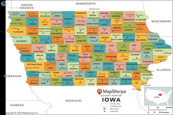
Iowa Counties Map - Extra Large
This map has been created exclusively for MapSherpa, and designed for reference or business use. Clear and clean colors & fonts matched with cartographic research makes this map of the 99 Iowa counties easily readable and useful.
Page Size: 60 x 40 in (1524 x 1013 mm)

Iowa Counties Map - Large
This map has been created exclusively for MapSherpa, and designed for reference or business use. Clear and clean colors & fonts matched with cartographic research makes this map of the 99 Iowa counties easily readable and useful.
Page Size: 48 x 32 in (1219 x 810 mm)

Iowa Counties Map - Standard
This map has been created exclusively for MapSherpa, and designed for reference or business use. Clear and clean colors & fonts matched with cartographic research makes this map of the 99 Iowa counties easily readable and useful.
Page Size: 36 x 24 in (914 x 608 mm)
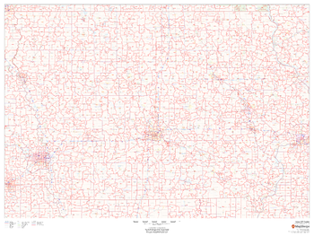
Iowa ZIP Code Map
This map of Iowa shows ZIP codes overlaid on a road map. Base map features include municipality and county boundaries, major road network features, and state and national parks and conservation areas.
Page Size: 48 x 36 in (1219 x 914 mm)

Iowa ZIP Code Map with Counties - Extra Large
This map has been created exclusively for MapSherpa, and designed for business or reference use. Clear and clean colors & fonts matched with cartographic research makes this map of Iowa's counties and ZIP codes easily readable and useful.
Page Size: 60 x 43.5 in (1524 x 1099 mm)
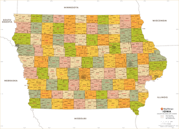
Iowa ZIP Code Map with Counties - Large
This map has been created exclusively for MapSherpa, and designed for business or reference use. Clear and clean colors & fonts matched with cartographic research makes this map of Iowa's counties and ZIP codes easily readable and useful.
Page Size: 48 x 34.75 in (1219 x 879 mm)

Iowa ZIP Code Map with Counties - Standard
This map has been created exclusively for MapSherpa, and designed for business or reference use. Clear and clean colors & fonts matched with cartographic research makes this map of Iowa's counties and ZIP codes easily readable and useful.
Page Size: 36 x 26 in (914 x 659 mm)
Ipswich
This map of Ipswich shows detailed street level information including extensive street labelling. Ideal for planning of deliveries, home services, sales territories, real estate and much more.
Page Size: 47 x 33.25 in (1189 x 841 mm)
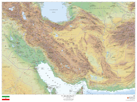
Iran
This beautiful map shows physical and political features for Iran and surrounding areas. Relief shading and the use of different colours by height above sea level are both informative and attractive.
Page Size: 48 x 36 in (1219 x 914 mm)
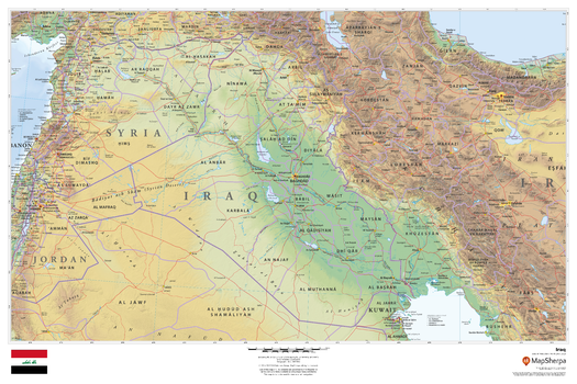
Iraq
This beautiful map shows physical and political features for Iraq and surrounding areas. Relief shading and the use of different colours by height above sea level are both informative and attractive.
Page Size: 36 x 24 in (914 x 610 mm)

Isle of Man
This wall map of the Isle of Man has been produced from current Ordnance Survey mapping, and displays the detailed topographic features of the island. A complete road network for the island is displayed, as well as all villages and towns including the capital Douglas. Detailed shoreline, points of interest, and waterways are displayed in recognizable Ordnance Survey styling.
Page Size: 33.25 x 47 in (841 x 1189 mm)
Italy Explorer
This versatile product allows you to get a topographic map of anywhere in Italy. It has been designed so you can create a map for your next excursion.This product has been designed to make custom topographic maps suitable for short walks to week long treks and anything in between. Walking and bike paths are featured prominently on this map along with key points of interest such as campsites, trailheads, and landmarks. Also included are traditional topographic features such as elevation contours, landforms, lakes, and rivers along with roads, rails, trails, and park boundaries.The details of this map make it ideal to plan your next trek and take it with you. Invaluable for outdoor recreation activities such as walking, biking, and exploration.
Italy Roads and Recreation
This versatile product allows you to get a road map of anywhere in Italy. It has been designed so you can create a map for your next trip.This product has been designed to make custom road and street maps suitable for road trips and sightseeing. This map features comprehensive points of interest including attractions, landmarks, amenities, scenic views and local foot and bike paths. Also included is a complete network of highways, streets and roads you can count on.The details of this map make it ideal to plan a trip and take it with you. Travel with confidence using a map created specifically for the area you will be discovering.
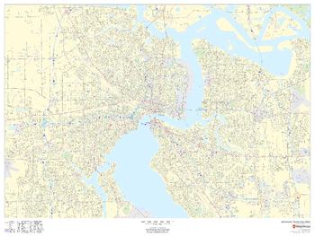
Jacksonville, Florida Inner Metro - Landscape
This landscape-oriented map of central Jacksonville, Florida shows detailed street level information including extensive street labeling. Ideal for planning of deliveries, home services, sales territories, real estate and much more. Base map features include all roads with major roads and highways labelled; neighborhood names; railways; high level land use such as parks and recreation areas, industrial areas and hospital campuses; and a variety of points of interest including schools, libraries, stadiums, museums, border crossings and more.
Page Size: 36 x 48 in (914 x 1219 mm)