top of page
Isle of Man
MapSherpa
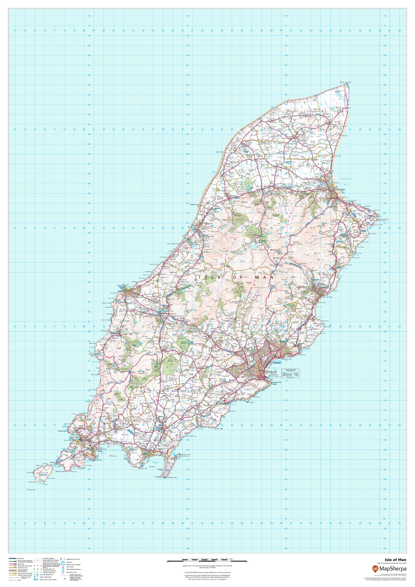
This wall map of the Isle of Man has been produced from current Ordnance Survey mapping, and displays the detailed topographic features of the island. A complete road network for the island is displayed, as well as all villages and towns including the capital Douglas. Detailed shoreline, points of interest, and waterways are displayed in recognizable Ordnance Survey styling.
Page Size: 33.25 x 47 in (841 x 1189 mm)
Buy this map on MapTrove.ca
bottom of page