


MapSherpa Catalog
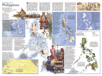
History of the Philippines - Published 1986
National Geographic
With the inauguration of Corazon Aquino earlier in 1986, the Philippines were on the road to recovery after the social and economic oppression of the Marcos regime. Published in July 1986 as a supplement to the Philippines map and the article "Hope and Danger in the Philippines," this map contains an abundance of information on the history of the region.
Page Size: 27.25 x 20.5 in (690 x 516 mm)
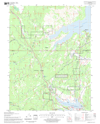
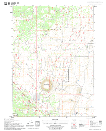
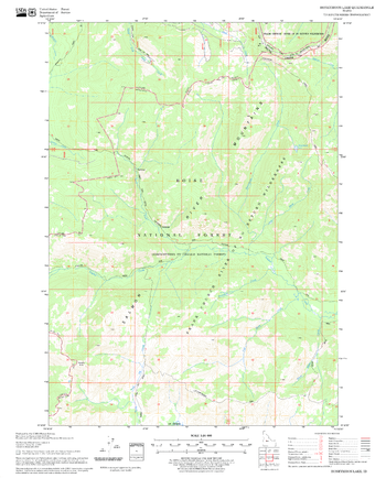
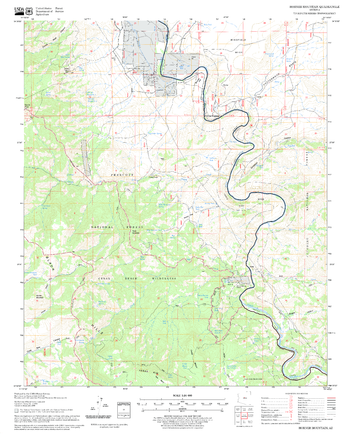
Hobart Mills Quadrangle, California
United States Department of Agriculture Forest Service
United States Department of Agriculture Forestry Service topographical map of Hobart Mills, Tahoe National Forest, California.
Page Size: 21.75 x 27 in (552 x 686 mm)
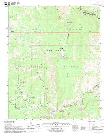
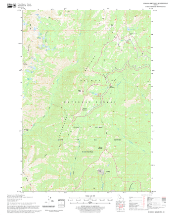
Hockett Peak Quadrangle, California
United States Department of Agriculture Forest Service
United States Department of Agriculture Forestry Service topographical map of Hockett Peak, Sequoia National Forest, California.
Page Size: 21.75 x 27 in (552 x 686 mm)
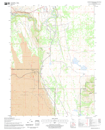
Hogback Ridge Quadrangle, California
United States Department of Agriculture Forest Service
United States Department of Agriculture Forestry Service topographical map of Hogback Ridge, Lassen National Forest, California.
Page Size: 21.75 x 27 in (552 x 686 mm)
Hole In The Ground Quadrangle, Oregon
United States Department of Agriculture Forest Service
United States Department of Agriculture Forestry Service topographical map of Hole In The Ground, Deschutes National Forest, Oregon.
Page Size: 21.75 x 27 in (552 x 686 mm)

Holy Land
National Geographic
Fascinating in-depth look at the faiths, peoples, and politics that have shaped this historic region. Features a detailed political map overlayed with facts about significant religious sites.
Page Size: 23 x 33.75 in (579 x 855 mm)
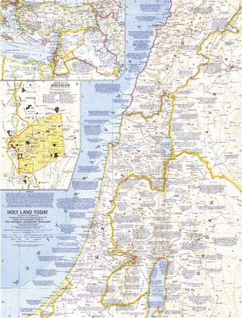
Holy Land Today - Published 1963
National Geographic
This map of the Holy Land provides crisp detail and an abundance of historical notes. An inset map of the Middle East shows Crusade routes, and the Walled City of Jerusalem map reveals the fourteen stations marking the way of the cross from Pilate's hall to Calvary. Published in December 1963 with the articles "Crusader Road to Jerusalem" and "Conquest of the Holy City."
Page Size: 19 x 25 in (481 x 631 mm)
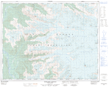
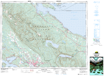
Homathko Icefield - 92 N/2 - British Columbia
Natural Resources Canada
Canadian topographic map of Homathko Icefield, British Columbia. NTS sheet 092N02 Edition 1.
Page Size: 31.75 x 25.25 in (804 x 640 mm)
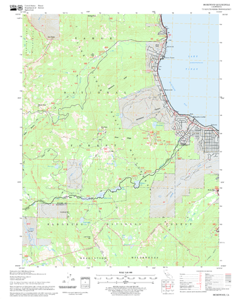
Homewood Quadrangle, California
United States Department of Agriculture Forest Service
United States Department of Agriculture Forestry Service topographical map of Homewood, Tahoe National Forest, California.
Page Size: 21.75 x 27 in (552 x 686 mm)
Honeymoon Lake Quadrangle, Idaho
United States Department of Agriculture Forest Service
United States Department of Agriculture Forestry Service topographical map of Honeymoon Lake, Salmon-Chalis National Forest, Idaho.
Page Size: 21.75 x 27 in (552 x 686 mm)
Hoodoo Meadows Quadrangle, Idaho
United States Department of Agriculture Forest Service
United States Department of Agriculture Forestry Service topographical map of Hoodoo Meadows, Salmon-Chalis National Forest, Idaho.
Page Size: 21.75 x 27 in (552 x 686 mm)
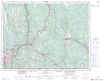
Hope - 92 H - British Columbia
Natural Resources Canada
Canadian topographic map of Hope, British Columbia. NTS sheet 092H Edition 3.
Page Size: 28 x 22 in (708 x 555 mm)
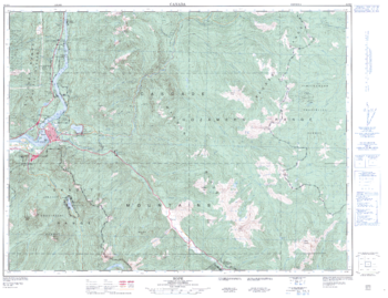
Hope - 92 H/6 - British Columbia
Natural Resources Canada
Canadian topographic map of Hope, British Columbia. NTS sheet 092H06 Edition 2.
Page Size: 33 x 25.5 in (837 x 643 mm)
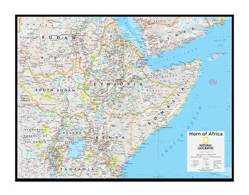
Horn of Africa - Atlas of the World, 10th Edition
National Geographic
Burundi, Djibouti, Eritrea, Ethiopia, Kenya, Rwanda, Somalia, Somaliland, South Sudan, Uganda
Page Size: 28 x 22 in (711 x 559 mm)
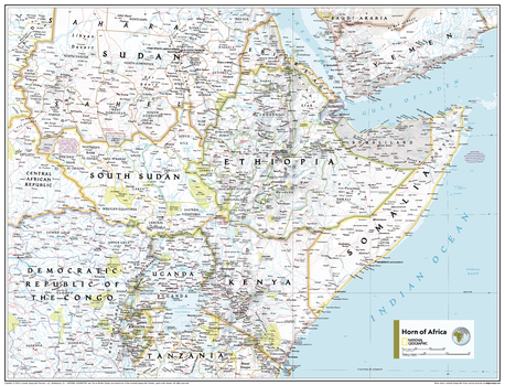
Horn of Africa - Atlas of the World, 11th Edition
National Geographic
This Horn of Africa map of physical and political features can fit in any space. Showcasing the region in stunning detail with state-of-the-art cartographic techniques delivering accuracy and exceptional quality, the innovative and engaging design makes the content easily accessible and user-friendly.
Ideal for classrooms with an emphasis on teaching geography or environmental themes. The inclusion of physical features gives your students a genuine feel for how our world appears.
This map uses a bright, easy to read color palette featuring blue oceans and stunning shaded relief that has been featured on National Geographic wall maps for over 75 years. It is drawn in the Transverse Mercator projection, which is a cylindrical map projection for nautical navigation because it represents lines of constant course.
This map is found in National Geographic's 11th Edition World Atlas and is now available as a stand alone product.
Page Size: 31.5 x 24 in (798 x 610 mm)

Horn of Africa - Atlas of the World, 11th Edition - Compact
National Geographic
This Horn of Africa map of physical and political features can fit in any space. Showcasing the region in stunning detail with state-of-the-art cartographic techniques delivering accuracy and exceptional quality, the innovative and engaging design makes the content easily accessible and user-friendly.
Ideal for classrooms with an emphasis on teaching geography or environmental themes. The inclusion of physical features gives your students a genuine feel for how our world appears.
This map uses a bright, easy to read color palette featuring blue oceans and stunning shaded relief that has been featured on National Geographic wall maps for over 75 years. It is drawn in the Transverse Mercator projection, which is a cylindrical map projection for nautical navigation because it represents lines of constant course.
This map is found in National Geographic's 11th Edition World Atlas and is now available as a stand alone product.
Page Size: 21.5 x 16.25 in (540 x 413 mm)
Horne Lake - 92 F/7 - British Columbia
Natural Resources Canada
Canadian topographic map of Horne Lake, British Columbia. NTS sheet 092F07 Edition 6.
Page Size: 35.75 x 26.25 in (904 x 662 mm)
Horner Mountain Quadrangle, Arizona
United States Department of Agriculture Forest Service
United States Department of Agriculture Forestry Service topographical map of Horner Mountain, Coconino National Forest, Arizona.
Page Size: 21.75 x 27 in (552 x 686 mm)
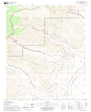
Horse Canyon Quadrangle, California
United States Department of Agriculture Forest Service
United States Department of Agriculture Forestry Service topographical map of Horse Canyon, Sequoia National Forest, California.
Page Size: 21.75 x 27 in (552 x 686 mm)
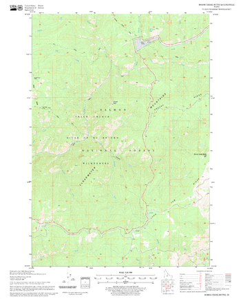
Horse Creek Butte Quadrangle, Idaho
United States Department of Agriculture Forest Service
United States Department of Agriculture Forestry Service topographical map of Horse Creek Butte, Salmon-Chalis National Forest, Idaho.
Page Size: 21.75 x 27 in (552 x 686 mm)
No search results