


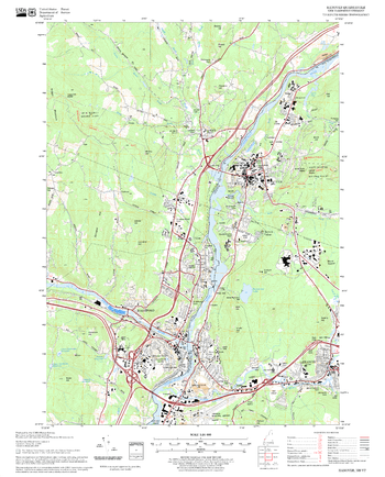
MapSherpa Catalog
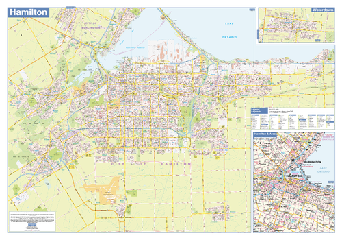
Hamilton Wall Map - Street Detail - Large
Lucidmap
This large wall map shows highly detailed local information of the city of Hamilton. Full street labeling along with transit information, parks, schools, churches and landmarks throughout the city are displayed.
The map has been designed in a very clear and legible manner with a traditional Canadian street map style embraced by map buyers over many years.
Page Size: 54 x 37.5 in (1372 x 953 mm)
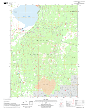
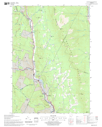
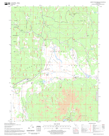
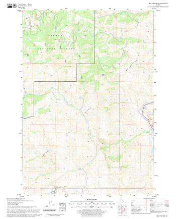
Hamner Butte Quadrangle, Oregon
United States Department of Agriculture Forest Service
United States Department of Agriculture Forestry Service topographical map of Hamner Butte, Deschutes National Forest, Oregon.
Page Size: 21.75 x 27 in (552 x 686 mm)
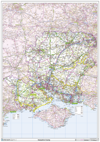
Hampshire County Map
XYZ Maps
This is a large ceremonial county map of Hampshire highlighting the county border, with the surrounding area faded out for excellent contrast. The map covers Aldershot, Basingstoke, Bournemouth, Christchurch, Cowes, Newport, Petersfield, Portmouth, Ringwood, Ryde, Southampton, Winchester and Ventnor. The county map shows the latest County and Unitary Authority Boundaries, Overlaid on a Clear and Easy to Read Ordnance Survey map.
Page Size: 33.25 x 47 in (841 x 1189 mm)
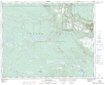
Hanceville - 92 O/14 - British Columbia
Natural Resources Canada
Canadian topographic map of Hanceville, British Columbia. NTS sheet 092O14 Edition 2.
Page Size: 31.5 x 25.5 in (797 x 644 mm)
Hancock Quadrangle, New Hampshire-Vermont
United States Department of Agriculture Forest Service
United States Forestry Service topographical map of Hancock, New Hampshire-Vermont
Page Size: 21.75 x 27 in (552 x 686 mm)
Hanover Quadrangle, New Hampshire-Vermont
United States Department of Agriculture Forest Service
United States Forestry Service topographical map of Hanover, New Hampshire-Vermont
Page Size: 21.75 x 27 in (552 x 686 mm)
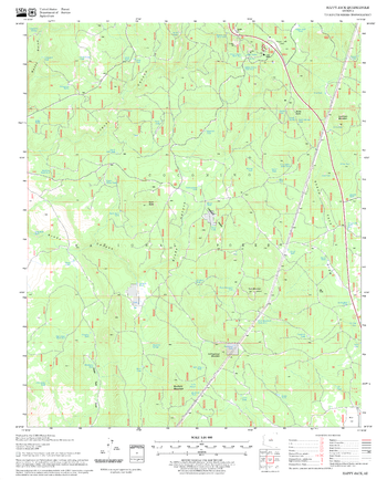
Happy Jack Quadrangle, Arizona
United States Department of Agriculture Forest Service
United States Department of Agriculture Forestry Service topographical map of Happy Jack, Coconino National Forest, Arizona.
Page Size: 21.75 x 27 in (552 x 686 mm)
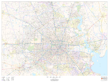
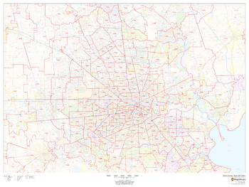
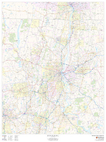
Harris County, Texas
MapSherpa
This map of Harris County, Texas shows regional level information. Base map features include highways and major roads with labelling; railways; high level land use such as parks and recreation areas; and a selection of points of interest including transportation hubs like airports and train stations, tourist information and police stations. ZIP code boundaries are shown as a secondary map feature.
Page Size: 48 x 36 in (1219 x 914 mm)
Harris County, Texas ZIP Codes
MapSherpa
This map of Harris County, Texas shows ZIP code areas overlaid on a road map. Ideal for planning of deliveries, home services, sales territories, real estate and much more. Base map features include all roads with major roads and highways labelled; neighborhood names; railways; and high level land use such as parks and recreation areas, industrial areas and hospital campuses.
Page Size: 48 x 36 in (1219 x 914 mm)
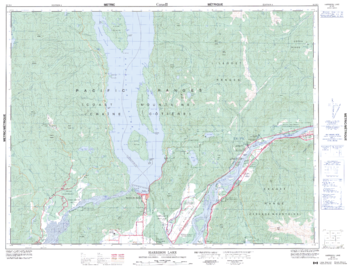
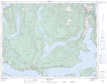
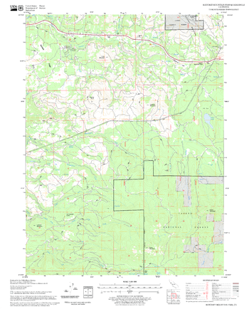
Harrison Lake - 92 H/5 - British Columbia
Natural Resources Canada
Canadian topographic map of Harrison Lake, British Columbia. NTS sheet 092H05 Edition 4.
Page Size: 33.25 x 25.5 in (841 x 643 mm)
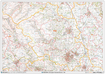
Harrogate - HG - Postcode Wall Map
XYZ Maps
The Harrogate Postcode Sector Wall Map shows detailed postcode sector boundaries (HG1 1, HG1 2) on a comprehensive background and is perfect for determining postcode boundaries for sales areas, planning mailshots and also an excellent reference for logistics. This wall map covers the whole of the HG Postcode Area.
Page Size: 47 x 33.25 in (1189 x 841 mm)
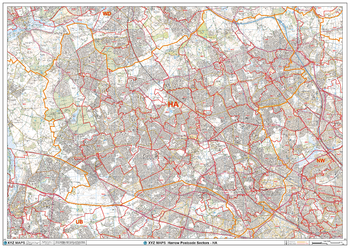
Harrow - HA - Postcode Wall Map
XYZ Maps
The Harrow Postcode Sector Wall Map shows detailed postcode sector boundaries (HA1 1, HA1 2) on a comprehensive background and is perfect for determining postcode boundaries for sales areas, planning mailshots and also an excellent reference for logistics. This wall map covers the whole of the HA Postcode Area.
Page Size: 47 x 33.25 in (1189 x 841 mm)
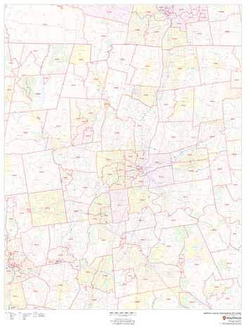
Hartford County, Connecticut
MapSherpa
This map of Hartford County, Connecticut regional level information. Base map features include highways and major roads with labelling; neighborhood names; railways; high level land use such as parks and recreation areas, industrial areas and hospital campuses; and a selection of points of interest including transportation hubs like airports and train stations, tourist information, police stations and shopping centres. ZIP code boundaries are shown as a secondary map feature.
Page Size: 36 x 48 in (914 x 1219 mm)
Hartford County, Connecticut ZIP Codes
MapSherpa
This map of Hartford County, Connecticut shows ZIP code areas overlaid on a road map. Ideal for planning of deliveries, home ervices, sales territories, real estate and much more. Base map features include all roads with major roads and highways labelled; neighborhood names; railways; and high level land use such as parks and recreation areas, industrial areas and hospital campuses.
Page Size: 36 x 48 in (914 x 1219 mm)
Harvey Mountain Quadrangle, California
United States Department of Agriculture Forest Service
United States Department of Agriculture Forestry Service topographical map of Harvey Mountain, Lassen National Forest, California.
Page Size: 21.75 x 27 in (552 x 686 mm)
Haslam Lake - 92 F/16 - British Columbia
Natural Resources Canada
Canadian topographic map of Haslam Lake, British Columbia. NTS sheet 092F16 Edition 2.
Page Size: 32.5 x 25.25 in (820 x 640 mm)
Hat Creek Quadrangle, Idaho
United States Department of Agriculture Forest Service
United States Department of Agriculture Forestry Service topographical map of Hat Creek, Salmon-Chalis National Forest, Idaho.
Page Size: 21.75 x 27 in (552 x 686 mm)
Hatchet Mountain Pass Quadrangle, California
United States Department of Agriculture Forest Service
United States Department of Agriculture Forestry Service topographical map of Hatchet Mountain Pass, Lassen National Forest, California.
Page Size: 21.75 x 27 in (552 x 686 mm)
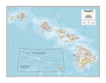
Hawai'i - Atlas of the World, 10th Edition
National Geographic
Page Size: 28 x 22 in (711 x 559 mm)
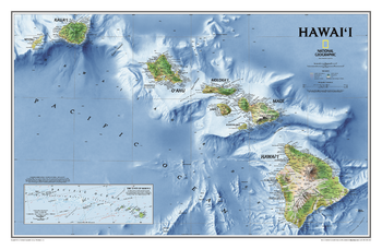
Hawaii
National Geographic
One of our most visually stunning maps, the Hawaii Physical Map shows all eight of the major islands and includes an inset of the entire chain of reefs stretching nearly 3,000 miles across the central Pacific. In addition to showing all of the major land features, the map also shows the Hawaiian Ridge shelves underneath the islands, providing a wonderful perspective on how the islands were formed.
Page Size: 34.75 x 22.75 in (883 x 575 mm)
No search results