


MapSherpa Catalog
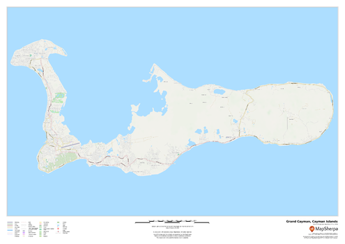
Grand Cayman, Cayman Islands
MapSherpa
This map of Grand Cayman in the Cayman Islands features a full road network for the island including the capital George Town, walking paths, land use, points of interest, and many of the buildings. Useful for the traveller, and as a wall map for display in your home.
Page Size: 33.25 x 23.5 in (841 x 594 mm)
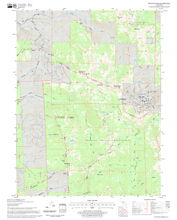
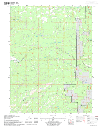
Granite Chief Quadrangle, California
United States Department of Agriculture Forest Service
United States Department of Agriculture Forestry Service topographical map of Granite Chief, Tahoe National Forest, California.
Page Size: 21.75 x 27 in (552 x 686 mm)
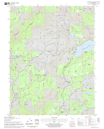
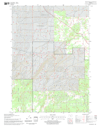
Graniteville Quadrangle, California
United States Department of Agriculture Forest Service
United States Department of Agriculture Forestry Service topographical map of Graniteville, Tahoe National Forest, California.
Page Size: 21.75 x 27 in (552 x 686 mm)
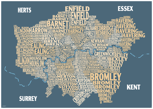
Graphic Map London - boroughs, beige background
Oxford Cartographers
Colourful design-led map using text to show London Boroughs
Page Size: 33.25 x 23.5 in (841 x 594 mm)
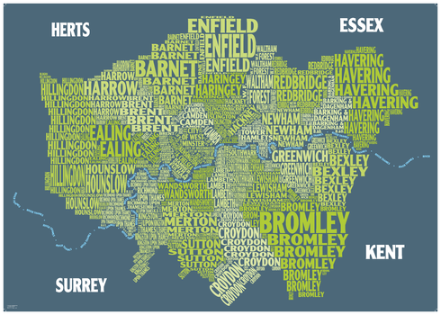
Graphic Map London - boroughs, green background
Oxford Cartographers
Colourful design-led map using text to show London Boroughs
Page Size: 33.25 x 23.5 in (841 x 594 mm)
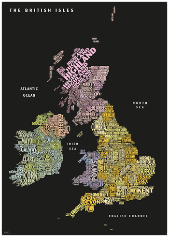
Graphic Map UK - counties, black background
Oxford Cartographers
Colourful design-led map using text to show countries and counties
Page Size: 23.5 x 33.25 in (594 x 841 mm)
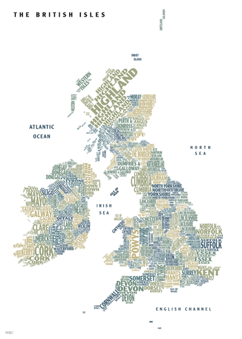
Graphic Map UK - counties, white background
Oxford Cartographers
Colourful design-led map using text to show countries and counties
Page Size: 23.5 x 33.25 in (594 x 841 mm)
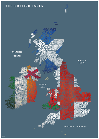
Graphic Map UK - flags
Oxford Cartographers
Colourful design-led map using text to show countries and counties
Page Size: 23.5 x 33.25 in (594 x 841 mm)
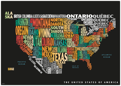
Graphic Map USA - colours, black background
Oxford Cartographers
Colourful design-led map using text to show the states of the USA
Page Size: 33.25 x 23.5 in (841 x 594 mm)
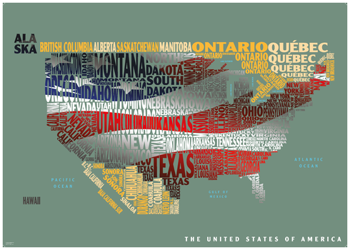
Graphic Map USA - flag
Oxford Cartographers
Colourful design-led map using text to show the states of the USA
Page Size: 33.25 x 23.5 in (841 x 594 mm)
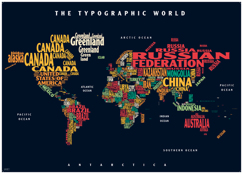
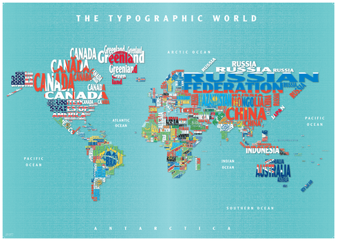
Graphic Map World - colours, black background
Oxford Cartographers
Colourful map using text to show the countries of the World
Page Size: 33.25 x 23.5 in (841 x 594 mm)
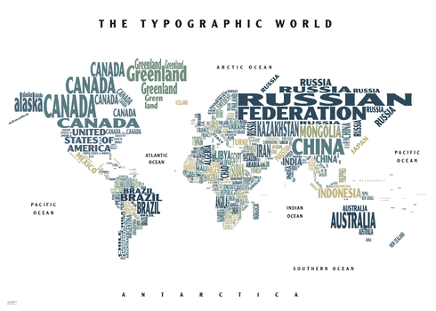
Graphic Map World - colours, white background
Oxford Cartographers
Colourful map using text to show the countries of the World
Page Size: 33.25 x 23.5 in (841 x 594 mm)
Graphic Map World - flags
Oxford Cartographers
Colourful map using text to show the countries of the World
Page Size: 34.25 x 24.5 in (864 x 617 mm)
Grass Well Quadrangle, Oregon
United States Department of Agriculture Forest Service
United States Department of Agriculture Forestry Service topographical map of Grass Well, Deschutes National Forest, Oregon.
Page Size: 21.75 x 27 in (552 x 686 mm)
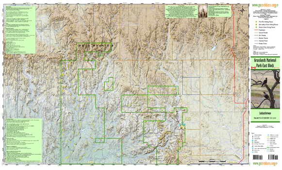
Grasslands National Park East
GoTrekkers
Grasslands National Park East
Page Size: 41.5 x 25 in (1054 x 635 mm)
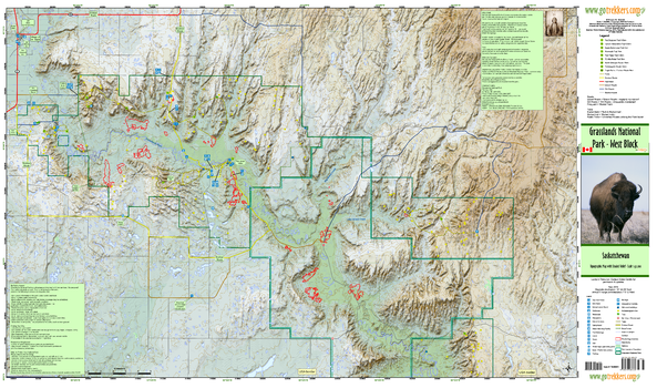
Grasslands National Park West
GoTrekkers
Grasslands National Park West
Page Size: 41.5 x 24.5 in (1054 x 622 mm)
Grays Peak Quadrangle, California
United States Department of Agriculture Forest Service
United States Department of Agriculture Forestry Service topographical map of Grays Peak, Lassen National Forest, California.
Page Size: 21.75 x 27 in (552 x 686 mm)
Great Britain A-Z Road Map
A-Z Maps
The Great Britain A-Z road map is a detailed full colour road map of Great Britain. The following features are shown on the road mapping: motorways with full junction detail; service areas; primary routes and destinations; A & B roads, selected minor roads; gradients 1:5 and steeper; tolls; mileages; national and county boundaries; and spot heights. A wide range of ancillary and tourist information, including points of interest such as golf courses, castles and country parks are included on the map.
Great Britain A-Z Street Map
A-Z Maps
The Great Britain A-Z Street Map provides street level coverage for all of England. Scotland coverage includes the corridor between Edinburgh-Glasgow-Greenock, Perth, Dundee, Aberdeen and Inverness, as well as select smaller localities. Coverage in Wales includes South Wales, and Caernarfon, Bangor, Conwy and Llandudno in the north.The full colour street mapping has a wealth of information, including one-way streets, walking and bicycle paths, National Rail and London Underground stations, and River Bus piers. Selected places of interest identified on the map include theatres, cinemas, museums and tourist attractions.
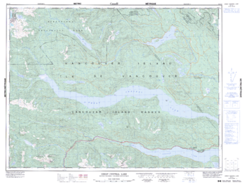
Great Central Lake - 92 F/6 - British Columbia
Natural Resources Canada
Canadian topographic map of Great Central Lake, British Columbia. NTS sheet 092F06 Edition 5.
Page Size: 34 x 25.5 in (863 x 647 mm)
No search results