


MapSherpa Catalog
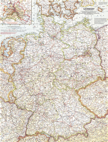
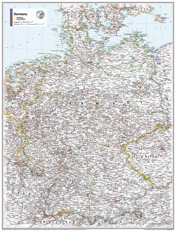
Germany - Published 1959
National Geographic
Germany enjoyed prolonged economic growth in the 1950s, so much so that the term Wirtschaftswunder, meaning "economic miracle", was coined to describe the upturn experienced by the economy after World War II. Discover the thriving, yet divided country of Germany with this detailed map published in June 1959.
Page Size: 19 x 25 in (480 x 631 mm)
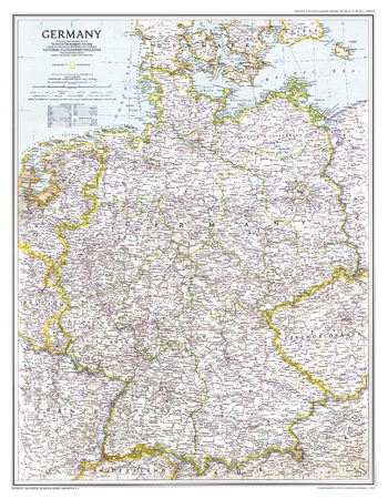
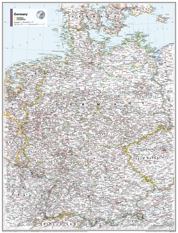
Germany - Published 1991
National Geographic
This map shows the political boundaries of Germany after the fall of the Berlin Wall and the country's reunification after the Cold War. Published in September 1991 with the companion map "Travelers Map of Germany" and the article "The Morning After: Germany Reunited".
Page Size: 20.25 x 26 in (513 x 659 mm)
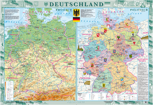
Germany (Deutschland) Wall Map - Physical and Political - German - Extra Large
Kartographia
This decorative wall map of Germany (in German) includes both a physical map “PHYSISCH” and political map “POLITISCH”.
The physical map illustrates the relief of the country. Landmarks identified include famous nature monuments, natural parks and reserves, zoos, historical and archeological features, caves, climatic spas, ski resorts and other interesting features.
The political map highlights the German Federal States. Points of interest identified include architectural and historical monuments, middle age abbeys, palaces and castles, museums, theaters and exhibitions, universities, places of birth of prominent people and other interesting features. Special attention is given to UNESCO world heritage monuments.
Page Size: 62.25 x 42.75 in (1580 x 1080 mm)
Germany - Atlas of the World, 10th Edition
National Geographic
null
Page Size: 22 x 28 in (559 x 711 mm)
Germany - Atlas of the World, 11th Edition
National Geographic
This Germany map of physical and political features can fit in any space. Showcasing the countries in stunning detail with state-of-the-art cartographic techniques delivering accuracy and exceptional quality, the innovative and engaging design makes the content easily accessible and user-friendly.
Ideal for classrooms with an emphasis on teaching geography or environmental themes. The inclusion of physical features gives your students a genuine feel for how our world appears.
This map uses a bright, easy to read color palette featuring blue oceans and stunning shaded relief that has been featured on National Geographic wall maps for over 75 years. It is drawn in the Albers Conic Equal-Area projection, which uses two standard parallels between which distortion is minimized, however scale and shape is not preserved.
Names of geographic features are carefully placed on the map to maintain legibility.
This map is found in National Geographic's 11th Edition World Atlas and is now available as a stand alone product.
Page Size: 24 x 31.5 in (610 x 798 mm)
Germany - Atlas of the World, 11th Edition - Compact
National Geographic
This Germany map of physical and political features can fit in any space. Showcasing the countries in stunning detail with state-of-the-art cartographic techniques delivering accuracy and exceptional quality, the innovative and engaging design makes the content easily accessible and user-friendly.
Ideal for classrooms with an emphasis on teaching geography or environmental themes. The inclusion of physical features gives your students a genuine feel for how our world appears.
This map uses a bright, easy to read color palette featuring blue oceans and stunning shaded relief that has been featured on National Geographic wall maps for over 75 years. It is drawn in the Albers Conic Equal-Area projection, which uses two standard parallels between which distortion is minimized, however scale and shape is not preserved.
Names of geographic features are carefully placed on the map to maintain legibility.
This map is found in National Geographic's 11th Edition World Atlas and is now available as a stand alone product.
Page Size: 16.25 x 21.5 in (413 x 540 mm)
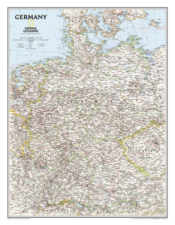
Germany Classic
National Geographic
Complete political detail of Germany - country boundaries, roads and cities, airports, bodies of water, and other geographic details.
Page Size: 23.5 x 30.25 in (597 x 768 mm)
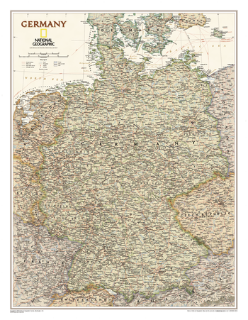
Germany Executive
National Geographic
Our executive style political map of Germany features country boundaries, place names, bodies of water, airports, major highways and roads, and much more.
Page Size: 23.5 x 30.25 in (597 x 768 mm)
Germany Streets
MapSherpa
Multi-scale product for Germany based on OpenStreetMap content. Appropriate for street, city and regional level mapping starting from 1:10,000 and up.
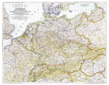
Germany and Its Approaches 1938-1939 - Published 1944
National Geographic
A must-have for those interested in World War II, this informative map was published in July 1944 with an article entitled "Landing Craft for Invasion." This work shows the international boundaries as of Sept. 1, 1939, the day Germany invaded Poland, and boundaries as of Jan. 1, 1938, before Germany seized Austria and Czechoslovakia.
Page Size: 33.75 x 26.5 in (852 x 669 mm)
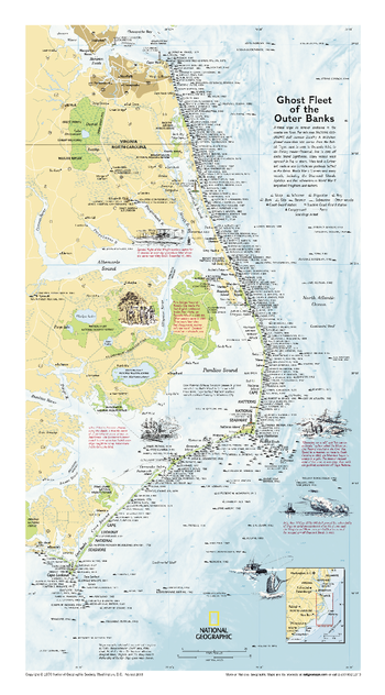
Ghost Fleet of the Outer Banks 1970 Map - Published 2008
National Geographic
Originally printed for the National Geographic Magazine in 1970, this map plots over 500 ill-fated ships that lie forever anchored in the Atlantic coastal sea floor. A classic shipwreck map of one of the graveyards of the Atlantic.
Page Size: 11.75 x 21.25 in (296 x 534 mm)
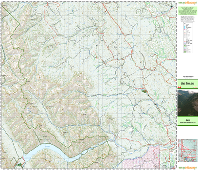
Ghost River Area
GoTrekkers
Ghost River Area
Page Size: 41.5 x 35.5 in (1054 x 902 mm)
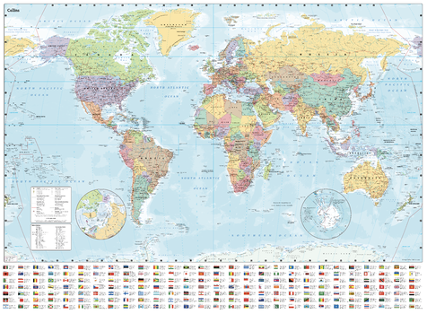
Giant World Wall Map (101 x 138 cm): Paper map with flags, capital cities, and countries of the world
Collins
Fully updated world map to include the latest political changes. The map contains politically coloured mapping which shows each country and their capital city, major roads, railways and cities and towns clearly. Also included are national flags, key statistics for every country and inset maps of the polar regions. Great poster for any classroom, bedroom or office wall.
Size: 1015 x 1380 mm (40 x 54 inches)
Scale: 1:22 000 000; 1 cm to 220 km; 1 inch to 347 miles
Page Size: 54.5 x 40 in (1380 x 1015 mm)
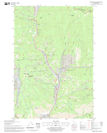
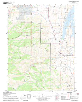
Gibbonsville Quadrangle, Idaho
United States Department of Agriculture Forest Service
United States Department of Agriculture Forestry Service topographical map of Gibbonsville, Salmon-Chalis National Forest, Idaho.
Page Size: 21.75 x 27 in (552 x 686 mm)
Gibraltar
MapSherpa
This map of Gibraltar features a full detailed road network for the island, walking paths, land use, points of interest, and almost all buildings. Useful for the traveller, and as a wall map for display in your home.
Page Size: 33.25 x 47 in (841 x 1189 mm)
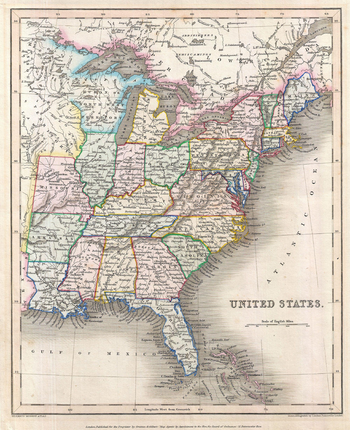
Gilbert Map of the United States (1843)
Artokoloro
Map of the United States from the 1843 edition of Gilbert's Modern Atlas. Map title: United States
Page Size: 11 x 13.5 in (278 x 341 mm)
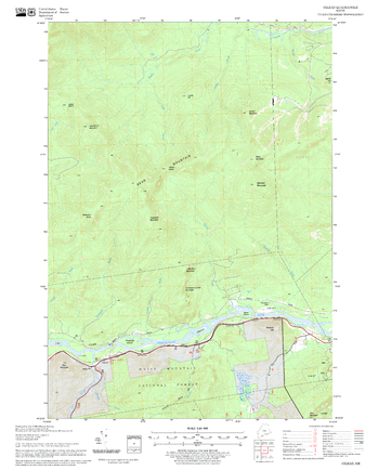
Gilead Quadrangle, New Hampshire-Vermont
United States Department of Agriculture Forest Service
United States Department of Agriculture Forestry Service topographical map of Gilead, White Mountains National Forest, New Hampshire-Vermont.
Page Size: 21.75 x 27 in (552 x 686 mm)
Gilmore Peak Quadrangle, California
United States Department of Agriculture Forest Service
United States Department of Agriculture Forestry Service topographical map of Gilmore Peak, Mendocino National Forest, California.
Page Size: 21.75 x 27 in (552 x 686 mm)
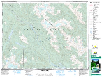
Glacier Lake - 92 G/16 - British Columbia
Natural Resources Canada
Canadian topographic map of Glacier Lake, British Columbia. NTS sheet 092G16 Edition 3.
Page Size: 34.25 x 26 in (869 x 659 mm)
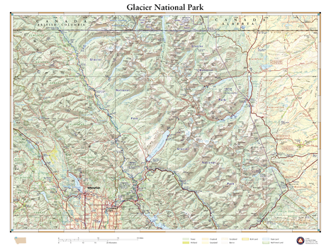
Glacier National Park
Benchmark Maps
This wall map details the rugged landscapes of Glacier National Park, the crown jewel of Montana’s Rocky Mountains. Map features include public land ownership, recreation points of interest, campgrounds, peak and river names, and the network of highways and back roads that provide access to this stunning mountainous region at the U.S. – Canada border.
Page Size: 26 x 34.75 in (660 x 880 mm)
No search results