top of page
Germany and Its Approaches 1938-1939 - Published 1944
National Geographic
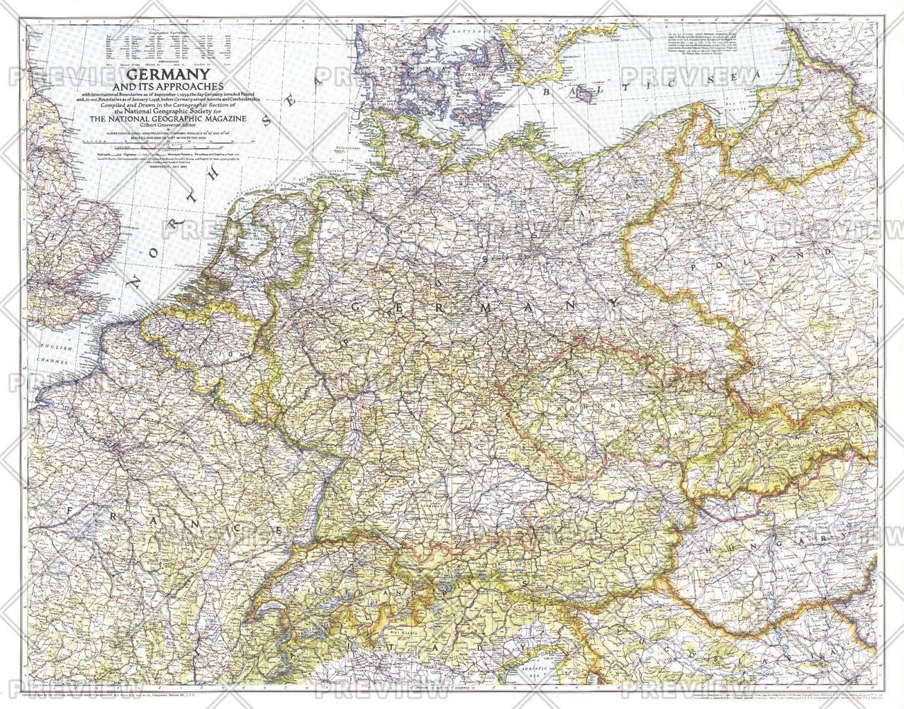
A must-have for those interested in World War II, this informative map was published in July 1944 with an article entitled "Landing Craft for Invasion." This work shows the international boundaries as of Sept. 1, 1939, the day Germany invaded Poland, and boundaries as of Jan. 1, 1938, before Germany seized Austria and Czechoslovakia.
Page Size: 33.75 x 26.5 in (852 x 669 mm)
Buy this map on MapTrove.ca or MapTrove.com
bottom of page