


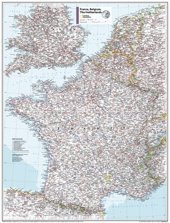
MapSherpa Catalog
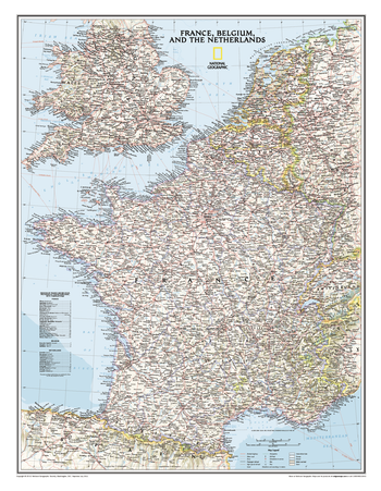
France, Belgium, and The Netherlands Classic
National Geographic
Classic wall map of France, Belgium, and the Netherlands shows political boundaries, major highways and roads, cities and towns, national parks, and a wealth of other accurate geographic detail.
Page Size: 23.5 x 30.25 in (597 x 768 mm)
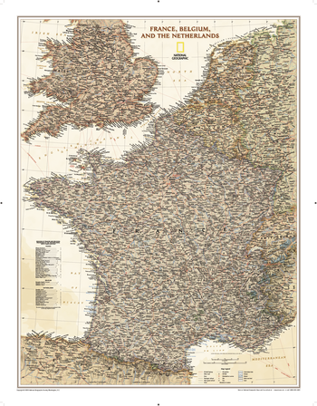
France, Belgium, and The Netherlands Executive
National Geographic
Our executive style political map of France, Belgium, and the Netherlands features country boundaries, place names, bodies of water, airports, major highways and roads, and much more.
Page Size: 24.25 x 31 in (612 x 783 mm)
France, Belgium, the Netherlands - Atlas of the World, 10th Edition
National Geographic
null
Page Size: 22 x 28 in (559 x 711 mm)
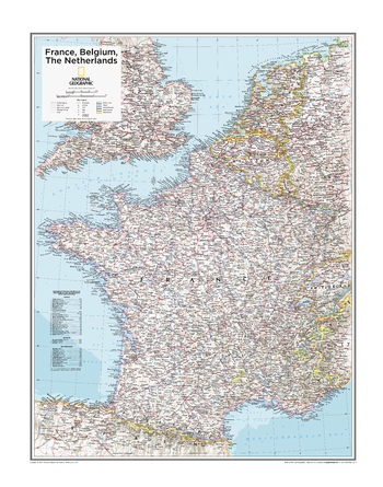
France, Belgium, the Netherlands - Atlas of the World, 11th Edition
National Geographic
This France, Belgium and the Netherlands map of physical and political features can fit in any space. Showcasing the countries in stunning detail with state-of-the-art cartographic techniques delivering accuracy and exceptional quality, the innovative and engaging design makes the content easily accessible and user-friendly.
Ideal for classrooms with an emphasis on teaching geography or environmental themes. The inclusion of physical features gives your students a genuine feel for how our world appears.
This map uses a bright, easy to read color palette featuring blue oceans and stunning shaded relief that has been featured on National Geographic wall maps for over 75 years. It is drawn in the Albers Conic Equal-Area projection, which uses two standard parallels between which distortion is minimized, however scale and shape is not preserved.
Names of geographic features are carefully placed on the map to maintain legibility. Details on the regions and provinces of these countries add to this classic map.
This map is found in National Geographic's 11th Edition World Atlas and is now available as a stand alone product.
Page Size: 24 x 31.5 in (610 x 798 mm)
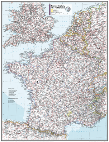
France, Belgium, the Netherlands - Atlas of the World, 11th Edition - Compact
National Geographic
This France, Belgium and the Netherlands map of physical and political features can fit in any space. Showcasing the countries in stunning detail with state-of-the-art cartographic techniques delivering accuracy and exceptional quality, the innovative and engaging design makes the content easily accessible and user-friendly.
Ideal for classrooms with an emphasis on teaching geography or environmental themes. The inclusion of physical features gives your students a genuine feel for how our world appears.
This map uses a bright, easy to read color palette featuring blue oceans and stunning shaded relief that has been featured on National Geographic wall maps for over 75 years. It is drawn in the Albers Conic Equal-Area projection, which uses two standard parallels between which distortion is minimized, however scale and shape is not preserved.
Names of geographic features are carefully placed on the map to maintain legibility. Details on the regions and provinces of these countries add to this classic map.
This map is found in National Geographic's 11th Edition World Atlas and is now available as a stand alone product.
Page Size: 16.25 x 21.5 in (413 x 540 mm)
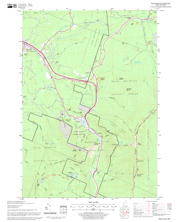
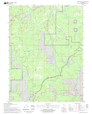
Franconia Quadrangle, New Hampshire-Vermont
United States Department of Agriculture Forest Service
United States Forestry Service topographical map of Franconia, New Hampshire-Vermont
Page Size: 21.75 x 27 in (552 x 686 mm)
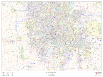
Franklin County, Ohio
MapSherpa
This map of Franklin County, Ohio shows regional level information. Base map features include highways and major roads with labelling; neighborhood names; railways; high level land use such as parks and recreation areas, industrial areas and hospital campuses; and a selection of points of interest including transportation hubs like airports and train stations, tourist information, police stations and shopping centres. ZIP code boundaries are shown as a secondary map feature.
Page Size: 48 x 36 in (1219 x 914 mm)
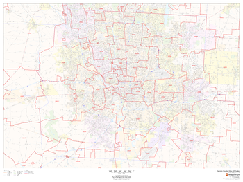
Franklin County, Ohio ZIP Codes
MapSherpa
This map of Franklin County, Ohio shows ZIP code areas overlaid on a road map. Ideal for planning of deliveries, home services, sales territories, real estate and much more. Base map features include all roads with major roads and highways labelled; neighborhood names; railways; and high level land use such as parks and recreation areas, industrial areas and hospital campuses.
Page Size: 48 x 36 in (1219 x 914 mm)
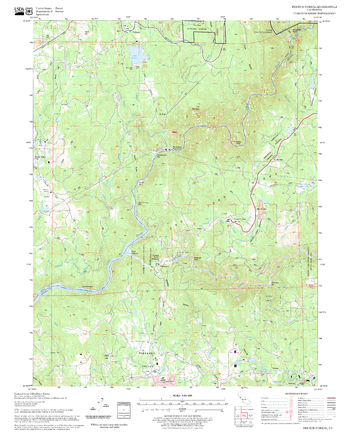
Fredonyer Pass Quadrangle, California
United States Department of Agriculture Forest Service
United States Department of Agriculture Forestry Service topographical map of Fredonyer Pass, Lassen National Forest, California.
Page Size: 21.75 x 27 in (552 x 686 mm)
French Corral Quadrangle, California
United States Department of Agriculture Forest Service
United States Department of Agriculture Forestry Service topographical map of French Corral, Tahoe National Forest, California.
Page Size: 21.75 x 27 in (552 x 686 mm)
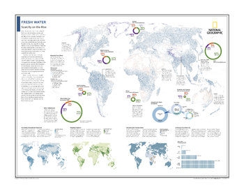
Fresh Water: Scarcity on the Rise - Atlas of the World, 10th Edition
National Geographic
Mapping Fresh Water; Water Withdrawals; Visualizing Groundwater Resources; Mapping Irrigation; Securing Safe Drinking Water; Assessing True Water Use
Page Size: 28 x 22 in (711 x 559 mm)
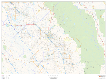
Fresno County, California
MapSherpa
This map of Fresno County, California shows regional level information. Base map features include highways and major roads with highway numbering and high level land use such as parks and recreation areas.
Page Size: 48 x 36 in (1219 x 914 mm)
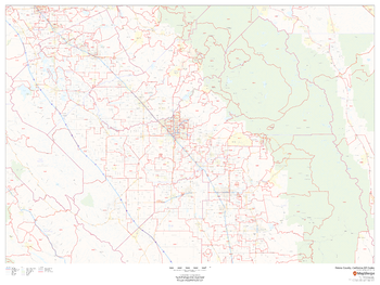
Fresno County, California ZIP Codes
MapSherpa
This map of Fresno County, California shows ZIP code areas overlaid on a road map. Ideal for planning of deliveries, home services, sales territories, real estate and much more. Base map features include all roads with major roads and highways labelled; neighborhood names; railways; and high level land use such as parks and recreation areas, industrial areas and hospital campuses.
Page Size: 48 x 36 in (1219 x 914 mm)
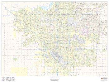
Fresno, California Inner Metro - Landscape
MapSherpa
This landscape-oriented map of central Fresno, California shows detailed street level information including extensive street labeling. Ideal for planning of deliveries, home services, sales territories, real estate and much more. Base map features include all roads with major roads and highways labelled; neighborhood names; railways; high level land use such as parks and recreation areas, industrial areas and hospital campuses; and a variety of points of interest including schools, libraries, stadiums, museums, border crossings and more.
Page Size: 48 x 36 in (1219 x 914 mm)
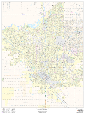
Fresno, California Inner Metro - Portrait
MapSherpa
This portrait-oriented map of central Fresno, California shows detailed street level information including extensive street labeling. Ideal for planning of deliveries, home services, sales territories, real estate and much more. Base map features include all roads with major roads and highways labelled; neighborhood names; railways; high level land use such as parks and recreation areas, industrial areas and hospital campuses; and a variety of points of interest including schools, libraries, stadiums, museums, border crossings and more.
Page Size: 36 x 48 in (914 x 1219 mm)
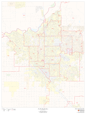
Fresno, California ZIP Codes
MapSherpa
This map of Fresno, California shows ZIP code areas overlaid on a road map. Ideal for planning of deliveries, home services, sales territories, real estate and much more. Base map features include all roads with major roads and highways labelled; neighborhood names; railways; and high level land use such as parks and recreation areas, industrial areas and hospital campuses.
Page Size: 36 x 48 in (914 x 1219 mm)
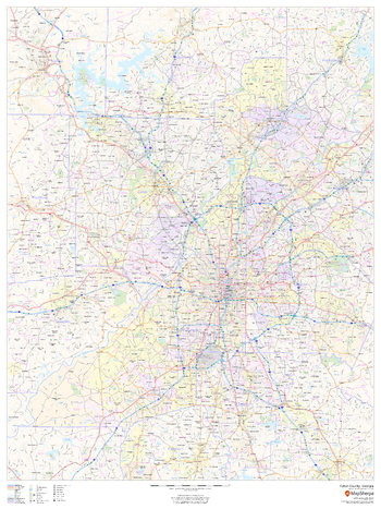
Fulton County, Georgia
MapSherpa
This map of Fulton County, Georgia shows regional level information. Base map features include highways and major roads with labelling; railways; high level land use such as parks and recreation areas; and a selection of points of interest including transportation hubs like airports and train stations, tourist information and police stations. ZIP code boundaries are shown as a secondary map feature.
Page Size: 36 x 48 in (914 x 1219 mm)
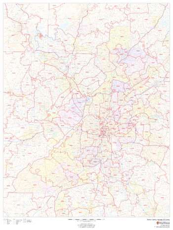
Fulton County, Georgia ZIP Codes
MapSherpa
This map of Fulton County, Georgia shows ZIP code areas overlaid on a road map. Ideal for planning of deliveries, home services, sales territories, real estate and much more. Base map features include all roads with major roads and highways labelled; neighborhood names; railways; and high level land use such as parks and recreation areas, industrial areas and hospital campuses.
Page Size: 36 x 48 in (914 x 1219 mm)
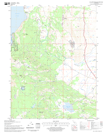
Fuzztail Butte Quadrangle, Oregon
United States Department of Agriculture Forest Service
United States Department of Agriculture Forestry Service topographical map of Fuzztail Butte, Deschutes National Forest, Oregon.
Page Size: 21.75 x 27 in (552 x 686 mm)
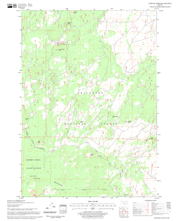
Gallatin Peak Quadrangle, California
United States Department of Agriculture Forest Service
United States Department of Agriculture Forestry Service topographical map of Gallatin Peak, Lassen National Forest, California.
Page Size: 21.75 x 27 in (552 x 686 mm)
No search results