


MapSherpa Catalog
Eastern Québec
Lucidmap
Create custom regional maps in Canada from this series of attractive detailed road maps covering most of the populated areas across Canada. Maps are developed from Lucidmap’s iconic Canadian cartography. Coverage in eastern Québec is along the Saint Lawrence river from Cap-Chat to Lotbinèire along the southern shore, and Rivière-Portneuf to Deschambault on the northern shore. The southern boundary of the map is the Canada-USA border. The area around the Saguenay River to Lac Saint-Jean is also included. Native scale is 1:250,000.
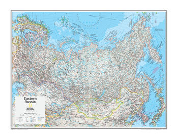
Eastern Russia - Atlas of the World, 10th Edition
National Geographic
null
Page Size: 28 x 22 in (711 x 559 mm)
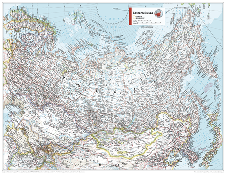
Eastern Russia - Atlas of the World, 11th Edition
National Geographic
This Eastern Russia area map of physical and political features can fit in any space. Showcasing the region in stunning detail with state-of-the-art cartographic techniques delivering accuracy and exceptional quality, the innovative and engaging design makes the content easily accessible and user-friendly.
Ideal for classrooms with an emphasis on teaching geography or environmental themes. The inclusion of physical features gives your students a genuine feel for how our world appears.
This map uses a bright, easy to read color palette featuring blue oceans and stunning shaded relief that has been featured on National Geographic wall maps for over 75 years. Drawn in the Two-Point Equidistant Projection, this map ensures that all points are at proportionally correct distances from two points chosen by the cartographer.
Names of geographic features are carefully placed on the map to maintain legibility.
This map is found in National Geographic's 11th Edition World Atlas and is now available as a stand alone product.
Page Size: 31.5 x 24 in (798 x 610 mm)
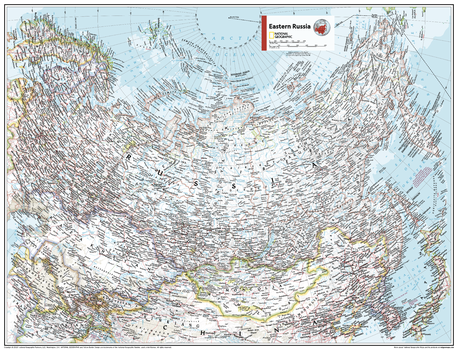
Eastern Russia - Atlas of the World, 11th Edition - Compact
National Geographic
This Eastern Russia area map of physical and political features can fit in any space. Showcasing the region in stunning detail with state-of-the-art cartographic techniques delivering accuracy and exceptional quality, the innovative and engaging design makes the content easily accessible and user-friendly.
Ideal for classrooms with an emphasis on teaching geography or environmental themes. The inclusion of physical features gives your students a genuine feel for how our world appears.
This map uses a bright, easy to read color palette featuring blue oceans and stunning shaded relief that has been featured on National Geographic wall maps for over 75 years. Drawn in the Two-Point Equidistant Projection, this map ensures that all points are at proportionally correct distances from two points chosen by the cartographer.
Names of geographic features are carefully placed on the map to maintain legibility.
This map is found in National Geographic's 11th Edition World Atlas and is now available as a stand alone product.
Page Size: 21.5 x 16.25 in (540 x 413 mm)
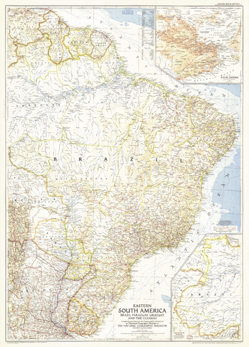
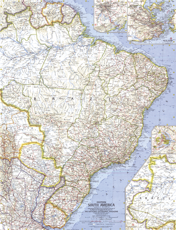
Eastern South America - Published 1955
National Geographic
This map of Eastern South America map features an inset of Rio de Janeiro. Published in March 1955 with two articles on the region including "Spectacular Rio de Janeiro" and "Life Among the Wai Wai Indians." A fine companion to the map of 1958 Southern South America.
Page Size: 29 x 40.5 in (735 x 1026 mm)
Eastern South America - Published 1962
National Geographic
This map of the Eastern part of South America features inset maps of the cities of Brasilia, Rio de Janeiro, and Sao Paulo. Published in September 1962 with the article "Brazil, Oba!" A fine companion to the 1964 map of Northwestern South America.
Page Size: 19 x 25 in (481 x 630 mm)
Eastern South America - Atlas of the World, 10th Edition
National Geographic
Brazil, French Guiana (France), Paraguay, Suriname
Page Size: 22 x 28 in (559 x 711 mm)
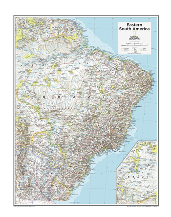
Eastern South America - Atlas of the World, 11th Edition
National Geographic
This Eastern South America map of physical and political features can fit in any space. Showcasing the region in stunning detail with state-of-the-art cartographic techniques delivering accuracy and exceptional quality, the innovative and engaging design makes the content easily accessible and user-friendly.
Ideal for classrooms with an emphasis on teaching geography or environmental themes. The inclusion of physical features gives your students a genuine feel for how our world appears.
This map uses a bright, easy to read color palette featuring blue oceans and stunning shaded relief that has been featured on National Geographic wall maps for over 75 years. Drawn in the Azimuthal Equidistant projection, this map ensures that all points on the map are at proportionally correct distances from the center point.
Names of geographic features are carefully placed on the map to maintain legibility.
This map is found in National Geographic's 11th Edition World Atlas and is now available as a stand alone product.
Page Size: 24 x 31.5 in (610 x 798 mm)

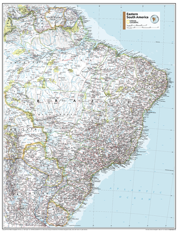
Eastern South America - Atlas of the World, 11th Edition - Compact
National Geographic
This Eastern South America map of physical and political features can fit in any space. Showcasing the region in stunning detail with state-of-the-art cartographic techniques delivering accuracy and exceptional quality, the innovative and engaging design makes the content easily accessible and user-friendly.
Ideal for classrooms with an emphasis on teaching geography or environmental themes. The inclusion of physical features gives your students a genuine feel for how our world appears.
This map uses a bright, easy to read color palette featuring blue oceans and stunning shaded relief that has been featured on National Geographic wall maps for over 75 years. Drawn in the Azimuthal Equidistant projection, this map ensures that all points on the map are at proportionally correct distances from the center point.
Names of geographic features are carefully placed on the map to maintain legibility.
This map is found in National Geographic's 11th Edition World Atlas and is now available as a stand alone product.
Page Size: 16.25 x 21.5 in (413 x 540 mm)
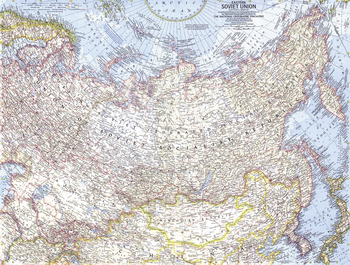
Eastern Soviet Union - Published 1967
National Geographic
This map of the eastern portion of the Soviet Union features many physical and political details, including the country's boundaries in 1938 and the northern limits of wooded country. Published in March 1967 with the article "Siberia: Russia's Frozen Frontier."
Page Size: 25 x 19 in (631 x 478 mm)
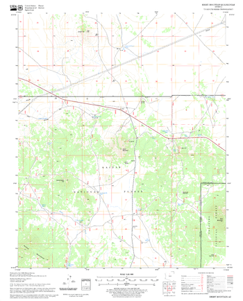
Ebert Mountain Quadrangle, Arizona
United States Department of Agriculture Forest Service
United States Department of Agriculture Forestry Service topographical map of Ebert Mountain, Coconino National Forest, Arizona.
Page Size: 21.75 x 27 in (552 x 686 mm)
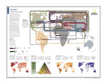
Economy: Straining Financial Links - Atlas of the World, 10th Edition
National Geographic
Tracking World Merchandise Trade, 2012; Charting Imports and Exports; Locating Global Wealth; Economic Engines; Identifying Wealth Disparities; Calculating External Debt
Page Size: 28 x 22 in (711 x 559 mm)
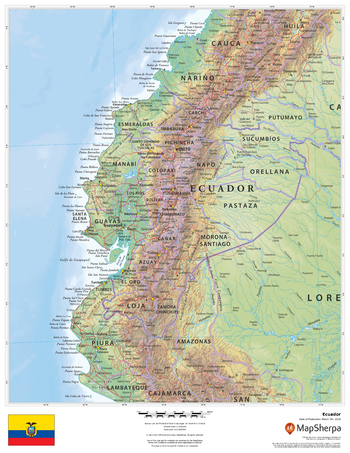
Ecuador
MapSherpa
This beautiful map shows physical and political features for Ecuador and surrounding areas. Relief shading and the use of different colours by height above sea level are both informative and attractive.
Page Size: 17 x 22 in (432 x 559 mm)
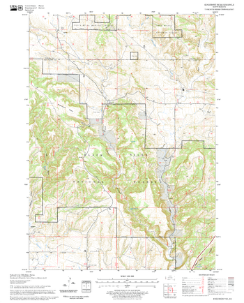
Edgemont NE Quadrangle, South Dakota
United States Department of Agriculture Forest Service
United States Department of Agriculture Forestry Service topographical map of Edgemont NE, Black Hills National Forest, South Dakota.
Page Size: 21.75 x 27 in (552 x 686 mm)
Edgemont Quadrangle, South Dakota
United States Department of Agriculture Forest Service
United States Department of Agriculture Forestry Service topographical map of Edgemont, Black Hills National Forest, South Dakota.
Page Size: 21.75 x 27 in (552 x 686 mm)

Edinburgh - EH - Postcode Wall Map
XYZ Maps
The Edinburgh Postcode Sector Wall Map shows detailed postcode sector boundaries (EH1 1, EH1 2) on a comprehensive background and is perfect for determining postcode boundaries for sales areas, planning mailshots and also an excellent reference for logistics. This wall map covers the whole of the EH Postcode Area.
Page Size: 47 x 33.25 in (1189 x 841 mm)

Edinburgh City Centre Postcode Sectors Wall Map (C6)
XYZ Maps
The Edinburgh City Centre Postcode Sector Wall Map shows detailed postcode sector boundaries along with its associated label(EH1 1, EH1 2) on a comprehensive background and is perfect for determining postcode boundaries, for sales, logistics, planning mailshots or as a regional reference guide.
Page Size: 47 x 33.25 in (1189 x 841 mm)
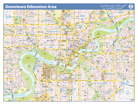
Edmonton Downtown
Lucidmap
Map of downtown Edmonton showing all roads, road names, political boundaries, transit, points of interest, parks, schools, churches, public buildings and landmarks.
Page Size: 28 x 40 in (711 x 1016 mm)
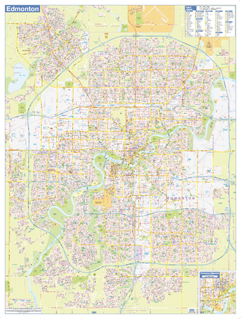
Edmonton Downtown - Compact
Lucidmap
Map of downtown Edmonton showing all roads, road names, political boundaries, transit, points of interest, parks, schools, churches, public buildings and landmarks.
Page Size: 21.5 x 16.25 in (546 x 413 mm)
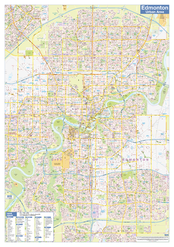
Edmonton Wall Map - Street Detail - Large
Lucidmap
This large wall map shows highly detailed local information for the city of Edmonton. Full street labeling along with transit information, parks, schools, churches and landmarks throughout the city are displayed.
The map has been designed in a very clear and legible manner with a traditional Canadian street map style embraced by map buyers over many years.
Page Size: 37 x 49 in (940 x 1245 mm)
No search results