


MapSherpa Catalog
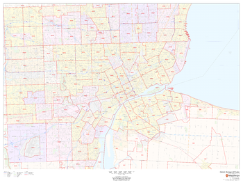
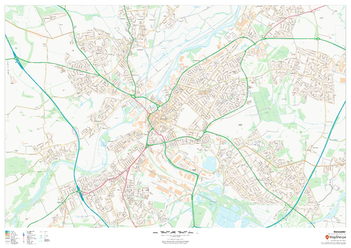
Detroit, Michigan ZIP Codes
MapSherpa
This map of Detroit shows ZIP code areas overlaid on a road map. Ideal for planning of deliveries, home services, sales territories, real estate and much more. Base map features include all roads with major roads and highways labelled; neighborhood names; railways; and high level land use such as parks and recreation areas, industrial areas and hospital campuses.
Page Size: 48 x 36 in (1219 x 914 mm)
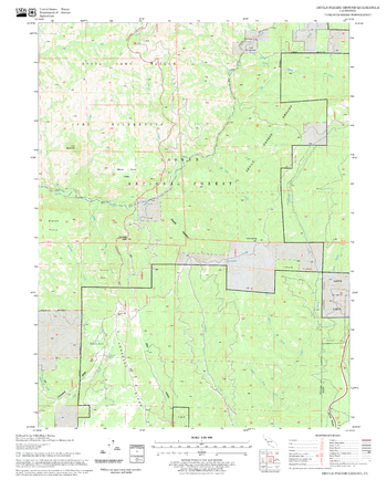
Devils Parade Ground Quadrangle, California
United States Department of Agriculture Forest Service
United States Department of Agriculture Forestry Service topographical map of Devils Parade Ground, Lassen National Forest, California.
Page Size: 21.75 x 27 in (552 x 686 mm)
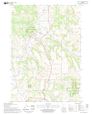
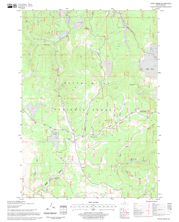
Devils Tower Quadrangle, South Dakota
United States Department of Agriculture Forest Service
United States Department of Agriculture Forestry Service topographical map of Devils Tower, Black Hills National Forest, South Dakota.
Page Size: 21.75 x 27 in (552 x 686 mm)

Devon County Map
XYZ Maps
This is a large ceremonial county map of Devon highlighting the county border, with the surrounding area faded out for excellent contrast. The map covers Axminster, Barnstaple, Bideford, Dartmouth, Exeter, Exmouth, Ilfracombe, Newton Abbot, Plymouth, Sidmouth, Torquay, Paignton, Tiverton, Newton Abbot and Tavistock. The county map shows the latest County and Unitary Authority Boundaries, overlaid on a clear and easy to read Ordnance Survey map.
Page Size: 33.25 x 47 in (841 x 1189 mm)

Devon, Dorset & Somerset Postcode Sector Wall Map (S2)
XYZ Maps
The Devon, Dorset & Somerset Postcode Sector Wall Map shows detailed postcode sector boundaries along with its associated label (TA1 1, TA1 2) on a comprehensive background and is perfect for determining postcode boundaries, for sales, logistics, planning mailshots or as a regional reference guide.
Page Size: 47 x 33.25 in (1189 x 841 mm)
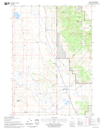
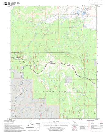
Dewey Quadrangle, South Dakota
United States Department of Agriculture Forest Service
United States Department of Agriculture Forestry Service topographical map of Dewey, Black Hills National Forest, South Dakota.
Page Size: 21.75 x 27 in (552 x 686 mm)
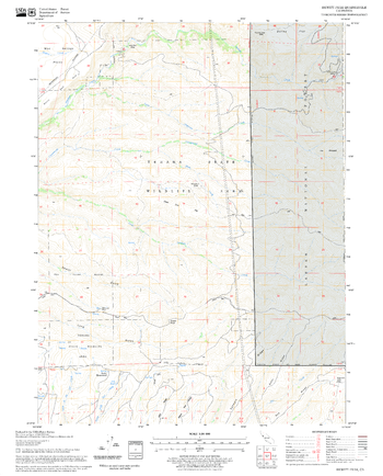
Dewitt Peak Quadrangle, California
United States Department of Agriculture Forest Service
United States Department of Agriculture Forestry Service topographical map of Dewitt Peak, Lassen National Forest, California.
Page Size: 21.75 x 27 in (552 x 686 mm)
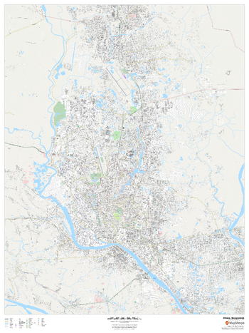
Dhaka, Bangladesh
MapSherpa
This detailed street map of Dhaka, Bangladesh shows the full road and rail networks, points of interest, and land use across the city. Useful for businesses operating in the city, or as consumer memorabilia of the city.
Page Size: 36 x 48 in (914 x 1219 mm)
Diamond Mountain Quadrangle, California
United States Department of Agriculture Forest Service
United States Department of Agriculture Forestry Service topographical map of Diamond Mountain, Lassen National Forest, California.
Page Size: 21.75 x 27 in (552 x 686 mm)
Dickson Range - 92 J/14 - British Columbia
Natural Resources Canada
Canadian topographic map of Dickson Range, British Columbia. NTS sheet 092J14 Edition 1.
Page Size: 32 x 25.5 in (811 x 645 mm)
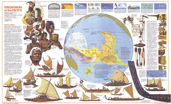
Discoverers of the Pacific - Published 1974
National Geographic
The Discoverers of the Pacific map was published in December 1974 as half of a two-map set with the Islands of the Pacific map and the article "The Coming of the Polynesians." An educational work, this map contains an abundance of information about Pacific Islanders, their shipbuilding techniques, types of canoes, and how they navigated using the stars, birds, and other natural data.
Page Size: 37 x 22.75 in (940 x 573 mm)
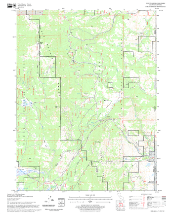
Ditch Creek Quadrangle, South Dakota
United States Department of Agriculture Forest Service
United States Department of Agriculture Forestry Service topographical map of Ditch Creek, Black Hills National Forest, South Dakota.
Page Size: 21.75 x 27 in (552 x 686 mm)
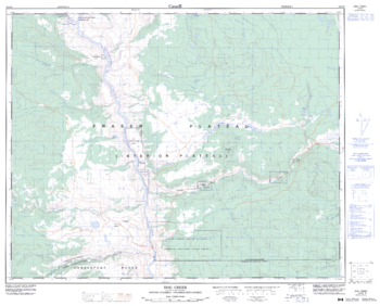
Dog Creek - 92 O/9 - British Columbia
Natural Resources Canada
Canadian topographic map of Dog Creek, British Columbia. NTS sheet 092O09 Edition 4.
Page Size: 31.75 x 25.5 in (804 x 647 mm)
Dog Valley Quadrangle, California
United States Department of Agriculture Forest Service
United States Department of Agriculture Forestry Service topographical map of Dog Valley, Tahoe National Forest, California.
Page Size: 21.75 x 27 in (552 x 686 mm)
Doncaster
MapSherpa
This map of Doncaster shows detailed street level information including extensive street labelling. Ideal for planning of deliveries, home services, sales territories, real estate and much more.
Page Size: 47 x 33.25 in (1189 x 841 mm)

Doncaster - DN - Postcode Wall Map
XYZ Maps
The Doncaster Postcode Sector Wall Map shows detailed postcode sector boundaries (DN1 1, DN1 2) on a comprehensive background and is perfect for determining postcode boundaries for sales areas, planning mailshots and also an excellent reference for logistics. This wall map covers the whole of the DN Postcode Area.
Page Size: 47 x 33.25 in (1189 x 841 mm)
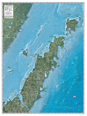
Door Peninsula
Mapping Specialists
An Attractive map of the lake showing a visual 3D representation of the lake bottom. Includes boat launches, rock area and vegetation. Land area is high resolution aerial imagery.
Page Size: 27.75 x 37.25 in (705 x 943 mm)

Dorchester - DT - Postcode Wall Map
XYZ Maps
The Dorchester Postcode Sector Wall Map shows detailed postcode sector boundaries (DT1 1, DT1 2) on a comprehensive background and is perfect for determining postcode boundaries for sales areas, planning mailshots and also an excellent reference for logistics. This wall map covers the whole of the DT Postcode Area.
Page Size: 47 x 33.25 in (1189 x 841 mm)

Dorset County Map
XYZ Maps
This is a large ceremonial county map of Dorset highlighting the county border, with the surrounding area faded out for excellent contrast. The map covers Abbotsbury, Bridport, Dorchester, Gillingham, Lyme Regis, Poole, Portland, Shaftesbury, Sherborne, Herbourne, Swanage, Weymouth and Wimborne Minster. The county map shows the latest County and Unitary Authority Boundaries, Overlaid on a Clear and Easy to Read Ordnance Survey map.
Page Size: 47 x 33.25 in (1189 x 841 mm)
Douglas Lake - 92 I/1 - British Columbia
Natural Resources Canada
Canadian topographic map of Douglas Lake, British Columbia. NTS sheet 092I01 Edition 2.
Page Size: 32.5 x 25.25 in (822 x 640 mm)
No search results