


MapSherpa Catalog
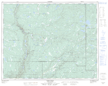
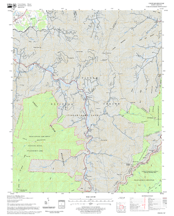
Criss Creek - 92 P/2 - British Columbia
Natural Resources Canada
Canadian topographic map of Criss Creek, British Columbia. NTS sheet 092P02 Edition 2.
Page Size: 32 x 25.5 in (812 x 644 mm)
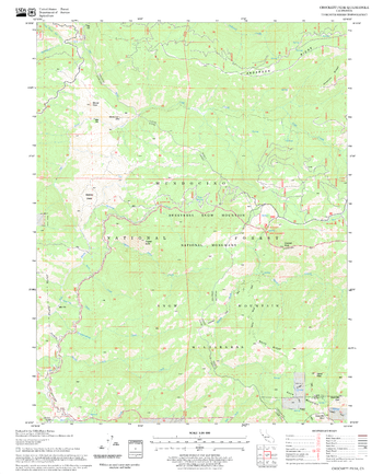
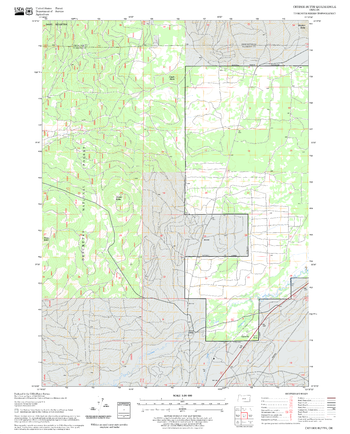
Crockett Peak Quadrangle, California
United States Department of Agriculture Forest Service
United States Department of Agriculture Forestry Service topographical map of Crockett Peak, Mendocino National Forest, California.
Page Size: 21.75 x 27 in (552 x 686 mm)
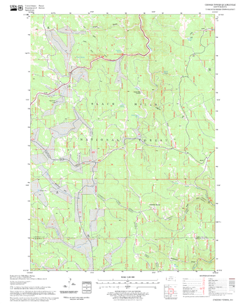
Crooks Tower Quadrangle, South Dakota
United States Department of Agriculture Forest Service
United States Department of Agriculture Forestry Service topographical map of Crooks Tower, Black Hills National Forest, South Dakota.
Page Size: 21.75 x 27 in (552 x 686 mm)
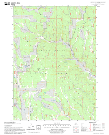
Crows Nest Peak Quadrangle, South Dakota
United States Department of Agriculture Forest Service
United States Department of Agriculture Forestry Service topographical map of Crows Nest Peak, Black Hills National Forest, South Dakota.
Page Size: 21.75 x 27 in (552 x 686 mm)

Croydon - CR - Postcode Wall Map
XYZ Maps
The Croydon Postcode Sector Wall Map shows detailed postcode sector boundaries (CR1 1, CR1 2) on a comprehensive background and is perfect for determining postcode boundaries for sales areas, planning mailshots and also an excellent reference for logistics. This wall map covers the whole of the CR Postcode Area.
Page Size: 33.25 x 47 in (841 x 1189 mm)
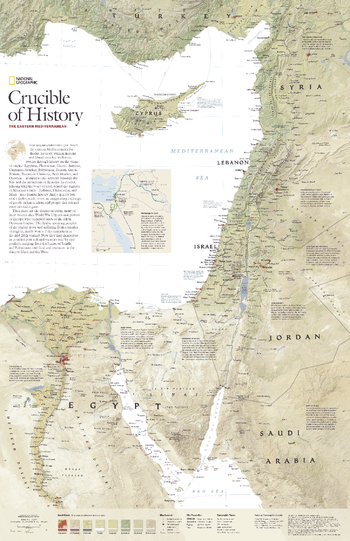
Crucible of History, the Eastern Mediterranean - Published 2008
National Geographic
Few regions on Earth can match the eastern Mediterranean for drama. Its story, written in stone and blood over five millennia, sweeps through history on the wings of empire: Egyptian, Phoenician, Hittite, Assyrian, Canaanite, Israelite, Babylonian, Persian, Greek, Roman, Byzantine Christian, Arab Muslim, and Ottoman -- all ruled in this territory between the Nile and the mountains of Anatolia. Now, the people of the region find themselves in troubled post-colonial societies torn by epic conflicts, ranging from the battles of Israelis and Palestinians over land and resources to the clash of Islam and the West. Explore the eastern Mediterranean region with this attractive and informative map. Published in December 2008, this map was half of a two-map set with "Jerusalem's Holy Ground."
Page Size: 20.25 x 31.25 in (512 x 791 mm)
Cruso Quadrangle, North Carolina
United States Department of Agriculture Forest Service
United States Department of Agriculture Forestry Service topographical map of Cruso, Pisgah National Forest, North Carolina.
Page Size: 21.75 x 27 in (552 x 686 mm)
Cryder Butte Quadrangle, Oregon
United States Department of Agriculture Forest Service
United States Department of Agriculture Forestry Service topographical map of Cryder Butte, Deschutes National Forest, Oregon.
Page Size: 21.75 x 27 in (552 x 686 mm)
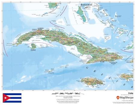
Cuba
MapSherpa
This beautiful map shows physical and political features for Cuba and surrounding areas. Relief shading and the use of different colours by height above sea level are both informative and attractive.
Page Size: 22 x 17 in (559 x 432 mm)
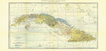
Cuba - Published 1906
National Geographic
This map of Cuba was published in October 1906, the year disputed elections led to an armed revolt on the island. The United States intervened and occupied the country, installing a US governor for three years. This is an attractive historical work and a fine map for collectors.
Page Size: 28 x 13.75 in (710 x 347 mm)
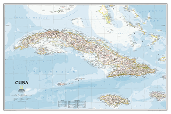
Cuba Classic
National Geographic
The most accurate and detailed reference map available for the iconic Caribbean island nation. <br><br>Cuba's many offshore islands, reefs, and rivers are noted, as are sites of interest including national parks, mountains, swamps, and coastal reefs. Ocean bathymetry, peak elevations, and handcrafted shaded relief provide topographical detail. Jamaica, the Cayman Islands, the Florida Keys, and most of the Bahamas and Haiti are shown, presenting Cuba in the context of its important geographical position in the Caribbean.<br><br>Includes thousands of place names in Spanish and English, accurate political boundaries and major transportation features including highways, roads, canals, ferry routes, and airports.<br><br>Popular places on the map include Havana, Pinar del Rio, Baracoa, Trinidad, Caya Largo, Santa Clara, Varadera, and Isla de la Juventad.
Page Size: 36 x 24 in (914 x 610 mm)
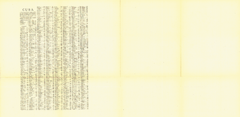
Cuba Index - Published 1906
National Geographic
Index to place names on Cuba Map 1906
Page Size: 28 x 13.75 in (710 x 347 mm)
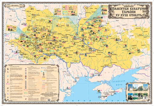
Cultural Monuments of Ukraine in the 15th – 18th Centries - Ukrainian - Extra Large
Kartographia
Development of Ukrainian culture in the 15th-18th centuries took place under conditions when Ukrainian lands were divided among neighboring states, as reflected on this Ukrainian-language map. Points of interest relating to writing of annals and printing, religious life, education, science and literature, music, pictorial art, architecture and construction are included to illustrate the growing culture in this period.
Four cities - Kyiv, Lviv, Ostroh and Chernihiv - where the most cultural monuments are collected, are presented on individual inset maps. Photos of architectural constructions from this time period, and monuments to the famous cultural workers are also included.
Page Size: 62.5 x 43 in (1586 x 1086 mm)
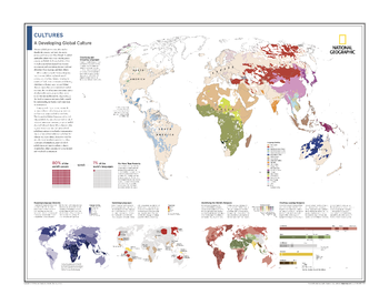
Cultures: A Developing Global Culture - Atlas of the World, 10th Edition
National Geographic
Classifying and Grouping Languages; For More Than Posterity; Mapping Language Diversity; Vanishing Languages; Identifying the World's Religions; Charting Leading Religions
Page Size: 28 x 22 in (711 x 559 mm)

Cumbria County Map
XYZ Maps
This is a large ceremonial county map of Cumbria, highlighting the ceremonial county border, with the surrounding area faded out for excellent contrast. The county map shows the latest ceremonial boundaries overlaid on a clear, easy to read and up to date Ordnance Survey map.
Page Size: 33.25 x 47 in (841 x 1189 mm)
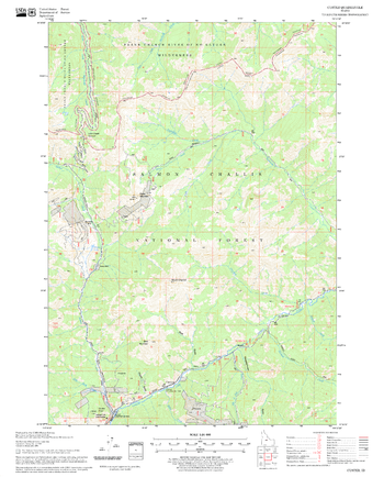
Custer Quadrangle, Idaho
United States Department of Agriculture Forest Service
United States Department of Agriculture Forestry Service topographical map of Custer, Salmon-Chalis National Forest, Idaho.
Page Size: 21.75 x 27 in (552 x 686 mm)
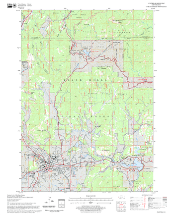
Custer Quadrangle, South Dakota
United States Department of Agriculture Forest Service
United States Department of Agriculture Forestry Service topographical map of Custer, Black Hills National Forest, South Dakota.
Page Size: 21.75 x 27 in (552 x 686 mm)
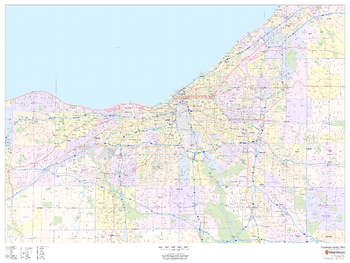
Cuyahoga County, Ohio
MapSherpa
This map of Cuyahoga County, Ohio shows regional level information. Base map features include highways and major roads with labelling; neighborhood names; railways; high level land use such as parks and recreation areas, industrial areas and hospital campuses; and a selection of points of interest including transportation hubs like airports and train stations, tourist information, police stations and shopping centres. ZIP code boundaries are shown as a secondary map feature.
Page Size: 48 x 36 in (1219 x 914 mm)
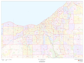
Cuyahoga County, Ohio ZIP Codes
MapSherpa
This map of Cuyahoga County, Ohio shows ZIP code areas overlaid on a road map. Ideal for planning of deliveries, home services, sales territories, real estate and much more. Base map features include all roads with major roads and highways labelled; neighborhood names; railways; and high level land use such as parks and recreation areas, industrial areas and hospital campuses.
Page Size: 48 x 36 in (1219 x 914 mm)
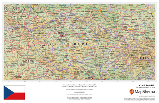
Czech Republic
MapSherpa
This beautiful map shows physical and political features for the Czech Republic and surrounding areas. Relief shading and the use of different colours by height above sea level are both informative and attractive.
Page Size: 17 x 11 in (432 x 279 mm)
No search results