


MapSherpa Catalog
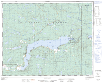
Canim Lake - 92 P/15 - British Columbia
Natural Resources Canada
Canadian topographic map of Canim Lake, British Columbia. NTS sheet 092P15 Edition 2.
Page Size: 31.5 x 25.25 in (795 x 640 mm)
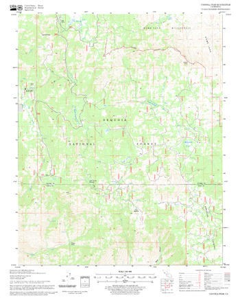
Cannell Peak Quadrangle, California
United States Department of Agriculture Forest Service
United States Department of Agriculture Forestry Service topographical map of Cannell Peak, Sequoia National Forest, California.
Page Size: 21.75 x 27 in (552 x 686 mm)

Canterbury - CT - Postcode Wall Map
XYZ Maps
The Canterbury Postcode Sector Wall Map shows detailed postcode sector boundaries (CT1 1, CT1 2) on a comprehensive background and is perfect for determining postcode boundaries for sales areas, planning mailshots and also an excellent reference for logistics. This wall map covers the whole of the CT Postcode Area.
Page Size: 47 x 33.25 in (1189 x 841 mm)
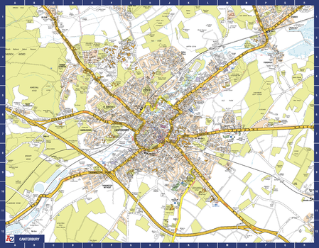
Canterbury A-Z Street Map
A-Z Maps
The perfect reference map for finding your way around Canterbury. This up-to-date detailed A-Z town plan includes more than 1,000 streets in and around Canterbury. As well as the Canterbury Cathedral and Canterbury city centre, other areas covered are Blean Woods National Nature Reserve, Chartham, Harbledown, Rough Common, University of Kent and Fordwich. The highly detailed 1 mile to 5.5 inch street map includes places of interest, among other features.
Page Size: 28.5 x 22.25 in (718 x 560 mm)
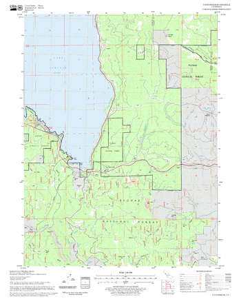
Canyondam Quadrangle, California
United States Department of Agriculture Forest Service
United States Department of Agriculture Forestry Service topographical map of Canyondam, Lassen National Forest, California.
Page Size: 21.75 x 27 in (552 x 686 mm)
Cape Caution - 92 M/4 - British Columbia
Natural Resources Canada
Canadian topographic map of Cape Caution, British Columbia. NTS sheet 092M04 Edition 2.
Page Size: 31.75 x 25.25 in (804 x 639 mm)
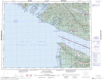
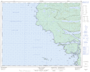
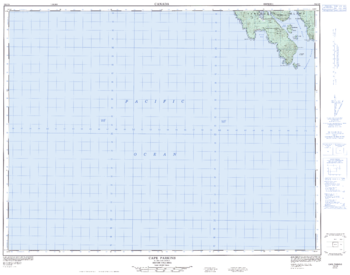
Cape Flattery - 92 C - British Columbia
Natural Resources Canada
Canadian topographic map of Cape Flattery, British Columbia. NTS sheet 092C Edition 4.
Page Size: 28.25 x 21.75 in (717 x 551 mm)
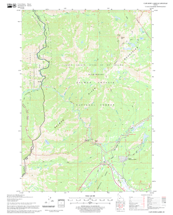
Cape Horn Lakes Quadrangle, Idaho
United States Department of Agriculture Forest Service
United States Department of Agriculture Forestry Service topographical map of Cape Horn Lakes, Salmon-Chalis National Forest, Idaho.
Page Size: 21.75 x 27 in (552 x 686 mm)
Cape Parkings - 102 I/8 - British Columbia
Natural Resources Canada
Canadian topographic map of Cape Parkings, British Columbia. NTS sheet 102I08 Edition 3.
Page Size: 32.25 x 25.25 in (815 x 641 mm)
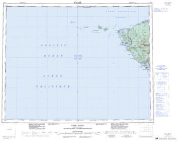
Cape Scott - 102 I - British Columbia
Natural Resources Canada
Canadian topographic map of Cape Scott, British Columbia. NTS sheet 102I Edition 2.
Page Size: 27.75 x 22 in (702 x 555 mm)
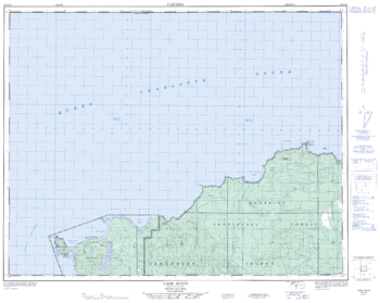
Cape Scott - 102 I/16 - British Columbia
Natural Resources Canada
Canadian topographic map of Cape Scott, British Columbia. NTS sheet 102I16 Edition 3.
Page Size: 31.75 x 25.5 in (806 x 642 mm)
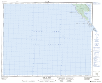
Cape St James - 102 O/14 - British Columbia
Natural Resources Canada
Canadian topographic map of Cape St James, British Columbia. NTS sheet 102O14 Edition 3.
Page Size: 31.75 x 25.75 in (803 x 650 mm)
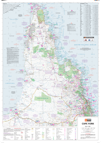
Cape York Supermap
Hema Maps
A large map of Cape York that features 4WD tracks, touring information, points of interest, facilities and distances, making it the perfect trip planning tool and reference map.
ISBN 9781925195583
Page Size: 38.75 x 55.25 in (980 x 1400 mm)

Cardiff - CF - Postcode Wall Map
XYZ Maps
The Cardiff Postcode Sector Wall Map shows detailed postcode sector boundaries (CF1 1, CF1 2) on a comprehensive background and is perfect for determining postcode boundaries for sales areas, planning mailshots and also an excellent reference for logistics. This wall map covers the whole of the CF Postcode Area.
Page Size: 33.25 x 47 in (841 x 1189 mm)
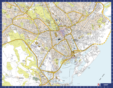
Cardiff A-Z Street Map
A-Z Maps
The perfect reference map for finding your way around Cardiff. This up-to-date detailed A-Z town plan indexes 2,025 streets in and around Cardiff. As well as Cardiff Bay, the other areas covered are Cathays, Roath, Bute Park, and Riverside. The highly detailed 1 mile to 5.5 inch street map includes places of interest, among other features.
Page Size: 28.5 x 22.25 in (718 x 560 mm)
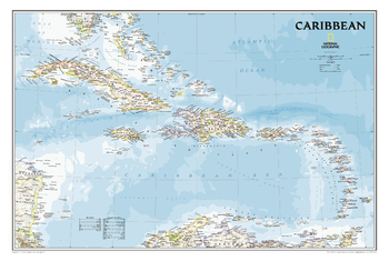
Caribbean Classic
National Geographic
One of the most authoritative maps for the islands of the Caribbean Sea.<br><br>It shows the entire region in great detail, with coverage extending from the tip of Florida to the northern extents of Colombia and Venezuela, east to Barbados, and west to the eastern edge of Honduras, Costa Rica, and Nicaragua. Updated bathymetry reveals the remarkable seafloor variation of the Caribbean including the Puerto Rico Trench, the deepest point in the Atlantic Ocean at 8,605 meters (28,232 feet).<br><br>Includes over 1,000 named places including country capitals, primary and secondary towns; political boundaries, important infrastructure, and all key landforms. Useful and informative notes about the region's history and unique geography are spread throughout the map, providing the reader further understanding of the Caribbean's unique attributes.
Page Size: 36 x 24 in (914 x 609 mm)
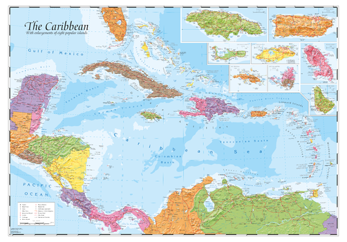
Caribbean and main islands
Oxford Cartographers
The Caribbean with hill-shading and inset maps of 8 popular islands
Page Size: 39.5 x 27.25 in (1000 x 690 mm)
Caribou Quadrangle, California
United States Department of Agriculture Forest Service
United States Department of Agriculture Forestry Service topographical map of Caribou, Lassen National Forest, California.
Page Size: 21.75 x 27 in (552 x 686 mm)

Carlisle - CA - Postcode Wall Map
XYZ Maps
The Carlisle Postcode Sector Wall Map shows detailed postcode sector boundaries (CA1 1, CA1 2) on a comprehensive background and is perfect for determining postcode boundaries for sales areas, planning mailshots and also an excellent reference for logistics. This wall map covers the whole of the CA Postcode Area.
Page Size: 47 x 33.25 in (1189 x 841 mm)
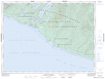
Carmanah Creek - 92 C/10 - British Columbia
Natural Resources Canada
Canadian topographic map of Carmanah Creek, British Columbia. NTS sheet 092C10 Edition 5.
Page Size: 33.75 x 25.5 in (852 x 641 mm)
No search results