


MapSherpa Catalog
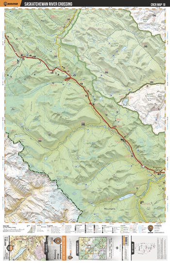
CRCR18 Saskatchewan River Crossing - Canadian Rockies Topo
Backroad Mapbooks
This recreation topographic map for Saskatchewan River Crossing highlights all the roads, fishing lakes & streams, front and backcountry campsites, paddling routes for canoeing and kayaking, wildlife viewing areas, multi-use trails for hiking, backcountry skiing, snowshoeing, mountain biking, horseback riding & more. Covering 1,950 km2 (753 mi2), this map measures 38 x 51 km (24 x 32 mi), providing you with more topographic and recreational detail for the Whiteswan Lake area than any other map on the market. Special features include private land and countless roads, trails and recreational Points of Interest. Included on this map are Saskatchewan River Crossing, Jasper National Park, White Goat Wilderness Area, Brazeau River, North Saskatchewan River, Glaciar Lake and more!
Page Size: 24 x 37 in (610 x 940 mm)
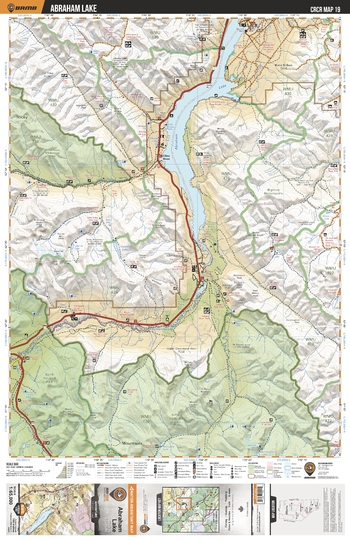
CRCR19 Abraham Lake - Canadian Rockies Topo
Backroad Mapbooks
This recreation topographic map for Abraham Lake highlights all the roads, fishing lakes & streams, front and backcountry campsites, paddling routes for canoeing and kayaking, wildlife viewing areas, multi-use trails for hiking, backcountry skiing, snowshoeing, mountain biking, horseback riding & more. Covering 1,950 km2 (753 mi2), this map measures 38 x 51 km (24 x 32 mi), providing you with more topographic and recreational detail for the Whiteswan Lake area than any other map on the market. Special features include private land and countless roads, trails and recreational Points of Interest. Included on this map are Abraham Lake, Cline River, North Ram River, North Saskatchewan River, Siffleur River, Siffleur Wilderness Area, Banff National Park and more!
Page Size: 24 x 37 in (610 x 940 mm)
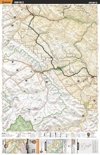
CRCR20 Ram Falls - Canadian Rockies Topo
Backroad Mapbooks
This recreation topographic map for Ram Falls highlights all the roads, fishing lakes & streams, front and backcountry campsites, paddling routes for canoeing and kayaking, wildlife viewing areas, multi-use trails for hiking, backcountry skiing, snowshoeing, mountain biking, horseback riding & more. Covering 1,950 km2 (753 mi2), this map measures 38 x 51 km (24 x 32 mi), providing you with more topographic and recreational detail for the Whiteswan Lake area than any other map on the market. Special features include private land and countless roads, trails and recreational Points of Interest. Included on this map are Ram Falls, North Ram Nice Creek Natural Area, Ram River, North Ram River, Banff National Park, Clearwater River and more!
Page Size: 24 x 37 in (610 x 940 mm)
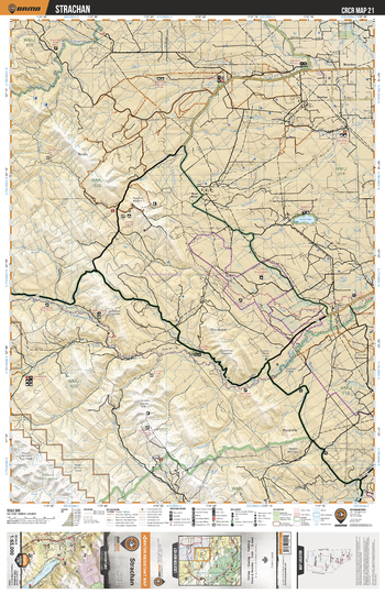
CRCR21 Strachan - Canadian Rockies Topo
Backroad Mapbooks
This recreation topographic map for Strachan highlights all the roads, fishing lakes & streams, front and backcountry campsites, paddling routes for canoeing and kayaking, wildlife viewing areas, multi-use trails for hiking, backcountry skiing, snowshoeing, mountain biking, horseback riding & more. Covering 1,950 km2 (753 mi2), this map measures 38 x 51 km (24 x 32 mi), providing you with more topographic and recreational detail for the Whiteswan Lake area than any other map on the market. Special features include private land and countless roads, trails and recreational Points of Interest. Included on this map are Strathcan, Swan Lake, Clearwater River, Tay River, Limestone Creek, Cutoff Creek, Rocky Creek, Moosewallow Creek and more!
Page Size: 24 x 37 in (610 x 940 mm)
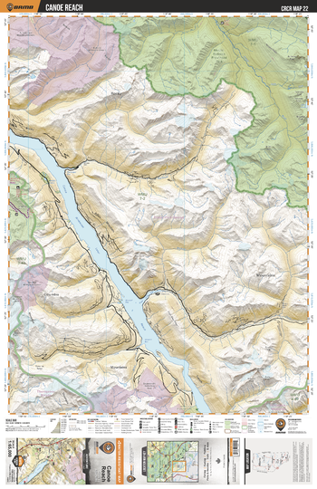
CRCR22 Canoe Reach - Canadian Rockies Topo
Backroad Mapbooks
This recreation topographic map for Canoe Reach highlights all the roads, fishing lakes & streams, front and backcountry campsites, paddling routes for canoeing and kayaking, wildlife viewing areas, multi-use trails for hiking, backcountry skiing, snowshoeing, mountain biking, horseback riding & more. Covering 1,950 km2 (753 mi2), this map measures 38 x 51 km (24 x 32 mi), providing you with more topographic and recreational detail for the Whiteswan Lake area than any other map on the market. Special features include private land and countless roads, trails and recreational Points of Interest. Included on this map are Canoe Reach, Mount Robson Provincial Park, Ptarmigan Creek, Windfall Creek, Howard Creek, Baker Creek, Bulldog Creek and more!
Page Size: 24 x 37 in (610 x 940 mm)
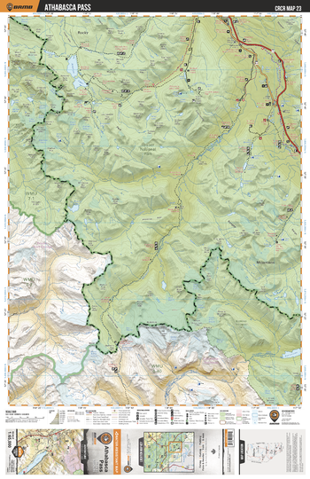
CRCR23 Athabasca Pass - Canadian Rockies Topo
Backroad Mapbooks
This recreation topographic map for Athabasca Pass highlights all the roads, fishing lakes & streams, front and backcountry campsites, paddling routes for canoeing and kayaking, wildlife viewing areas, multi-use trails for hiking, backcountry skiing, snowshoeing, mountain biking, horseback riding & more. Covering 1,950 km2 (753 mi2), this map measures 38 x 51 km (24 x 32 mi), providing you with more topographic and recreational detail for the Whiteswan Lake area than any other map on the market. Special features include private land and countless roads, trails and recreational Points of Interest. Included on this map are Athabasca Pass, Hamber Provincial Park, Jasper National Park, Mount Robson Provincial Park, Whirlpool River, Athabasca River, Amethyst Lakes, Fortress Lake and more!
Page Size: 24 x 37 in (610 x 940 mm)
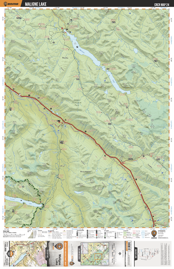
CRCR24 Maligne Lake - Canadian Rockies Topo
Backroad Mapbooks
This recreation topographic map for Maligne Lake highlights all the roads, fishing lakes & streams, front and backcountry campsites, paddling routes for canoeing and kayaking, wildlife viewing areas, multi-use trails for hiking, backcountry skiing, snowshoeing, mountain biking, horseback riding & more. Covering 1,950 km2 (753 mi2), this map measures 38 x 51 km (24 x 32 mi), providing you with more topographic and recreational detail for the Whiteswan Lake area than any other map on the market. Special features include private land and countless roads, trails and recreational Points of Interest. Included on this map are Maligne Lake, Maligne River, Sunwapta River, Fortress Lake, Chaba River, Athabasca River, Restless River, Jasper National Park, Gong Lake and more!
Page Size: 24 x 37 in (610 x 940 mm)
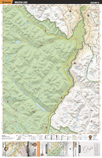
CRCR25 Brazeau Lake - Canadian Rockies Topo
Backroad Mapbooks
This recreation topographic map for Brazeau Lake highlights all the roads, fishing lakes & streams, front and backcountry campsites, paddling routes for canoeing and kayaking, wildlife viewing areas, multi-use trails for hiking, backcountry skiing, snowshoeing, mountain biking, horseback riding & more. Covering 1,950 km2 (753 mi2), this map measures 38 x 51 km (24 x 32 mi), providing you with more topographic and recreational detail for the Whiteswan Lake area than any other map on the market. Special features include private land and countless roads, trails and recreational Points of Interest. Included on this map are Brazeau Lake, North West Brazeau River, Southesk Lake, Southesk River, Jasper National Park, Brazeau Canyon Wildland Provincial Park and more!
Page Size: 24 x 37 in (610 x 940 mm)
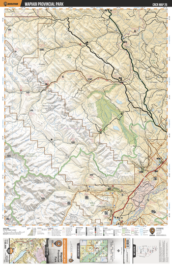
CRCR26 Wapiabi Provincial Park - Canadian Rockies Topo
Backroad Mapbooks
This recreation topographic map for Wapiabi Provincial Park highlights all the roads, fishing lakes & streams, front and backcountry campsites, paddling routes for canoeing and kayaking, wildlife viewing areas, multi-use trails for hiking, backcountry skiing, snowshoeing, mountain biking, horseback riding & more. Covering 1,950 km2 (753 mi2), this map measures 38 x 51 km (24 x 32 mi), providing you with more topographic and recreational detail for the Whiteswan Lake area than any other map on the market. Special features include private land and countless roads, trails and recreational Points of Interest. Included on this map are Wapiabi Provincial Park, Blackstone River, Bighorn River, North Saskatchewan River, Nordegg River, Sunkay Creek and more!
Page Size: 24 x 37 in (610 x 940 mm)
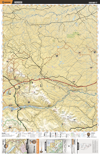
CRCR27 Nordegg - Canadian Rockies Topo
Backroad Mapbooks
This recreation topographic map for Nordegg highlights all the roads, fishing lakes & streams, front and backcountry campsites, paddling routes for canoeing and kayaking, wildlife viewing areas, multi-use trails for hiking, backcountry skiing, snowshoeing, mountain biking, horseback riding & more. Covering 1,950 km2 (753 mi2), this map measures 38 x 51 km (24 x 32 mi), providing you with more topographic and recreational detail for the Whiteswan Lake area than any other map on the market. Special features include private land and countless roads, trails and recreational Points of Interest. Included on this map are Nordegg, McGregor Lake Natural Area, Aurora Natural Area, Nordegg River, Baptiste River, North Saskatchewan River and more!
Page Size: 24 x 37 in (610 x 940 mm)
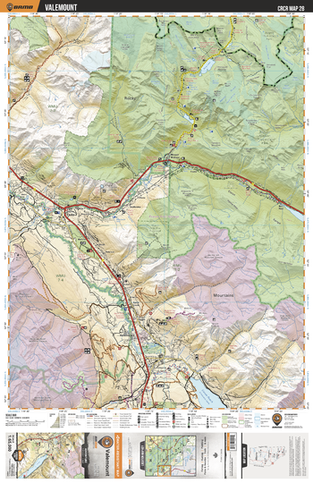
CRCR28 Valemount - Canadian Rockies Topo
Backroad Mapbooks
This recreation topographic map for Valemount highlights all the roads, fishing lakes & streams, front and backcountry campsites, paddling routes for canoeing and kayaking, wildlife viewing areas, multi-use trails for hiking, backcountry skiing, snowshoeing, mountain biking, horseback riding & more. Covering 1,950 km2 (753 mi2), this map measures 38 x 51 km (24 x 32 mi), providing you with more topographic and recreational detail for the Whiteswan Lake area than any other map on the market. Special features include private land and countless roads, trails and recreational Points of Interest. Included on this map are Valemount, Mount Robson Provincial Park, Jasper National Park, Small River Caves Provincial Park, Mount Terry Fox Provincial Park, Reargaurd Falls Provincial Park, Jackman Flats Provincial Park and more!
Page Size: 24 x 37 in (610 x 940 mm)
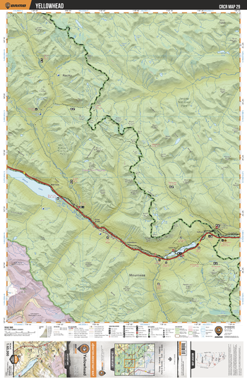
CRCR29 Yellowhead - Canadian Rockies Topo
Backroad Mapbooks
This recreation topographic map for Yellowhead highlights all the roads, fishing lakes & streams, front and backcountry campsites, paddling routes for canoeing and kayaking, wildlife viewing areas, multi-use trails for hiking, backcountry skiing, snowshoeing, mountain biking, horseback riding & more. Covering 1,950 km2 (753 mi2), this map measures 38 x 51 km (24 x 32 mi), providing you with more topographic and recreational detail for the Whiteswan Lake area than any other map on the market. Special features include private land and countless roads, trails and recreational Points of Interest. Included on this map are Yellowhead, Moose Lake, Yellowhead Lake, Snaring River, Moose River, Alpine Lakes, Fraser River, Jasper National Park and more!
Page Size: 24 x 37 in (610 x 940 mm)
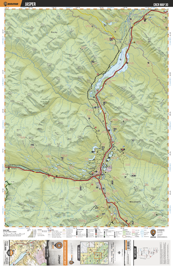
CRCR30 Jasper - Canadian Rockies Topo
Backroad Mapbooks
This recreation topographic map for Jasper highlights all the roads, fishing lakes & streams, front and backcountry campsites, paddling routes for canoeing and kayaking, wildlife viewing areas, multi-use trails for hiking, backcountry skiing, snowshoeing, mountain biking, horseback riding & more. Covering 1,950 km2 (753 mi2), this map measures 38 x 51 km (24 x 32 mi), providing you with more topographic and recreational detail for the Whiteswan Lake area than any other map on the market. Special features include private land and countless roads, trails and recreational Points of Interest. Included on this map are Jasper, Jasper National Park, Jasper Lake, Talbot Lake, Miette River, Maligne River, Athabasca River, Mount Robson Provincial Park and more!
Page Size: 24 x 37 in (610 x 940 mm)
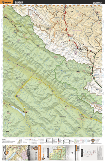
CRCR31 Cadomin - Canadian Rockies Topo
Backroad Mapbooks
This recreation topographic map for Cadomin highlights all the roads, fishing lakes & streams, front and backcountry campsites, paddling routes for canoeing and kayaking, wildlife viewing areas, multi-use trails for hiking, backcountry skiing, snowshoeing, mountain biking, horseback riding & more. Covering 1,950 km2 (753 mi2), this map measures 38 x 51 km (24 x 32 mi), providing you with more topographic and recreational detail for the Whiteswan Lake area than any other map on the market. Special features include private land and countless roads, trails and recreational Points of Interest. Included on this map are Cadomin, Whitehorse Wildland Provincial Park, Medicine Lake, Rocky River, Maligne River, Fiddle River, Gregg River, Jasper National Park and more!
Page Size: 24 x 37 in (610 x 940 mm)
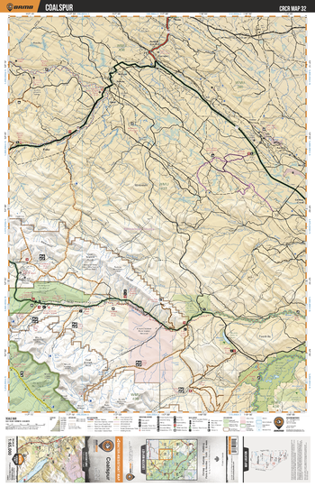
CRCR32 Coalspur - Canadian Rockies Topo
Backroad Mapbooks
This recreation topographic map for Coalspur highlights all the roads, fishing lakes & streams, front and backcountry campsites, paddling routes for canoeing and kayaking, wildlife viewing areas, multi-use trails for hiking, backcountry skiing, snowshoeing, mountain biking, horseback riding & more. Covering 1,950 km2 (753 mi2), this map measures 38 x 51 km (24 x 32 mi), providing you with more topographic and recreational detail for the Whiteswan Lake area than any other map on the market. Special features include private land and countless roads, trails and recreational Points of Interest. Included on this map are Coalspur, Whitehorse Wildland Provincial Park, Grave Flats Natural Area, Jasper National Park, Brazeau Canyon Wildland Provincial Park, Mcleod River, Pembina River and more!
Page Size: 24 x 37 in (610 x 940 mm)
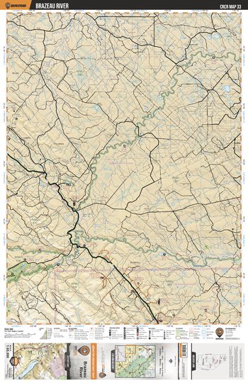
CRCR33 Brazeau River - Canadian Rockies Topo
Backroad Mapbooks
This recreation topographic map for Brazeau River highlights all the roads, fishing lakes & streams, front and backcountry campsites, paddling routes for canoeing and kayaking, wildlife viewing areas, multi-use trails for hiking, backcountry skiing, snowshoeing, mountain biking, horseback riding & more. Covering 1,950 km2 (753 mi2), this map measures 38 x 51 km (24 x 32 mi), providing you with more topographic and recreational detail for the Whiteswan Lake area than any other map on the market. Special features include private land and countless roads, trails and recreational Points of Interest. Included on this map are Brazeau River, Pembina River, Cardinal River, Blackstone River, Elk River, Brazeau Tufa Natural Area,Thunder Lake and more!
Page Size: 24 x 37 in (610 x 940 mm)
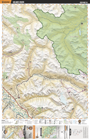
CRCR34 Holmes River - Canadian Rockies Topo
Backroad Mapbooks
This recreation topographic map for Holmes River highlights all the roads, fishing lakes & streams, front and backcountry campsites, paddling routes for canoeing and kayaking, wildlife viewing areas, multi-use trails for hiking, backcountry skiing, snowshoeing, mountain biking, horseback riding & more. Covering 1,950 km2 (753 mi2), this map measures 38 x 51 km (24 x 32 mi), providing you with more topographic and recreational detail for the Whiteswan Lake area than any other map on the market. Special features include private land and countless roads, trails and recreational Points of Interest. Included on this map are Holmes River, Willmore Wilderness Provincial Park, Mt Renshaw Alpine Rec Site, Fraser River, McKale River, Ptarmigan Lake and more!
Page Size: 24 x 37 in (610 x 940 mm)
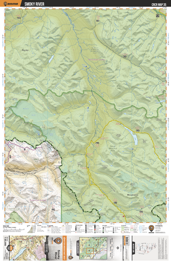
CRCR35 Smoky River - Canadian Rockies Topo
Backroad Mapbooks
This recreation topographic map for Smoky River highlights all the roads, fishing lakes & streams, front and backcountry campsites, paddling routes for canoeing and kayaking, wildlife viewing areas, multi-use trails for hiking, backcountry skiing, snowshoeing, mountain biking, horseback riding & more. Covering 1,950 km2 (753 mi2), this map measures 38 x 51 km (24 x 32 mi), providing you with more topographic and recreational detail for the Whiteswan Lake area than any other map on the market. Special features include private land and countless roads, trails and recreational Points of Interest. Included on this map are Smoky River, Jasper National Park, Mount Robson Provincial Park, Twintree Lake, Jackpine River, Small River Caves Provincial Park and more!
Page Size: 24 x 37 in (610 x 940 mm)
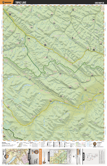
CRCR36 Topaz Lake - Canadian Rockies Topo
Backroad Mapbooks
This recreation topographic map for Topaz Lake highlights all the roads, fishing lakes & streams, front and backcountry campsites, paddling routes for canoeing and kayaking, wildlife viewing areas, multi-use trails for hiking, backcountry skiing, snowshoeing, mountain biking, horseback riding & more. Covering 1,950 km2 (753 mi2), this map measures 38 x 51 km (24 x 32 mi), providing you with more topographic and recreational detail for the Whiteswan Lake area than any other map on the market. Special features include private land and countless roads, trails and recreational Points of Interest. Included on this map are Topaz Lake, South Sulphur River, Snake Indian River, Mount Robson Provincial Park, Sulphur River, Wildhay River, Willmore Wilderness Provincial Park and more!
Page Size: 24 x 37 in (610 x 940 mm)
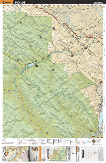
CRCR37 Rock Lake - Canadian Rockies Topo
Backroad Mapbooks
This recreation topographic map for Rock Lake highlights all the roads, fishing lakes & streams, front and backcountry campsites, paddling routes for canoeing and kayaking, wildlife viewing areas, multi-use trails for hiking, backcountry skiing, snowshoeing, mountain biking, horseback riding & more. Covering 1,950 km2 (753 mi2), this map measures 38 x 51 km (24 x 32 mi), providing you with more topographic and recreational detail for the Whiteswan Lake area than any other map on the market. Special features include private land and countless roads, trails and recreational Points of Interest. Included on this map are Rock Lake, Willmore Wilderness Provincial Park, Rock Lake Provincial Park, Rock Lake-Salmon Creek Provincial Park,Snake Indian River, Brule Lake and more!
Page Size: 24 x 37 in (610 x 940 mm)
No search results